Chinook
-
Posts
10,674 -
Joined
-
Last visited
Content Type
Profiles
Blogs
Forums
American Weather
Media Demo
Store
Gallery
Everything posted by Chinook
-
I'd say the 4.0" - 4.5" hail is the largest I've seen on a report during most years. You can easily see why that type of cell was possible based on forecast soundings/ SPC maps for significant hail parameter. (4.5" hail would be a nightmare... In fact it was a nightmare. A long time ago, someone died in Fort Collins Colorado due to a 4" hailstone.) Southern Texas had a heat index of about 120 yesterday and isolated locations in Mexico got over 110 measured temperature. Meanwhile my place here in Ohio was dreary and cold. My old favorite place in Colorado, that is, Estes Park, got snow to 8000 ft as viewed by the national park cams.
-
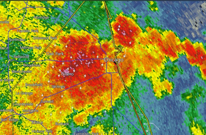
This storm that produced up to baseball sized hail and, more recently, golf ball sized hail.

-
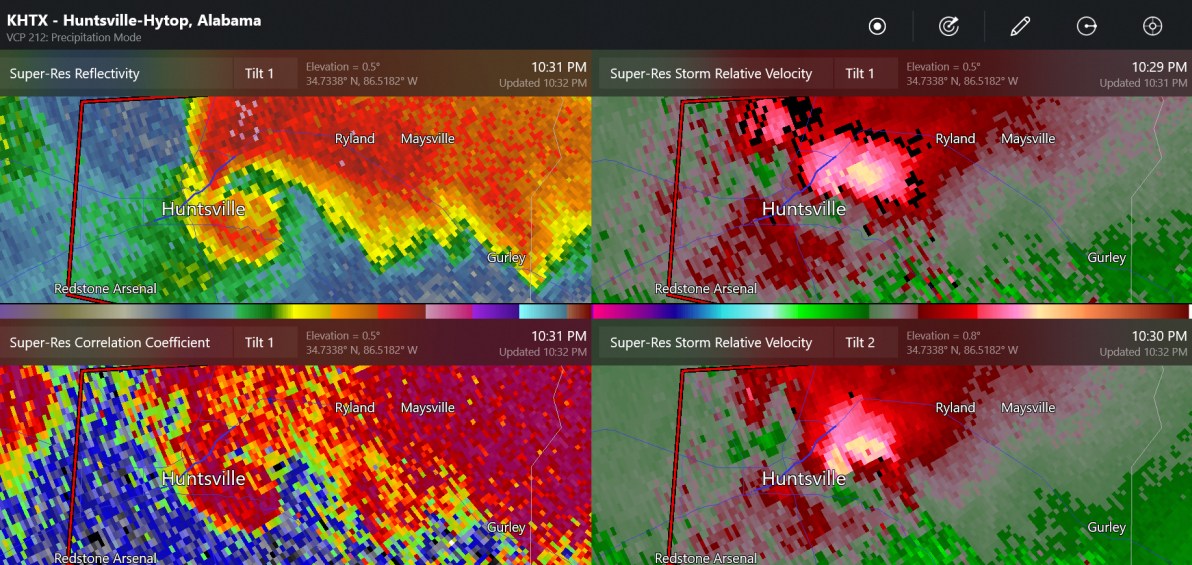
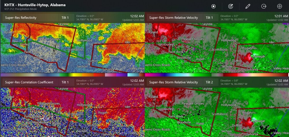
both of these are confirmed tornadoes in Alabama. It's possible that two tornadoes hit Huntsville tonight
-
tornado seen by traffic cam
-
this looks huge now, in the city
-
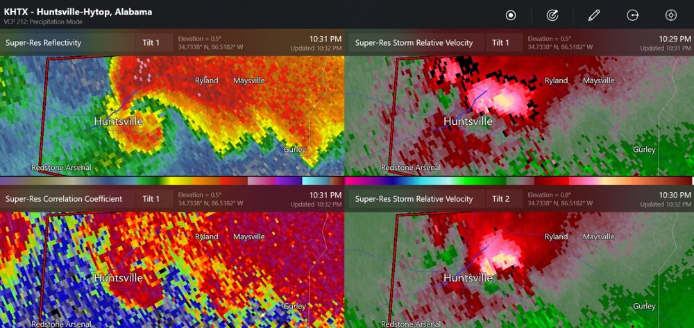
tornado warning for Huntsville
-
first tornado warning for Georgia today
-
TDS and potentially large tornado outside of Athens, Alabama
-
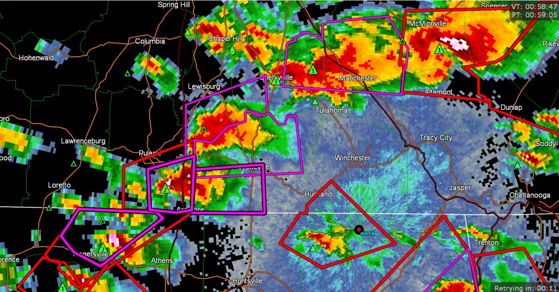
multiple confirmed tornado warnings at the AL/TN border

-
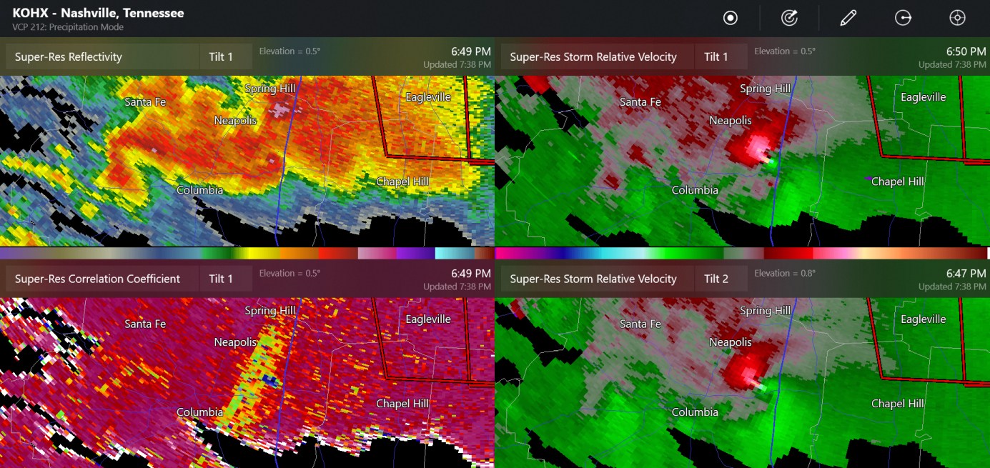
this was a tornado emergency near and east of Columbia Tennessee and I think the tornado tracked over I-65 and may have dissipated near that.

-
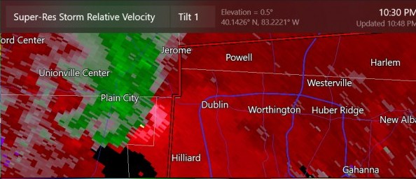
I think this is when there was a confirmed tornado warning, but I wasn't quite paying attention at the time. Do you are think that this tornado went from Plain City to somewhere near Powell?
-
radar doesn't cover it too well, but it is of great importance to my brother!
-
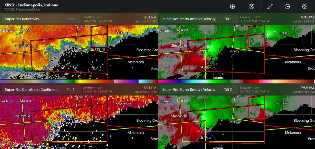
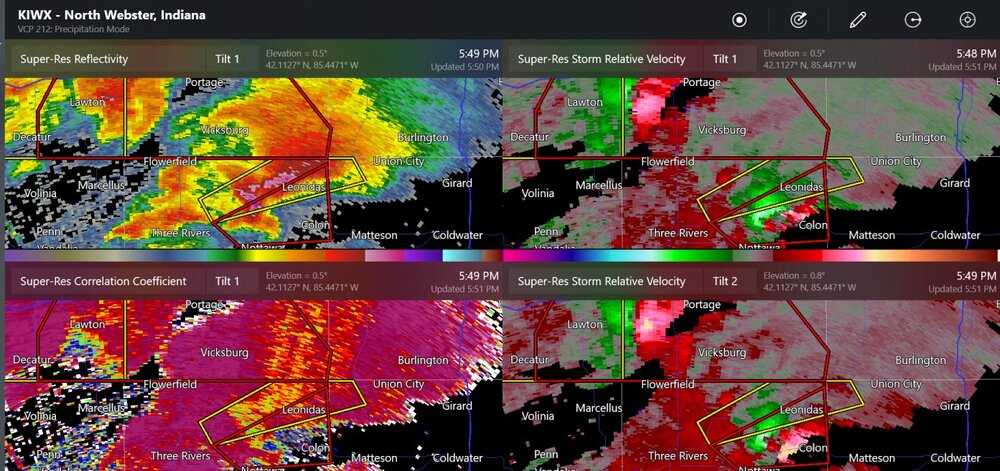
tornado near Shelbyville IN

-
double tornado warnings (confirmed tornado by Mendon Michigan)
-
new tornado warning at Terre Haute
-
Tomorrow looks like there might be some small tornadic supercells for OH/IN, like near me

-
even KTLX and KICT radars can see the TDS, lowered correlation coefficient, on the Hominy tornado.
-
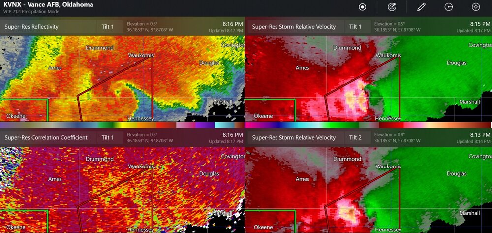
This is a possible rain-wrapped tornado near Hennessy Oklahoma. The wind damage report from Lacey says there could have been tornado damage.
-
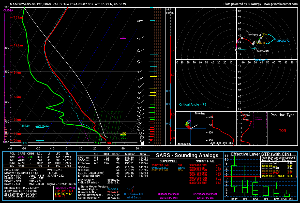
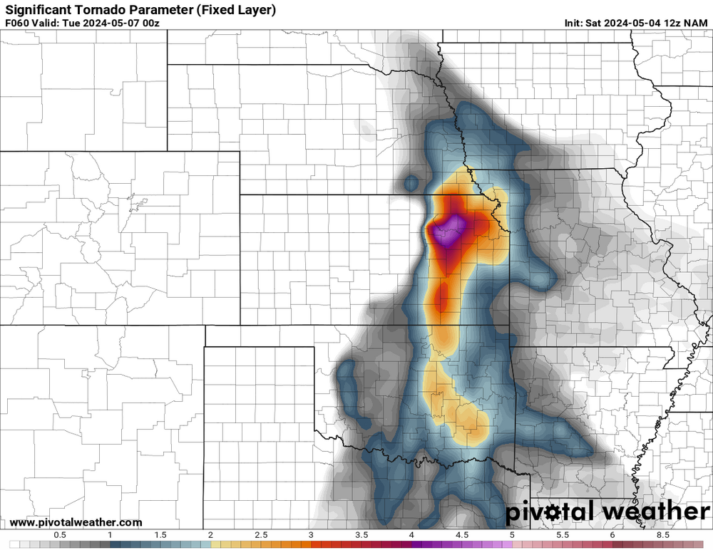
I am seeing forecast soundings of STP (effective) of 14.7 to 15.7 on the most recent HRRR valid for 03z (same as shown). I think that's maybe about 1 or 2 more than I've ever seen on a model sounding.
-
oh you mean linear like this? I guess this raises the chances for severe winds

-
I think parameters will be very high for tornadoes on Monday night. The models show a small cap in place. Lifting condensation levels should be quite low in Oklahoma with higher dew points. As usual, the ramp-up in lower level winds will occur at night to possibly increase chances of tornadoes.

-
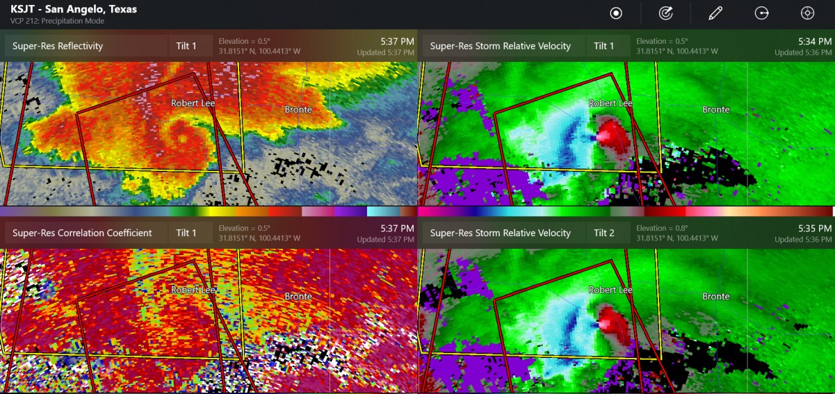
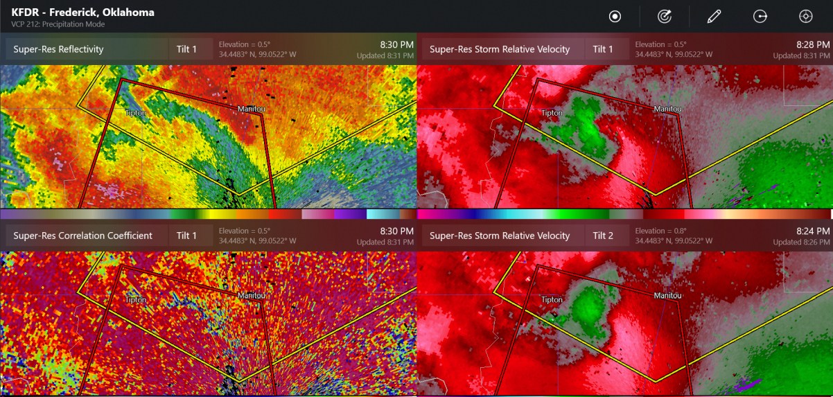
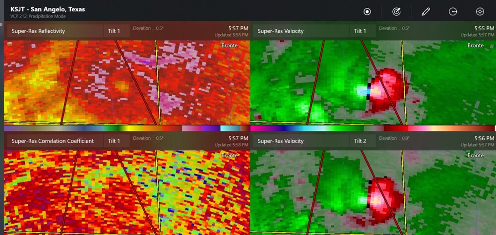
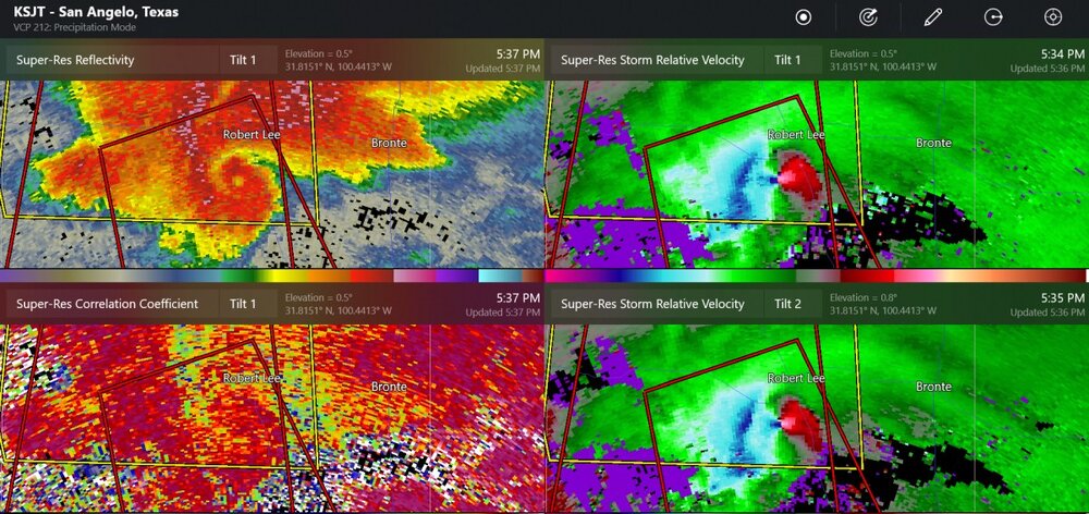
large tornado south of Robert Lee Texas a little while ago
-
lightning and heavy rain coming in to downtown
-
welcome to May in the Plains
-
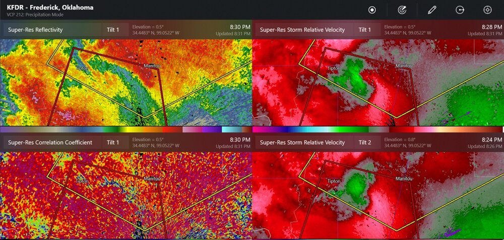
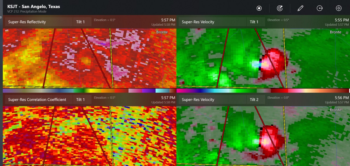
confirmed tornado warning at Frederick Radar