WVclimo
-
Posts
5,480 -
Joined
-
Last visited
Content Type
Profiles
Blogs
Forums
American Weather
Media Demo
Store
Gallery
Everything posted by WVclimo
-
Pitching is bad, but this isn’t much better: Henderson .213 avg. Holliday .213, Rutschman .200, Westburg .187. Mountcastle .229, O’Neill .230
-
The 8 extra base hits that Kremer allowed were the most ever by a starting pitcher in team history. That’s amazing. The starters ERA is now 6.22 for the season.
-
The ump was squeezing him
-
I would probably give Gary Sanchez an inning for the 9th.
-
Wonder if we will get to see Jorge Mateo on the mound today ?
-
This is the road that heads south from my neighborhood.


- 581 replies
-
- 14
-

-

-

-

-

-
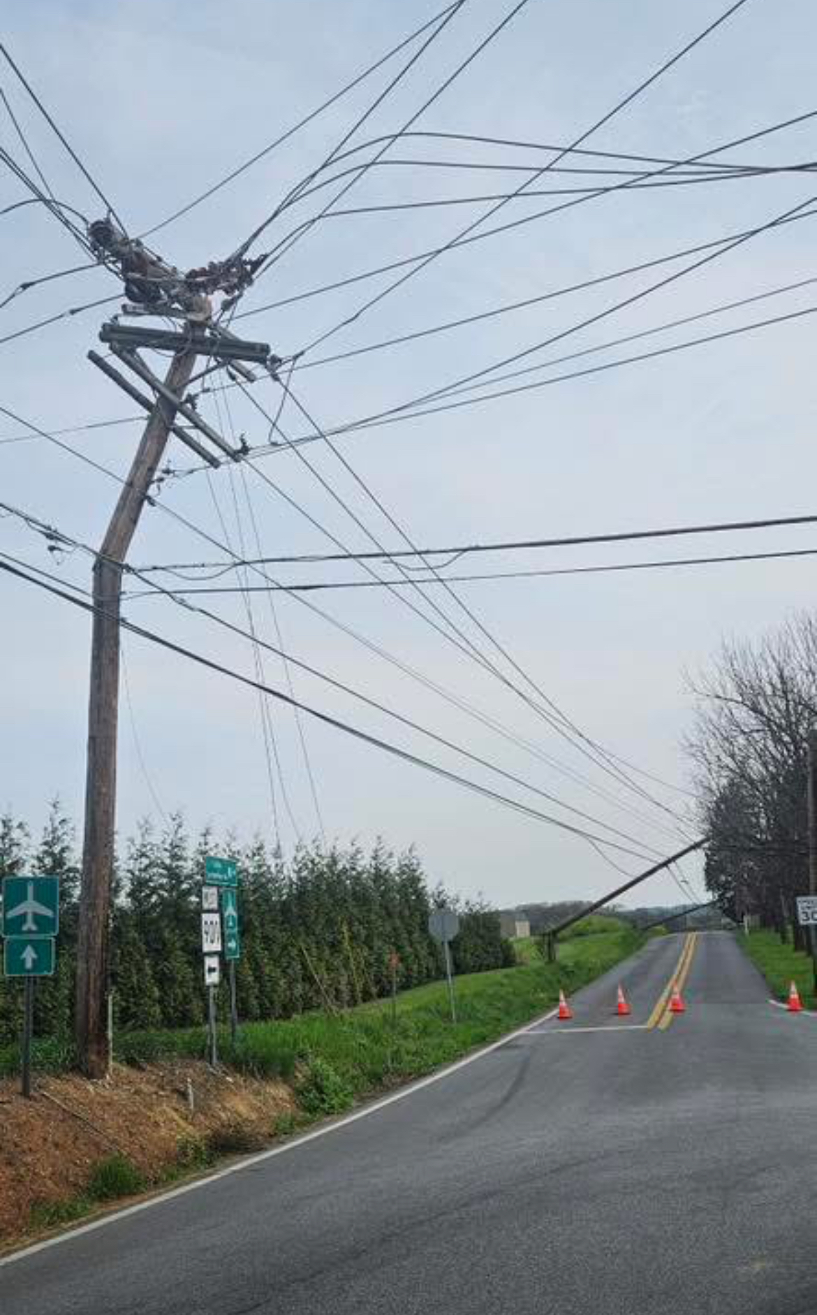
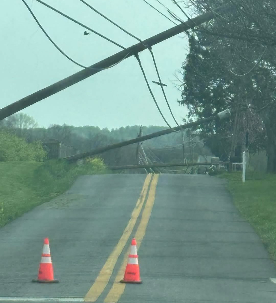
Yes, Berryville is about 25 miles west of me, just south of Berkeley Springs High School. Walked my property and found large tree branches down everywhere across my 4 acres. The whole time I was outside I could hear sirens coming from different directions. Rare to hear that out here in the sticks. A large tree is down on I-81 near me and a trampoline landed in the highway also lol
-
Reports on Facebook around my immediate area include power poles snapped in half, trees blocking rural roads, fences blown down, and an unconfirmed report of a roof torn off of a building in Hedgesville.
-
Per the STW, the storm is moving east at 75 mph !
-
Getting rocked here with frequent lightning and winds gusting over 50 mph. Lost power briefly.
-
Orioles announced that Grayson Rodriguez is headed for an MRI on his shoulder. So that’s his elbow and his shoulder. Might be time to see if he can learn to pitch lefthanded.
-
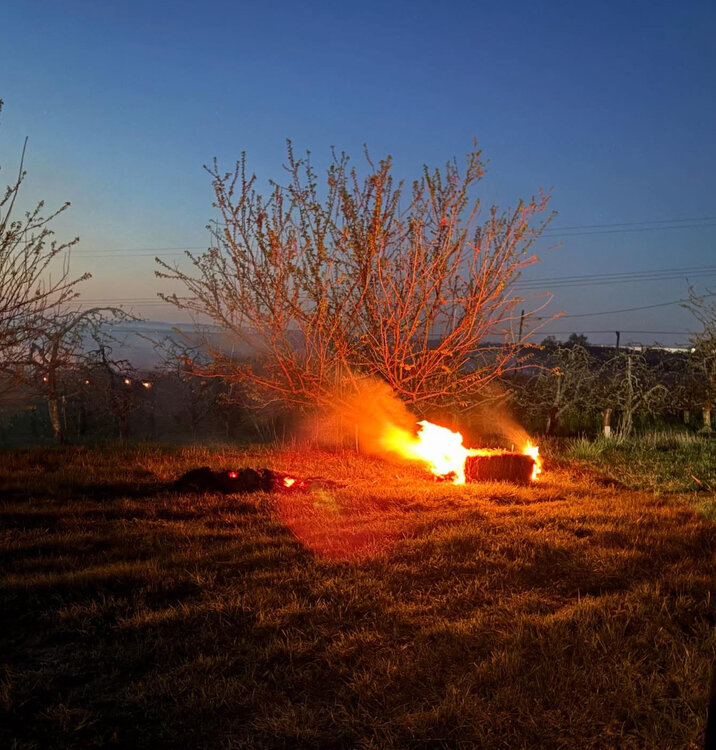
29° with frost. The orchard behind my backyard is burning hay and straw again to protect the fruit trees.
-
Booming thunder here. Best action with this first batch looks to slip south of my yard.
- 1,378 replies
-
- 1
-
-
- severe
- thunderstorms
- (and 2 more)
-
Just mist and fog all day here with nothing measurable. The sharp edge of the rain shield is rotating this way now. Gonna be close.
-
Steady light rain all day added up to 0.49”
-
22° and the neighborhood is choked with the smoke from fires that the farmers are burning in the orchards to protect the trees.
-
45° for the high here today.
-
Socked in here with fog and mist. 53°.
-
Finally getting a nice shower after being missed all week.
-
Didn’t hear it mentioned in the broadcast, but word in College Park is that Willard didn’t show up for the team dinner last night.
-
And does he take Rice and Gillespie with him ?
-
Florida has so many weapons. 6 players in double figures and one of them isn’t even Condon. I felt coming into the tournament Florida was the most complete team. Will be interesting to see if anyone can stop them.
-
24° and frosty here.
-
26° this morning. Dry air really doing its work.
-
Relative humidity at 21% at DCA, 20% at BWI for the most recent obs.