jbenedet
-
Posts
7,800 -
Joined
-
Last visited
Content Type
Profiles
Blogs
Forums
American Weather
Media Demo
Store
Gallery
Everything posted by jbenedet
-
 I’d be very skeptical of the 6z GFS output. The 6z GEFS was clearly a capitulation to the warm camp. Warmest run probably in 2 days. It looks a lot like EPS now.
 -
Solid look. I think extreme Northeast MA into far SE NH gonna have BL issues throughout. Take em down. Snow profiles but with really poor ratios.
-
I like this a lot actually. Very reasonable ATM.
-
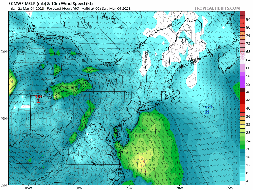
The timing on the euro couldnt be better in terms of diurnal min. That run would have been quite a bit worse in terms of snowmaps otherwise. SE and East winds ripping out ahead.
-
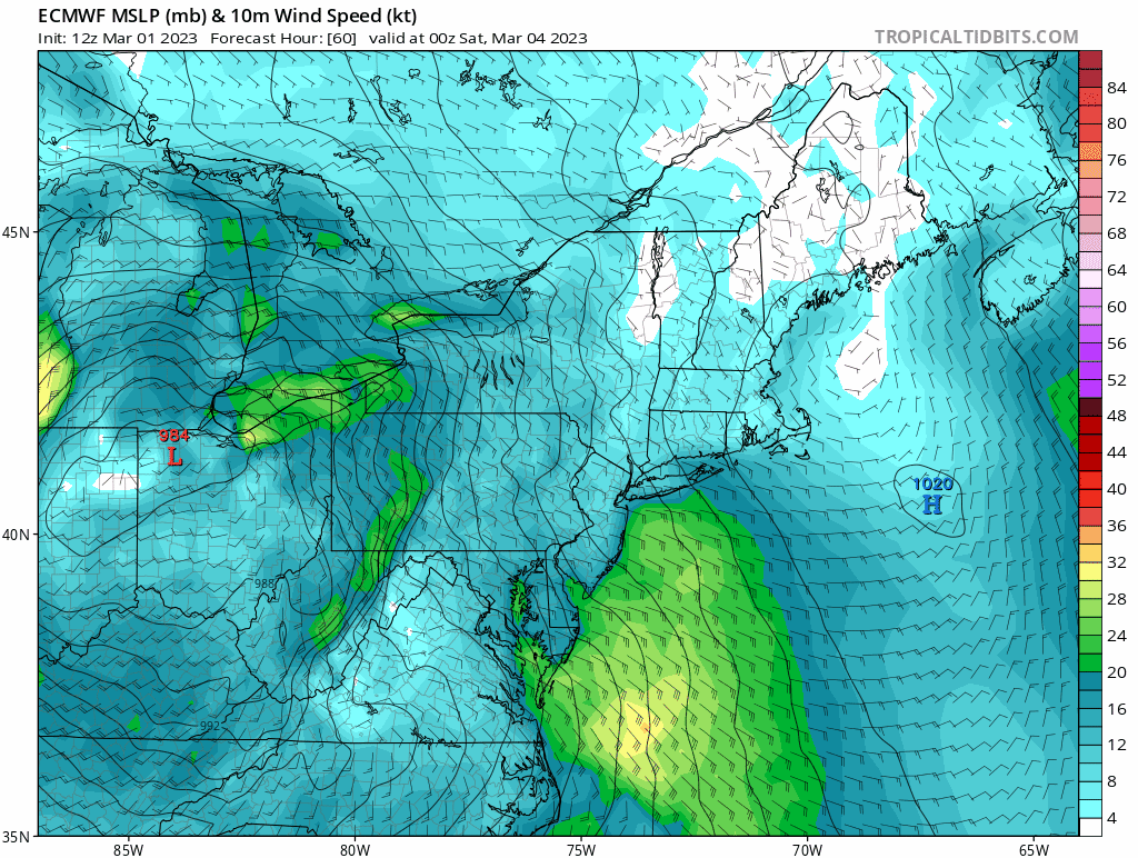
There's even a sneaky surface meso high on the 6z Euro, SE of the cape.
-
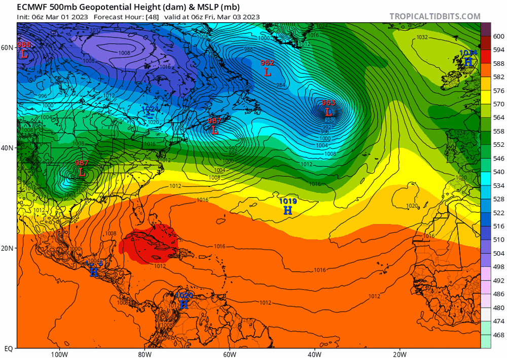
The Canadian surface hp, in actuality, extends to the western Atlantic. Those big Blue H's can be an error trap.
-
It's subtle but the GEFS trending towards other warmer guidance the past 2 model cycles. The WAR hook-up that we have seen so often this season, with confluence in place. This translates to much more of an easterly fetch despite the Canadian high in a good spot (initially). The cold canadian dews fighting the dews advecting off the atlantic.
-
I see the GFS vs most other guidance. Maybe I'm missing something? Euro/EPS looks more like rgem.
-
I don't disagree. But again, to my original post "equal chances" in mid march, New england, is far from hostile.
-
We're after accumulating snow. that's one point. Not necessarily profiles that support snow. The other is - HP/LP it's all relative. Will the cold win? Well it's surrounded by relatively warmer air. Cold is on the run - relatively warm air is overtaking it. You also don't get that classic CCB, which really makes for the big events. That's the point of these depictions, in laymen's terms.
-
Yea, Sat morning. Looks like white rain/drizzle imby by 15z. East winds are ripping on the euro, though even with that look. It's tenuous for many. And again the timing is like ideal, if it shifts either way it's worse. I'm a seller of the GFS depiction (for now).
-
There's also a light rain drizzle/rot end with this look because how warm the atmosphere is by Sat afternoon. No cold hook-up to the west, north or the upper levels.
-
The NAM would have been quite a bit worse if not for the night time onset. That aspect looks key across multiple pieces of guidance. It's effin' warm.
-
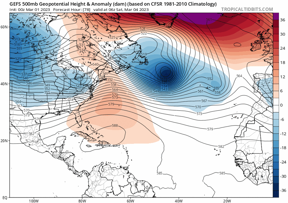
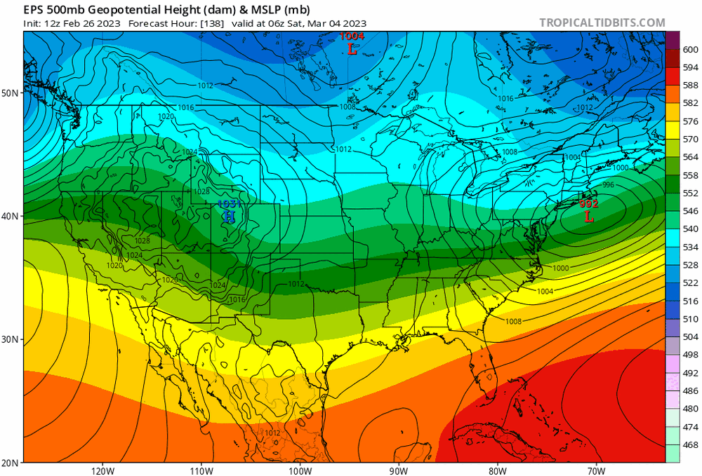
I'm not really feelin' it. At least not yet. The GEFS are strongly pointing to a resurgence to a +NAO regime. The MJO signal to phase 8 is quite strong around that time frame, but does not at all align with the EPS depiction. Therefore I believe the GEFS has a better handle on that timeframe than the EPS currently, and you're going to see the latter trend toward to former, which is more "equal chances" than gang-busters.
-
Lol at the 2m temp guidance for this morning. Today is going to be nicest day in a while. Coupled with full march sun. Packs gonna take a beating today. Was too lazy to clean to car off this morning—parked it in the sun towards the front…already doing its work.
-
Phase 8 really loses its cold Jan-->Feb--> March. I don't know why. Maybe someone else here can add. Tomorrow being March 1st, and phase 8 happening around mid month, a blend of the two graphics is probably best, but any way, point is: December and January phase 8 ain't nearly the same as March. Seeing some AN tendency sneak into VT, and MA Berks.
-
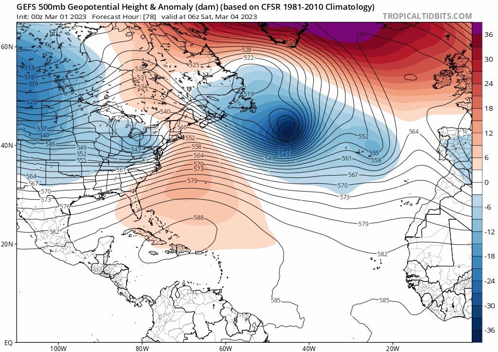
Have to watch this closely - a big drop in the AO, to strongly negative. This isn't a positive for a more snowy outcome, ironically - it will promote the primary phasing with the northern stream, as the PV sags south out of central Canada, and troughing is heavily displaced to the west. More phasing of the primary means more trouble at the mid levels to the north, and less frozen solutions to the south.
-
Seeing a stronger primary on the EPS, and increasing phasing with the PV over Manitoba. The primary was stubborn for tomorrow's event but we had antecedent cold to overcome that. That's the big problem, for many, this time imo.
-
lol. Not saying that will happen verbatim but that is like the seasonal gradient right there, to a Tee
-
Yea you're def in a good spot, as which has been true on the season. The rest of us...
-
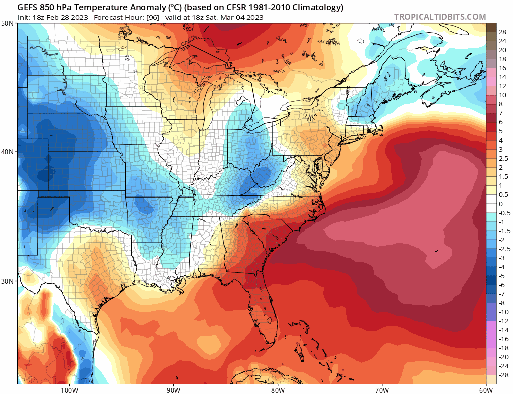
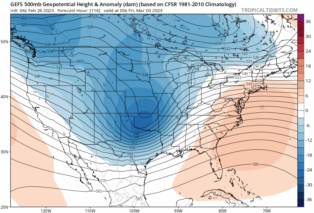
Out west to the plains it's trending stronger. I think the problem is damage is done on that front, sending the 540 thickness where many are "out of the game". Confluence is there but with background warmth.

-
H700 looks like biggest nagging issue for snow accums.
-
Ho hum, no kiddin' . Re: winter 2022-2023