jbenedet
-
Posts
7,617 -
Joined
-
Last visited
Content Type
Profiles
Blogs
Forums
American Weather
Media Demo
Store
Gallery
Everything posted by jbenedet
-
 Yea. I’m saying the general idea. I don’t like that for your specific area at all.
 -
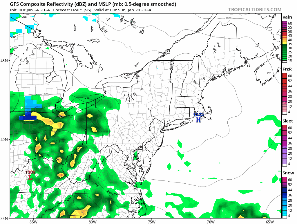
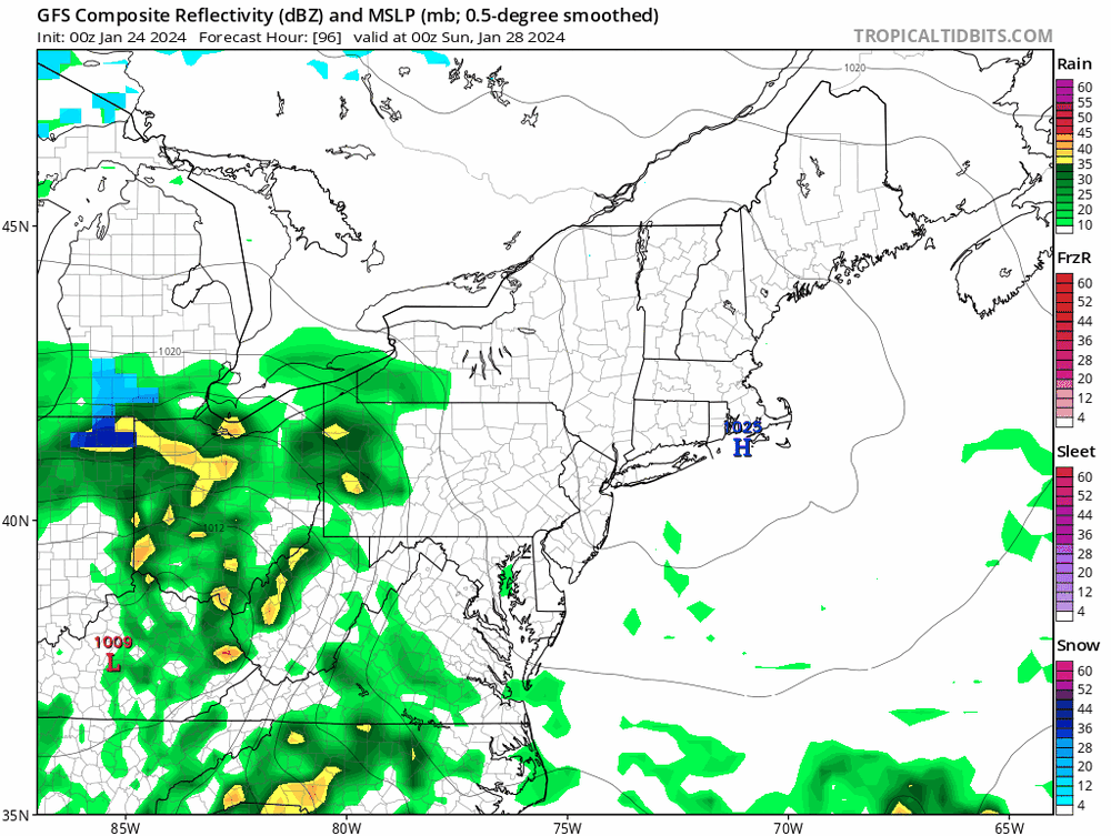
Kinda makes sense with that early H5 occlusion causing two qpf maxes, one west, the other east, later on Monday. Much less in between…
-
That early H5 occlusion gonna cause heartburn up until go time.
-
It’s not just the sun man; be objective.
-
Of course now all the detractors will think I’m saying dendriteland will have p-type/ratio issues tomorrow. No, I’m not…sorry guys…
-
“It won’t mean much” Please elaborate. Everything matters at the margin. Wasn’t it just yesterday that you guys got skunked on modeled snow that never came?
-
What’s it like living in a bubble?
-
I’m talking about today. In regards to yesterday, Most of rockingham county, chief. Even DAW hit 37/36 in heart of Strafford.
-
Just paying attention to the last storm, and the one before that, and the one before that and….. Oh yea… and we are already at the NAM’s progged highs for today…
-
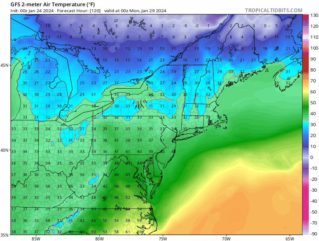
40’s today. Feels, sounds and looks like very late march. Short term guidance, again, lost.
-
Damn I better reconsider my thoughts then….
-
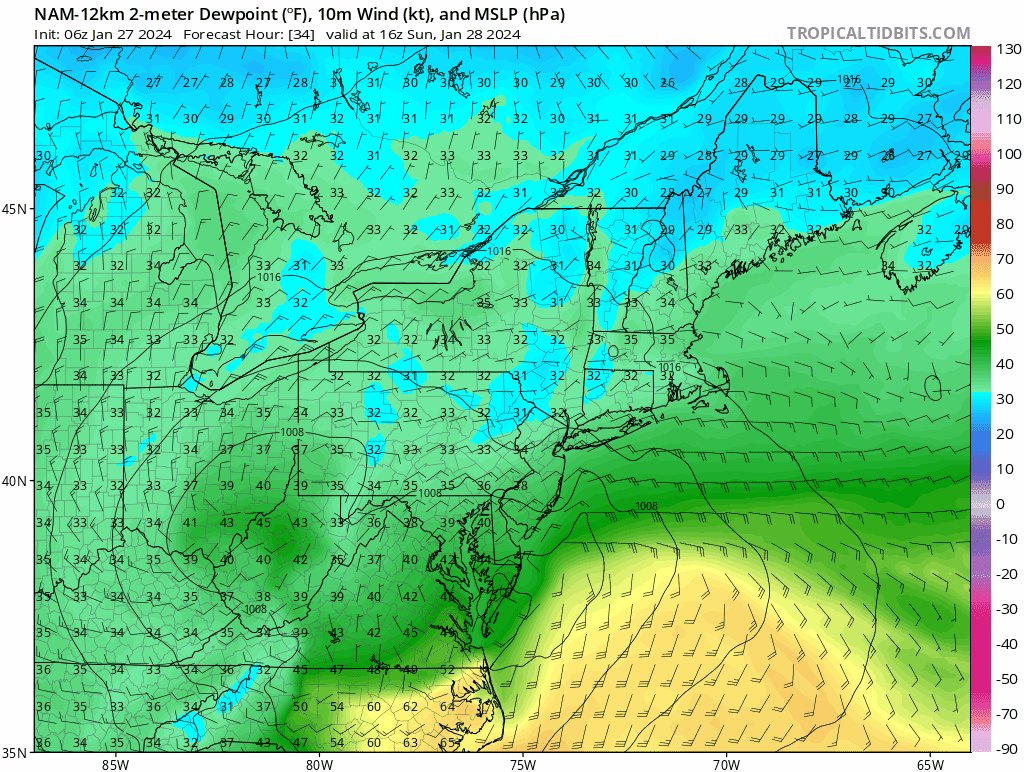
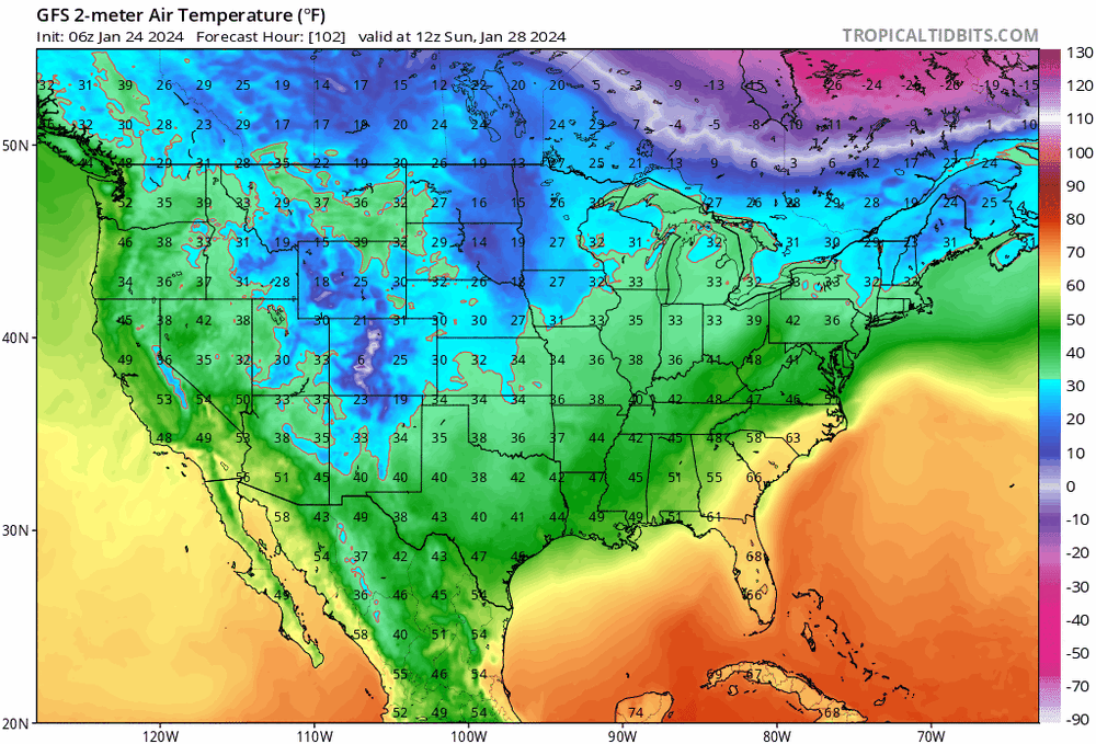
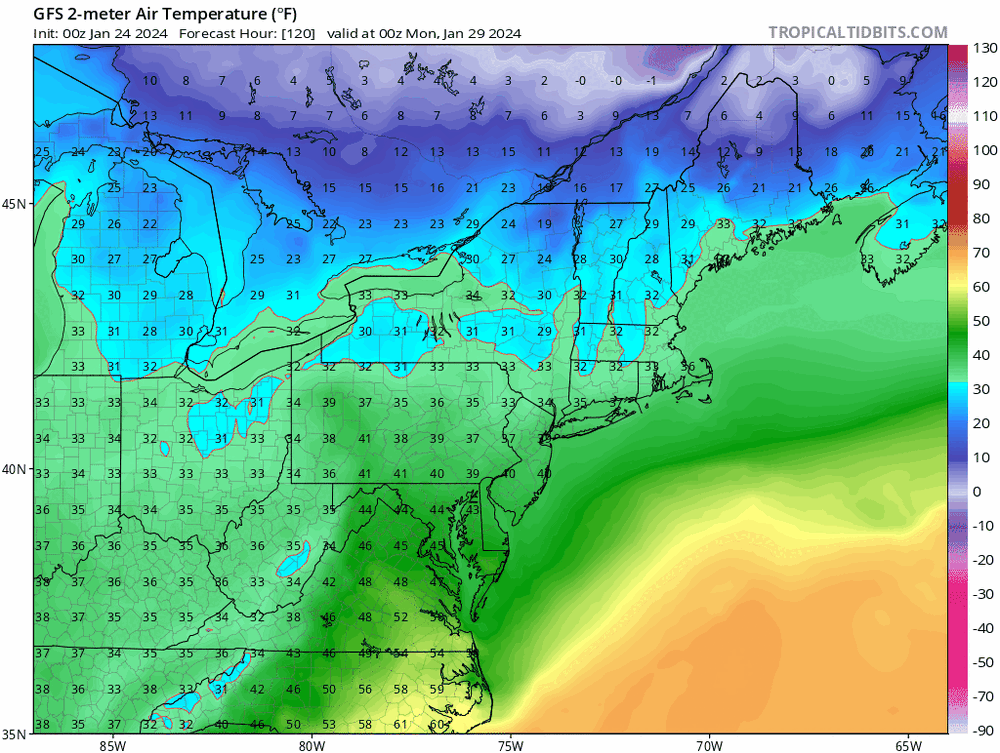
I believe best chance for accums is Monday. NAM is warm verbatim and that’s with a cold bias. These are dews folks; not surface temps….They are above freezing throughout the front end thump, and I don’t see this eroding quickly with 30 dews in Ontario and QC and a 1000 mb low… Start time is also late morning, strongest push is 12 -3 pm for the front end thump. Normally wouldn’t mean much in late Jan, but every fractional degree counts with such warm BL temps and very limited dynamics.

-
LOL. South East Canada CP airmass vaporizing in 10 GFS runs.
-
Surprised to see low 40's into ALB. Warm sector making a much stronger push than guidance consensus. ALB: 40/37 AQW: 39/33
-
Temperatures busting low on guidance today. 37/35 @ PSM. 40's possible as we dry out.
-
These clown maps are gonna cause snow weenie rage in SNE. This bump north isn’t coming with better dynamics; it’s with a much weaker surface high and CP airmass has all but vanished. last 10 runs of GFS - check out Canada I didn’t think that would happen… Result is less suppressed but still very weak storm, and more ptype/low ratio issues. Mostly the latter.
-
GEFS type solution makes the most sense. Currently MJO warm phase state and PNA neutral and ++NAO but cold and suppression is still fighting very strong over northeast and SE Canada. Very El Niño esque. Can’t build a ripping WAR for shit. Now, for this disturbance, jack up the PNA ridge allowing that CP airmass and UL height field to dip south over New England and western Atlantic and it’s major suppression. This is further compounded by the fact that there’s very limited baroclonity in the airmass which the disturbance originates, no countervailing forcing to build the downstream UL height field.
-
About a coating here, with flurries now.
-
Weak forcing. This won’t stack well. Use lower ratios then 10:1, until/unless see improved dynamics.
-
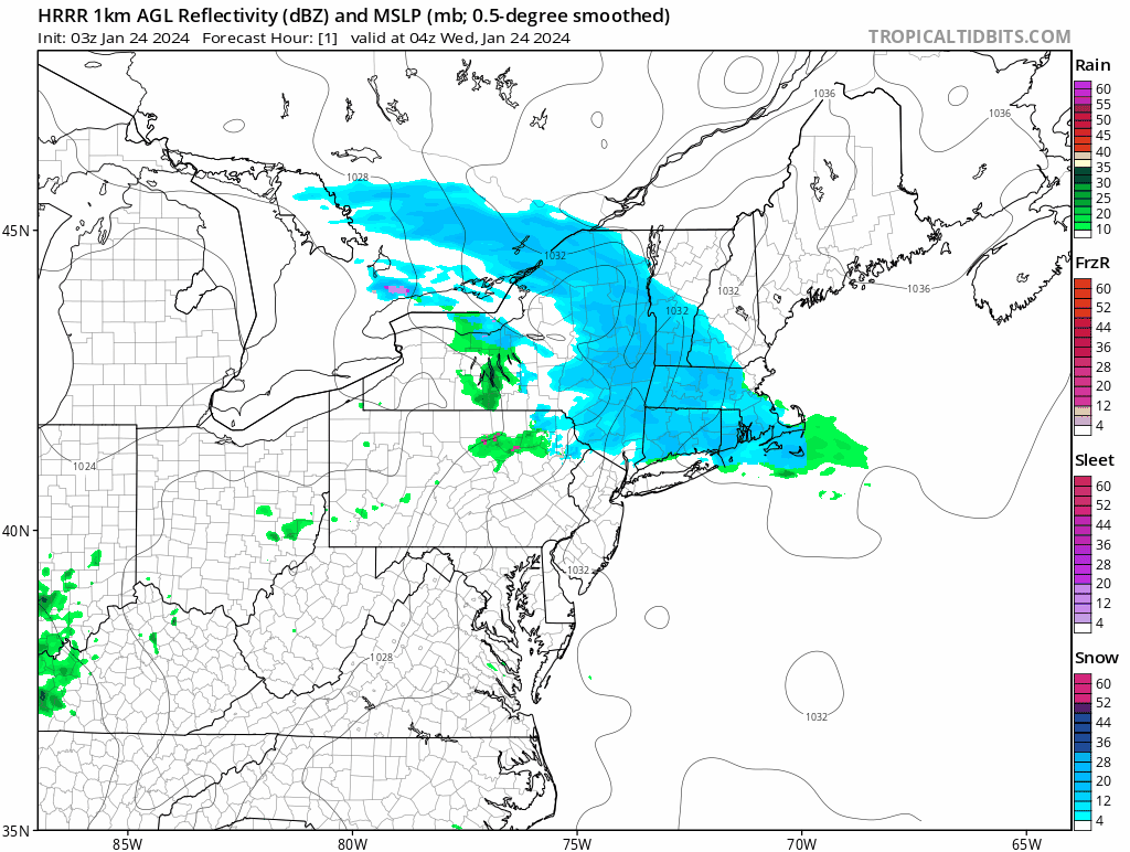
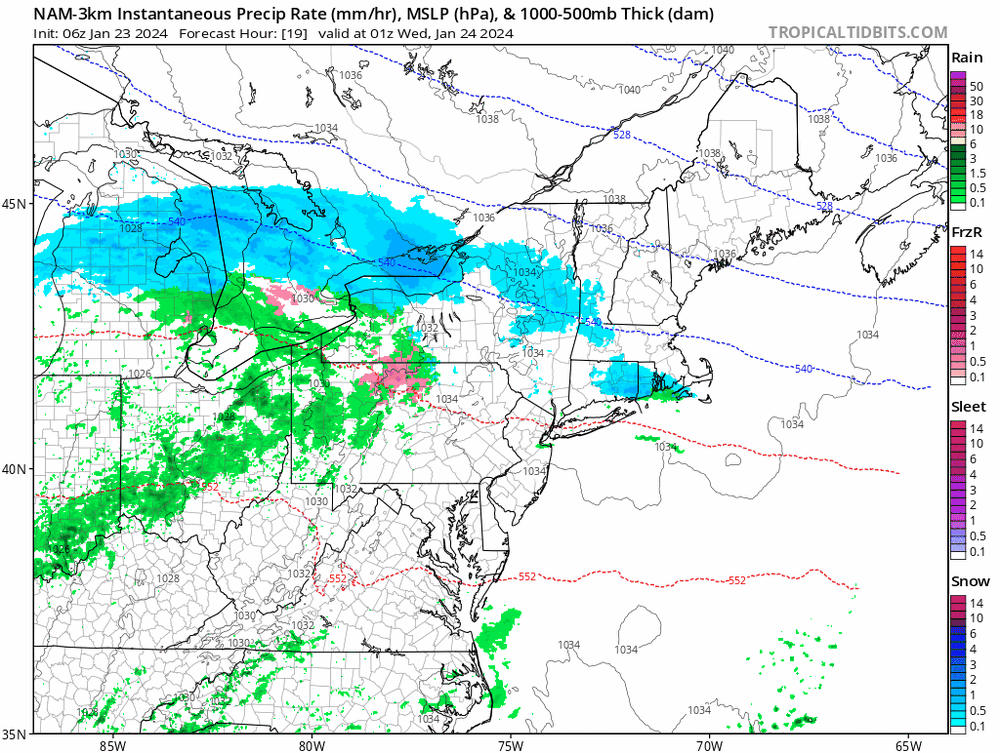
Looks like this is racing through on radar. western CT over in under an hr HRRR showing the same. Wondering if I’ll see even a flake here.

-
Dislike this map south of 84. Adding total qpf for marginal temps and scattered light precip is a big sell in something like this.
-
commuting sure. That’s timing and treating. south of the pike I’d cut BOX map in half. Leave the rest. I’d tack on an inch to their map in the berks and extreme NW CT. But many south of 84 won’t see more than a dusting/trace. Just don’t see the precip for it.
-
Very shallow cold; very weak disturbance—> no isentropic lift. Looks like a non-event south of the pike; east of the berks.
-
Sell. This is the radar output. Bottom half of that map won’t even see a coating.
-
No. It's a case of "I'm an imbecile and didn't look at surrounding obs." Time well wasted. But don't worry. You're in great company!