Chris78
-
Posts
5,226 -
Joined
-
Last visited
Content Type
Profiles
Blogs
Forums
American Weather
Media Demo
Store
Gallery
Everything posted by Chris78
-
Yeah. We've been bleeding the wrong way all day. Going to be close all the way to the M/D line it seems.
-
It's the modern day version of the Dgez model from back in the day. Basically a 4 day extension of the Nam. Imagine how fun those runs were....
-
I can vouch for this. Coming over the Catoctins from Smithsburg to Thurmont daily for work it's a different world above 1500. There's been rain on both sides of the mountain with several inches of accumulating snow in the Catoctins on many occasions over the years.
-
Mid season form
-
Avoid the motel 8.
-
Some bad posting going on right now in the Tuesday thread ...
-
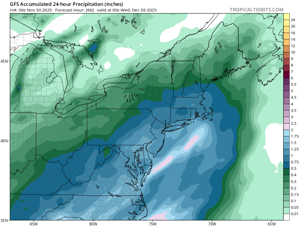
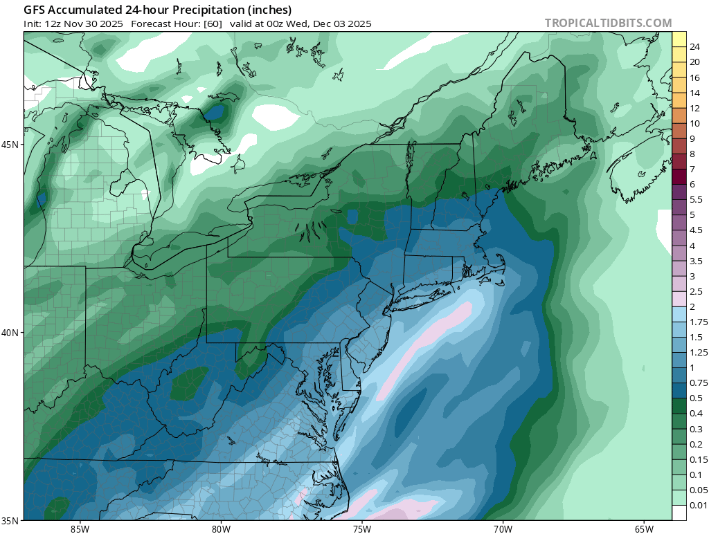
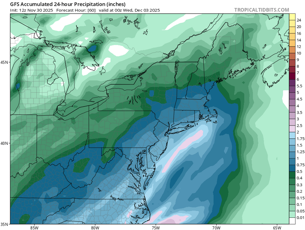
06z and 12z

-
The main difference for Northern areas is less precip
-
Gfs slowing creeping south. Nice thump for N+W
-
Yesss
-
You new here?
-
Euro still south and looks decent for areas N+W
-
Time for #2
-
BWI: 13.7 DCA: 10.5 IAD: 14.3 RIC: 8.1 SBY: 10.2
-
Not at all. Less confluence and higher heights. This one is slipping away
-
What time does the 18z run now?
-
Probably going to be a warmer run. Hope I'm wrong.
-
The cmc has upper level energy swing through Tuesday night that changes some areas back to snow. For areas NW of DC it would be a snow to ice to rain then back to snow. Similar to last night's run minus the snow on the backend. Definitely different than the gfs.
-
That was a perfect set up. Cold High anchored NW of us in Canada and a huge slug of moisture running Sw to NE. As the run ended we had 6"+ on the ground and several panels of snow left to go past 240 hours. North of DC would of been easily 12+ amounts.
-
Cmc has your 12/5 storm
-
It's ugly
-
Looking at the McHenry extended forecast temps look good for snow making once we get to Thursday. Hopefully Wisp can get going in the next couple of weeks
-
With that much snow on the maps my guess is it sucks at winter storms lol
-
Oh good. I thought winter was canceled.
-
It's awful. Lots of bad posting going on right now. A few need a break already.