snowbird1230
-
Posts
503 -
Joined
-
Last visited
Content Type
Profiles
Blogs
Forums
American Weather
Media Demo
Store
Gallery
Everything posted by snowbird1230
-
Jan 30th-February 1st 2026 Arctic Blast/ULL Snow OBS Thread.
snowbird1230 replied to John1122's topic in Tennessee Valley
I can confirm you have more than The Skyway. -
Jan 30th-February 1st 2026 Arctic Blast/ULL Snow OBS Thread.
snowbird1230 replied to John1122's topic in Tennessee Valley
Unreal. We have had no rates anywhere close to that on this side of the Skyway..very small flakes entire event..6" now..please send it this way lol -
2025-2026 Fall/Winter Mountain Thread
snowbird1230 replied to Buckethead's topic in Southeastern States
13° ..5" snow in Graham County. Not sure why but flakes have been tiny entire storm. -
2025-2026 Fall/Winter Mountain Thread
snowbird1230 replied to Buckethead's topic in Southeastern States
She dug..and then some. I often wonder what happened to the Old ULL's..The bowling balls...Appears this one is definitely bowling. BUT its the GFS -
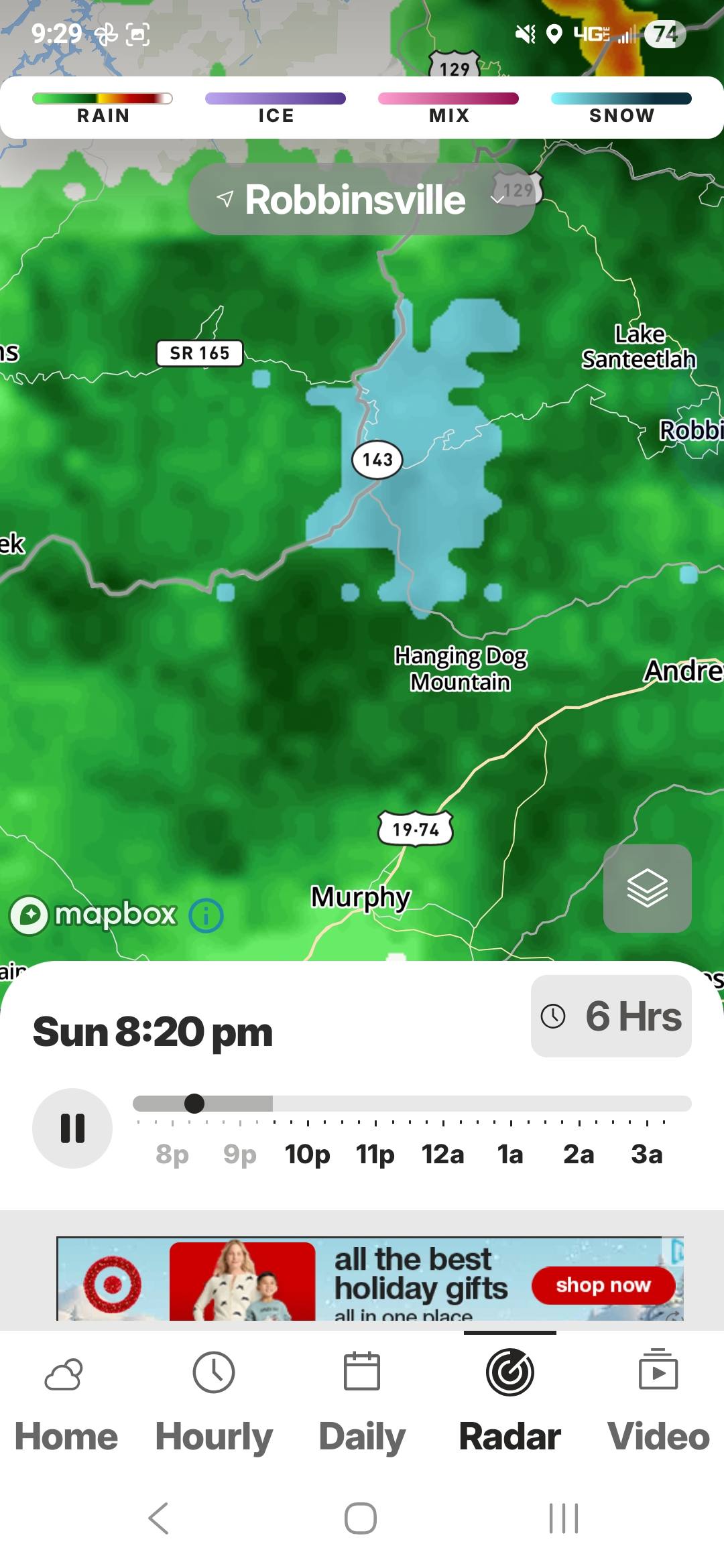
Kinda strange..Light Snow in Robbinsville (NC)
-
2025-2026 Fall/Winter Mountain Thread
snowbird1230 replied to Buckethead's topic in Southeastern States
I've saw alot of em trend NW but very few if any trend SW once it starts the N jog. Hopefully bad data ingestion but I've never been skilled enough to argue with the Euro... -
2025-2026 Fall/Winter Mountain Thread
snowbird1230 replied to Buckethead's topic in Southeastern States
I wanna believe but this is turning historic, 93ish..Life threatening for elders and shut ins.. -
January 25/26 Jimbo Back Surgery Storm
snowbird1230 replied to Jimbo!'s topic in Southeastern States
In your backyard? -
January 25/26 Jimbo Back Surgery Storm
snowbird1230 replied to Jimbo!'s topic in Southeastern States
Bump -
2025-2026 Fall/Winter Mountain Thread
snowbird1230 replied to Buckethead's topic in Southeastern States
Hate looking ahead but shouldn't this produce major NWFS on the backside with such bitter air crashing in behind the storm? -
2025-2026 Fall/Winter Mountain Thread
snowbird1230 replied to Buckethead's topic in Southeastern States
Enjoy for the next 4 hrs guys. -
Close the thread.
-
2025-2026 Fall/Winter Mountain Thread
snowbird1230 replied to Buckethead's topic in Southeastern States
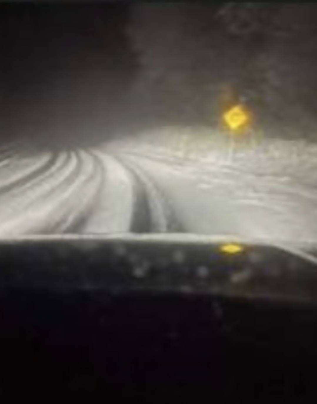
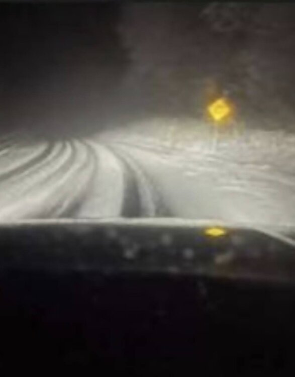
Snapchat-1795855289.mp4 -
2025-2026 Fall/Winter Mountain Thread
snowbird1230 replied to Buckethead's topic in Southeastern States
Been pouring in Graham County for last hour. 31° -
Mountain friends please ignore this thread.
-
2025-2026 Fall/Winter Mountain Thread
snowbird1230 replied to Buckethead's topic in Southeastern States
Met im at Ingles in Rville! Missed u! -
2025-2026 Fall/Winter Mountain Thread
snowbird1230 replied to Buckethead's topic in Southeastern States


-
2025-2026 Fall/Winter Mountain Thread
snowbird1230 replied to Buckethead's topic in Southeastern States
Reports of heavy snow on the Cherohala Skyway for the last 4 hrs..Radar is definitely backing it up. -
February 19-20 Major Winter Storm Threat
snowbird1230 replied to NorthHillsWx's topic in Southeastern States
Horrible map..4-6" for Graham Co lol -
2024-2025 Fall/Winter Mountain Thread
snowbird1230 replied to Buckethead's topic in Southeastern States
Just under 2" now -
February 19-20 Major Winter Storm Threat
snowbird1230 replied to NorthHillsWx's topic in Southeastern States
True, what I was meaning is some tv meteorologist don't interpret the models well at all. -
February 19-20 Major Winter Storm Threat
snowbird1230 replied to NorthHillsWx's topic in Southeastern States
Ive saw literally every model out there show huge amounts of snow in the mountains 24hrs before the event, yet when NWS GSP meteorologist look at them and cut the totals 60-70%.. 90% of the time they are right. Lots to interpreting models other than just looking at them -
February 19-20 Major Winter Storm Threat
snowbird1230 replied to NorthHillsWx's topic in Southeastern States
Thanks but his is Weather Bell..Tennessee forum is talking that for some reason, Tropical, Pivotal , WB all showing different amounts -
February 19-20 Major Winter Storm Threat
snowbird1230 replied to NorthHillsWx's topic in Southeastern States
Do u have this map for the entire state? -
2024-2025 Fall/Winter Mountain Thread
snowbird1230 replied to Buckethead's topic in Southeastern States
Hows the NWFS looking after the storm Met?