

CAPE
-
Posts
36,289 -
Joined
-
Last visited
Content Type
Profiles
Blogs
Forums
American Weather
Media Demo
Store
Gallery
Everything posted by CAPE
-
Go Canada. Looks like a TPV lobe migrating southward as well.
-
The Okhotsk vortex that has been enhancing/sustaining the strength of NPAC ridge weakens dramatically towards the end of the GEFS run, and heights build a bit more over AK and poleward(-EPO). If that is real it would allow the western US trough to broaden and shift eastward some. Canadian ens looks even better than the GEFS at the end of its run. EPS wants to mostly keep the trough out west, although it is expanding eastward at the end.
-
A little pre holiday (fantasy) cheer.
-
Oh shit, yeah.
-
^Above my pay grade, but 86-87, 09-10, or 14-15 would work for me.
-
Utopias Barrel Aged WWS for HH. Its basically Friday for the next 3 days.
-
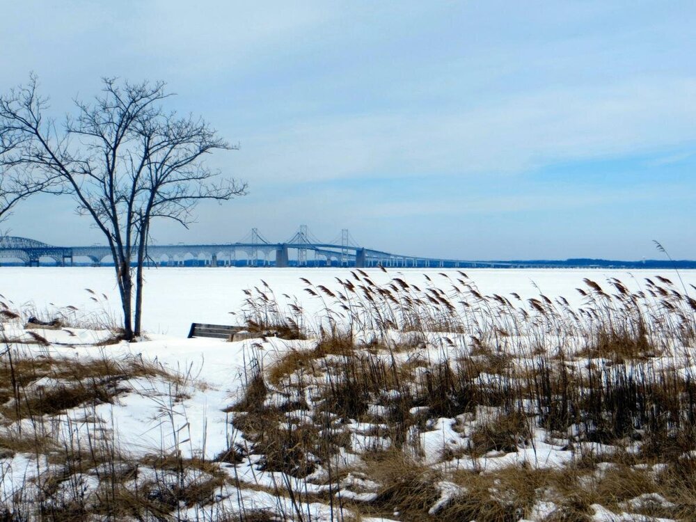
This is from late Feb 2015 taken from Terrapin Park, east side of the bridge. Have not seen anything close to this since.
-
In this thread when there is not much to see in the shorter range, we are mostly left with discussion/conjecture centered on progression of the longwave pattern in the long range. Analysis of a LR ensemble mean plot for a given timeframe over multiple model cycles can provide indications about the evolution of the overall pattern. Big picture stuff with plenty of uncertainty obviously.
-
And ofc the cold typically comes via a -AO, or in the absence of that something like 2014 with the -EPO. The -NAO (esp during a Nino with a legit stj) enhances the odds of a storm tracking underneath and just off the coast, plus keeps a N/NE wind component during a coastal storm. This is critical for significant snow in the lowlands, not so much for places further inland, esp the western highlands where there are microclimates with mechanisms like NW flow/upslope that also provide snow.
-
Maybe the best article ever written about the various teleconnections and their importance for snow in DC, by Wes Junker. https://www.washingtonpost.com/news/capital-weather-gang/wp/2015/11/12/what-the-different-weather-patterns-might-mean-for-snow-this-winter/ Lots of good info and plots/graphs, but for those who don't want to take the time to read it-
-
I mentioned this yesterday, but this window looks somewhat interesting for a possible modest wave moving along the boundary to our south.
-
Light rain and 37 here. Another few hundredths maybe? 0.62" for the month.
-
2013-14 was a cool winter but also pretty rare in that it was EPO/WPO driven and the AO/NAO was predominately positive, and we had plenty of luck with timing of the smaller events. Bigger events mostly cut. 2015 was fun once we got to mid Feb, but literally nothing for more than 2/3 of met winter for the lowlands. Those winters were also back before clippers became seemingly 'extinct' which is something you have noted of late. I would guess if we see a close repeat of the big -EPO setup again(with +AO) it would be generally frustratingly dry and cold in between rain/slop with any wave that amplified.
-
Should also include ENSO state to get a complete picture, and maybe EPO phase. From this plot you can clearly see the importance of -AO though.
-
LC2 = cyclonic wave breaking equatorward P2 = anticyclonic wave breaking poleward
-
-
Thanks, good post. In the bolded, you meant Nino favors stj, not Nina. And yes that is a major factor at our latitude to get bigger storms, and that's the big difference- in a Nino with an active stj we can score a big event or 2, and the winter as a whole is not necessarily even very cold. Combined with a -AO/NAO, we get the opportunity for a much more favorable storm track to maximize chances. 2009-10 was just cold enough with the -AO/NAO plus the active southern jet.
-
A -EPO can deliver some big cold yes, but also can be dry. In conjunction with a +AO/+NAO, amped storms have the tendency to cut NW. -AO has the strongest correlation to significant snow for the DC area.
-
-AO is king. -NAO typically occurs concurrently. Tough to beat for cold/snow in these parts. We can do fine with a -PNA, and some of our best storms have occurred with the PNA negative, but not severely so, like we can tend to see in a Nina. I would guess the -AO/NAO and -PNA combo mostly produces in a Nino winter for the DC area, but psu is the man to confirm or debunk that.
-
He hammered it. Beat the living eff out the dead horse. He was right. That said, a persistent -PNA is highly correlated to a Nina. One simple post would have done the trick. Didn't really need 100+.
-
I was looking at it as it was rolling out but had to go before the run completed. The primary thing that stuck out to me was not as good a look in the HL region, specifically the -NAO, which looks weaker and the indication of a TPV lobe underneath is absent in todays' run. Fairly subtle changes on a LR mean, but perhaps enough to allow the SE ridge to bulge northward more than previous runs. Overall not a big difference in successive runs for a day 10+ mean, so we have to watch the 'trends'. That said, I believe the expectation with the stalled MJO is that we don't see the progression we would like as soon, and the SE ridge will be tough to flatten.
-
Earlier I had h5 animated on the 12z GEFS run and it is impressive how stable that Pac ridge is. A true block, and unfortunately it is often a fixture in a Nina. We at least need it to shift a little eastward and/or poleward at times.
-
EPS from last night- negative temp anomalies pretty much coast to coast by Jan 4. Canadian ens from 12z today gets anomalous cold to the east coast by Jan3, but more impressive a few days later-
-
Out of the big 3 globals it is mostly the GFS/GEFS that is delaying expansion of the cold further east. Check out the CMC ens today after Jan 1. It is smiling at us lol.
-
I mentioned this in another post but the trough looks pretty locked in over the west for the next 10 days(fun times out there) but with the NAO block and slow moving vortices underneath that, we can still get transient cold and a well timed ejection of a shortwave from out west. This is happening now but too far north. That panel I posted is suggestive that maybe we get at least a brief period in early Jan where there is a bit more suppression under the block/ a little relaxation out west where a wave could track underneath and we are on the cold side. Just a big picture snapshot on a 10 day mean and it could easily deteriorate.


