CAPE
-
Posts
36,270 -
Joined
-
Last visited
Content Type
Profiles
Blogs
Forums
American Weather
Media Demo
Store
Gallery
Everything posted by CAPE
-
That was a classic lol
-
For some reason when I read this I thought of the illegal U-turn.
-
You know there is now a person here with the screen name Jake Wx? I had to look twice before I realized it was you lol
-
I just thought it was weird he even brought you into his whiny rant.
-
Just keep him out of the main threads. Panic room only access lol.
-

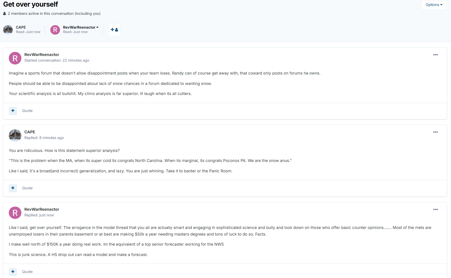
February 2026 Medium/ Long Range Discussion: 150K Salary Needed to Post
CAPE replied to Weather Will's topic in Mid Atlantic
I think I'm gonna. So much bullshit. And Randy might be interested to see it. -
February 2026 Medium/ Long Range Discussion: 150K Salary Needed to Post
CAPE replied to Weather Will's topic in Mid Atlantic
He didn't like my post lol. He messaged me...I might post it in banter. -
February 2026 Medium/ Long Range Discussion: 150K Salary Needed to Post
CAPE replied to Weather Will's topic in Mid Atlantic
Your 'analysis' is a broad generalization and is whiny and lazy as fuck. -
February 2026 Medium/ Long Range Discussion: 150K Salary Needed to Post
CAPE replied to Weather Will's topic in Mid Atlantic
Storm after the storm potential on the EPS with energy ejecting east from the southwest and the look up top on the Atlantic side remaining largely intact. -
February 2026 Medium/ Long Range Discussion: 150K Salary Needed to Post
CAPE replied to Weather Will's topic in Mid Atlantic
It has been suggestive of a wave or 2 between the 9th and 12th on recent runs. There is some decent vorticity being puked out from the upper low digging south along the west coast of Canada and riding overtop the de-amplifying ridge as it shifts eastward. Also some energy ejecting eastward from the SW. Wouldn't it be something if there was enough interaction as those pieces head east to make something happen before the window we are focused on lol. -
February 2026 Medium/ Long Range Discussion: 150K Salary Needed to Post
CAPE replied to Weather Will's topic in Mid Atlantic
It had the strongest signal among the ens runs at 0z. -
February 2026 Medium/ Long Range Discussion: 150K Salary Needed to Post
CAPE replied to Weather Will's topic in Mid Atlantic
The Latest Ensemble runs look good for mid month. I posted the GEFS earlier. Here is the Canadian- -
Snippet from WPC Forecast Discussion- With the passage of the Arctic front, snow squalls are possible from MI and western NY to OH, PA, and WV starting late Thursday night and continuing through the day on Friday. Some of the stronger showers and squalls are looking increasingly likely to spill over the central Appalachians into parts of the Mid-Atlantic later in the afternoon, possibly impacting the evening commute on Friday. Upslope snow in the central Appalachians should maximize Friday afternoon/evening as the front moves through.
-
February 2026 Medium/ Long Range Discussion: 150K Salary Needed to Post
CAPE replied to Weather Will's topic in Mid Atlantic
Then Will says we should be using the ensembles more lol. Uh, yeah been saying and doing it forever lol. Only post I made this morning was 'big picture' ens mean. Good to see Will post that though. Reborn! -
February 2026 Medium/ Long Range Discussion: 150K Salary Needed to Post
CAPE replied to Weather Will's topic in Mid Atlantic
Yep. Facilitated by those who race to be the first to post op run snow maps at range, then if the next run or 2 don't have it the posts become its a dud or a disaster. Gets the weenie pendulum swinging. -
February 2026 Medium/ Long Range Discussion: 150K Salary Needed to Post
CAPE replied to Weather Will's topic in Mid Atlantic
-
Mount Holly mentioned all of this in their AFD, plus snow squall potential. This could actually be fun. We shall see.
-
Its unexplainable unless you were there, or could see the posts. Unfortunately they seem to be lost in the abyss. Funny AF tho.
-
Yeah It was kinda sad, because he was such a good poster when he stuck to weather. Oh well.
-
That precipitated the all time epic Jebman rant, and made him a MA subforum legend lol. Ah, good times.
-
Currently 33 after a high of 37 Bring me my dusting. Refresh my bourbon. Oh shit, I'll have to do that.
-
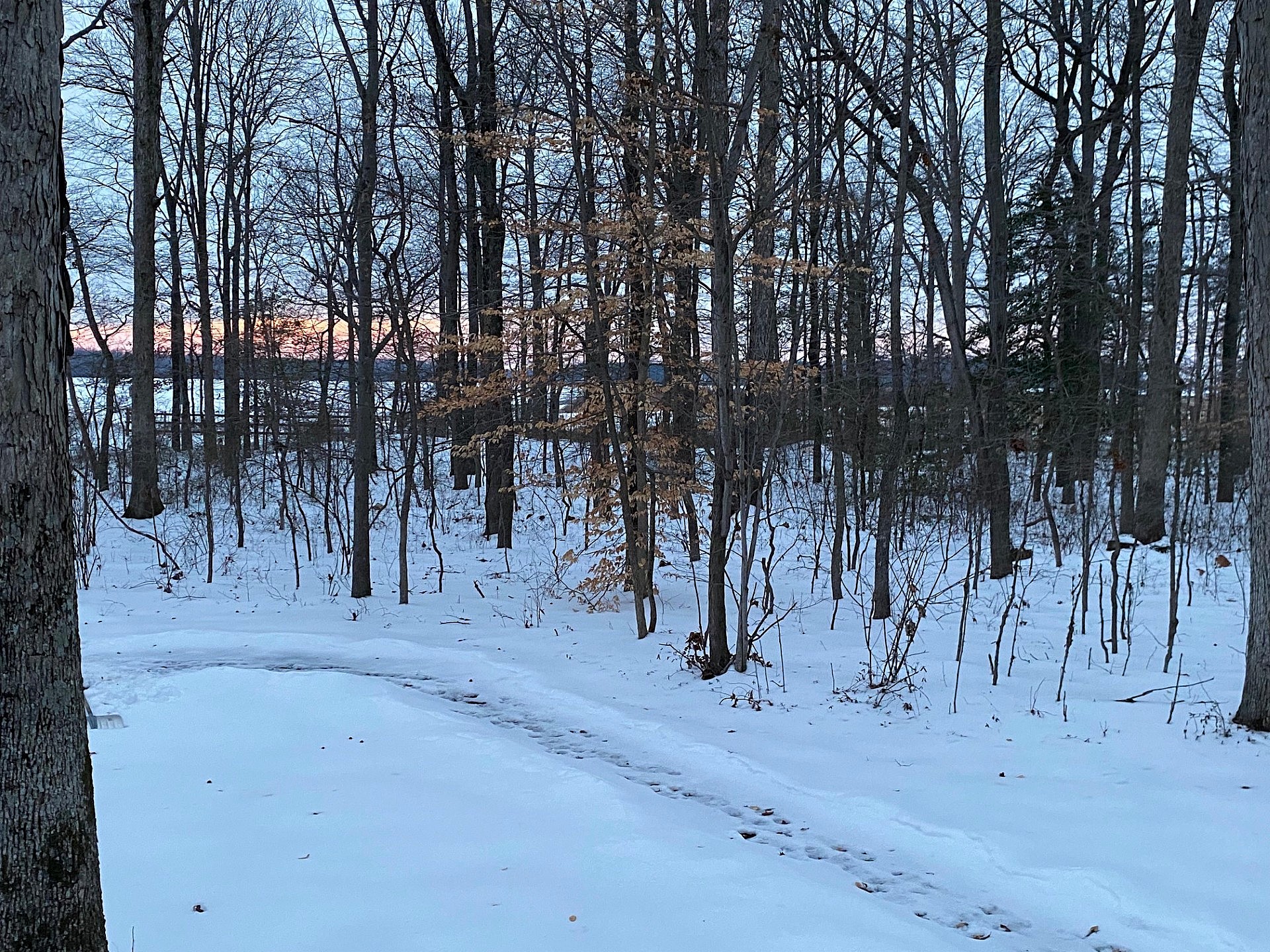
Cloud shrouded sunset. Still a deep winter look despite temps in the mid 30s with some meltage today. Hopefully a refresher is on the way.
-
He was funny as fuck. I loved how he trolled a certain poster.
-
He chose not to participate here anymore, during COVID. Nothing else to add to that, and not the place.