phil882
-
Posts
4,676 -
Joined
-
Last visited
About phil882

- Birthday 12/09/1988
Recent Profile Visitors


-
Winter Storm Izzy Obs Thread
phil882 replied to Prismshine Productions's topic in Southeastern States
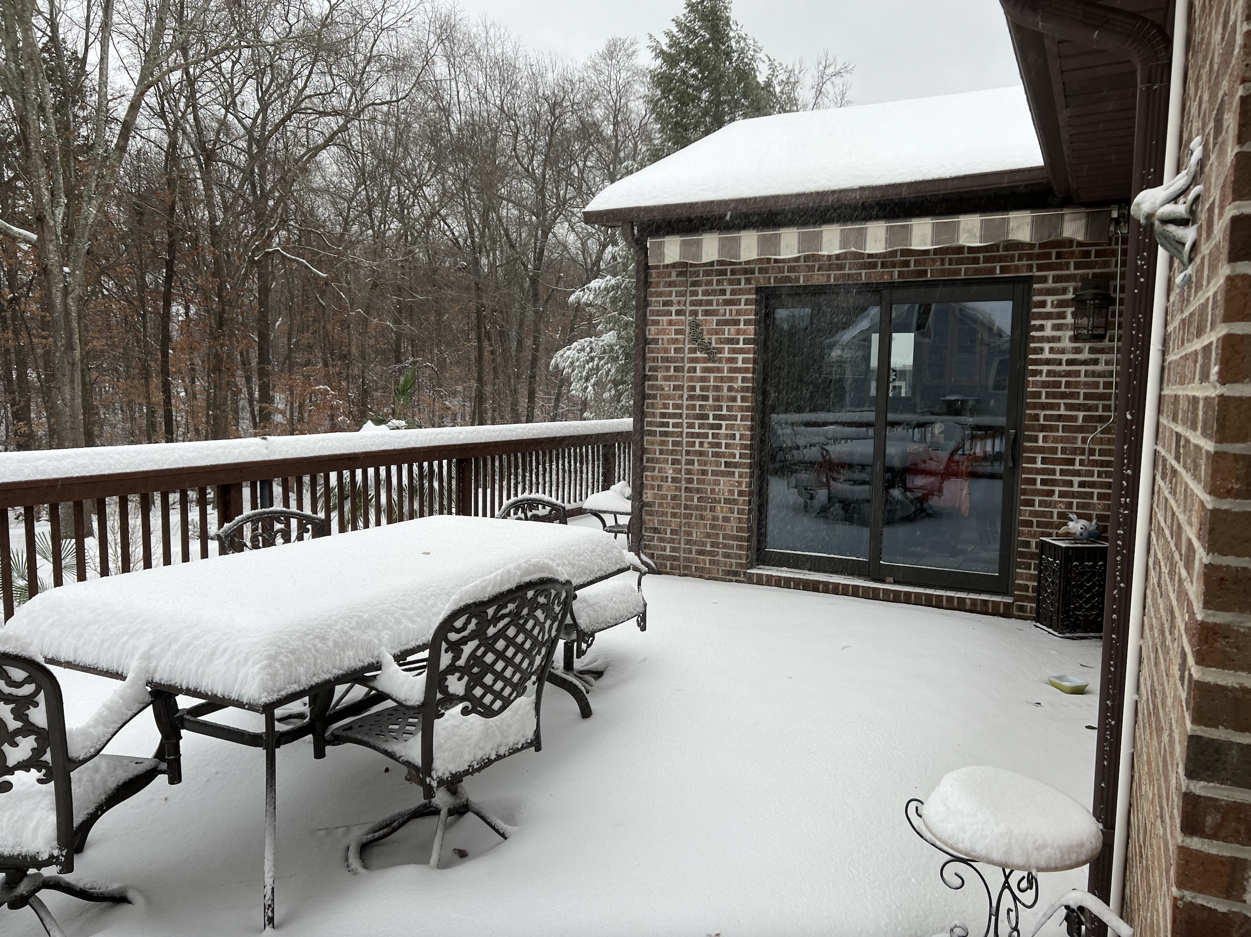
Ended up with 6.5" total as things were wrapping up around 730pm. Overall great event for the greenville area and really thankful all the precipitation stayed frozen (snow, sleet) with little to no freezing rain. Congrats to those who saw some impressive totals up in the NC mountains! -
Winter Storm Izzy Obs Thread
phil882 replied to Prismshine Productions's topic in Southeastern States
Wow I can say the back end is overpreforming by a significant margin here in Greenville. Under a very impressive band with 35-40 DBz and I can confirm we are back to moderate snow here. Waiting for this band to move out to measure again, but I suspect I've picked up another 1.5" or so from when I last measured this morning. Temp: 28.0 F (for the event low was 24.4 F at around 930am and high was 29.5 F at around 330pm). Dewpoint: 27.5 F -
Winter Storm Izzy Obs Thread
phil882 replied to Prismshine Productions's topic in Southeastern States
Picked up around 4.5" here of snow/sleet. Changeover happened right around 7am and we have been mostly sleet with blowing snow as winds have continued to increase. Big story is also the temp which continues to fall. Not sure how low we will bottom out before the wedge begins to be scoured out as the sfc low pivots through. Needless to say road conditions aren't likely to improve much today as we remain well below freezing. Temp: 24.4 F Dewpoint: 23.7 F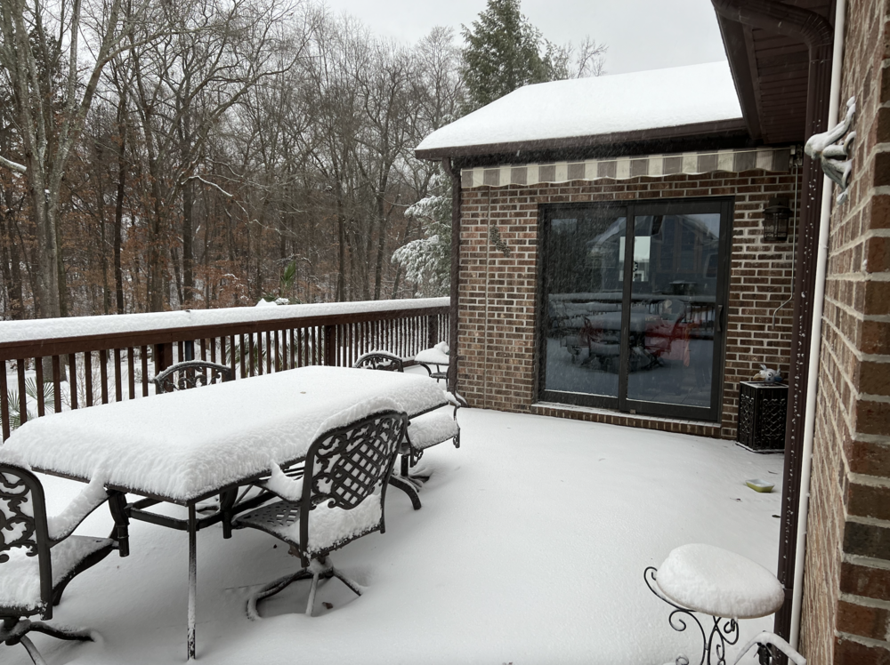
-
Winter Storm Izzy Obs Thread
phil882 replied to Prismshine Productions's topic in Southeastern States
Moderate to Heavy Snow here now... this band is quite impressive with large dendritic aggregates galore. Accumulation wise we are at nearly an inch and counting... its starting to pile up fast! Temp: 30.9 F Dewpoint: 30.6 F -
Winter Storm Izzy Obs Thread
phil882 replied to Prismshine Productions's topic in Southeastern States
I'd be a happy guy if we can keep the mixing line there there until daybreak. The earlier mixing issues made me a bit worried we were going to flip over sooner than expected but now that the line seems to have settled south of I-85 we are looking pretty good for a few inches of snow over the next several hours. -
Winter Storm Izzy Obs Thread
phil882 replied to Prismshine Productions's topic in Southeastern States
Of course right after I say that we flipped back to much better quality flakes in this nice band. Snowing probably the hardest it has so far for this event. Just slipped below freezing too. Temp 31.8 F Dewpoint 31.3 F -
Winter Storm Izzy Obs Thread
phil882 replied to Prismshine Productions's topic in Southeastern States
Looks like we have gone back to mostly snow, but you can tell the flakes are still partially melted and are very crusty without very well defined dendrites. I suppose beggars can't be choosers though. -
Winter Storm Izzy Obs Thread
phil882 replied to Prismshine Productions's topic in Southeastern States
I updated my location haha... right now I'm in Greenville, SC near the interaction of Hwy 14 & Woodruff road. Sorry I wasn't more specific earlier. -
Winter Storm Izzy Obs Thread
phil882 replied to Prismshine Productions's topic in Southeastern States
Yeah looks like we may be battling the sleet/snow line for quite a bit this morning before we flip over entirely to sleet. Hope snow winds out more times than sleet though, as this current mix is pretty rapid for ratios Temp down to 32.0 F Dewpoint 31.5 F -
Winter Storm Izzy Obs Thread
phil882 replied to Prismshine Productions's topic in Southeastern States
Uh oh, already starting to mix again with some sleet while we are in a lull between bands. Hopefully will be able to flip back over to snow once the heavier band moves overhead. Temp: 32.2 F Dewpoint: 31.6 F -
Winter Storm Izzy Obs Thread
phil882 replied to Prismshine Productions's topic in Southeastern States
Coming down good here too. Temp continues to fall. Snow beginning to be measurable on the deck. Temp: 32.4 F Dewpoint: 30.6 F -
Winter Storm Izzy Obs Thread
phil882 replied to Prismshine Productions's topic in Southeastern States
Snowing picking up here as well and temperature is crashing. Already a coating beginning to show up on the deck. Temp: 34.0 F Dewpoint: 29.7F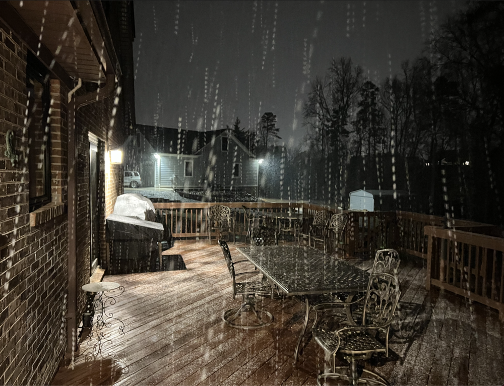
-
Winter Storm Izzy Obs Thread
phil882 replied to Prismshine Productions's topic in Southeastern States
We have changed over to all snow here but still fairly light about 1 mile SE of I-85 near the Five Forks area. Temp: 35.6 F Dewpoint: 29.1 F -
Winter Storm Izzy Obs Thread
phil882 replied to Prismshine Productions's topic in Southeastern States
Hey all (long time no see!) I happen to be at home this weekend visiting family so might as well post some obs while i'm here for the storm! Been such a long time since I got to contribute in a SE obs thread! Light Sleet/Snow mix just started here. Will be interesting to see if we have a decent period of snow tonight. Temp 38.1F Dewpoint: 28.0 -
Ask and you shall receive! Haven't been here in a while, but I wouldn’t miss a chance to check in with my old friends here. I’m out now on the west coast in a location (Monterey, CA) that never gets snow so now I get to live vicariously through you all. To keep things on topic, one thing I’d lookout for is the front end precipitation rates (now-midnight). Have a feeling those in the WNC mountains will over preform with snow accumulation in the early going for this system, as the frontogenesis on the front end band is probably being a bit underforecasted given the impressive 40-45 dBz band seen on radar upstream. For upstate SC, it will depend if the precip rates get high enough to bring the entire 800-sfc column to isothermal. We still have a ways to go for those still in the 40F range, but there is already plenty of mixing for those in the 35-37F range, so once the stronger band moves in, we should see most of the northern upstate (North of I-85) flip over to wet snow before the warm nose comes in.