

klw
-
Posts
4,902 -
Joined
-
Last visited
About klw

Recent Profile Visitors
8,205 profile views


-

Wounded Duck Strikes Back: Dec 26 & 27th Winter Storm Obs
klw replied to WxWatcher007's topic in New England
1.4" new here -
26th-27th event, coming at us like a wounded duck.
klw replied to Go Kart Mozart's topic in New England
1.4 " new overnight -
26th-27th event, coming at us like a wounded duck.
klw replied to Go Kart Mozart's topic in New England
Just when I think I have seen everything the internet has to offer... -
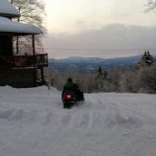
very light snow here the past couple hours- lovely mood flakes after a quarter inch over night
-
Along with the 80% of the population of Massachusetts and Connecticut that drive to NNE every Friday evening.
-
-
another 2.4 overnight. 5.3 total
-
heading to bed so cleared the board, 2.9" so far
-
Snowing nicely at the moment. A quick check found 2.4" new.
-
That image right there makes me glad I decided to work from home today.
-
It sounds like we can definitively declare winter's back is broken. Can I hold off until New Year's before I install?
-
Pack survived here, just got home to a freshly covered driveway.
-
I threw my chainsaw in the back of the Prius this morning in case I need to clear anything to get back home. I acknowledge this may be the first time in recorded history that someone has uttered or written the words "I threw my chainsaw in the back of the Prius"
-
in case folks missed the BTV area discussion earlier: https://forecast.weather.gov/product.php?site=BTV&issuedby=BTV&product=AFD&format=CI&version=1&glossary=1 Sfc analysis places powerful and deepening 985mb low pres near Ely MN, while a 1030mb high pres is acrs the north Atlantic. Upper air analysis shows sharpening full latitude mid/upper lvl trof acrs the central Plains, while deep moisture advection continues on a strengthening south to southwest flow in the 925mb to 500mb layer. As sfc low pres deepens the 925mb to 850mb wind fields strengthens overnight into Friday acrs our region. The NAM and RAP both show progged 850mb winds of 75 to 90 knots, while 925mb winds are in the 55 to 70 knot range, highest over the northern Dacks into the northern CPV. The difficult challenge continues to be how much mixing occurs, as the strongest winds are co-located with the axis of heaviest rainfall. However, given the progged fine line of convective showers by NAM3KM/HRRR, the embedded heavier down pours would have the potential to tap very strong winds in the 925mb to 850mb layer and transfer some higher speeds to the sfc. Given this potential and latest RAP/HRRR soundings showing 500 foot agl winds of 45 to 55 knots, with 59 knots at Malone at 12z Friday, we have expanded the wind advisory. HREF shows 60 to 80% prob of 60 mph or greater winds along the Route 11 corridor and acrs parts of central/northern VT with <30% prob of winds greater than 65 mph, while indicating 90 to 100% of winds >45 mph acrs most of our cwa. Did consider High Wind Warning for northern Dacks, but southeast direction and still some uncertainty on boundary layer mixing, may limit areal coverage of 60 mph wind gusts. Still something to watch closely. Also, have some concerns over southern Greens with southeast downslope gusts near Rutland, but soundings are showing slightly weaker low level wind fields and limited mixing due to the moist adiabatic sounding profile and weak inversion above ridgetop. Generally thinking wind gusts in the 45 to 55 mph range, which wl peak between 4 AM and Noon on Friday.
-
1.4 here


