All Activity
- Past hour
-

December 2025 regional war/obs/disco thread
TauntonBlizzard2013 replied to Torch Tiger's topic in New England
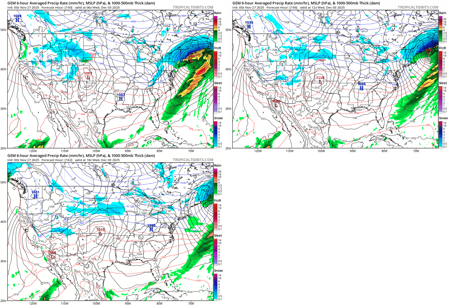
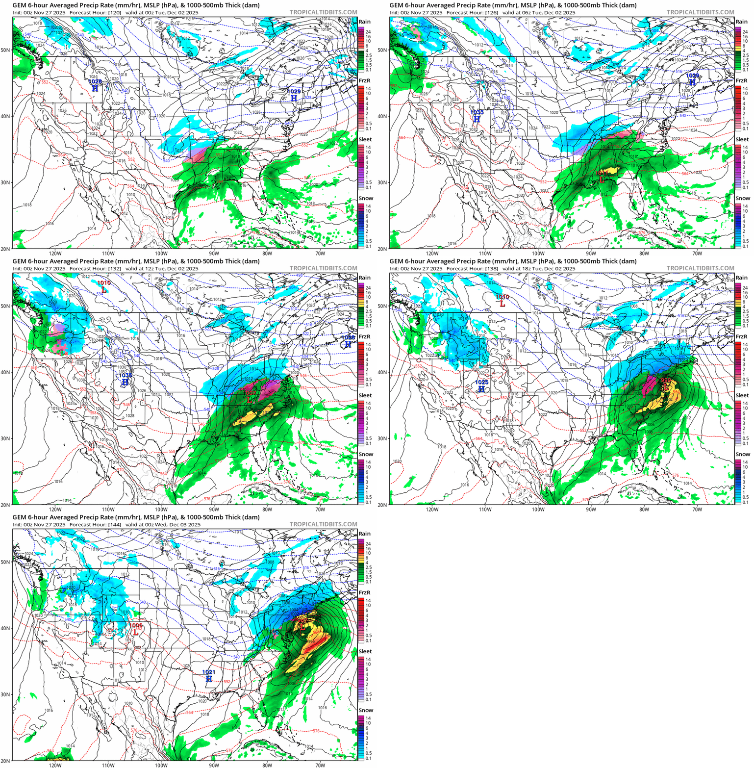
The cmc is basically just a rainstorm for SNE, briefly starts as snow, but the actual accumulating snow is confined to central and NNE -
Time for the Euro to switch places and reel us back in! LOL!
-
Run out of my basement. Damn near 2" QPF on that run verbatim, just for 12/2.
-
Happy Thanksgiving all
-
Nov 28-30th Post Turkey Day Wintry Potential
HillsdaleMIWeather replied to Chicago Storm's topic in Lakes/Ohio Valley
Hoping it trends back up -
Still a few days out on the Op models but ensembles should start to show members leaning with more of a west track.
-
Oh well. Bedtime for me while I try to sleep with an arm covered in hives. Found out I can't take omoxicillan the hard way. Good luck with the Euro.
-
It's ugly
-
Your 12/4-5 that I believe in is still on Models will cycle and show it some snd then not . Busy time and then analogs say 12/20-21
-
Gotta pick up a win here
-
Yes, Early on climo will rule.
-
Add the ukie to that also
-
Nah, Ukie same problem. No High up north and cold surrenders.
-

December 2025 regional war/obs/disco thread
Torch Tiger replied to Torch Tiger's topic in New England
yeah it looks like exactly what you'd expect for 12/2. -
Ukie vort further south. Has a better chance. We'll see soon.
-
-
Interior would get pounded on these runs verbatim.
-

December 2025 regional war/obs/disco thread
Torch Tiger replied to Torch Tiger's topic in New England
yeah ggem and gfs op really amped up. snow/mix/rain -
If we can just get GFS and cmc to shift about 50 to 100 miles east a lot of us would be in business.... Still 130+ hours out.
-
-
Agreed!!
-
Colder at surface but primary rides into wv. Sleet
-
Gem better than Gfs but same problem with no confluence to the north. High in the NE just moves out too fast.
-
Cmc also
-
When I Debbie downed about being in the southern end of the snow.. And I know it was not the edge, what we see on the Gfs is what I expected to see.. And I am not saying it won't shift around and I think the GFS is way too excited about precip and strength which are working against us.. But it was a logical shift. Could reverse in the morning.. I dunno.. Just seemed like the natural progression that the cold would move out. Timing, location, luck. Always needed. Will see what twh GEFS say.

