All Activity
- Past hour
-

12/31-1/1 Possible Snow Showers/Squalls to Start 2026
Stormchaserchuck1 replied to bncho's topic in Mid Atlantic
Snow squall warning for me! -

12/31-1/1 Possible Snow Showers/Squalls to Start 2026
TSSN+ replied to bncho's topic in Mid Atlantic
Picked up quick powder
-

12/31-1/1 Possible Snow Showers/Squalls to Start 2026
HighStakes replied to bncho's topic in Mid Atlantic
Started here. Strong winds, 1/4 mike visibility and S++. -

E PA/NJ/DE Winter 2025-26 Obs/Discussion
Fields27 replied to LVblizzard's topic in Philadelphia Region
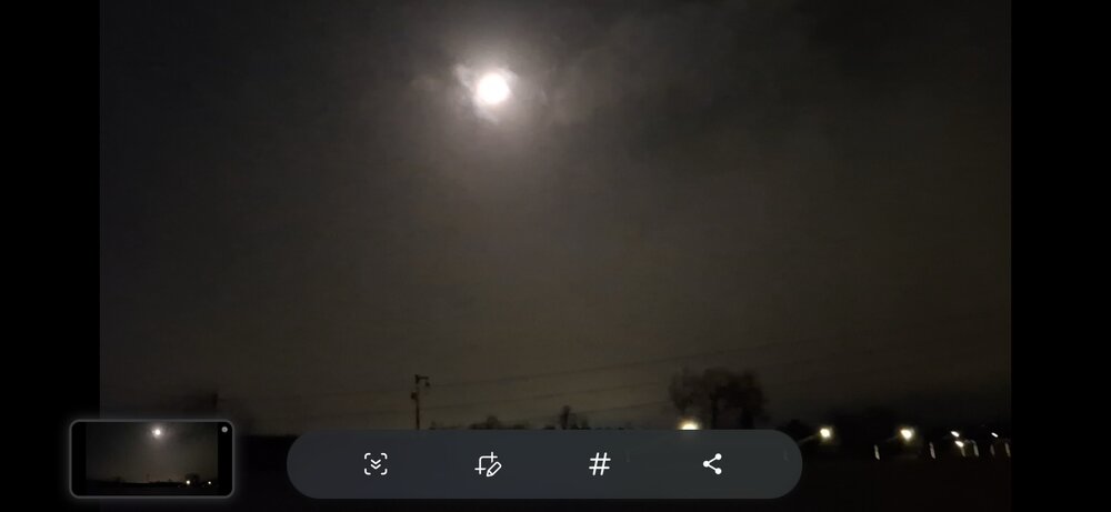
Will see if that holds together to reach Philly. Currently 33 here in NW Philly with dp 26. One of the most intense squall lines I've experienced. Also one of the longest. Glad I randomly woke up to see it. Sent from my SM-S938U using Tapatalk -
12/31-1/1 Possible Snow Showers/Squalls to Start 2026
TSSN+ replied to bncho's topic in Mid Atlantic
Getting ripped here -

E PA/NJ/DE Winter 2025-26 Obs/Discussion
Hurricane Agnes replied to LVblizzard's topic in Philadelphia Region
Snow Squall Warning lofted to counties N/W of Philly - Will see if that holds together to reach Philly. Currently 33 here in NW Philly with dp 26.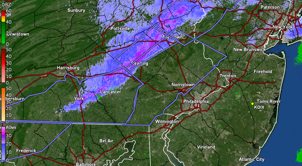
-
.thumb.jpg.6a4895b2a43f87359e4e7d04a6fa0d14.jpg)
Central PA Winter 25/26 Discussion and Obs
Yardstickgozinya replied to MAG5035's topic in Upstate New York/Pennsylvania
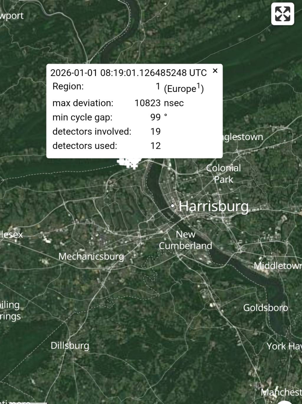
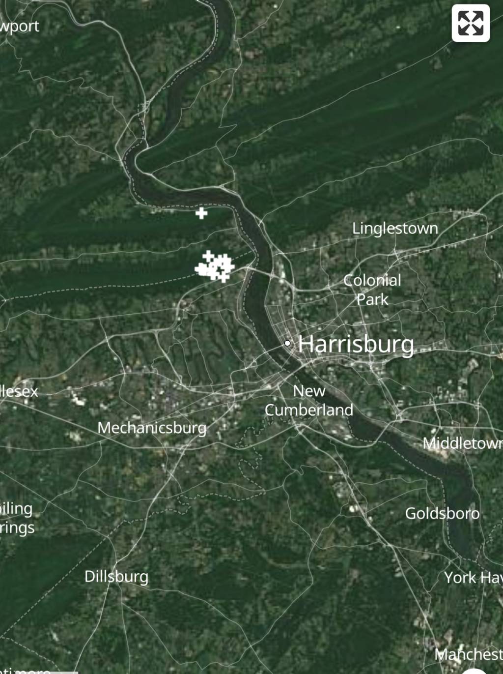
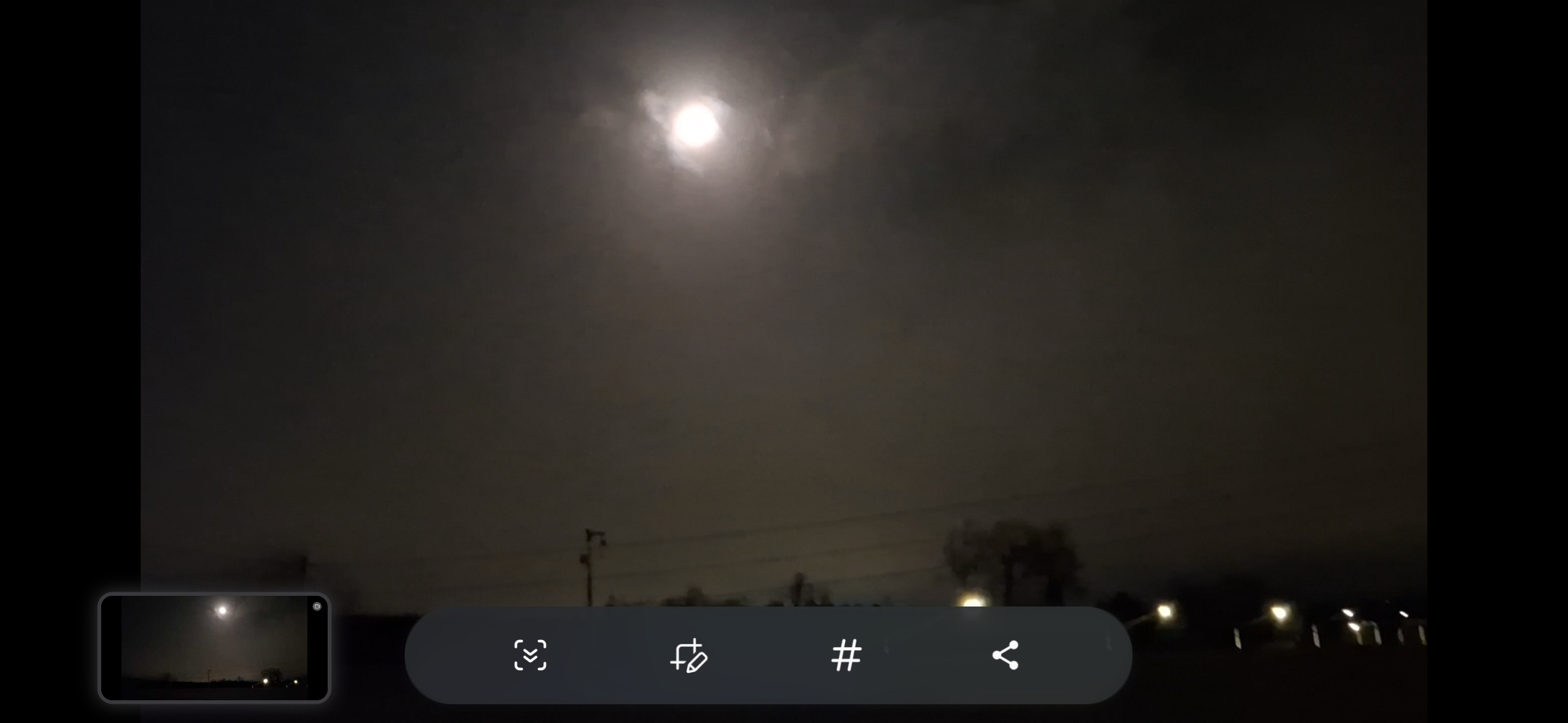
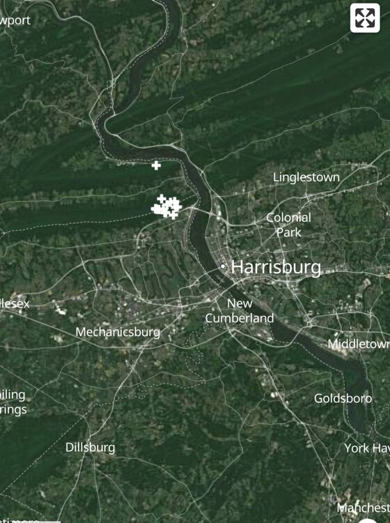
Right after I saw the couple lightning flashes , there was also a few transformers that exploded to the north of my location. My New Year's resolution is to experience. a lot more of those this winter, along with a couple big ones. -
Central PA Winter 25/26 Discussion and Obs
Yardstickgozinya replied to MAG5035's topic in Upstate New York/Pennsylvania
114 Lewisberry Rd at Fairview elementary school entrance.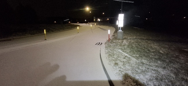
-
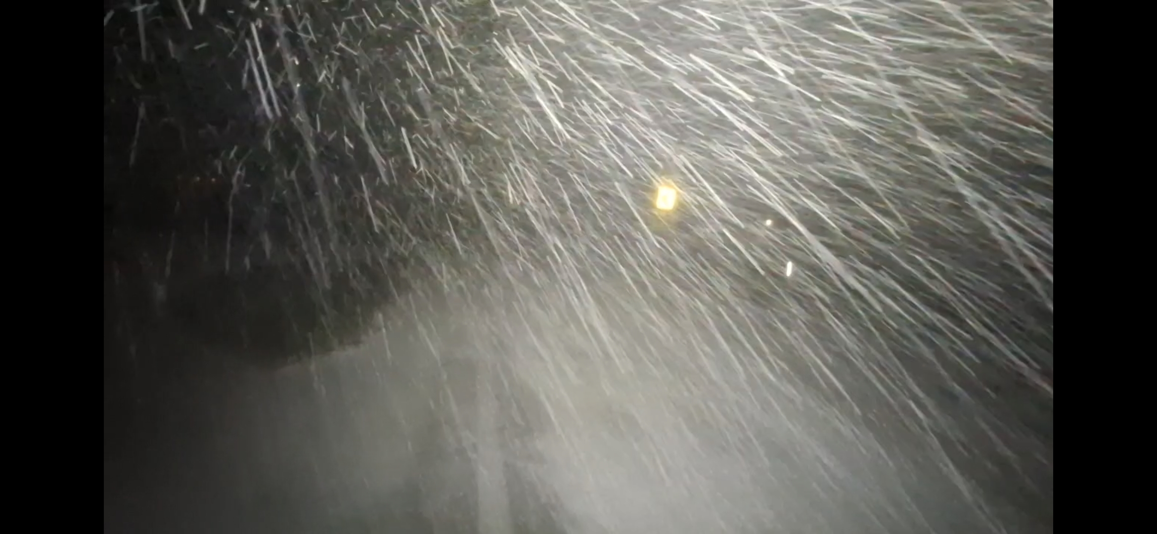
This feature is causing whiteout conditions to develop within about 60 seconds as it passes. I am seeing this on traffic cams along both I78 and I80. Crazy stuff.
-
Central PA Winter 25/26 Discussion and Obs
Yardstickgozinya replied to MAG5035's topic in Upstate New York/Pennsylvania
-

New Years Day 2026 - 1st snows of the new year possible
Torch Tiger replied to Baroclinic Zone's topic in New England
ama zing -
New Years Day 2026 - 1st snows of the new year possible
Torch Tiger replied to Baroclinic Zone's topic in New England
looks like a wintery pattern going forward -
12/31-1/1 Possible Snow Showers/Squalls to Start 2026
Stormchaserchuck1 replied to bncho's topic in Mid Atlantic
-

New Years Day 2026 - 1st snows of the new year possible
ineedsnow replied to Baroclinic Zone's topic in New England
squalls to the west look good.. hoping they hold -

Central PA Winter 25/26 Discussion and Obs
canderson replied to MAG5035's topic in Upstate New York/Pennsylvania
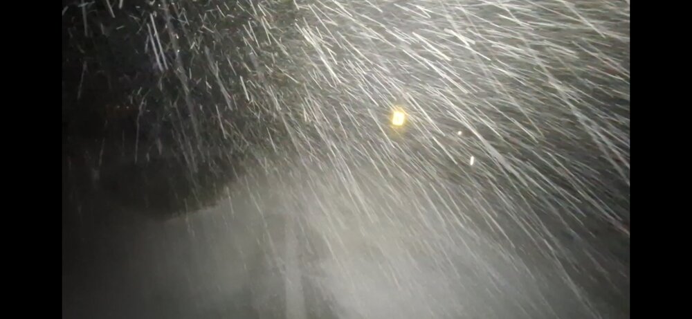
That was insane - woke me up with a huge lightning flash and a freight train of winds Heavy snow and 48 mph winds -

12/31-1/1 Possible Snow Showers/Squalls to Start 2026
Weather Will replied to bncho's topic in Mid Atlantic
County VA-Frederick County VA-Loudoun County VA-Berkeley County WV-Hampshire County WV-Hardy County WV-Jefferson County WV-Mineral County WV-Morgan County WV- The National Weather Service in Sterling Virginia has issued a * Snow Squall Warning for... Washington County in north central Maryland... Northwestern Carroll County in north central Maryland... Frederick County in north central Maryland... Northern Loudoun County in northern Virginia... Central Frederick County in northwestern Virginia... Northern Clarke County in northwestern Virginia... Jefferson County in the Panhandle of West Virginia... Morgan County in the Panhandle of West Virginia... Mineral County in eastern West Virginia... Northern Hardy County in eastern West Virginia... Berkeley County in the Panhandle of West Virginia... Hampshire County in eastern West Virginia... * Until 430 AM EST. * At 329 AM EST, a dangerous snow squall was located along a line extending from 6 miles southeast of Mount Holly Springs to near Berkeley Springs to Keyser, moving southeast at 40 mph. HAZARD...Intense bursts of heavy snow. Gusty winds leading to blowing snow and visibility rapidly falling to less than one-quarter mile. Wind gusts up to 35 mph. SOURCE...Radar and webcams. IMPACT...Dangerous and life-threatening travel conditions are expected to develop rapidly in the warning area. This includes the following highways... Interstate 68 in Maryland between mile markers 72 and 80. Interstate 70 in Maryland between mile markers 1 and 58. Interstate 81 in Maryland between mile markers 1 and 11. Interstate 270 in Maryland near mile marker 32. Locations impacted include... Frederick, Hagerstown, Winchester, Westminster, Martinsburg, Thurmont, Keyser, Charles Town, Emmitsburg, Moorefield, Romney, Shepherdstown, Hancock, Paw Paw, Municipal Stadium, Harry Grove Stadium, Greenwood, Ballenger Creek, Robinwood, and Taneytown. PRECAUTIONARY/PREPAREDNESS ACTIONS... Reduce speed and turn on headlights! During snow squalls, the visibility may suddenly drop to near zero in whiteout conditions. -

Central PA Winter 25/26 Discussion and Obs
Jns2183 replied to MAG5035's topic in Upstate New York/Pennsylvania
Huge lighting bolt few minutes ago Sent from my SM-S731U using Tapatalk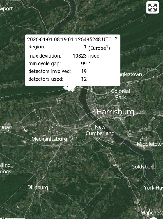
-
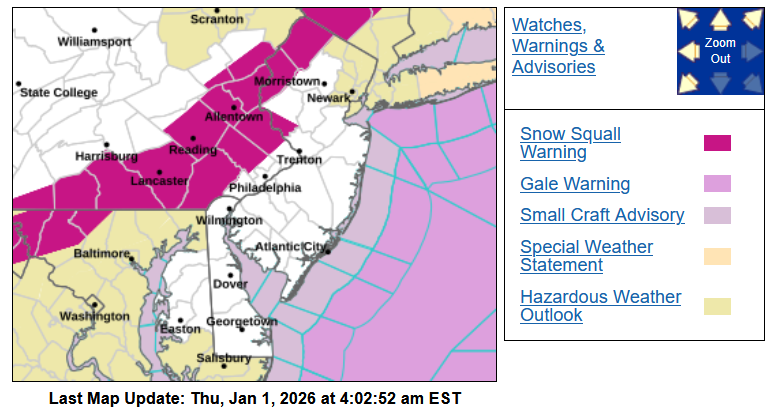
Snow squall warnings for NW NJ now.
-
Latest short range guidance (HRRR) has it reaching the city between 5:00 AM and 6:00 AM.
- Today
-
Central PA Winter 25/26 Discussion and Obs
Yardstickgozinya replied to MAG5035's topic in Upstate New York/Pennsylvania
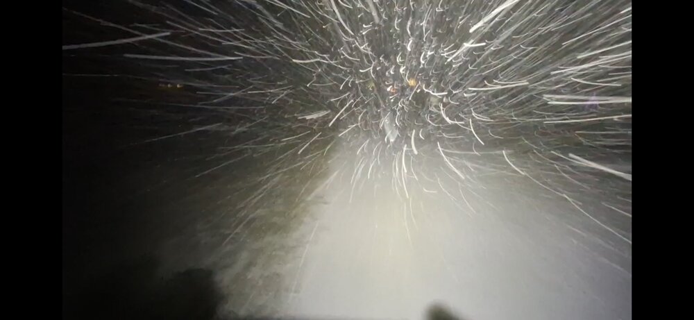
It's like a f****** freight train out of f****** nowhere. -
Central PA Winter 25/26 Discussion and Obs
Yardstickgozinya replied to MAG5035's topic in Upstate New York/Pennsylvania
-
Think it'll reach the immediate NYC Metro area?
-
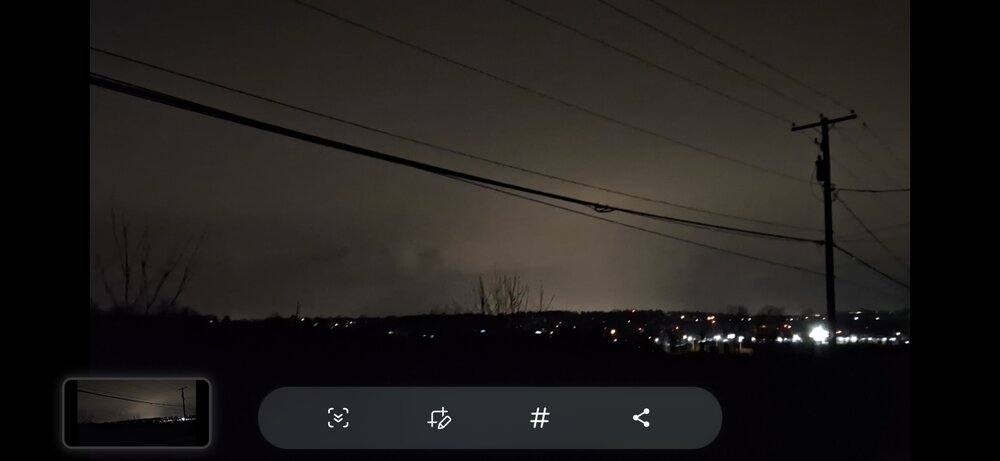
A large part of eastern and northeastern PA is now under snow squall warnings. This is very much the real deal as seen on traffic cams in that area. This will be approaching NW NJ and adjacent areas in less than an hour.
-
Central PA Winter 25/26 Discussion and Obs
Yardstickgozinya replied to MAG5035's topic in Upstate New York/Pennsylvania
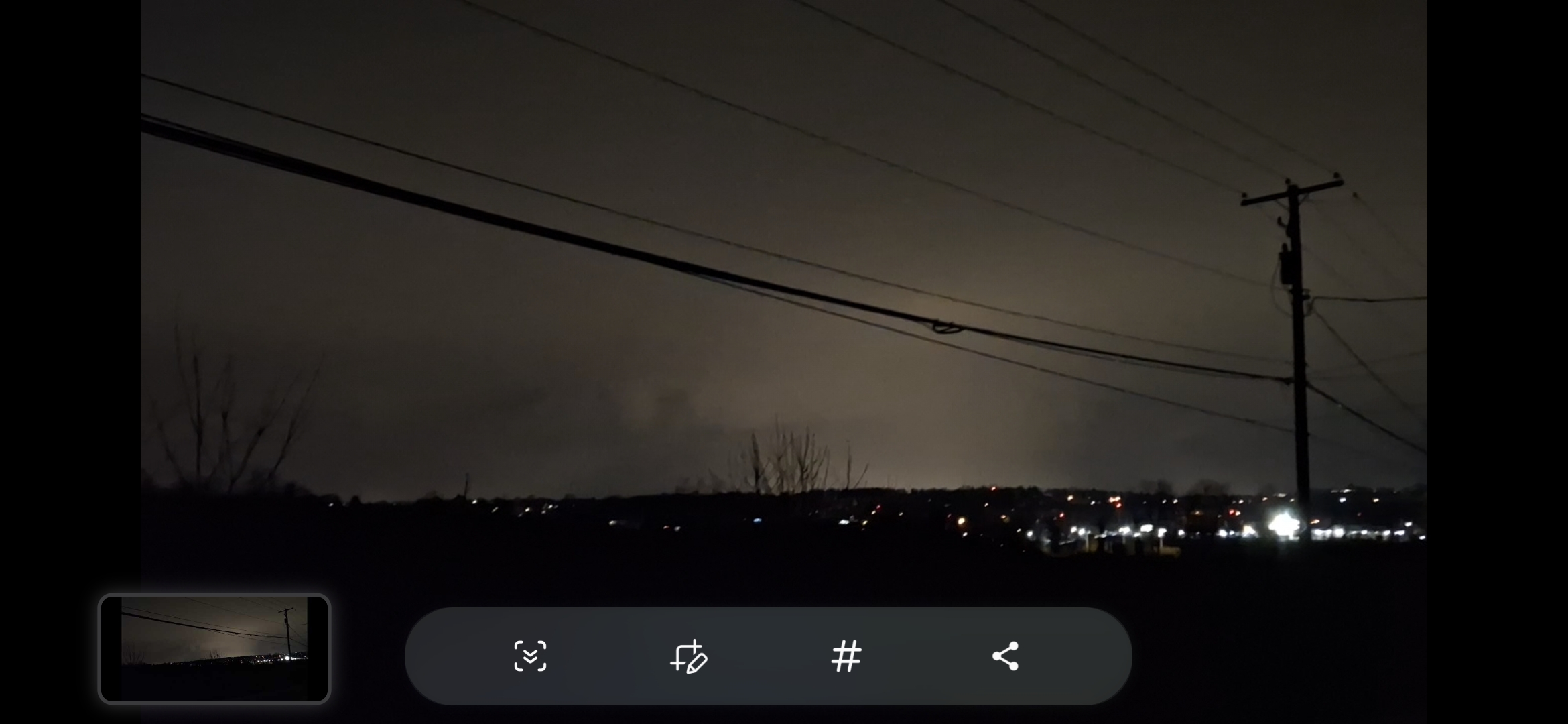
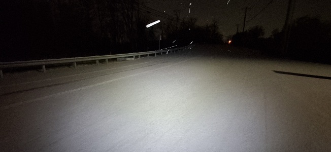
A pretty clean front edge.The city lights are lighting this thing up like a wall see if I can grab some video stills and put em up. -
Central PA Winter 25/26 Discussion and Obs
Yardstickgozinya replied to MAG5035's topic in Upstate New York/Pennsylvania
I'm walking back from ruttters near mile marker 38.8 i just saw multiple flashes of lightning .