All Activity
- Past hour
-

October Comes Early: Late September Multi-Hazard Hybrid Storm
vortex95 replied to WxWatcher007's topic in New England
Did you like the alkaline FOAM INVASION on the beach as the tide came in? I hope you didn't stand in it like reporters sometimes do...gross! -
Not good
-
October Comes Early: Late September Multi-Hazard Hybrid Storm
vortex95 replied to WxWatcher007's topic in New England
Well, at least so far we don't see the ultimate over/under maps like the NWS has started putting out for snow events. 0-6" or 1-14" for a single point fcst? That is practically useless for most. Yes, I know some want to see the full range possible but overall, it just causes more confusion and has ppl going ????? Put out one specific fcst w/ reasonable prob snow ranges at a given time, and that's it! Adjust as needed as new model data comes in (not every single weenie model every 3 hr or so!). Focused, coherent, consistent messages is important! Don't make things any more complex than they need to be. -
 buy erectile dysfunction pills and best ed meds online erectile dysfunction pills for sale http://www.fouillez-tout.com/cgi-bin/redirurl.cgi?http://apexmenmeds.com/ online ed treatments or https://4k-porn-video.com/user/rbeslhrxkr/ what is the cheapest ed medication [url=https://maps.google.so/url?q=https://apexmenmeds.com]ed online meds[/url] buying ed pills online and [url=https://mantiseye.com/community/jvcighjsss]ed medications cost[/url] cheapest ed online
 -
Daily PDO has been tanking.. it's near -2 right now
-
October Comes Early: Late September Multi-Hazard Hybrid Storm
vortex95 replied to WxWatcher007's topic in New England
One issue is the all storms have the same cookie-cutter hype formula in the eyes of TV stations. Sure, not all OCMs follow that or want to do that, but many are forced to. If one wanted to scale things properly and have something unique to say, they should have said, "such a storm fcst is quite unusual for September", but that takes more than generic knowledge of wx, one needs to know local wx history as well. This is of value b/c it puts things in proper context and perspective, which sadly is sorely lacking these days in media. Not all Nor'easters are alike, but they are treated as such for max hype and ratings. Heaven help us when the next HU takes aim at New England. Mark my words, they will make ZERO difference between the 1938 HU and a MEH HU like Belle in 1976. "Look, the track is *similar* the 1938 HU!" O-kay, but all big HU hits in New England have similar tracks! That doesn't say anything really to the public as to total sensible wx impact It's like after Sandy, every E Coast TC threat was "track similar to Sandy" which in that case was nonsense. Sandy 's track was exceptional. But never let a recent big event go unused for hype for "the next one!" -

September 2026 Medium/Long Range
Stormchaserchuck1 replied to JenkinsJinkies's topic in Mid Atlantic
Under. Late Summer to September has been pretty cool. -
September 2026 Medium/Long Range
Stormchaserchuck1 replied to JenkinsJinkies's topic in Mid Atlantic
I would say October snow is a good thing. In 2002, it snowed here in October 4x.. I had 125" that Winter, easily best of my lifetime. It snowed all the way until early May 2003, patterns tend to be longer term. -
 Imagine if it was winter Sent from my SM-S176V using Tapatalk
 -
September 2026 Medium/Long Range
Stormchaserchuck1 replied to JenkinsJinkies's topic in Mid Atlantic
NAO's only inversely correlated month of the year to DJFM NAO is October.. opposite correlation.. the Pacific is linearly correlated at 57%, but sometimes in El Nino's a favorable Pac October shifts to unfavorable (+EPO) for the Winter. That might just be because of not enough examples though. -
Yeah, seasonal models showing -200dm monthly +PNA in the N. Pacific doesn't seem likely. They are heavily ENSO-bias, need to be reprogrammed
- Today
-
Tadalafil price: TadaStream - cheapest cialis
-

2026 C and E Pacific tropical activity
Wannabehippie replied to GaWx's topic in Tropical Headquarters
Another core penetration by Josh. new update from him on FB "8:15 pm Hearing distinct howling in the distance. Things starting to bang. Hurricane POLO in Las Barrancas." That 8:15pm is his local time -
October Comes Early: Late September Multi-Hazard Hybrid Storm
78Blizzard replied to WxWatcher007's topic in New England
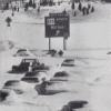
Final total event of 7.93". -
October Comes Early: Late September Multi-Hazard Hybrid Storm
vortex95 replied to WxWatcher007's topic in New England
@weatherwiz posts are solid and make excellent points. Good debate/discussion material! "just because the lead story was on the storm does not mean it was hyped," Wx is almost always the lead story. Even when nothing is going on, the newscast will throw to the wx right away and talk about how sunny it was today, and never not let an excuse happen for them to say "WE'RE TRACKING!" even if it is clouds or a slight change in temp! This is fluff and obvious to the viewer. That time could be used to report on much more important news out there (not like there isn't enough out there). "Cancelling events ultimately is the decision of the person or people responsible for that decision." Correct, but there is cause and effect here. When you hype things to the max, turning the ordinary into the extraordinary, that has real psychological impacts and skews perception big time. Even if you know better and are well-versed in the basics as to wx, say as an EM, this still will sway your objectivity subconsciously, and result in decisions that are not always the best. Also, even if you know better and do not let this influence you, external pressures socially/politically/economically amped up by the hype are a factor and make you do things you otherwise would not do. Do not underestimate the bandwagon logical fallacy. That is, if "everyone" says this or that is true or is going to happen, then it *must* be true or going to happen! This is known social science and human psychology. Also, as mets and wx enthusiasts, we can't let our wx knowledge bias us here. Yes, WE know the deal and how to interpret/read between the lines when a wx event is fcst, scaling and quantifying things correctly, but the vast majority out there have no idea, and given the info overload these days and not knowing what is what from it, you can't really blame the public for being skeptical/distrustful, which leads me to this: "Also, there is a greater trust in weather forecasts these days which factors in as well. " I don't know about that. In some sectors/fields, yes, but from a public POV? I'll never forget what I heard in a grocery line some years ago. A storm was coming, and one person talking to another said, "last time they said it was not going to hit, and it did, so maybe this time it won't b/c they say it will!" What kind of logic is that!? But you see the notions and perceptions out there! -
https://tadastreamrx.com/# Generic Tadalafil 20mg price
-
Josh is about to be hit hard by very compact Polo as he was only 21 miles from the center 1/2 hour ago with only light rain and just some breezes:
-
October Comes Early: Late September Multi-Hazard Hybrid Storm
vortex95 replied to WxWatcher007's topic in New England
When you say "local TV stations" I assume you just mean those that you get in your viewing areas in CT.? Not every TV market is the same, some are more out of control w/ hype than other and intense (you should see the OKC market!). Not all markets have the same caliber OCMs as to overall met knowledge or the OCM able to do things in a reasonable/balanced way for wx presentation as the news director is breathing down their necks micromanaging and saying hype to the max. Since wx is the #1 reason why ppl watch local news, I don't have to say how intense and competitive it is these days at many TV stations. -
Considering I’m 42 and hes 38, I applaud this…except calling him old
-

2026 Atlantic Hurricane Season
WxWatcher007 replied to Stormchaserchuck1's topic in Tropical Headquarters
Two whole tropical storms in the Atlantic! -
Records: High: EWR: 87 (2014) NYC: 88 (1881) LGA: 84 (2014) JFK: 82 (1948) Lows: EWR: 38 (1947) NYC: 41 (1947) LGA: 42 (1947) JFK: 44 (1989) Historical: 1836 - The first of three early season snows brought four inches of snow to Hamilton, NY, and two inches to Ashby MA. (David Ludlum) 1837: The first recorded storm to rake the entire Texas coast was Racer’s Storm, named for a British sloop of war which encountered the system in the extreme northwestern Caribbean on September 28th. It is remembered as one of the most destructive storms of the nineteenth century due to its extreme duration and 2000 mile path of destruction. 1874 - A strong category 1 hurricane went by Charleston and Georgetown, South Carolina. The tide was unprecedented height, inundating the entire riverfront of the city of Charleston. 1893 - Albuquerque, NM, was soaked with 2.25 inches of rain, enough to establish a 24 hour record for that city. (The Weather Channel) 1917 - A hurricane hit Pensacola, FL. Winds gusted to 95 mph, and the barometric pressure dipped to 28.50 inches. Winds at Mobile AL gusted to 75 mph. (The Weather Channel) 1929 - A hurricane-spawned tornado hit Fort Lauderdale, Florida. While the path length of this estimated F2 tornado was 0.8 miles, it caused 16 injuries. 1947: Boston, Massachusetts recorded its highest September pressure of 30.66 inches of mercury. (Ref. NOAA Boston Weather Events) 1974: Belleville Ill.--Lightning killed a man who was playing football in a park. Orlando, Fla.--A 20-year-old Naval Training Center student was killed while jogging. (Ref. Lightning-The Underrated Killer.pdf) 1984: Coolest September day ever recorded in Washington, DC. The maximum was 51 °F and the minimum was 47°F. (Ref. Washington Weather Records) Richmond, Virginia had a high temperature for the day of 52 °F making it the coolest September day on record (records since 1897). (Ref. Richmond Weather Records) 1986: Flash flooding swept a car off the Kamehameha Highway on Oahu, Hawaii, and into a swollen stream. The driver held onto some branches until help arrived, but the current did strip him of his clothes and watch! (Ref. AccWeather Weather History) 1987 - Thunderstorms produced up to ten inches of rain in southern Kansas and north central Oklahoma overnight. The Chikaskia River rose 2.5 feet above flood stage at Blackwell OK during the day causing flooding in Kay and Grant counties of north central Oklahoma. Early morning thunderstorms in the Lower Rio Grande Valley of Texas produced 3.07 inches of rain in six hours at McAllen. Thunderstorms produced up to six inches of rain in southeastern Texas later in the day. (National Weather Summary) (Storm Data) 1988 - Thunderstorms developing ahead of a cold front in the central U.S. produced severe weather from northern Texas to the Lower Missouri Valley during the late afternoon and evening hours. Hail three inches in diameter was reported at Nolan TX, and wind gusts to 80 mph were reported at Lawrence KS. Thunderstorms drenched downtown Kansas City MO with up to four inches of rain, leaving some cars stranded in water six feet deep. (Storm Data) (The National Weather Summary) 1989 - Thunderstorms over northeastern Florida drenched Jacksonville with 4.28 inches of rain between midnight and 6 AM EDT. Unseasonably cool weather prevailed in the northeastern U.S. Five cities reported record low temperatures for the date, including Binghamton NY with a reading of 30 degrees. Morning lows were in the 20s in northern New England. Unseasonably mild weather prevailed in the northwestern U.S., with afternoon highs in the upper 70s and 80s. In Oregon, Astoria reported a record high of 83 degrees. (The National Weather Summary) (Storm Data) 1998: On the morning of September 28th, Hurricane George made landfall near Biloxi, Mississippi with maximum winds of 110 mph and a minimum pressure of 964 mb, making it a Category 2 hurricane. After landfall, Georges moved very slowly across southern Mississippi and weakened to a tropical depression by the morning of the 29th when the center was about 30 miles north-northeast of Mobile, Alabama. The storm dissipated near the northeast Florida/southeast Georgia coast by the morning of October 1, 1998.
-
Nice for the old guys to get a win every once in a while lol
-
Made it to 67 today, despite lingering clouds hope to get to the low 70s tomorrow and then Wed - Fri 80s.
-
Happy to see Keenum play like he’s playing, what a night he’s having.