MichaelScott Posted February 11, 2014 Share Posted February 11, 2014 Clown map thru 48. Not even done yet but it's a big hit. It's no 00Z EURO, but still pretty good. ~CHO jackpot. Link to comment Share on other sites More sharing options...
JB Fins Posted February 11, 2014 Share Posted February 11, 2014 Warnings are up. AKQ beating LWX on the warning trigger. Link to comment Share on other sites More sharing options...
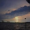
MACoastWx Posted February 11, 2014 Share Posted February 11, 2014 Guidance says rain for me, but this image says it all for non-coastal of VA, wow what a look! Link to comment Share on other sites More sharing options...
Snow Threat Posted February 11, 2014 Share Posted February 11, 2014 Guidance says rain for me, but this image says it all for non-coastal of VA, wow what a look! I wish I knew how to read this. Are there any good sites that explain the basics of these maps so I can at least try to learn without getting killed for asking questions? Link to comment Share on other sites More sharing options...
JMU2004 Posted February 11, 2014 Share Posted February 11, 2014 18z GFS further cuts snow totals. It hasn't had a clue, but outside of the NAM/Ukie, we are trending the wrong way. I don't know WHY I continue to get my hopes up here in CVA for a large snow storm. Link to comment Share on other sites More sharing options...
mikeeng92 Posted February 11, 2014 Share Posted February 11, 2014 There could be an epic/ hilarious snow hole for central VA from RIC to Williamsburg . For the winter so far. Link to comment Share on other sites More sharing options...
eaglesin2011 Posted February 11, 2014 Share Posted February 11, 2014 Geez.. What bunch of baby's on here. What's wronwg with getting only 4 inches..Thats more then many of us have gotten all winter...To me anything more is a bonus...... People need to relax and enjoy the ice/snow..haha Link to comment Share on other sites More sharing options...
JMU2004 Posted February 11, 2014 Share Posted February 11, 2014 nothing wrong with getting 4 inches. What sucks is the rain that comes after it. What also sucks is that we were progged to get 12+ inches (IMBY) as recently as 8 hours ago. Just disappointed, that's all. I know better than to get excited...but after many good runs, I was confident. My bad. Link to comment Share on other sites More sharing options...
MidlothianWX Posted February 11, 2014 Share Posted February 11, 2014 18z GFS further cuts snow totals. It hasn't had a clue, but outside of the NAM/Ukie, we are trending the wrong way. I don't know WHY I continue to get my hopes up here in CVA for a large snow storm. As I said in my previous post, I think this was the wrong one to get your hopes up for. +AO +NAO -PNA is not the recipe for a historic storm around here. I'm hoping we get our Nino next winter. Get that southern stream rocking and I'll take my chances. Throw in the proper indices and we have a decent shot at getting another foot+ area-wide event. We've just been unlucky with the big ones since 96. Jan. 2000 was about 25 miles east. PDII and Feb. 2010 were Miller B storms. Dec. 09 was a 25-50 mile slp shift away from giving us a 1/20 year snowfall (December is also not a great month for huge events). January 2010 gave us solid totals but wasn't a coastal. Our blockbuster storms usually come from lows that move off Hatteras and OTS anyway. Our time will come. It would be silly to think it won't. The atmosphere doesn't hold grudges. Link to comment Share on other sites More sharing options...
eaglesin2011 Posted February 11, 2014 Share Posted February 11, 2014 Let's give it some time.. too many people jumping off the bridge before a single flake has hit the ground. mainly in the M/A thread of course.. Link to comment Share on other sites More sharing options...
MidlothianWX Posted February 11, 2014 Share Posted February 11, 2014 I want to be clear that I'm not dismissing this event. If the NCEP models continue to stand their ground tonight things get interesting. Sometimes these front-end thumps from Miller A's are better than advertised (Dec. 09 certainly was). Who knows where the mesoscale features will set up. I've been throwing 5-10" out there as my range. Link to comment Share on other sites More sharing options...
Martin Posted February 12, 2014 Author Share Posted February 12, 2014 Keep your eye on the WPC forecast low track map as we get closer to the event: http://www.hpc.ncep.noaa.gov/lowtracks/lowtrack_ensembles.gif I can see why they have recon out there now getting some extra data. Interesting Link to comment Share on other sites More sharing options...
Fodie77 Posted February 12, 2014 Share Posted February 12, 2014 It is amusing (not amusing) how RIC always seems to be in the wrong place at the wrong time. We're looking like a jackpot 72 hours out, and we get hit with the dreaded "north trend." We have a storm to our south (i.e.- Boxing Day 2010) and the trend is nowhere to be found (no disrespect intended for our SEVA crew, that was an awesome storm for you guys). Big snow to the north, big snow to the south... Now that my ranting is done, as MidlothianWX alluded to, the front-end thump is huge. I wouldn't be surprised if that's where 80%+ of our totals come from. My best guess for totals at this point would be: The Gooch: 6-8" West Henrico and Midlo: 4-6" The City and East Henrico: 3-5" Link to comment Share on other sites More sharing options...
JMU2004 Posted February 12, 2014 Share Posted February 12, 2014 As I said in my previous post, I think this was the wrong one to get your hopes up for. +AO +NAO -PNA is not the recipe for a historic storm around here. I'm hoping we get our Nino next winter. Get that southern stream rocking and I'll take my chances. Throw in the proper indices and we have a decent shot at getting another foot+ area-wide event. We've just been unlucky with the big ones since 96. Jan. 2000 was about 25 miles east. PDII and Feb. 2010 were Miller B storms. Dec. 09 was a 25-50 mile slp shift away from giving us a 1/20 year snowfall (December is also not a great month for huge events). January 2010 gave us solid totals but wasn't a coastal. Our blockbuster storms usually come from lows that move off Hatteras and OTS anyway. Our time will come. It would be silly to think it won't. The atmosphere doesn't hold grudges. Agreed. I'm no where near shocked of how this is evolving. Disappointed, absolutely, but not shocked. Link to comment Share on other sites More sharing options...
Kevin Druff Posted February 12, 2014 Share Posted February 12, 2014 I much preferred last week's setup where today's overrunning that hit NC was modeled up here. I'd much rather take my chances with overrunning than a coastal. That being said, there's a fair amount of guidance still east of WPC at the moment. A slightly further east track wouldn't surprise me. I will hope for such. Link to comment Share on other sites More sharing options...
MidlothianWX Posted February 12, 2014 Share Posted February 12, 2014 Euro holds, perhaps a hair east. WPC continues to insist on a blend of it with the GFS (for track purposes, not precip). I think the west end has an outside shot of getting into the 10"+ range but I wouldn't bet on it. Too many question marks with this one. If I had to make a call now I'd say 4-8" for the metro going east to west. Definitely a large bust potential with this one, on both sides of the envelope. Link to comment Share on other sites More sharing options...
jlewis1111 Posted February 12, 2014 Share Posted February 12, 2014 can you post the euro snow map for va Ric Also do we get into the deform band down here? Link to comment Share on other sites More sharing options...
MidlothianWX Posted February 12, 2014 Share Posted February 12, 2014 can you post the euro snow map for va Ric Also do we get into the deform band down here? Deform banding seems to be mostly to the NW, although I believe it does swing through eventually. I have most of the snow maps but I'm fairly positive that I don't have permission to post them. You'll probably find a few in the main MA thread. Link to comment Share on other sites More sharing options...
miller.b.time Posted February 12, 2014 Share Posted February 12, 2014 Any qpf maps lying about that might be shareable, too? (I presume not, but worth asking. One showed up after the 0Z last night, but those were special weenie circumstances, I think. ) Link to comment Share on other sites More sharing options...
eaglesin2011 Posted February 12, 2014 Share Posted February 12, 2014 Defiantly going to add up quick when it starts to snow...looking at the reports coming in from SC/NC..Radar is impressive to say the least... Link to comment Share on other sites More sharing options...
Fodie77 Posted February 12, 2014 Share Posted February 12, 2014 To be honest, I'm going to avoid the models as much as I can at this point, as they're only going to drive me crazy between now and tonight. We'll just have to watch the returns as they come in and hope that the mix is put off as long as possible. If we start mixing in the early morning hours, I think we could be looking at a solid 4-6 event across the metro area. If by some miracle we wake up tomorrow morning and see that flakes are still flying, I think we have a real shot at 10"+. Has anyone heard anything about how the models have been performing with temps down south? Link to comment Share on other sites More sharing options...
JMU2004 Posted February 12, 2014 Share Posted February 12, 2014 If we can stay under 30 today (c'mon cloud cover), I'll be happy. Holding at 26 in Manakin. Link to comment Share on other sites More sharing options...
JB Fins Posted February 12, 2014 Share Posted February 12, 2014 Sun was peeking through on the way to work but looks like cloud cover starting to thicken up. I have not heard about temp verification down south on the models. All I can gather from the thread is GFS is still the warmest and driest, NAM is still a shellacking with best weenie scenario. Link to comment Share on other sites More sharing options...
JMU2004 Posted February 12, 2014 Share Posted February 12, 2014 Peaked at 28.6, now down to 28.2. DP hanging around 13. Slights winds out of NW, and pressure dropping fast. Good signs. Link to comment Share on other sites More sharing options...
crainjd Posted February 12, 2014 Share Posted February 12, 2014 I'm at 30 with a DP of 23 in Virginia Beach. Maybe we'll get a little bit more snow on the front edge this afternoon than expected.... Link to comment Share on other sites More sharing options...
D-Money Posted February 12, 2014 Share Posted February 12, 2014 I'm at 30 with a DP of 23 in Virginia Beach. Maybe we'll get a little bit more snow on the front edge this afternoon than expected....I think we will. Base line is about to cross the NC boarder now. Good guess would be 2:30-3:15 we start to see snow. Link to comment Share on other sites More sharing options...
SeVa Posted February 12, 2014 Share Posted February 12, 2014 Radar looks good to our south. We might be able to squeak out an inch or two before the flip. Link to comment Share on other sites More sharing options...
DJnVa Posted February 12, 2014 Share Posted February 12, 2014 Chesapeake has apparently canceled after-school activities. Guessing they're seeing the same thing. Link to comment Share on other sites More sharing options...
crainjd Posted February 12, 2014 Share Posted February 12, 2014 I think we will. Base line is about to cross the NC boarder now. Good guess would be 2:30-3:15 we start to see snow. Yea, I was guessing 3-3:30 for northern sections of southside. Can't tell whether leading edge is virga or not though Link to comment Share on other sites More sharing options...
DJnVa Posted February 12, 2014 Share Posted February 12, 2014 Nothing hitting the ground in southern Chesapeake as of about 30 minutes ago. Link to comment Share on other sites More sharing options...

Recommended Posts
Archived
This topic is now archived and is closed to further replies.