brooklynwx99
-
Posts
6,214 -
Joined
-
Last visited
Content Type
Profiles
Blogs
Forums
American Weather
Media Demo
Store
Gallery
Everything posted by brooklynwx99
-
welp
-

“Cory’s in NYC! Let’s HECS!” Feb. 22-24 Disco
brooklynwx99 replied to TheSnowman's topic in New England
.gif.fecdef27599a289597a401122274cf8a.gif)
-
.gif.a7448e18664b7bf0778b020424c7048b.gif)
-
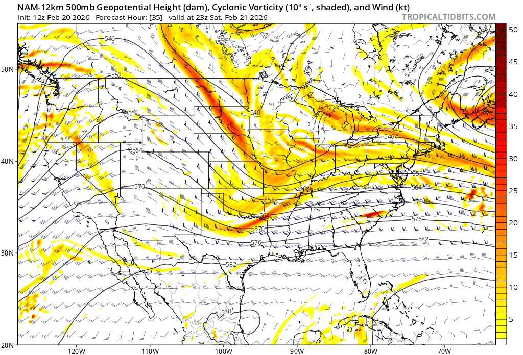
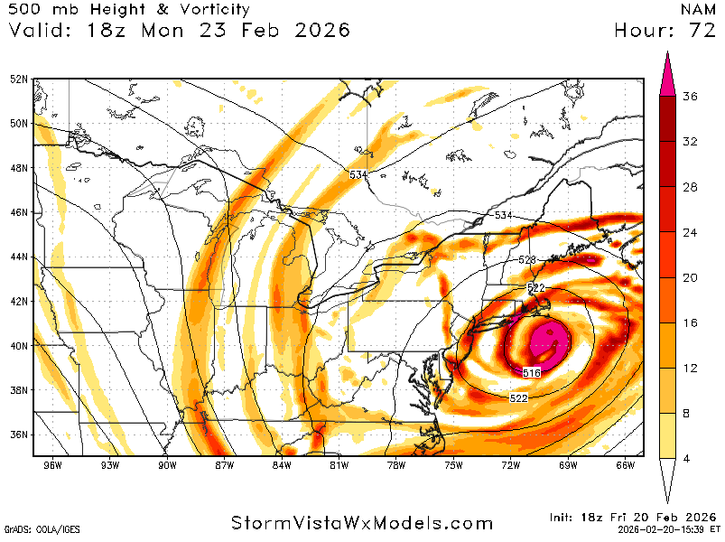
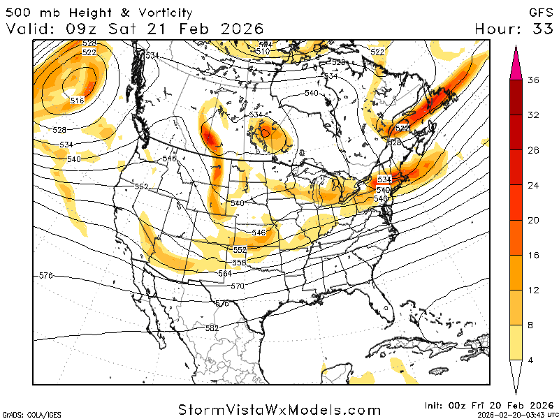
NAM is significantly more phased

-
considering that the GFS has absolutely owned literally every other piece of guidance so far, I might give it a bit more credence
-
Feb 22nd/23rd "There's no way..." Storm Thread
brooklynwx99 replied to Maestrobjwa's topic in Mid Atlantic
well, fuck me -
yeah we're in for it. don't need to see much more than that

-
“Cory’s in NYC! Let’s HECS!” Feb. 22-24 Disco
brooklynwx99 replied to TheSnowman's topic in New England
good god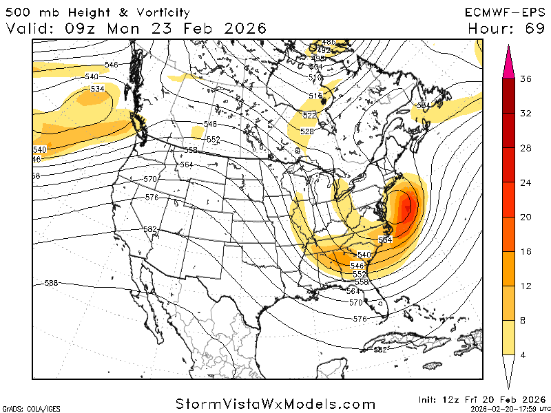
-
if we get a foot or more out of this, it would be the second biggest coup of all time behind 2016
-
incredible

-
it's coming.
-
“Cory’s in NYC! Let’s HECS!” Feb. 22-24 Disco
brooklynwx99 replied to TheSnowman's topic in New England
glue factory allegations have NOT been dispelled -
“Cory’s in NYC! Let’s HECS!” Feb. 22-24 Disco
brooklynwx99 replied to TheSnowman's topic in New England
lol it continues to cave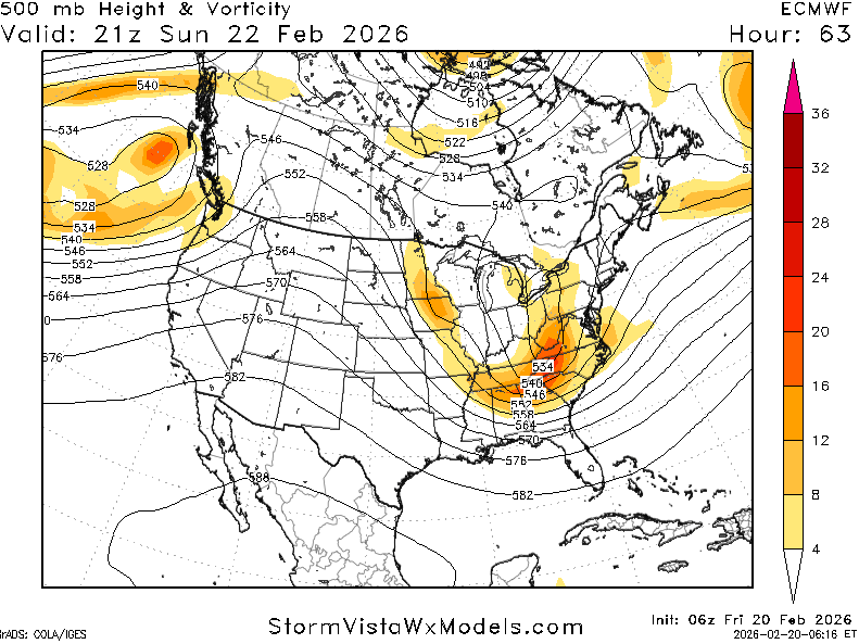
-
“Cory’s in NYC! Let’s HECS!” Feb. 22-24 Disco
brooklynwx99 replied to TheSnowman's topic in New England
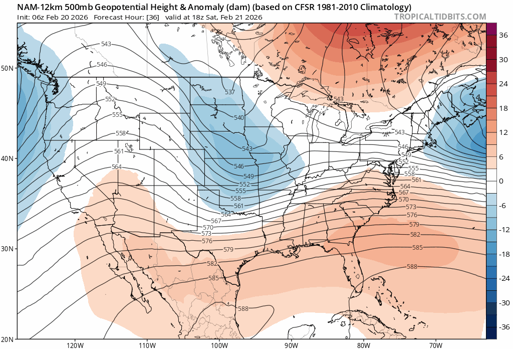
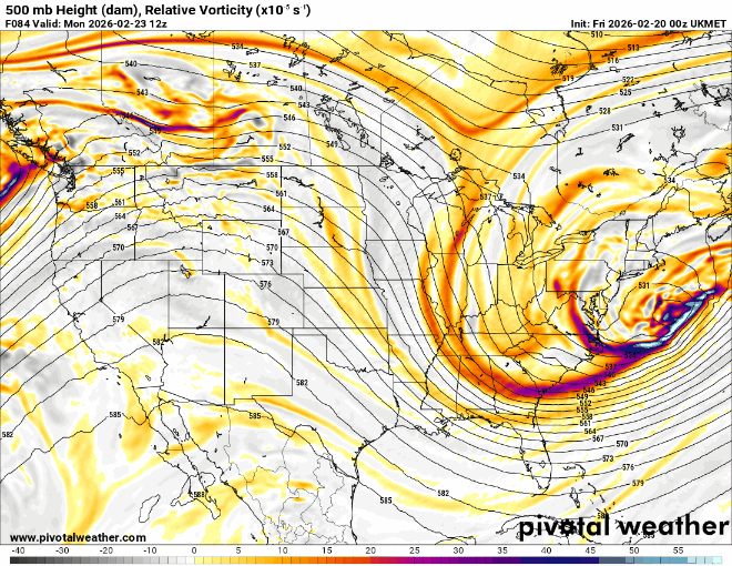
euro is obviously more amped. phase is cleaner over the Plains and heights are responding at 45 -
“Cory’s in NYC! Let’s HECS!” Feb. 22-24 Disco
brooklynwx99 replied to TheSnowman's topic in New England
yes, big jump. it's coming -
full cave
-
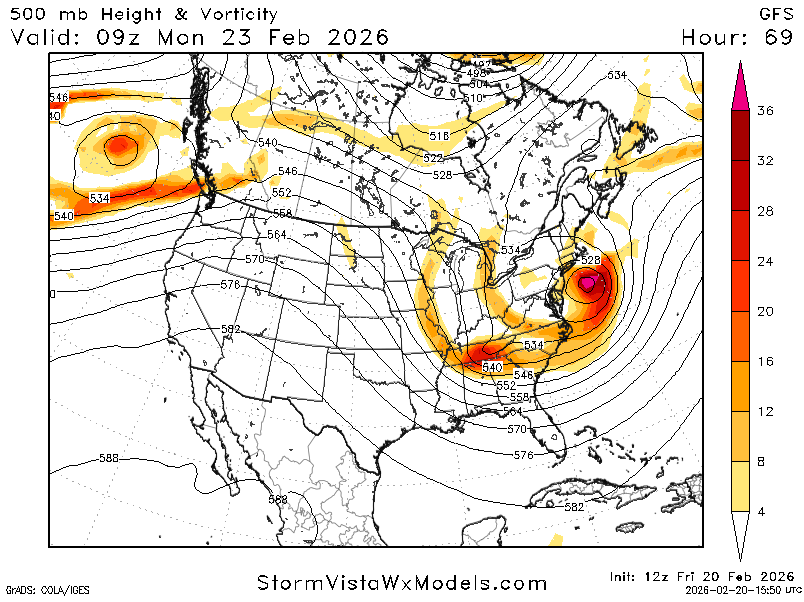
game set. KU
-
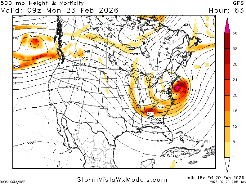
GFS is going for broke with that NS piece over MT. my god
-
“Cory’s in NYC! Let’s HECS!” Feb. 22-24 Disco
brooklynwx99 replied to TheSnowman's topic in New England
GFS is going for broke with that NS piece over MT. my god
-
“Cory’s in NYC! Let’s HECS!” Feb. 22-24 Disco
brooklynwx99 replied to TheSnowman's topic in New England
can see the little fuji here... slightly later phase with more NS involvement leads to later occlusion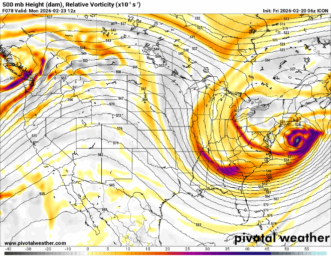
-
“Cory’s in NYC! Let’s HECS!” Feb. 22-24 Disco
brooklynwx99 replied to TheSnowman's topic in New England
i like seeing the shift with that backside vort phasing in more
-
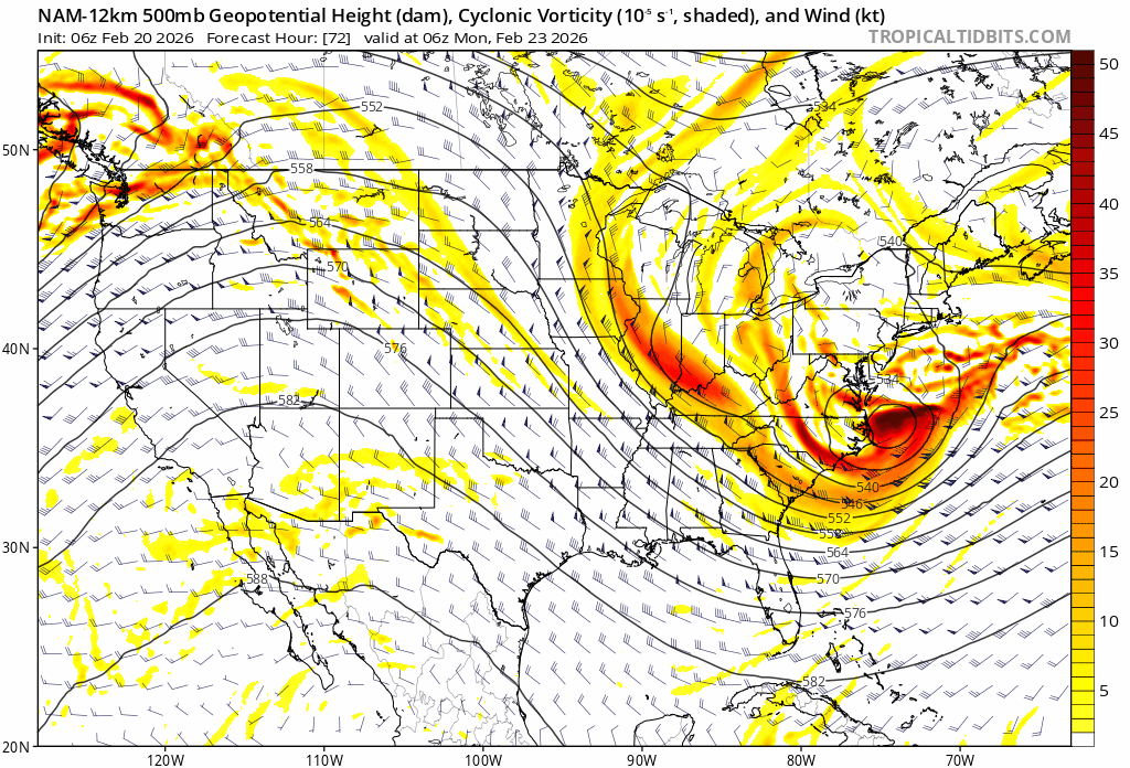
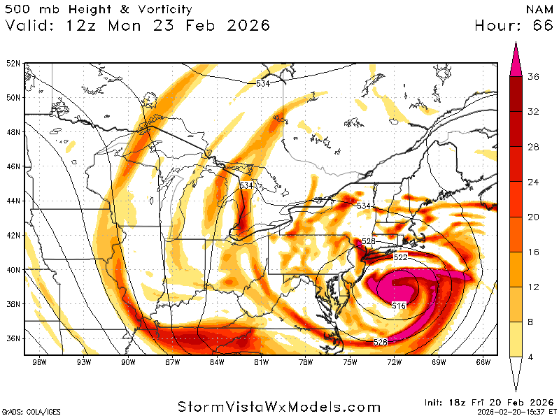
NAM looks better with the backside vort phase, which is a big deal

-
NAM is cooking with gas

-
regardless of what happens in the next couple of days, this is one of the most spectacular model shifts for the better I have seen at this range in a long time. let's reel this one in
-
“Cory’s in NYC! Let’s HECS!” Feb. 22-24 Disco
brooklynwx99 replied to TheSnowman's topic in New England
it can be called hot garbage but there is no way to get around the fact that every model today has at least lent credence to the idea that it was previously on an island with