
KamuSnow
-
Posts
5,540 -
Joined
-
Last visited
Content Type
Profiles
Blogs
Forums
American Weather
Media Demo
Store
Gallery
Everything posted by KamuSnow
-

Parts 1 and 2 Obs - 2/10-2/12 Winter Storm
KamuSnow replied to KamuSnow's topic in Philadelphia Region
Hello and welcome! This is a little late but you should have the French toast. -
With the MJO and SOI moving in the right direction, and the models starting to show threats, I've become cautiously optimistic over the last few days. But the most encouraging indicator to me since yesterday is how this storm has trended colder, along with the weekend suddenly looking pretty interesting, and it's only 5 days out. Actual evidence of changes as opposed to 7 to 10 days out "maybes".
-
Parts 1 and 2 Obs - 2/10-2/12 Winter Storm
KamuSnow replied to KamuSnow's topic in Philadelphia Region
Currently 31F and freezing rain here, slept through the changeover so to speak. Did pick up an additional 0.2" after my last measurement at 2 am, which makes the storm total 3.9". Seasonal total is now 14.7", slowly inching towards respectability. Hope everyone up north does well today! Glad I dressed up the snow pile last night (at 2 am), lol. -
Parts 1 and 2 Obs - 2/10-2/12 Winter Storm
KamuSnow replied to KamuSnow's topic in Philadelphia Region
Hey Rob! How the heck are you? You need to team up with RedSky and get that Monmouth County snow magnet working! -
Parts 1 and 2 Obs - 2/10-2/12 Winter Storm
KamuSnow replied to KamuSnow's topic in Philadelphia Region
HM mentioned this last night but I didn't think it would be as impactful on this side of the river as it has been. I also remember seeing a couple of model runs (don't remember which) showing a chewed up eastern edge right up until arrival of the sleet essentially, which pretty much all the mesos do show now. I did a weenie discount on them, lol. -
Parts 1 and 2 Obs - 2/10-2/12 Winter Storm
KamuSnow replied to KamuSnow's topic in Philadelphia Region
I'm guessing around 5 am (maybe before), although I'd love for the HRRR to be correct, it has it around 7 or 8 am. -
Parts 1 and 2 Obs - 2/10-2/12 Winter Storm
KamuSnow replied to KamuSnow's topic in Philadelphia Region
Why not, right? Fwiw, the 04z HRRR upped the snowfall about an inch for us southern and eastern denizens. Radar is starting to get busy down around DC and to the west, hope it doesn't bring too much warm air with it initially. -
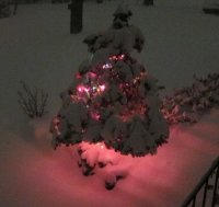
Parts 1 and 2 Obs - 2/10-2/12 Winter Storm
KamuSnow replied to KamuSnow's topic in Philadelphia Region
Nice - looks good under the Christmas lights, lol. We have a small tree out front that we leave the lights on until the last snowfall. Saw some deer out by it earlier, lit up just a little, a nice scene with the snow :-). -
Parts 1 and 2 Obs - 2/10-2/12 Winter Storm
KamuSnow replied to KamuSnow's topic in Philadelphia Region
1.2" so far tonight, storm total 3.7". Temperature and dew point dropped a degree, 29F and DP 27F. Just freshened up the snow pile a little . eta - radar looks a little squirrelly at the moment but still getting light snow here. -
Parts 1 and 2 Obs - 2/10-2/12 Winter Storm
KamuSnow replied to KamuSnow's topic in Philadelphia Region
Snowing at rates between light and moderate here, 30F, DP 28F. Just measured a hair over 1" of new snow, storm total up to 3.5". Nice little NE breeze now. -
Parts 1 and 2 Obs - 2/10-2/12 Winter Storm
KamuSnow replied to KamuSnow's topic in Philadelphia Region
I just had a Birds~69 sighting! I hope you and your folks are okay. Looks like most of the PA portion of the CWA is in snow now - steady light snow and 31F here. I'm loving it. -
Parts 1 and 2 Obs - 2/10-2/12 Winter Storm
KamuSnow replied to KamuSnow's topic in Philadelphia Region
Lol....you're welcome! I know what you mean too, I've had the same thought, this one has had a lot of uncertainty leading into it. -
Parts 1 and 2 Obs - 2/10-2/12 Winter Storm
KamuSnow replied to KamuSnow's topic in Philadelphia Region
You guys want to have a 2nd obs thread for this part of the storm??? Or keep it here and edit the topic? Picked up about 0.4" of new snow since about 4 pm - still light snow, in spite of not much overhead on the radar at the moment. 31F currently. -
Parts 1 and 2 Obs - 2/10-2/12 Winter Storm
KamuSnow replied to KamuSnow's topic in Philadelphia Region
Likewise here, very light. 34F currently. -
Any dippin dots?
-
Parts 1 and 2 Obs - 2/10-2/12 Winter Storm
KamuSnow replied to KamuSnow's topic in Philadelphia Region
2.5" here as well, and the snow pile is back! (After a 3 day hiatus). Currently 32F with very light snow. -
Parts 1 and 2 Obs - 2/10-2/12 Winter Storm
KamuSnow replied to KamuSnow's topic in Philadelphia Region
I would guess Newark NJ, since he was headed east on the turnpike. If so he made pretty good time! -
Parts 1 and 2 Obs - 2/10-2/12 Winter Storm
KamuSnow replied to KamuSnow's topic in Philadelphia Region
Just shy of 2.4" here, 28F and light snow currently. Beautiful outside! -
Parts 1 and 2 Obs - 2/10-2/12 Winter Storm
KamuSnow replied to KamuSnow's topic in Philadelphia Region
Nice - congrats! Just getting up from a nap but pleased to see that the radar looks better for now. -
Parts 1 and 2 Obs - 2/10-2/12 Winter Storm
KamuSnow replied to KamuSnow's topic in Philadelphia Region
The HRRR shows a bubble of precipitation developing in southwest PA and moving across the state, which the radar appears to be showing. We shall see.... -
Parts 1 and 2 Obs - 2/10-2/12 Winter Storm
KamuSnow replied to KamuSnow's topic in Philadelphia Region
Looking at the correlation coefficient loop on the COD radar it looks roughly 25 miles south of the Mason Dixon line. -
Parts 1 and 2 Obs - 2/10-2/12 Winter Storm
KamuSnow replied to KamuSnow's topic in Philadelphia Region
Nice - good thing you stayed up for it! -
Parts 1 and 2 Obs - 2/10-2/12 Winter Storm
KamuSnow replied to KamuSnow's topic in Philadelphia Region
Just measured 1.1" here...not sure how much more we'll get given the look of the radar to the west, but nice to get to the 1" mark anyway. -
Parts 1 and 2 Obs - 2/10-2/12 Winter Storm
KamuSnow replied to KamuSnow's topic in Philadelphia Region
Just measured 0.6" - probably more like moderate snow now. 28F and DP 24F. Just restarted the snow pile, lol (disappeared on Friday). -
Parts 1 and 2 Obs - 2/10-2/12 Winter Storm
KamuSnow replied to KamuSnow's topic in Philadelphia Region
Good steady light snow here, 29F. Except for a sunny area of the driveway, things are whitening up!
