MillvilleWx
-
Posts
5,543 -
Joined
-
Last visited
Content Type
Profiles
Blogs
Forums
American Weather
Media Demo
Store
Gallery
Everything posted by MillvilleWx
-
Did a 3 mile walk earlier and I'm pretty certain the sun is actively trying to kill us today. Humidity and full sun was abysmal in the Lowlands. UGH
-
Happy Birthday @mappy!! Hopefully it was a great day with family and friends
-
Amazing day after the run of heat. Got in a long walk and it was stellar. Nice little break before summer comes back in for the weekend and beyond. High only hit 76 today, good for only a 9 degree diurnal!! Rain hit us last night, but we somehow missed the heavier rain as it developed all around us and then weakened as it moved through and out. 0.3” in total. I’ll take it since it came with a nice cool down.
-
High or 99 briefly in the neighborhood before the storm/outflow hit. Down to 80° now and feels so much better even with the humidity.
-
It officially hit 100° in my neighborhood this afternoon. At one point it was 99/80 for a HI of 121° I’m not even going for my walk today. Just gonna stay inside and do laundry. Slept great after night 6/8.
-
Truly disgusting and we still have tomorrow!
-
Yup! The additional higher dew points has made this feel worse than at any point last year. I mentioned a week or so ago about the higher ground moisture content may curb the air temps a bit, but the humidity will be a bigger problem in the grand scheme. Sweltry is the word for this kind of heat.
-
Yup! We see the ridging get beat down from disturbances in the northern stream and the flow becomes more amplified after Monday. At least the heat will take a beating, but it'll still be summer!
-
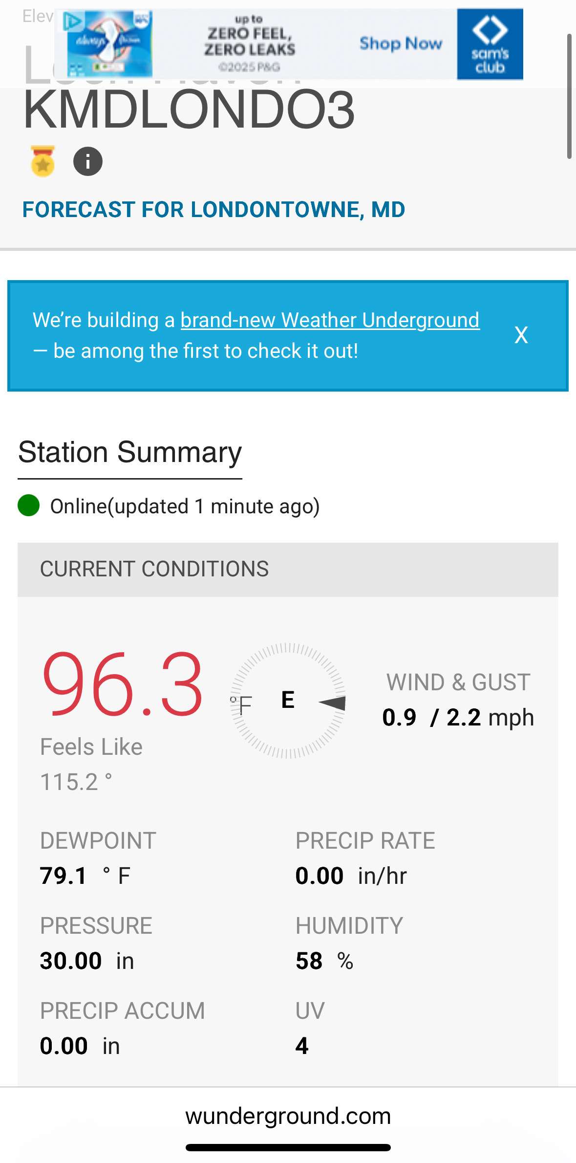
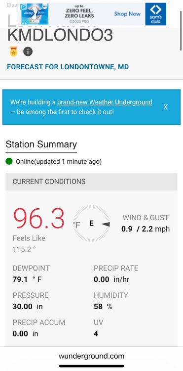
Here’s the local station near my house that I took right as I finished my walk. Blistering!!
-
Hi of 99F Low of 78F Heat Index hit 115 during my mid-afternoon walk after my post night shift sleep. It's been years since I felt anything like this. Have to go back to when I was in Central Texas middle of July in 2022. Yuck
-
The humidity is really going to be a monster to overcome this week. Today was the "cooler" day of the heat wave and it was downright NASTY out this afternoon. 94/75 for the hi/low in my neighborhood. The dew point was able to breach 80 today in the middle of the afternoon with a majority of the time hovering around 77-79. Brutal
-
Final numbers yesterday were 92/69 with 0.34" of precip. I think the winds hurt the rain collection because it was dumping, but coming down sideways. Still a decent total and brings the month to 3.97" already. This has been a really wet May/June combo. Now to bake.....
-
Tons of small branches down across Eastern AA county as I assessed on my way into work. Crofton area had a bunch down as well along Rt3. Nothing too major seen on my assessment, but certainly took out some smaller dead branches in its path.
- 1,378 replies
-
- 1
-

-
- severe
- thunderstorms
- (and 2 more)
-
Getting rocked in Edgewater right now. Winds and rain are legit
- 1,378 replies
-
- 1
-
-
- severe
- thunderstorms
- (and 2 more)
-
They got off at the exit.... Edit: Crashed on the off ramp
-
87/72 so far for the hi/low 1.52" of rain today Quite a summer afternoon with those storms earlier. It feels like late June out there and the heat will not be ceasing anytime soon.
-
This was such a low risk, high reward signing given the details of the contract. This only adds to a pretty solid secondary for starting sense with some of the depth pieces reputable and likely to learn over time from the people ahead on the depth chart. Considering our schedule this season, this is a huge pickup in a scheme sense. Need to stay healthy, and the rotation should help Alexander in that regard. I am stoked for this one.
-
Rain lightening up around here. Was a soaker though. Picked up 1.27” of rain (Still going a little bit) in 25 min or so. Intra-hour rates hit 3.8”/hr at one point. Temp dropped from 87 to 72 during the storm. Great storm! I’ll post my final temp and precip numbers this evening.
-
Getting blasted right now in Edgewater. Thunder woke me up. Start a stretch of nights tonight. I’ll take the rain cooled air. Bring it
-
80/78 out in my neighborhood. Absolutely brutal
-
Got a few small showers overnight with a grand total of 0.03" to add to the persistent mist this morning. Yesterday had a relatively small diurnal; 83/70 was the hi/low. The kicker was the max dew point hit 77F at one point yesterday. Just brutal As a heads up, would want to keep an eye out across Northern and Northeast WV down through Central and Southeast VA today. Soils are very much saturated or compromised in these areas, so the threat for flash flooding is heightened. Would expect some FFW to be issued by local offices later in this setup.
-
Environments like this are notorious for significant heavy rain potential. 99th percentile PWATs for the day
-
I am actually down closer to Annapolis now, but still in the region!
-
It was wild around quarter to 9. Came in like a freight train. The lowlands keeps on stacking precip W's
-
Good to see you again Cash! Hopefully all is well up in your area in SoPA. I need to stop by your area and meet at some point. You were always one of the friendliest people I ever met on here back in the days I lived at Millersville while getting my degree. I need to stop by the PA forum again and say hello