TSSN+
-
Posts
4,814 -
Joined
-
Last visited
About TSSN+

- Birthday 06/26/1989
Recent Profile Visitors
9,246 profile views


-
Managed to only get about .25” of rain yesterday as it lightning and thundered for 3 hours and 3-5 miles from my place got 2-3” of rain. Classic. Snow hole and now rain hole wherever I am. lol
-
Yet barely anything at my place just south of you lol
-
Can’t buy a break around here. Missed yesterdays rain and missing everything around my by 2-3 miles. 0” here 3 miles away 1.8” in last hour lol
-
Don’t think it’s getting as hot around here today at least. In Westminster right now and it’s getting decently cloudy.
-
91 wow
-
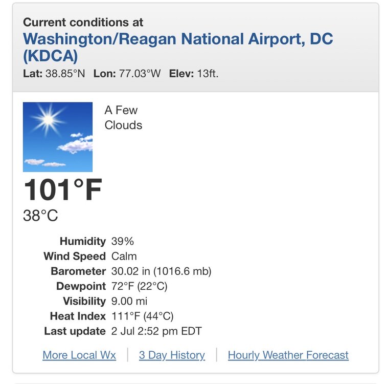
Dca might be close to 90 by 9am woof
-
Looks like DCA only got down to 83 or 84
-
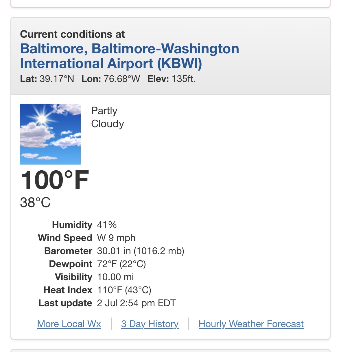
No change at the 352 update 101 at dca and 100 bwi. Will have to see intra hours to see if got any higher.
-
Time for this old meme

-
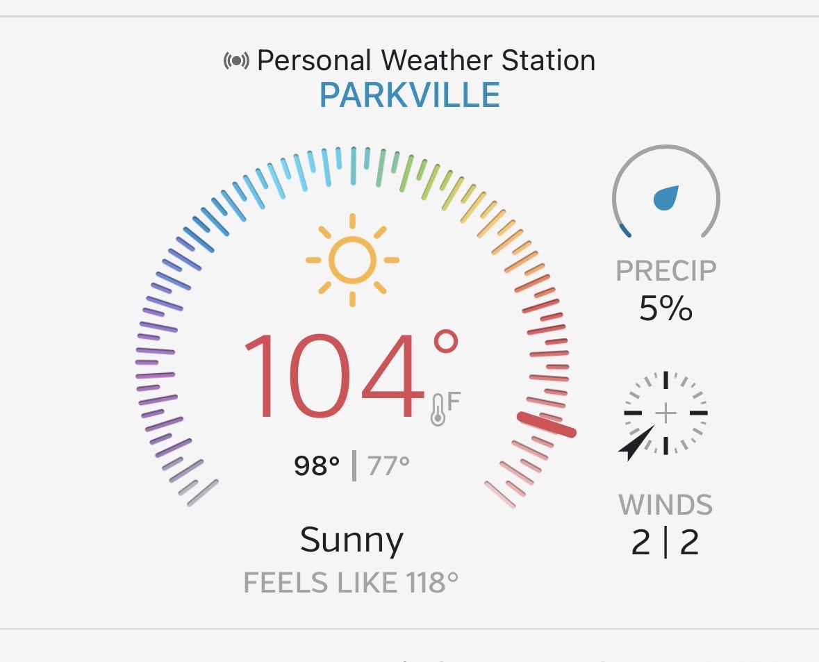
My location is cookin

-
First hot day I can remember where there’s not a cloud in the sky. Impressive
-
They did it

-
Just 6 months ago we had -15 windchill and now we have 115 heat index at nothing like a 130 degree real feel difference
-
Not sure what you looking at lol
-
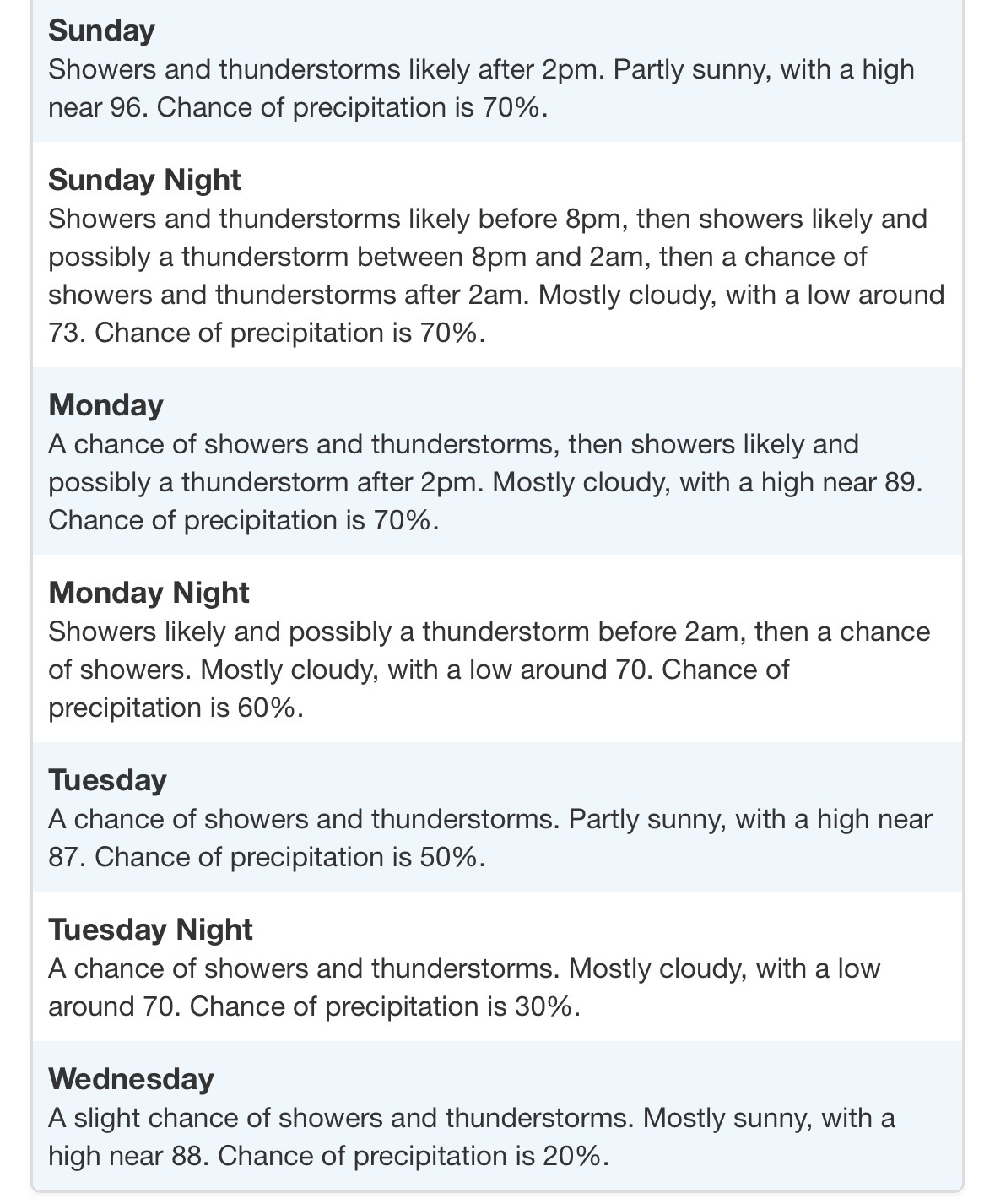
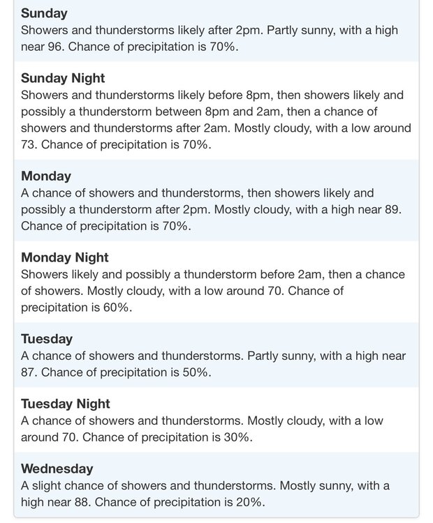
Glad this is short lived. Next week rainy and 80s