

WxWatcher007
-
Posts
35,972 -
Joined
-
Last visited
Content Type
Profiles
Blogs
Forums
American Weather
Media Demo
Store
Gallery
Everything posted by WxWatcher007
-
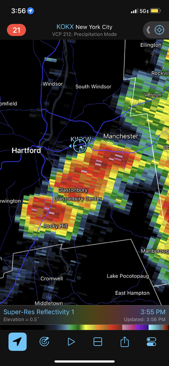
Not the most successful day, but still got a few wins.
-
Even odds the stuff near Springfield/BDL dries up before reaching me. God, I sound like TBlizz.
-
It’s insanely hard, and deeply frustrating as a result. Between the trees, local road network, and interstate traffic, it’s awful. I’ve been able to get ahead of some in the past by doing what you mentioned, but that’s the exception to the rule. Had these storms developed west, I would have had a couple of good viewing spots nearby. Oh well. I’m just bored.
-
Very frustrated. Tried to chase the cell that popped just to my south because it looked promising, but could never get where I needed to be. My area just sucks for anything interesting. It is what it is.
-
Blows. Absolutely blows.
-
Nice looking cell right by @Sey-Mour Snow
-
Cloud cover from the missed storms taking down my temp lol. High of 93.3 today.
-
-
Torching now. 90.5°
-
Not a bad series of cells up there. Probably quite a bit of rain too with some training going on.
-
Nothing spectacular but 38k ft top on that cell near Blandford, MA.
-
I just want to see a good storm
-
86.5° here at noon.
-
Running six degrees ahead of yesterday’s temperature at this part of the day.
-
High of 89.4° here today.
-
TD Two at 5pm
-
I think we have enough.
-

Tropical Storm Arlene—40mph/998mb
WxWatcher007 replied to WxWatcher007's topic in Tropical Headquarters
Agree. Thought we’d see a more well-defined circulation but this is pretty close to a tropical cyclone if it’s not there already. -
More TS winds in the newest data. Just need to find a well-defined LLC now IMO.
-
Some tropical storm winds at flight level and via SFMR on the latest batch of data from recon.
-
Tropical Storm Arlene—40mph/998mb
WxWatcher007 replied to WxWatcher007's topic in Tropical Headquarters
Recon descending into 91L now. -
Recon descending into 91L now. You can tell via visible satellite that dry air is nearby, but the circulation does look better defined at least at the mid level.
-
Tropical Storm Arlene—40mph/998mb
WxWatcher007 replied to WxWatcher007's topic in Tropical Headquarters
Posting text as well Tropical Weather Outlook NWS National Hurricane Center Miami FL 200 PM EDT Thu Jun 1 2023 For the North Atlantic...Caribbean Sea and the Gulf of Mexico: 1. Northeastern Gulf of Mexico (AL91): Recent satellite wind data, along with buoy and ship observations indicate the area of low pressure over the northeastern Gulf of Mexico has a broad but well-defined circulation with maximum sustained winds of about 35 mph. Shower and thunderstorm activity associated with the low is also showing signs of organization. Environmental conditions remain marginally favorable for additional development, and if these trends continue, a short-lived tropical depression or storm is likely to form as soon as this afternoon. The system is likely to meander over the northeastern Gulf of Mexico through tonight but begin a slow southward motion on Friday. By this weekend, environmental conditions are forecast to become unfavorable for additional development as the system continues moving southward, likely remaining offshore over the Gulf of Mexico. An Air Force Reserve Hurricane Hunter aircraft is scheduled to investigate the system later this afternoon. Regardless of development, locally heavy rainfall could occur over portions of the Florida Peninsula through this weekend. Additional information on the rainfall and flooding potential can be found in products issued by your local National Weather Service forecast office and Excessive Rainfall Outlooks issued by the Weather Prediction Center. * Formation chance through 48 hours...high...70 percent. * Formation chance through 7 days...high...70 percent. Forecaster Papin/Cangialosi -
Up to 70% odds now with the first recon mission of the year about to begin.
-
Barely any shear on the soundings lol


