

Typhoon Tip
-
Posts
44,234 -
Joined
-
Last visited
Content Type
Profiles
Blogs
Forums
American Weather
Media Demo
Store
Gallery
Everything posted by Typhoon Tip
-
Were you on campus resident when you were there or did you commute? because those bourgeois hall I think was the name of it and the other one and Fox Tower. They emptied out onto the commons and streets for WWIII massive snowball fight… I mean we were establishing factions and moving squadrons of troops into strategic geodesic boundaries. Lol. F awesomest SBF ever … but then the fervor would turned to shivers As those first three or 4 inches that came on really quick started to freeze harder the temperature was crashing to the upper 20s in the snow is starting to go sideways it was taken on that butter scotch nocturnal night glowing blizzard look outside. Snowball fight over. I want to say 15 inches by dawn and maybe another 3 inches during the day, and then it was kind of down to just that blowing light snow that doesn’t really accumulate that following night.
-
Funny that take… I remember 1992 as NWS having to play a bit of catch-up. two days before hand… I wasn’t even a meteorology major yet. Actually I briefly derailed myself. For some reason I tried to be a music major when I first went to college-how’s that for an out of left fielder. Lol No but I was sitting in some American lit 101 prereq waste of time class. Seated next over was an actual meteorology major. I use to bug her with theories. Anyway it was two days before that storm and she just kind of was staring off out the window and she muttered ‘We don’t know if that’s going to be all rain’ speaking in deference to the Met crowd up in the weather Lab/UML The day that it really got underway and we were getting cat paw rain with undulating snow plumes 900 feet off the deck (3:30 pm vantage from University bridge …39F)… they had to do a cut in on television before the evening news because apparently Worcester was getting utterly destroyed. In fact they had to do cut ins throughout the evening as all kinds of crazy shit started happening. I’ve told the story many times about what I observe that evening with the freakish instantaneous snow flash. Point being I wouldn’t of thought anybody SE was really thinking there was a big storm coming from 1992 because that kind of evolved as it was going on from what I remember. I remember Harvey Leonard on TV saying the next early morning how the snow line was rapidly collapsing SE so even they were going to get 6 inches of snow in Brockton after having gotten 4 to 6 inches of rain! That aspect there …that storm had chapters in its total story.
-
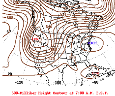
We’ve obviously beaten this horse 1000 times over the years but I still can’t get over that snow shadow in the Connecticut River Valley… I mean can you imagine if that storm hit with like 1.5°C colder through the column? I mean even if that thermally requires a slightly lower PWAT we’d still be talking about astronomical stack heights. We wouldn’t have had those big gaps like that in lower elevations either. some of course. Yup as awesome as that storm was -one of the greats of all time ……it left something on the table. They all do. Although actually… I’ve always thought that December 23, 1997 as having the highest efficiency I’ve ever seen. Which is interesting because I don’t even know if that registers in a lot of people’s personal annals. Went from a 3 inches of wet snow ending as light drizzle in the interior forecast to 23.5 inches of powder… Doing so in pretty much less than six hours… Skirted by a large area that easily got an excess of a foot with pretty much the same forecast in place…? Certainly that is a strong argument for maximizing efficiency and really for all intents and purposes NOT leaving anything on the table
-
Yeah. Could be fun. Of course… let’s get the pattern right. I mean if it turns out to be some kind of compressed shit show flow so fast nothing can really mix or anything it doesn’t really matter. We’ll end up with that dry mild winter everyone has self soothing horse blinders for. Recall, we did talk about this in the tropical thread though but how the low ACE might make things interesting in that regard - hypothetically speaking
-
That too. but you know I guess it really only matters if you invest a lot of time and energy into using this as a primary or a very important social outlet for oneself. Because it really shouldn’t matter whether somebody’s doing that or not – so why does it? logically, people are really pretty deeply invested in site shenanigans. Maybe even more so than they are the actual weather ha ha.. Something like that
-
I think it’s also kind of a state of cultural aspect, too. You know it’s like the Internet +20 years? People used to be a little bit timid about their approach to using the Internet especially in these social media platforms… It took a while for the general population to become brazen and realize they could operate in the anonymity on the web and act like total assholes. That’s definitely going on/more ubiquitous right now in these “wired” societies. As far as what it means for this forum …I mean not a lot of people in here are really assholes but there is still some of that kind of tendency to ignore the person who is saying what they don’t want to hear. Heh. Contributing in here to hopefully gain recognition as somebody who’s got some insights to offer, left, right and up or down you’d better make sure you are angling your delivery otherwise as was said in Caddyshack, “Oh ho well an you ain’ geddin no coke!”
-
Right you get a couple of confused emoji’s while the other person gets 20 likes and has a gifted insight … Nothing can hold a candle to the objective mental responsibility of the masses lol. If it meant their mortgage payments or whatever they’d smarten up and give credit where it’s due real fast. So you get what you get and this is a past time/recreation. oh well
-
12z GFS has the raging nor’easter off a single closed isohypses up to eastern seaboard now too
-
No kidding… you know the euro has never liked a clean ridge to date, re that mid ext range And in fact the GFS isn’t altogether very clean either. They both it keep building these over/top high-pressure systems that drill cold llv flow into the foundation of the higher heights. It’s an aspect oft seen in spring handling … great! We get to butt bang April’s in the same year… The sun is feeble and getting feebler by day. This late in the sol season … a SE-NE equation of state flow injecting under ridging overhead … you don’t get two be warm from ridging over head. Fleetly different universe up there
-
It also depends on how people read/take in the information. "Attribution studies" shouldn't be disrespected, either - if it's done right, and the chi test is > .05 side blah blah, but the calculatons don't mean 100% causality - in other words, it may not be entirely why, but is at least partial. That is not well understood, and those that write the papers are careful to point that sort of statistical theory out, but it seems to fail to get across... I've read posits ... nothing from them were very declarative. Meanwhile, I'm constantly hearing reprisals of other people's work that sounds like 'so and so said this because of that' - which isn't usually what that source stating. This happens a lot. We don't live in an "information responsible" society, not from private sector recounting, not from major media... not much in between, nor for the 'water coolers' either. We've become increasingly irresponsible 'liars' in a lot of ways. Particularly if we need to cherry pick to fit narratives ...and on and on...
-
Guys there is a semi permanent warm pool there that’s emerged over the last decade that’s been shown to resist forcing by either the ENSOs, or seasonal wind stressing.
-
The “looking stellar” aspect of November (than waning out ) is kind of really what’s been going on as part of the climate change signal, with the folding hemisphere/early meridional expression stuff that’s being papered. … said papers being mathematical. As we get into December January February the hemisphere reaches its highest compressed state so the wind velocity in the interface between the Farrell and Hadley cells (steepest mean) reach their seasonal strongest… And that stretches the x-coordinate —>reducing planetary wave numbers …. which tends to pancake or offset rather, the meridional autumn… I was snarky last page… But in a more levelheaded approach I really don’t have a good feeling about this winter as behaving much different than the last several - which really all have kind of taken us through that journey every year with early blocks and high convoluted flow types tending to end up being fast and more “sheery “ I do acknowledge some caveat emptors, however. … willing to see how it plays out One, still not completely sold we’re not gonna have some kind of interference with normal stratospheric chemistry —> thermal disruptions due to volcanism over the last year. How and or if that even does so is available to question. I haven’t found any specific empirical evidence that the stratosphere was infused but who knows… Two, I’m also curious about the GRB that just took place - deep field astrophysical phenomenon. Though it was 2.5 billion light years away this actually set records for the most intense x-ray and cosmic ray burst ever recorded - not sure if that distinction is relative to that distance scale. But that’s what’s being reported. There was a defined ionospheric modulation when that event swept through our solar system. It’s long but known that sudden stratospheric warming events modulate TEC from the bottom up … Strong enough GRB event might “cleanse” some ozone population out if the PV column high up in the stratosphere anyway …
-
Once November hits I throw in the towel on warmth though… Mostly it’s just knowing that it’s inevitable. I mean you’re going through the solar nadir over those next three months so there’s no use in fighting it lol. I like my winters frontloaded… steady diet of unusual cold and sustained, and dappled with surpassing significant snow events from about November 5 through February 5th … Then, equally as “realistic” … it’s 80 to 101 with stratospheric hard on convection towers until the following 3-strike EC ‘cane season. … totally could happen dude.. No but really front loaders are unfortunately rare. 1995 blah blah was king … but there are some other decent ones. Like those great Decembers back in the aughts, ‘07 and ‘08 and ‘10. There’s probably others going all the way back that at least get you to a C+ grade for early expression. But by in large the heft of all of them suggests we have to wait until after Christmas. And now with cc mucking around with stuff who knows how that’s going to distribute things
-
“Noooo winter for you … ONE YEAR!”
-
Mmm .. wondering when this either a … breaks toward a more seasonal warm anomaly -or- b … really commits to the more ominously near/at historic anomaly it seems tempted to go toward. This two weeks reminds me somewhat of late Oct thru the first 10 days of Nov 2020 … An early meridian flow/cold signal sloshed the other way. The cold even produced yet another in the growing numbers of Oct snow events nearing Halloween. Week later …historic warmth nearing or exceeding of 80 as late as the 10th … really surpassing the Indian Summer mystique It was actually an extraordinary “behaviorally significant series” … unsung do to the Pandemic’s capturing attention. Do people recall the 2,500 pg thread ? - don’t remind us … yuck. So anyway we’re not gonna get a snow event out of the trough side of it this time but we are doing in principle similar kind of large scale sloshing. Also… wondering if that Euro’s meandering thing astride the EC out there might take on some phase transition ?
-
Could actually end up exceptionally warm next weekend if that surface +PP escaping E can reorient itself for more continental conveyor. models are doing what they typically do in the spring with an early Ridge signal… They send the sfc high east north east of Boston such that we spend the entire ridge with a chilly stolen East flow
-
Terminating planetary waves at high latitude/altitude (basically the end game of WAA..) triggers PV perturbations. But the two other factors play an important role there, too: the wave number at mid latitudes is one - A lower number implies more zonal bias limiting merdional transport. The other being chemistry in the trapped PV as summer wanes to autumn. The latter is robustly enough correlated to UV/solar as those WL break up ozone. Ozone is thermally conductive and when WAA plumes interact arriving via wave advection slowing the wind velocities …triggers the warm burst/intrusion - the two are positive feed back and the PV fractures. That’s as it relates to SSW. The reason I’m mentioning this stuff is because there are recent studies/mathematical models showing that as the polar field is warming faster than the rest of the planet there’s a tendency for the Vortx to break down with more meridional structures emerging so it’s kind of hard to parse out what is caused by just fluid mechanics versus how much is that really EP originating out of the subtropics. Those seem to be disparate mechanism? Yeah I guess either way the culprit in the discussion is the A the G and the W regardless.
-
70 here
-
I'll betcha 50 bucks I'll be more right than wrong, ...even after "subjective review" tries to refute what is obvious, too - Climate change is affecting winter. ..badly. Winter season forecasters are not adapting to that, or enough, either way. The way it is affecting is it is causing surplus of gradient, regardless of ENSO. Regardless of polar index modes. In fact, the later appears to only add to it when those negative modes happen to be offloading over on our side of the N. hemisphere. Heights from Old Mexico to southern GA ... tend to stay 3-5 dm higher than the previous 300 years of climate inference. These are reproducing observations spanning 10 years at this point - other than outlier like 2015 Feb...which spikes along curves is also part of the business. Sometimes persistence is a forecaster's friend. Knowing when 'she wants to break up with you' ? That's another story - eventually, they all break your heart. But that's the problem... you're not getting pattern persistence in winters. We've been seeing disruptions in winter pattern footprints - particularly in one regard: very hard to maintain a pattern bias. Mass field changes occurring in short duration time spans. That stochastic aspect at large scales is causing a storm in January ( yay!) to be a week near 70 if not historic 80 in Februaries. Snow in October... with 78 F high temperatures on May 15 with hydrostatic heights of 538 dam! ( that's a weirdly odd, that synoptic combination of metrics). The fact that our mix event flop vector appears to now be wet, not white... Combinations of a varied spectrum of observational oddities, from sensible backyard, to more pan-dimensional/super-synoptic, can't be satisfied using the inferences that are still employed from the previous more stable climate - before the hockey stick got underway. But I don't put out seasonal forecasts... I wouldn't dare in a public venue like the Internet weather-based social forum, particularly now, when the winters are being affected by a warming world - ooh sign me up for that vitriol! The convention of "stellar attention to objective reasoning and acceptance" that goes on here isn't really very conducive. Plus, none of this means we can't have a better year, or even redux a 2015 something... It's a matter of said objectivity merely knowing the odds of doing that any given year ... is going down We'll either be below normal snow and above normal temperatures. Or ... we'll bootleg our way to normal snow from a lucky coastal and windex events, with a smattering of front enders that switch to 33 rain instead of icing... with temperatures still finding a way to be above normal if by decimals.
-
As far as it's 'believability' ... there is a reasonable coherent -EPO puse, albeit lower resonance, up there NW Canada toward the end of this next week. -EPO entries do send a reasonably good fit to lower heights west of Chicago, first, anyway. But the "lower" pulsed -EPO at this time of year... mm. It may be too weak to instruct an eventual cold load across N/A on whole as is in the trends ... So I'm imagining we may end up triggering a pattern reversal that sort of stalls, instead. Leaving us in some sort of more or less Nov 2020 look.
-
The modeled larger synoptic evolution, as we head into week 2, is beginning to remind me of a similar evolution that took place between about October 26 through November 11, 2020. Not an exact analog, but bears a lot of similarity nonetheless. I'd even caution, the signal may merely be fought by biases in either the Euro or American sources, in the present model trends - both of which would tend to damp the scale/dimensions of eastern N/A mid latitude ridging at a D8 - 13 range as their normal tendencies. Long words for, 'this could smooth toward a warmer episode.' It's a specter that's been in that time range now for like 4 or 5 days ...really since it first came over the outer temporal horizon of the guidance, and as we get closer...if it started to look more like this ... .... I would not be surprised.
-
I wonder if this will be the first winter in history, in which 70 F was reported at least once during all three months of Dec, Jan, and Feb. ...then of course we can't touch 40 in March... but wouldn't that be hoot.
-
Let’s set some late heat records after an (at least) elevation snow next week. Ha
-
GFS went quite warm looking in the extended
-
Jesus Christ what the hell does somebody have to say in that particular subforum to get banned. Was it from Darth Sith’s heart.


