

Typhoon Tip
-
Posts
44,235 -
Joined
-
Last visited
Content Type
Profiles
Blogs
Forums
American Weather
Media Demo
Store
Gallery
Everything posted by Typhoon Tip
-
-
same assessment over here. adding ... 00z GEFs ( fwiw) were a significant 'tick' ( as you guys call it) improved. Perhaps two or three ticks. There's spread only around the NW arc of the 132-144 hour position off the 00z. That "only" in that context is said deliberately. I've noticed in the past, if the spread is all directions, the entire envelope's value is lower in skill. This way, we argue at least a presence and go from there. But several of those members in that smear are below 995 mb, which is a new circumstance among GEF cluster. Prior cycles were unanimously weaker. The morphology of the 500 mb in the OV was also rotated more neutral. It's seemingly petty to focus, but this is threading the needle on mechanics. If the aft/trailing mechanics come off the Pacific weak vs just that much stronger has been clearly dictating whether we get .2" to .5" QPF in a marginal therm, vs the whiff. We said all along,...well, I did, that this was the first opportunity "at all" - which in spirit and fairness of what that means, no grousing if a minor appetizer isn't delivered. There's also a more of a telecon -scaled signal out there between 270 and 300 or so hours. I think we mentioned yesterday. No changes on that.
-
850mb holding in +2 to +5 (NW-SE) through SNE with a light NW flow and full sun ... If only in April. Immersion into ecstatic euphorium
-
We're punching the clock probably until 60 .. 72 hours from now. Every time that aft S/W comes off the Pacific attenuated over the previous run cycle, this happens. The straight longitudinal flow across the span of the Pac Basin is clearly causing continuity issues with the handling of that crucial contribution to that mess along the EC - it's no certainty that denser/physically realized sampling of that would make a difference, but would lean toward more confidence once that starts nosing over the land.
-
Sneaky fun aspect there ... helluva long fetch coming in by way of a impressive +PP situated ideally N of Maine. It's more impressive actually that the ensemble mean has 1038 contour... I mean we focus on the cyclonic regions but that's big. Granted the SSTs are just now into the 40s, but the synoptic air mass sourcing isn't coming from N. Atlantic. It's coming from the Canadian archipelago. That comes with other interesting value. OES being one... But but that could end up with saturated inversion flurries everywhere.
-
GGEM looks tasty for D9, too - but, actually...there's a proper telecon signal out between 250 and 300 hours. Already, 1/3 of the GEF members carry an important system through the eastern mid latitude/coastal. The EPS at 00z was also decently closing mean isobaric layouts in that range. The numeric telecon converging on 1/3 membership is a decent signal. I like that one as an early look. Maybe we can notch the bed posts with a couple sub -index scaled event before than...
-
This head cold is insane... It's just unrelenting misery. I had f'um Covid last April. I'd take that over this any day of the week. My god
-
I've been noticing that too. Interesting. It's like the data assimilation runs want to pull a Pac wave with more power dynamics, but the measured/realized sounding version don't. That's just just purely speculation based on the run differentials, mind you. Could be science fiction. Lol. But yeah, when see a better cyclone materialize and bring low/moderate goods, it's been the 06 or 18z versions.
-
It's threading in both ways. It's very marginally strong enough. And then suppose it turns out that way, it's marginal whether it is close enough. If those two were not enough, it marginal in the thermodynamics. We have to thread three needles there. lol
-
that's just about precisely where the sensitivity for this thing has been situated out there in space/time. Yup. From what I've been observing, anyway... The zonal careen of the Pacific jet is not an inherently good model performance circumstance - at least that was always the case. Distribution of wave mechanics that are entirely expressed in velocity deltas, much less in curved geometry... tends to lose features and wrongly emphasize others... I realize assimilation techniques and sat soundings have improved in the last 10 years. This modeled look across the Pac seems to be uniquely challenging, however - or I suspect it its. As you say, the trailing short wave...that's somewhere in here....good luck! There's several local maxims in there, and when looping this, it's almost impossible to tell which agglomerate into 'how much' and then gets delivered. Sort of looks like the model interpolation must estimate. And the problem with that is this is sensitive to as little as 10 or 15kts of jet momentum - could mean that trailer bends the boundary like an 06z GFS -type solution. Lol, all this writing over an event with a minor ceiling.
-
Few quick comments on the 5th-7th.. Modest support in the GEF/EPS. Not enough for thread at this time, tho get the feeling we'll likely want to watch the period intently. It's a 'relaxed flow' ordeal, not a lot of potency - it's sort of 'threading the needle' on whether it is even powerful enough to deliver. But, by circumstance ...its physical presence in the models will tend to get mottled sooner, perhaps even lost altogether by D6's - implicitly, that means it may reshow in the 72 hour window. There a several jet "maxes" moving along with the ill-defined progressive L/W. I.e., noisy. There may be room to wonder about sampling proficiency out over the Pacific -which is the focus? All of which coming off the Pac in a somewhat unusual straight W-E inject... With minor differences in spacial-temporal place within that noise, it's been varying between a mere ANA-like bulge back along the boundary (in which case QPF is likely not reaching the ground), to a 06z GFS version, which shows some more modest cyclogen and mechanics making use of a marginal atmosphere..etc. This is the bread/olive oil before the 270-300 hr lasagna.
-
Yeah the efforts to suppress Covid at civility scales ...world over, to varying degrees of success or not unfortunately means background immunity is uniquely set up for waves of 'normal' pathogens. This was predicted by super computing 2 years ago. I have nasty cold going on. Tested for C three times. Negative. Thing is, I did catch a hold of omicron back last April - it wasn't as bad this piece of shit I'm dealing with now. jesua
-
just going to say, wow - it's dazzling outside right now. Birds are active, too. Squirrels chasing each other through the canopies because ...well, they're after 'squirrel' Shouldn't they be hibernating by now.
-
We really only had two at that. There's going to be interpretation but we'd done better in less 'favorable' looking scaffolding. You know ...you get into that rare scenario where it seems to find a way to snow. Basically...you need a little fractal love, too. Both the events in that period were handled as occurrence. It just didn't parlay in favor of regional hopes and dreams to put it nicely.
-
The MJO, for the first time in recent months, is at least coughing momentum through lower amplitude phase 8-1-2. I Wonder if this weird linear jet between Japan and California is signaling constructive interference... just enough to allow that to happen. hmm Thing is... zonal flow types tend to precede the genesis of ridging - that's FAST 101 ( course in Forecast Analytics and Statistical Techniques for the daily double !) Anyway, "tend" is a bit shy of determinism. Still it creates a kind of competition for the Pacific. That zonal jet argues that an eventual east Pacific ridge begins to manifest ..eventually. La Nina on the other hand, doesn't correlate very well with either this modeled torpedo across the Basin ( it's anomalous looking even for "NINO" frankly - ), or any subsequent NE Pacific ridging. ( as an aside, the Nina footprint has been pretty coherent this autumn into early winter. Contrasting, this modeled happenstance ( which hasn't actually happened just yet...) would argue for a decoupled Nina - or an attempt in the mid latitudes to do so. Here we are...nearing mid winter, and yet another ENSO is detaching ... ) NCEP has a 70+% chance for neutralization of the ENSO by Feb-April... I mean it's possible this is the beginning of that taking place? I'm sort of simultaneously speculating two aspects, here: The NE Pacific as we get into January emerging -EPO and/or cyclic +PNA underneath, or both. The other is whether this 'apparent' decoupling Nina state is the very beginning harbinger of its demise. I think it is somewhat important to consider, because the last 10 years worth of ENSOs have been increasingly unstable/less coherent in the hemisphere, overall. Sort of implies a fragility there... If NCEP wants to pull the rug out from under the index anyway, it thus seems like an atmospheric abandon could happen relatively fast. The preceding was probably more for the seasonal thread.. As to next weeks shenanigans... You know, about 20 years ago... even 10 years ago, a straight linear delivered series of troughs off the Pacific were not always lending to model performance over the eastern continent. This was notoriously error prone. There have been advances ( it is assumed - I haven't kept a journal of release notes or anything) in the data assimilation techniques. I looking over the Pacific ... the mechanics that end up in that crumbling morass of vaguely organized wave out around D7-9 is still out west of the date line, embedded in that modeled anomalous jet. I don't think even in modern times that lends very well to continuity... There could be shadowing by parsing problems..
-
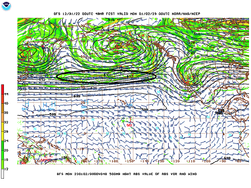
At this range one could question where the GFS gets anything on them charts. Heh
-
At this point ...I'd be willing to wait until it's yesterday. "Signal for a moderate to major flat wave snow event becoming much more coherent for two days ago..."
-
that's only 170+ hours out... Ha, 'only' - imagine saying that in 1995. But that's a hybrid between a NJ model low with a Miller A... Mostly the former though. The boundary kinks over the SE and and then it goes through the Norwegian sequencing along a perfect track to scalp Kevin while the rest of due really well with a ton of frontogenic sig. ...I can tell all that without looking.
-
I shoulda started a thread last Monday ...That woulda blown some minds. - earned me the ESPN hot dog eating classic worth of buns, but it woulda been cool
-
18 hours of moderate snow along rt 2 That much sleet to the pike/mixing in.. with ice south. This is the most promising run re the 5th-7th yet. Funny...this is the event I first mentioned 5 days ago but we've been tossing back and forth between in and something closer to the 8th - and likely will do that some more. It's possible the whole period is just magnified too -
-
I didn't think the EPS looked that great anyway when looping the polar stereographic projection over at Pivotal/500 mb anomaly. It looks like a -PNA transmitting a Chinook stretch across the continent with just a vague ridge mound ... more associated to mountain torque. At least ending on day 10. If that's better than the previous runs, wow. I guess they were really bad then lol There may be events in that mess that are just not powerful enough to footprint the mean - kinda what Jan 5-9th would be. But hey, someone was mentioning how there doesn't seem to be any 4-8" events any more. Might have to do some actual forecasting and not just rely upon the loud signaled bombs that show up two weeks ahead.
-
Another way that can be defined is just in knowing the EPO climatology. The actually d(index) may be most important, too. Early -EPO's subtend a troughs into the Rockies ..that's just conservation of mass. Heights go up over Alaska, they have to come down to balance and the total wave length requires the trough west initially. But as the EPO ages and starts to decay, it tends to progress SE and temporarily ...if not longer, this manifest in a +PNAP. Last week was peculiar in that there was this initial behavior but the subsequent +PNAP was not substantially exerting. It's really like the storm loaded into the flow during the early -EPO... and it's evolution overall interfered with the normal gestation.. It just didn't give the PNAP a chance. The other aspect that's hard for me to ignore is that the bomb sort of obeyed a La Nina memo in not being necessarily EC destined.
-
ICON's a nasty ice storm for the Jan 5-7th signal... It was a more impressive 00z solution than the other guidance. I'm still not completely sold on this models usefulness one way or the other, but I see it listed out on the web and some times mentioned in AFDs in NWS and so forth. It must get some street cred? who knows. But, the signal is still real folks. It's not that far away anymore, either. I'd like the see the GEFs come around. The EPS has some vague look at a coastal. We're not in threat mode. This is still signal eval. I don't think we're going be sending 582 heights up to NJ this whole month though, so long as the numerical PNA index sustains, albeit modestly, a positive SD. This in fact appears more related to hemispheric 'elasticity' in the rather abrupt/recent disappearance of the NAO blocking over the western limb. It is in fact a strong positive mode... but is presently ( I believe) over-compensated and will settle back. Probably when/as this thing comes along next week is resonant timing.
-
My advice ( seein' as everyone asked - ) ...is not to look at the 850 mb in that range. That +PP up there is going to correct the BL quite sharply inverted, particularly if that look trends 200 or so mile S ... and it's not likely to be depicted properly at this range - ... that's already a red flag icer in my mind given those main synoptic players. It could also be a 1/3 to mid way thru the event tuck jet scenario, ... lots of weird possibilities with that much weight folding around the elevations up there.
-
It only took you 5 years to figure that out ? haha


