

Typhoon Tip
-
Posts
44,243 -
Joined
-
Last visited
Content Type
Profiles
Blogs
Forums
American Weather
Media Demo
Store
Gallery
Everything posted by Typhoon Tip
-
Wake Me Up When September Ends..Obs/Diso
Typhoon Tip replied to 40/70 Benchmark's topic in New England
Looks like we're waiting on a cyclogen thrust ... kind of like in coastals ( that actually work out for f'n change) in the winter when you get that 6" IB then the lull.Then the storm bombs and the CCB blossoms and if things work out you double the total or even exceed by some. That looks like the NAM trying to pull those mechanics off in a subtropical column. We'll see... but the other guidance did have the sfc low tanking by 6 or so mb as it runs up over the inner Cape -
Wake Me Up When September Ends..Obs/Diso
Typhoon Tip replied to 40/70 Benchmark's topic in New England
Euro and GFS have swapped places comparing where they were 24 hours ago. Now the GFS ruins Sunday and the Euro suppresses -
Wake Me Up When September Ends..Obs/Diso
Typhoon Tip replied to 40/70 Benchmark's topic in New England
looks like this event was maybe 30 to 40% over billed by models ? at least imby. I was plannin' on 2.5" and I'm just now at an inch with radar shredded to showers not too far SW and moving this way. -
There's been statements if not papers that defamed the usefulness but I'm not sure if it really means it's futile, or if it's just come into contention...etc. I noticed myself years ago, that the recovery "rate" more so than the scalar aspects at any given point along the way, was perhaps a better metric and parlayed favorably. But I haven't been using that/stopped because there's been so much disruption ( winters just behavior errant wrt to traditional leading planetary indicators) over the last decade ... doesn't seem a the 'speckle/white' counts on that coarse image would really be as telling. That all said and just off the top of the head, that seems pretty paltry relative to the Septembers climo from prior -.
-
Wake Me Up When September Ends..Obs/Diso
Typhoon Tip replied to 40/70 Benchmark's topic in New England
When was the bulk of this supposed to happen? -
Wake Me Up When September Ends..Obs/Diso
Typhoon Tip replied to 40/70 Benchmark's topic in New England
Yeah, yesterday I spent some time outlining what the guidance was more than less ( at the time ) leaning toward, but these runs overnight ... heh. While not completely divorced from the ideas proposed then, they're certainly stressing the relationship... It's probably more sensible that there less continuity, actually, because the flow below the westerlies/polar jet, is really nebular/entropic. We lose the structure, we are open to run-to-run chaos. Still, there may be a something developing ( sub-tropical in nature) near the SE coast... but there's an array of equal chances as to what happens to it. If it fails, a slug of deep PWAT rains may end up coming N anyway. And in either case, unsure it even makes it this far N. -
Wake Me Up When September Ends..Obs/Diso
Typhoon Tip replied to 40/70 Benchmark's topic in New England
would you feel that way if you knew there was no winter coming behind it ? -
Wake Me Up When September Ends..Obs/Diso
Typhoon Tip replied to 40/70 Benchmark's topic in New England
You didn't ask for this I'm just commiserating: I'm sensing over the last 10 years or so of this engagement that some of the more dependable rocks of endearment to the winter season are beginning to erode their preferences, too, just as I am. Perhaps around the same rate as Greenland ice post 2000 ... lol. I'm probably being more reflective in that statement actually. I've noticed in me, more and more so I feel a hesitation as the day light shortens. I'm not so sure it's day-light related, though. I've always been sort of 'willing' to sacrifice the sun set by 4:10 because it was tied to a necessity for get exciting winter events to occur. It's always been about the entertainment and experience of winter's fare. The problem is ... the fare's been rained out too many times in the last 10 years. I actually knew or suspected anyway ... 2015's remarkable February was unsustainable. Heh, obviously. But it seems more and more so, we don't sustain 32 with 10:1 snow chances. The wide variations of temperatures, from teens and 20s, to even 60s or 70s in the heart of winter, happens too much to settle into the mystique of winter - it just won't psycho-babble allow it. In short, winters are being ruined. I don't think this is just a simple matter of a "1980s" type regression, either - I lived that decade and don't recall this type of disruptive complexion to the years as they past. Mostly, it just didn't snow around a narrower distributions of temperature. If it rained, then froze... it was like 38 to 18... Not 72 to -10. hahaha. I'm zaggeratin' there of course. My point is, it's hard to get psyched for the dimming daylight, like before, because celestial mechanics and the result of "winter" seem more and more to be uncoupling like the ENSOs people keep trying to use to predict them. Anyway, I wonder if anyone else is just sort of ...getting f'n sick of dealing with it, and now ... we're stuck with losing the day-light and getting short-changed on that investment. I'm not talking about 2015 February - that's some kind of 300-year return rate fluke [probably]. I'm talking about just getting a snow storm.. followed by menial cold. Maybe it softens a little. But then a cold front slips south, refreezes, and we get a ice storm... And, there's a big dawg on the Euro for D8... To soon to blame it on CC, perhaps But this newer version of ..whatever it is we are getting over the last 10 years is, it's been giving me pause. -
Wake Me Up When September Ends..Obs/Diso
Typhoon Tip replied to 40/70 Benchmark's topic in New England
Nice 2-3” swath right where the worst water deficits are … -
Wake Me Up When September Ends..Obs/Diso
Typhoon Tip replied to 40/70 Benchmark's topic in New England
GFS … in fact much of the guidance hints at a Bahama Blue pattern. -
Wake Me Up When September Ends..Obs/Diso
Typhoon Tip replied to 40/70 Benchmark's topic in New England
We’ve had like 20” this summer in my town. nothing -
Wake Me Up When September Ends..Obs/Diso
Typhoon Tip replied to 40/70 Benchmark's topic in New England
NWS has the heavy rain swathing east of Boston/over the Cape. meh must be old -
Wake Me Up When September Ends..Obs/Diso
Typhoon Tip replied to 40/70 Benchmark's topic in New England
How much f rain is it gonna take to flood anywhere accept Leominster -
I brought this up over in the general September thread ... but, probably should be here. This inverted trough and closing low llv pp off the Georgia coast may be the guidance et al in a primitive detection for a tropical/sub-tropical development. I feel this is a ligit synoptic tendency there, because of the super-synoptic aspects going on across our hemisphere at the time. Namely, the large anticyclone moving through Ontario/Quebec and New England toward the end of the week, would tend to accentuate an easterly return flow into the lower M/A. Additionally, the early week coastal reflection lifting northeast off/thru the region will lay in a decaying frontal boundary down there, which would extending seaward from the coast. So, ...E wind over top W wind. Meanwhile, the entire Basin including this region in question above, may yet remain in a divergence anomaly as prescribed by both persistence and the fact that there do not at this time appear to be any compelling reasons to change that static pattern. Presently CPC's 8+ day hazards has the SE/ M/A regions in a risk for excessive rainfall. We also have a low grade sort of flood risk in our area due to the antecedent "wet season" of summer ( weird...). Less than an organized TC, there's that too.
-
Wake Me Up When September Ends..Obs/Diso
Typhoon Tip replied to 40/70 Benchmark's topic in New England
Did you mean 'homegrown season' starting early? ... possibly. op ed: I've personally noted in autumns spanning the last 12 to 15 years ( not a hard experiment) a tendency for early arousal of the seasonal jet - by this I mean, cold season jet structures. That tendency - I suspect - is currently in play, yet again. The slow moving large anticyclone through Ontario and New England late in the week is a result of jet activation setting up pulsed synoptic confluence - which doesn't happen without the physical exertion of a stronger core of westerlies running by along or about the 50th. All that is "indirectly" relevant to the entire SW Basin climatology. You end up with tendencies of easterly llv wind bursts into Gulf/Floridian waters every time there is a +pp anomaly over NYC. That's sort of the relay in how the hemisphere 'activates home season early'. So being early, the water is still blazing away between Cape Hatteras and Miami. Early season high pressure migrates by to the N, there is your easterly acceleration below the M/A. There may even be a westerly compensating synoptic flow south of a decaying front extending E of Georgia, whilst there's that ongoing weird hemispheric couplet in the divergence of the upper levels between the Date Line and the Atlantic. -
Wake Me Up When September Ends..Obs/Diso
Typhoon Tip replied to 40/70 Benchmark's topic in New England
I was noticing the NAM's recent runs really don't have much gradient with this thing. The winds at Logan on the FOUS grid are flopping around at 10 kts. Also, the LI's are around -1 at the regional scope. At least for the NAM's sake, this appears to be more a coincidence/artifact than it is a very good analog for a coastal/winter profile. Just an observation. -
Wake Me Up When September Ends..Obs/Diso
Typhoon Tip replied to 40/70 Benchmark's topic in New England
That might evolve into a tropical system ... That upper air velocity anomalies are still divergent spanning much of the Basin, including that region off the SE coast. Granted ... that means it is based on guidance. But, the operation/model consensus want an over-top high pressure ( sign of the changing season ...), which puts that region initially in a long fetch easterly trade, with still ample OHC and a frontalysis axis, under which there is a light westerly flow... You have cyclonic tendencies under a divergence at high levels, over warm ocean. Not a hard calculus Without that, the GGEM ( also ) would plume a bulk slug of excessive rains. The GFS, while also on the same page with the high pressure, I feel is typically going over board with the activation of the early jet/westerlies, and thus ends up with too much confluence and that creates a suppression error - I mean I'm suspicious of that... Not totally certain it's doing that on these overnight runs but looks a bit like that. -
Wake Me Up When September Ends..Obs/Diso
Typhoon Tip replied to 40/70 Benchmark's topic in New England
I don’t see any guidance going west - what am I missing -
Wake Me Up When September Ends..Obs/Diso
Typhoon Tip replied to 40/70 Benchmark's topic in New England
12z GFS goes to October 2 -
Wake Me Up When September Ends..Obs/Diso
Typhoon Tip replied to 40/70 Benchmark's topic in New England
Unfortunately ... that Euro track is gonna punch the rain -snow line clear past Keene NH -
Wake Me Up When September Ends..Obs/Diso
Typhoon Tip replied to 40/70 Benchmark's topic in New England
Yeah .... but unfortunately, looks like we'll have to deal with another bout of warmth and DPs ... ~ day 6 - 11... The telecon is a tough sell still, because the hemispheric mode is still sort of stranded in summer nebular wave spacing/dimensions - that means that correlations become a bit less useful. That said, the PNA ( in the American cluster) is trying to slip negative, while these operational runs are trying to tip the PNAP into its negative mode with a little bit more coherency than the former. Bottom line ... it would seem the percentages are leaning to a warm period. We'll see. -
Wake Me Up When September Ends..Obs/Diso
Typhoon Tip replied to 40/70 Benchmark's topic in New England
I like establishing coastal tendencies earlier in autumns tho. Just my old man in rocking chair recollection ...that tends to parlay during ensuing cold seasons. Ha! we just have to make sure said season manifests its way to sufficiently 'cold' enough. -
Wake Me Up When September Ends..Obs/Diso
Typhoon Tip replied to 40/70 Benchmark's topic in New England
god we hope so. For the lord has forlorn our rain for too long -
Wake Me Up When September Ends..Obs/Diso
Typhoon Tip replied to 40/70 Benchmark's topic in New England
I tell you ...what I would give to just once see this Icelandic Low park 50 mi SW of Chatham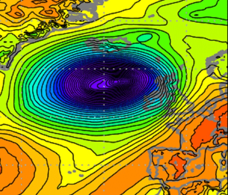
-
Wake Me Up When September Ends..Obs/Diso
Typhoon Tip replied to 40/70 Benchmark's topic in New England
"dud" can be sub-categorized by observation, too... Like, these individual tree species did always tend to favor different times. Some earlier along the ~ 3 week 'color season' while others, like Oak and Silver Maple were very late. It seems that is spread out even more now, such that particular species are getting to a 5-day span of pop more like solo acts. So instead of that one big week of technicolor explosions, fireworks crescendo at the end of the autumn show ...we're getting these small detonations at different times along a color season that's more like 4 or 5 weeks in length that just sort of fades out to a piece of shit brown ground winter ... I digress. The other aspect is disease. I've seen this sort of "blight" like Septiforia fungus other years since 2010. One year, the 90 year old sugar maple at the corner of my plat up and browned and downed by September 15. Zero color, just death. One year, ...tho the tree always turned a vibrant saffron that lit up the neighborhood with orange light during late October afternoons, it turn yellow by the end of September. Like banana yellow, and the individual leaves had dark spots. I did not live here prior to 10 years ago, but the first 4 years I did so, that tree was very consistently orange max on or about October 10. It's been rather unpredictable and more dullard ever since.


