

Typhoon Tip
-
Posts
44,243 -
Joined
-
Last visited
Content Type
Profiles
Blogs
Forums
American Weather
Media Demo
Store
Gallery
Everything posted by Typhoon Tip
-
Octorcher or Roctober 2023 Discussion Thread
Typhoon Tip replied to Damage In Tolland's topic in New England
I've noticed this with smoke ( which makes sense considering atmospheric mechanics...). It tends to alleviate as the sun climbs. The sky's less pall and more blue(ing) this late morning, being consistent with that observation. 71 .. .already vastly different appeal out there than that shit show that last 2 or 3 days. Not even close. I don't know if October ends up above normal. The +PNA in multi-guidance source teleconnector projections is real. We'll see. But, there is also an AO that goes neutral-negative as we hit mid month, so now were converging cooler signals. That all said, ... even telecon canvas can be less than stable in autumn(spring), so ..we'll wait on that. But I would start with neutral and lean neggie pistol to head. That's an abrupt change, too. We could go from mid 80s (bd notwithstanding) to 50 with night freeze headlines toward the beginning of next week. Shot across the bow but on the steeper side/steroid version. -
Yeah... my resentment of that is because I hate that expression. Temperature is temperature. Tell you what...someone dies from exposure to radiational cooling some night - let's ask them how they feel about its fakeness. Lol. No but I get what that means in the euphemism all that, but it's really hard to fake heat after the Equinox. We have to have some pretty significant mechanics at large scale really providing a scaffolding to press temps upward, because the sun above 40 N is getting fragile.
-
Octorcher or Roctober 2023 Discussion Thread
Typhoon Tip replied to Damage In Tolland's topic in New England
For the records nerds ... what's the latest 90 F day at LGA, HFD and BOS ? I imagine it's later down in LGA than CON NH ... but that +18.5 C at 850 on Tuesday at 18z, with a west wind, with zip cloud deck RH -
Octorcher or Roctober 2023 Discussion Thread
Typhoon Tip replied to Damage In Tolland's topic in New England
My lawn is turning over-water yellow -
That's not 'fake' heat ... There is synoptically supported, deep layer ridge, hosting an 850 mb thermal field that if anything supports a warmer temperature than all those 77's across western NY ... All building in from the west - over top in some sense, too. Look at western NY... We may be mid 80s pan dimensionally by mid week as this scenario continues to UNfake itself. Granted not 'at the picnic tables' but such is life up at the base of cumulus clouds.
-
Wake Me Up When September Ends..Obs/Diso
Typhoon Tip replied to 40/70 Benchmark's topic in New England
Oh man. You lucky sob. Look at that, it just opened up in every direction for you. I mean it wasn't like a clearing line approached... it just evaporated. I guess that's right on time per the super ensemble. Hey what did you guys get for in bucket up there, compared to guidance? This thing yesterday appears to have been one of the larger positive busts we've seen in many years - frankly an aspect that many may not be aware or care ( for that matter) due to it being uninspired non-excitable rain. Save for NYC...But that wasn't a bust down there. -
Heh... acceptance'll set you free. Draw the shades for this day. You'll appreciated tomorrow around 2pm when it's 75 under sun out around 495 ..ranging to 68 at shore points, with only light wind.
-
Octorcher or Roctober 2023 Discussion Thread
Typhoon Tip replied to Damage In Tolland's topic in New England
It's real ... but how amplified will be an interesting exercise for me. Often when models first detect aspects at the outer "temporal horizon" ( that range out in time when the noisy long range coalesces into an actual plausibility), they tend to magnify them. Ridges will be huge. Troughs will be made to look like wholesale pattern changes. But then, as the model runs and days click by ... the signal sneakily sheds, both in total tropospheric wave mechanics but also in the metrics they're bringing along ..etc. I used the metaphor in the past, the moon over the eastern horizon being the size of a celestial collision .. pure literary art. ha. Not every time, though. Toward the end of last January, the models brought a nasty cold insert into SE Canada and the NE U.S., some 8 days ahead. Looked like a candidate for "modeling moon rise". But if we looked at the D8.9.10 runs and compared them to what verified, that was an unusual case of early detection of extremeness that went on to occur. I recall a conversation ... 1.24 million years ago when I was still just a college lad. Ah yes, that stage of life where faking post adolescent precocious cynicism only covets a naivete that the world will be kind if you wait long enough ... It was still just the mid 1990s, but we contemplated how big events don't have continuity lapses post emergence through said 'horizon'. In other words, they are immutable; whatever went on around them along the river of time since they emerged, they were stones while the chaos flowed around them. Go back across your "Sandy" and "Super Storm, 1993" ... just pick one. The big ticket shows had a lot of leading promotional marketing from a long way off. Granted, in mid '90s the age of modeling was really still rather young. 20 years earlier in the 1970s, there was the LFM ... primitive in skill compared to these modern marvels that entitle to the extent of rolling model heads like the French Inquisition if they dare f-up a day 5 snow storm... Anyone born in 2000 and now coming into their 'age of Meteorological enlightenment' could really benefit by spending a winter season in a throwback forecast camp where they get abused both emotionally and physically as penance whenever they bust a forecast that was hand drawn isohypses from raw radio soundes just to determine where S/Ws are. You know? Humility is the pathway to a beautiful soul - which is a fantastic digression into why societal decay is driving humanity to a population correction ... -
Oh, it will ... whence it is determined your Saturday has been tidily and squarely ruined
-
Yeah… Radar is breaking up. Taking on a more showery distribution. Watch, the ending of this whole thing ends up being weaker than modeled. 18z NAM was bone dry over Logan by Sunday morning. Looks pretty mild in the interior - if so not shocked if it ended up 75 metro west.
-
Juding by BOX rad it's onto something ...even if its off by timing ? This model hasn't really been handling this some some playing catch-up seems underway.
-
Wake Me Up When September Ends..Obs/Diso
Typhoon Tip replied to 40/70 Benchmark's topic in New England
We've been getting 'tucked' in synoptically all f'ing summer long unrelenting and it really hasn't stopped. If it's not a trough it's a high pressure orienting due east sticking us up the fanny with Atlantic putrid flow - like this pos that barely has mid level mechanics but manages to over perform by several standard deviations.. These are hard extremes to explain - but an explanation is never sought when it is only ( so far..) minor enough inconveniences. -
Wake Me Up When September Ends..Obs/Diso
Typhoon Tip replied to 40/70 Benchmark's topic in New England
This one goes out to all those that endear to warm autumn weather... Cheers!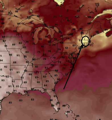
-
I'm hoping this shit gets outta here by Sunday morning ( like actually ... not just cuz the models say it will ). I wanna break in my new Destroyer
-
Yup ... I'm just not sure how much normalization that scenario can take before that becomes cold upslope water... It'll be close. Not the thread for it but I ended Kevin's warmth parade in his October thread saying we got 6 ... maybe the first 7 days of October/ beyond which there is pattern modality. The problem is, all the models at this range see the horizon like the moon coming up - huge.
-
pretty good gradient. You and I are not terribly far from one another and we're just now approaching an inch
-
Octorcher or Roctober 2023 Discussion Thread
Typhoon Tip replied to Damage In Tolland's topic in New England
The "furnace" likely doesn't last beyond D7... We'll see but there's pretty heavy ensemble support, cross guidance, for a strong -EPO relay into a +PNA...and a deepening L/W axis over Ohio already underway by October 6. May hold onto southerly deep layer flow along east of Appalachia into the 7th, but we set a +PNAP table pretty coherently in every guidance source by then. It's also believable for other reasons but the average reader's attention span in here stops right he - -
It was 2 days ago, but yeah... It was inconsistent before that. It really honed more than the others on the 18z run 2 days ago.
-
You guys may find this shocking but ...the models are bring rain a week from Saturday
-
right, yeah. There's a mechanism for rain - it's a matter of the synergy. I mean these seemingly innocuous set up are definitely over-producing more and more. We actually have to be hit by the climate train to admit we're standing on the tracks here? Or, going over the cliff in a bus and while someone yells above the calamity, don't worry ...it's just gravity.
-
Either way ... very high PWAT feed into a paltry mechanical layout is causing all this strife. wow. Standard intervals, granted... but there's only 10 to 15 kts of wind going around the 500 mb trough, which only has one isohypses ... way up at 582 dm no less. We've been close to 100 F under hgts that high. So CC'able or not, this is whack anomaly to have these coincident metrics create this much problem, either way.
-
heh... fire up the 'attribution' engine on this one, huh
-
Check this ... but I'm pretty sure no model had moderate rain all the way to Lakes Region of NH, either.
-
I was just thinking about that disgusting smell that happens when you mix urban germ phage with decaying trash into turbid flood waters. Nasty nasty nasty. Reminds me - in microcosm of course... - the French Quarter down in New Orleans/"Katrina", when the dikes failed and filled the neighborhoods in a nutritional broth of angry confused venomous snakes, dead animal carcasses, house hold chemicals and backed-out sewage ... clear to the roof-eaves in some cases.
-
I don't know why in the hell are these 'honorable mention' Darwinian runner-ups. They're venturing under ground into terminals that are in a flood situation

