Harry Perry
-
Posts
1,173 -
Joined
-
Last visited
Content Type
Profiles
Blogs
Forums
American Weather
Media Demo
Store
Gallery
Everything posted by Harry Perry
-
This storm will certainly be feast of famine for some, who is yet to be determined. I feel for the Mets/NWS in times like these. What a mess to sort through.
-
This, this is impressive.
-
Cold front is moving a bit quicker than previously thought.. at this rate Flat Rock to Adrian point south is in line for 3-5”
-
Those rates would be niiiiice. I’m 33 and think the biggest system I can recall is GHDII. Seems like there were big ones all the time when I was young, but when you’re only 3’ tall… doesn’t take much to have snow up to your knees. But yeah, this system… this one is exciting. Loved how GRR stated this to be a high end advisory yesterday, yet issued a warning today and will likely bust (unless these short range ensembles are correct). They’ll never issue a watch or warning here again. Ever.
-
I remember this. This was one of the events I remembered. The other was 2005-6ish. Dry air infiltration completely demolished the deformation zone snows with a sharp cut-off. Literally nothing but virga and a sharp NE wind.
-
Seems like this didn’t happen as much growing up, but I remember a few times where 6-10” was forecast and woke up to less than a dusting on the ground.
-
I don’t know… this smells like a bust around here.
-
Good call. I’d expect roughly the same over this way. Watch roughly from the I-96 corridor south including Clinton and Gratiot counties with 5-9” totals with locally higher amounts and the mention of a brief onset of sleet/freezing rain in the southern zones before changing to all snow.
-
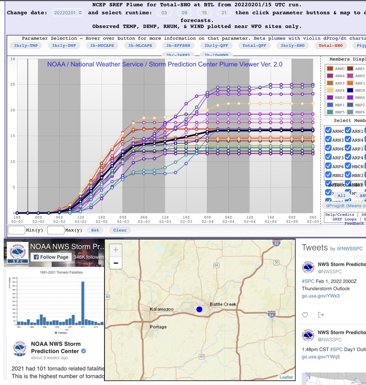
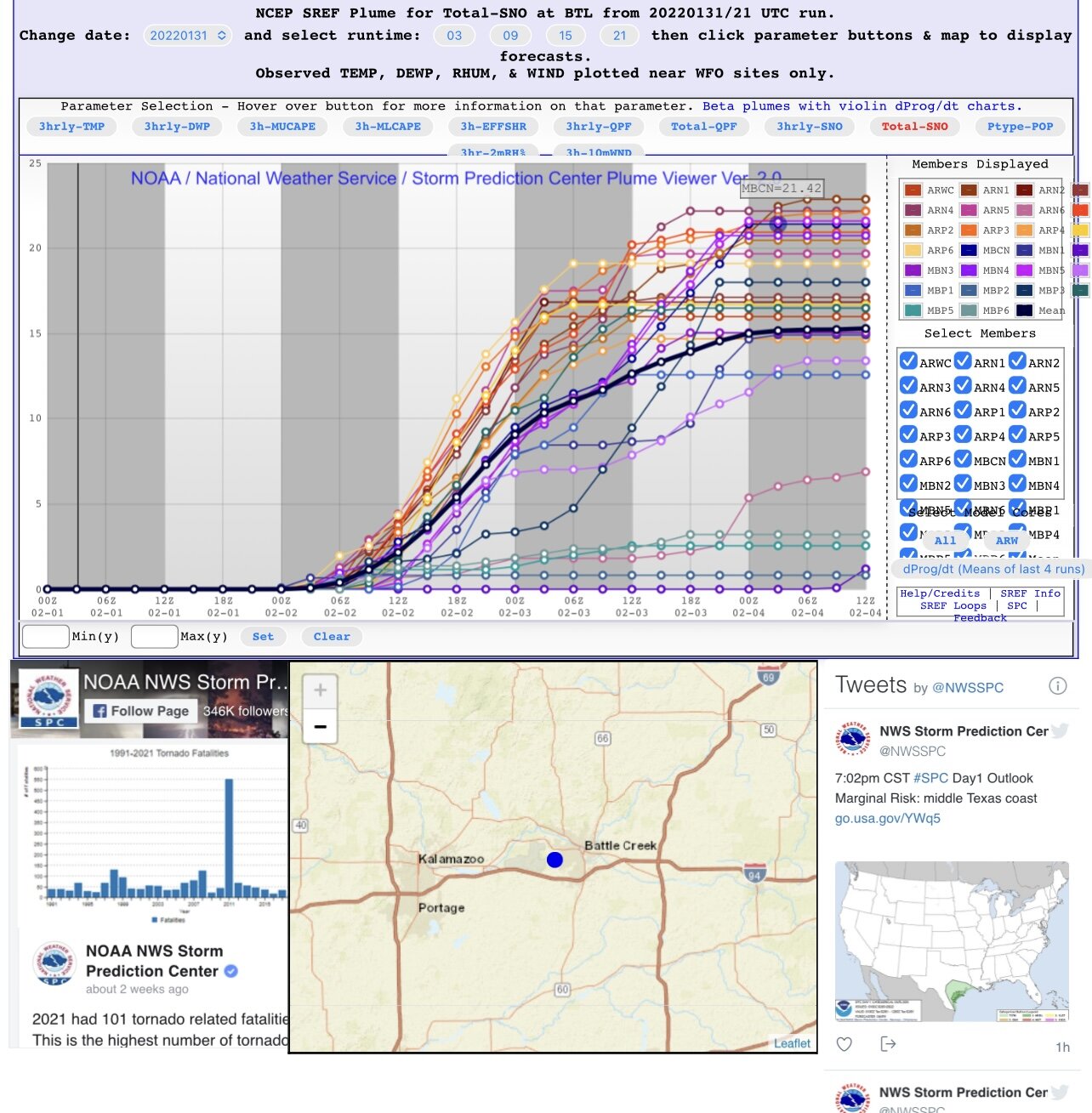
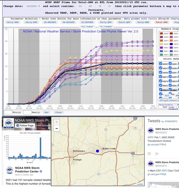
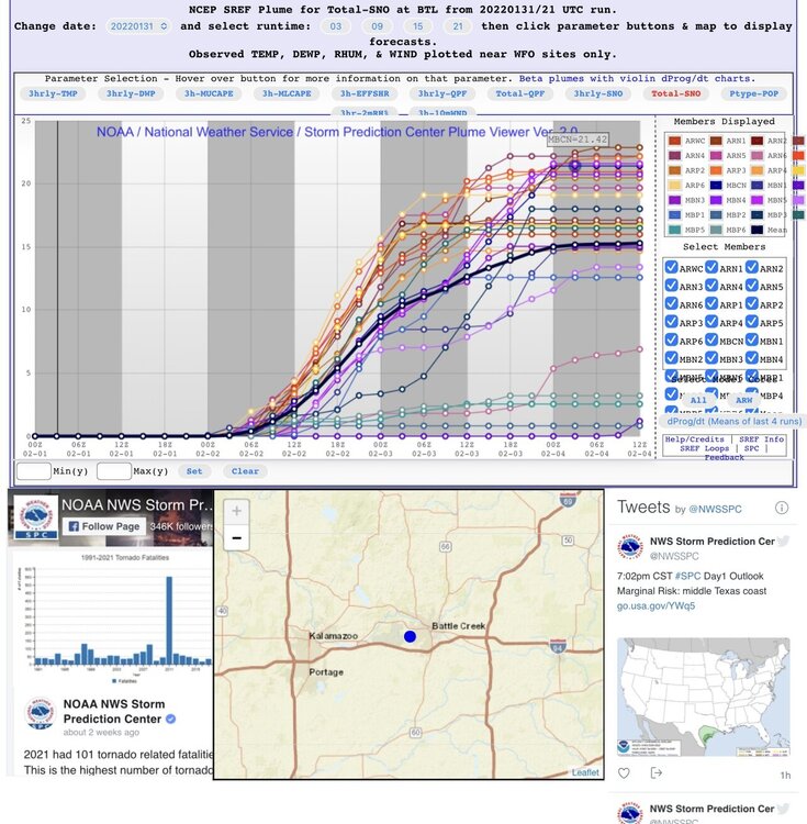
Came up with this. Pretty impressive spread.
-
This. Truer words never spoken.
-
First time I’ve personally witnessed plumes this high clustered between 12-25”
-
Good lookin out… Smells like hopes & dreams in here
-
Currently sitting at a strip club drinking a Michelob Ultra waiting to see the next model suite.. literally.
-
Guess we’ll see what happens in the next 24. Unique event nevertheless. Usually waiting on a sub-990mb surface low to bring us a storm like this.
-
Still makes for some good
-
This. What are we missing here..
-
Well at least we’ve got the RAP and HRRR
-
That’s probably the best way to look at it honestly. Most of our snow would come from Tuesday night - Wednesday and very little if anything more after that. Looking at some of 12z operational guidance SLP/Radar make this look like more of a one day storm.
-
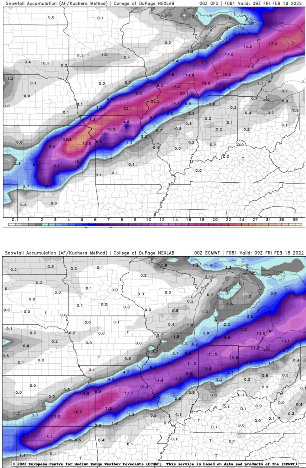
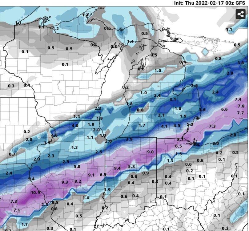
Man! What a change between 00z and 12z GFS. Some places went from 0” to 17.5” in southern Indiana. 50-75 mile jumps to keep us on the edge.
-
I would imagine that is going to happen eventually.. totals are more inline at 10:1 while everyone keeps posting Kuchera ratios. How much will they come down is the question. Willing to bet someone will end up with a foot (maybe a little more) out of this before all is said and done.
-
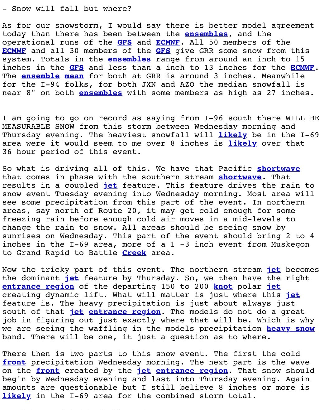
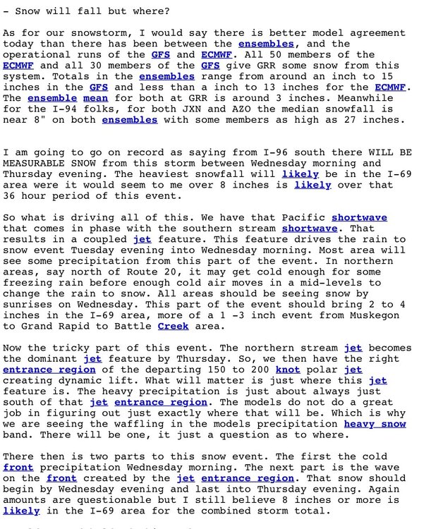
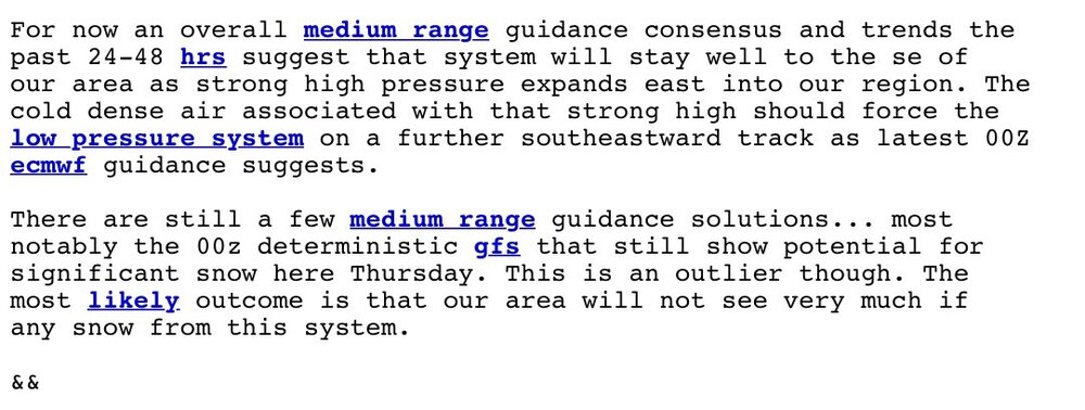
I will say one of our better forecasters WDM (Bill Marino) wrote an excellent forecast discussion this afternoon regarding the upcoming system(s).
-
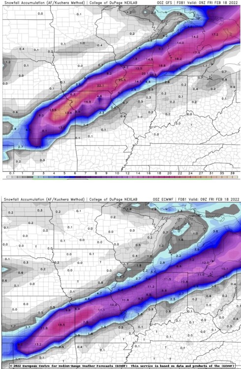
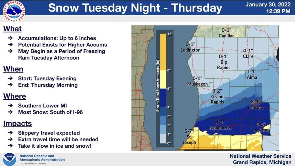
GRR “Little to no snow expected”. Interesting orientation of the heaviest snow axis…
-
GRR completely throwing the storm away that affects 75% of the CWA 72 hours out.. might not end up with an advisory at all, just 6-10” of snow haha. Even the EURO they’re riding to the grave shows appreciable snows across 50% of their CWA so their statement in this mornings AFD just shows how erroneous certain forecasters can be if it doesn’t affect their backyard.
-
Well said. Even if current forecast amounts were slashed in half it would still be a significant snow/ice for someone within the forum.
-
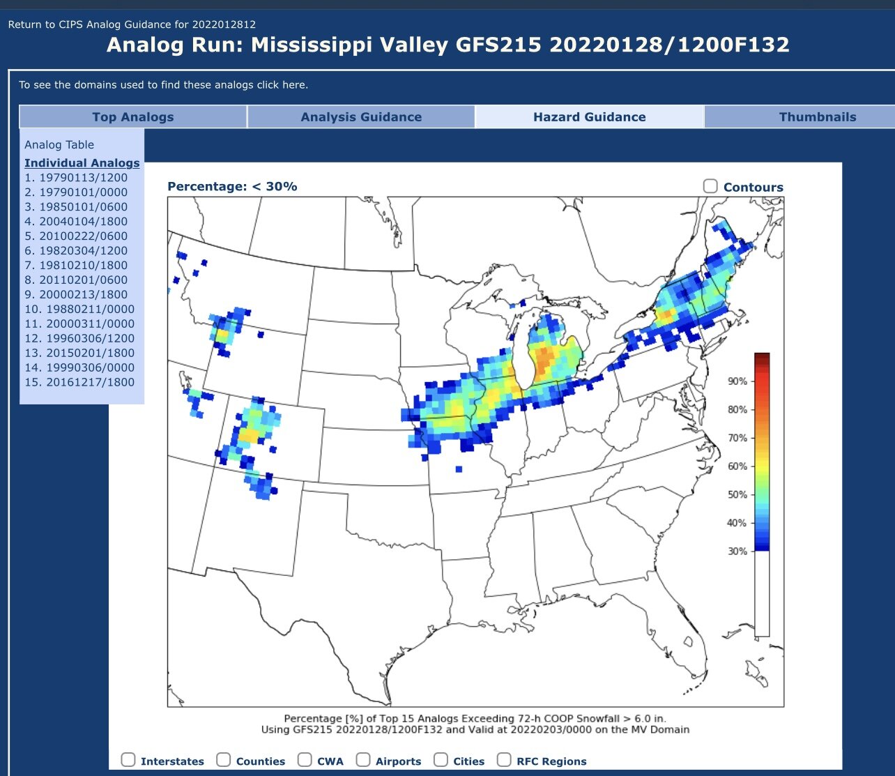
Suspect that GRR will issue an advisory for 8-12” for most around here … Looking at the CIPS analogs, 15 top matches. A few pretty good ones too.