

Kevin Reilly
-
Posts
3,401 -
Joined
-
Last visited
Content Type
Profiles
Blogs
Forums
American Weather
Media Demo
Store
Gallery
Everything posted by Kevin Reilly
-

2024 Valentines Day Rain/Snow/Who The Hell Knows Thread
Kevin Reilly replied to WinterWxLuvr's topic in Mid Atlantic
Don't forget the increasing sun angle between 10:30 am and 2:30 pm. -
E PA/NJ/DE Winter 2023-2024 OBS/Discussion
Kevin Reilly replied to The Iceman's topic in Philadelphia Region
It is on an island by itself unfortunately. Ukie, Euro, CMC, ICON vs. GFS and GEFS AT least we can say there is still a chance! -
2024 Valentines Day Rain/Snow/Who The Hell Knows Thread
Kevin Reilly replied to WinterWxLuvr's topic in Mid Atlantic
FWIW it looked like the CMC rushes to Syracuse but gets Shunted ESE so maybe it trends tomorrow to GFS and GEFS we shall see. Euro will be telling. -
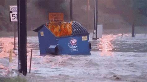
Take away storm further south, cold air crashing in, temps falling to 32 in SE PA with 9-11" of snow and falling to 34 with 3-6" in Baltimore not a dumpster fire LOL
- 2,509 replies
-
- 1
-

-
- weenie fest or weenie roast?
- weenies got roasted
- (and 2 more)
-
E PA/NJ/DE Winter 2023-2024 OBS/Discussion
Kevin Reilly replied to The Iceman's topic in Philadelphia Region
okay lock that up and we didn't see the CMC. -
E PA/NJ/DE Winter 2023-2024 OBS/Discussion
Kevin Reilly replied to The Iceman's topic in Philadelphia Region
Anyone got a snowfall map for the 0z GFS? CMC? LOL -
E PA/NJ/DE Winter 2023-2024 OBS/Discussion
Kevin Reilly replied to The Iceman's topic in Philadelphia Region
CMC to Syracuse to eastern Long Island Love it LOL! -
UMMM hour 138 GFS anyone umm!! Anyone!
-
Yea I should have been more specific I laughed at the 18z GFS and I don't believe at all what it was selling. I do not take many 18z runs "off runs" very seriously. Looks like it went out to lunch!
- 2,509 replies
-
- 1
-

-
- weenie fest or weenie roast?
- weenies got roasted
- (and 2 more)
-
18z GFS wow! What -NAO LOL... What a dumpster fire!
- 2,509 replies
-
- 4
-

-

-
- weenie fest or weenie roast?
- weenies got roasted
- (and 2 more)
-
Umm March 12th 1993 it was 62f before we got whacked! PHL picked up 13" of now and 4" of sleet with a rainbow at the end. It started snowing at 11 pm at 42f. What we need is dynamics.
- 2,509 replies
-
- 2
-
-
- weenie fest or weenie roast?
- weenies got roasted
- (and 2 more)
-
It is coming>>>> "FOLKS"
-
I liked that run better than 12z. Storm south falling as she goes 1004 to 994 to 989 to 978 offshore cold air crashes into those storms. I think the GFS at 18z is a move towards the EPS and a move back towards our 8-12" storm shown on gfs a few runs back. The thermals will be taken care of by a developing storm system as she goes. I am interested again.
-
Totally agree with you. It i the case of split the difference the take away is cold air intrusion from the Euro and I bet in future cycle runs we get a GFS solution a few times of 8-12" of snow.
-
Well we had 994-997 all over the place down in Florida, Alabama, Georgia, South Carolina and how far north did that get. Looks like we are getting the blocking just the wrong kind LOL and also with no real cold air to boot.
-
Keeps hope alive so I won't jump yet. A week out what can go wrong.
-
February 13th and 14th. I am out. No Cold High up north. Rain! Again this was a bonus wait until after the 15-16th of February.
- 2,509 replies
-
- 1
-
-
- weenie fest or weenie roast?
- weenies got roasted
- (and 2 more)
-
I will keep asking the question? Where is the Cold High up north for the cold air feed? This is a common theme time and time again with few exceptions over the past 5 years or so.
- 2,509 replies
-
- 5
-
-
-
- weenie fest or weenie roast?
- weenies got roasted
- (and 2 more)
-
Is that 975 mb?? okay that got real quick drops from 996 mb at Cape Hatteras to 975mb. Would like to see a cold high up north but that storm is strong enough to pull the cold air down and manufacture it's own cold air.
-
lol it's a start.
-
Oh, I agree I can care less about thermals this far out what's important is that there is a storm pretty much on the benchmark.
- 2,509 replies
-
- 2
-
-
- weenie fest or weenie roast?
- weenies got roasted
- (and 2 more)
-
Yea its great thermals are all messed up though.
-
Well, quite honestly by March 14th pretty much we are done so you better have something to show by then.
-
I hear you! In the meantime, be patient. Go shopping for Superbowl snacks, clear the yard of sticks to light a fire and roast marshmallows. It's coming and we track by next weekend!
- 2,509 replies
-
- 1
-
-
- weenie fest or weenie roast?
- weenies got roasted
- (and 2 more)
-
E PA/NJ/DE Winter 2023-2024 OBS/Discussion
Kevin Reilly replied to The Iceman's topic in Philadelphia Region
Yea he comes out before sunrise! Phil didn't see his shadow early spring! Wait it already has been spring! Wait the can kicking is real!