

Buddy1987
-
Posts
3,952 -
Joined
-
Last visited
Content Type
Profiles
Blogs
Forums
American Weather
Media Demo
Store
Gallery
Posts posted by Buddy1987
-
-
12Z GFS is even more juicy than its 6z run. Kind of funny to see it more juicy than the NAM. This close to start time and there are pretty significant differences that exist. For my area at least and the northern foothills as well, looks like a nice decent event is now being shown and in general agreement.
Edit: Man out to 54 now that is one heck of a nice little snowstorm for VA and now extending up into the Mid-Atlantic.
-
Just now, BIG FROSTY said:
Here, just checking in. Any accumulations here on the Nam?
.Yup!

-
 2
2
-
-
12Z NAM is a SOLID hit for southern/central VA and into the NC Foothills. Frosty, where you at bro?

-
12z nam looking very juicy at hr 30 here. May be a good run incoming. Pretty pumped to actually have a winter storm watch right now.
-
2 minutes ago, griteater said:
12z GFS moved away a bit from its idea of a stronger lead wave moving through TN. 12z CMC looks similar to GFS. Both look pretty good in your area Buddy. CMC has kind of been between the farther north GFS and weaker, farther south Euro/UKMet camp, and may be a good middle ground. For NC, it looks too warm on the front side of the storm, except for maybe the northern mtns...then there could be some changeover for some areas depending on how the backside wave evolves.
I’m thinking it may be hard to get it to accumulate however, given sun angle and time of year. Would really have to pour down. I do like where I sit at present though.
-
12z GFS going to be a big hit for VA northern NC mountains. Crazy spread at this timeframe, although Nam imo took a step toward GFS this morning.
-
12z RGEM looks ominous and more GFS like with the Miller B setup. Low over central TN at end of its run. RGEM still just a touch out of its range but I feel like it has performed very well this year.
-
24 minutes ago, NCSNOW said:
To much of a press , confluence up north for this to roll through southern KY, WVA imo. Well see
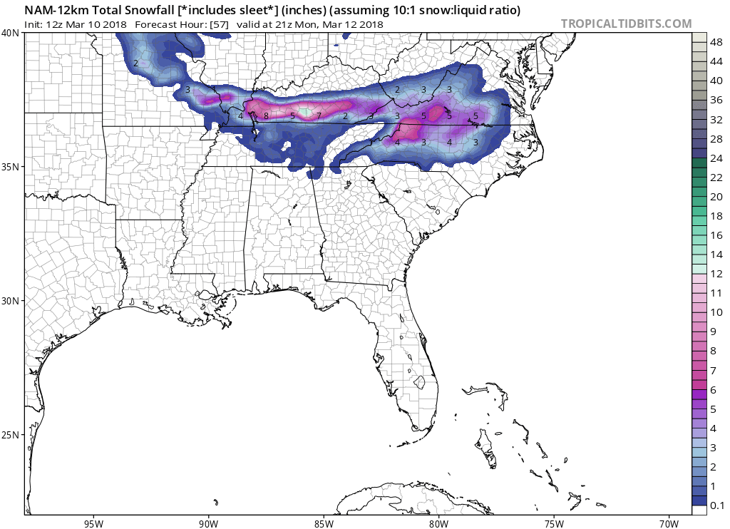
NAM did trend higher with QPF up my way, closer in line to GFS. Much weaker albeit with system and south overall however. 12K NAM gives me 7''.
-
48 minutes ago, PackGrad05 said:
6Z GFS a whiff for the triangle. Maybe some deformation band flurries. That's it.
GFS would be a wicked heavy power outage type snowstorm for VA. I’m up in CT still and was able to witness their nor’easter they got up here and it was awesome. Going to have to monitor this one.
-
4 minutes ago, BornAgain13 said:
Well the ICON/GEM give MBY 2-4", GFS maybe a coating, Mostly Rain... now will see what EURO has.
Got a feeling still this will be more a NC mountains storm and up my way on up to Winchester and points north. Euro has sucked pond water this winter imo.
-
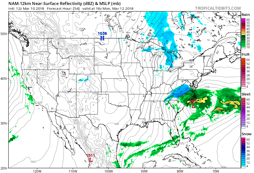
GFS between hrs 99-105 has a nasty little wedge showing up from my neck of the woods down the spine of western NC. Good run for Frosty and people to the south of me during this timeframe. I am assuming heavy sleet or freezing rain followed by a flip to rain if GFS is correct. I will say though with the GGEM showing the HP to the north, the GFS may be showing its hand and signifying its not great with cold air setups. Something to definitely keep an eye on the next couple of days.
-
1 minute ago, BornAgain13 said:
Why is the GEM colder than the GFS for the Sun/Mon system? Is it because the GFS is more amped?
GGEM has a HP system to the north of the system, whereas the GFS does not.
-
6 minutes ago, CaryWx said:
Sounds like west of 77 and north of 40 in NC stand a good chance in February but tough to get something east of there, especially in the next 10 days.
For once this winter, I actually like my chances. It’s been brutal up this way. I actually feel pretty hung-ho about sun mon timeframe. I really like how the Icon has been performing this year.
-
7 minutes ago, wncsnow said:
Dang man, I thought you got something last month when we got 5 inches in Southside. South Boston got a dusting to 1/2 inch down to Hyco lake then bending back to Reidsville and GSO last night but we didnt even see a flake to my knowledge.. Sharp edge. I think this this next threat could be some sleet/snow to start if the precip starts early enough.. Even EURO hints at this but doesnt really move in moisture until it has warmed up. Something to watch.
No we had heavy virga for hours. It was so dry here when GSO and everyone got there big snow. Was pretty painful to watch. About 50 miles south of ROA got 2''.
-
1 hour ago, BornAgain13 said:
CMC is a Major ICE Storm for southern and central VA.
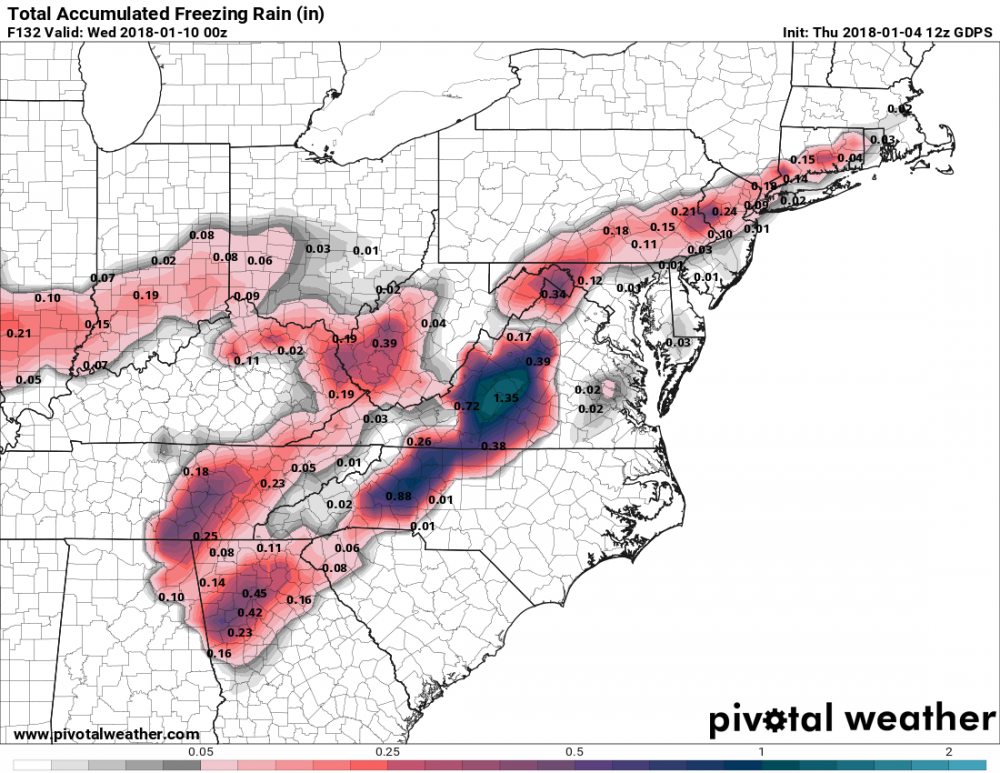
Man BRING IT! I am literally deprived of winter weather this year. My total for this year is 1/2 inch of snow from basically Lake Michigan effect, as there was a streamer that made it down this way and set up shop for a couple hours. I will take anything at this point. Is Euro showing anything similar to CMC as of 12z?
-
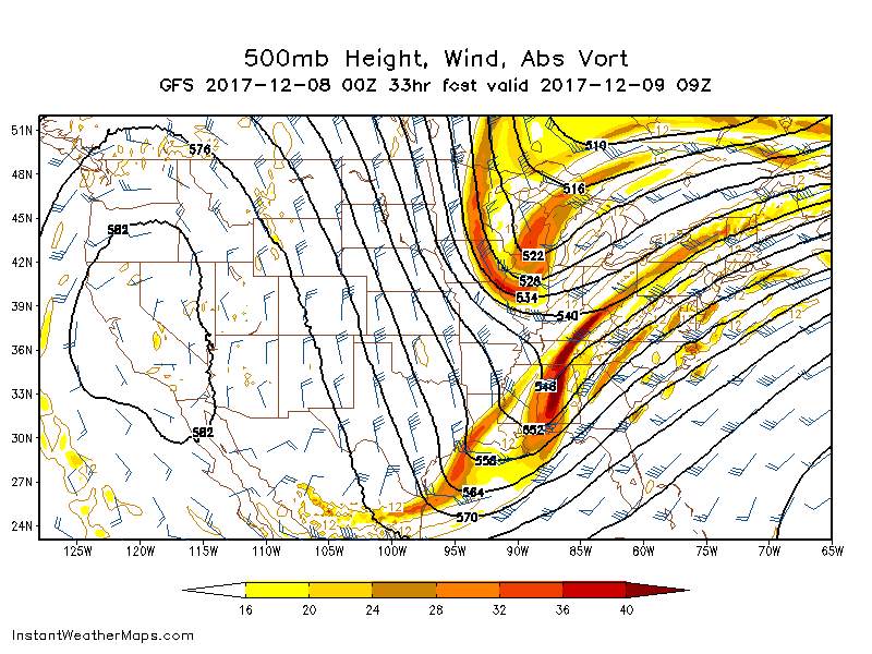
GFS looks better at 96 on 12z. Vort tracking further to the south this run, with a large 2m temp gradient all the way down to ATL.
At 102, closed contour over southeast Arkansas, whereas 6z had it over central TN.
-
6 minutes ago, wncsnow said:
QPF looks pretty good. Generally .5 to .7 for most, possible more.. especially upstate and WNC
Wow VERY nice! Lets do it! Will begin my journey into this upcoming storm and start assessing the model suites as they come out. Talk to everyone soon.
-
Guys,
I haven't even remotely followed this event yet. Been so entertained by my family in Charleston and Ladson/Summerville area getting plastered. What does qpf look like for the general region?
-
I am curious as to where to post the New Years threat. I am figuring it is still somewhat medium to long range (at least that's how the models make it feel this year) that this would be the best place to hold the discussion. The GFS is a little more aggressive for the event, with decent overrunning setting up for it. Hopefully the models will trend in a positive direction for this event.
-
1
-
-
1 minute ago, Turner Team said:
We are for now.... Looking good for later on tonight though. I think its going to be a situation where there is a very sharp cutoff somewhere just north of 81 though. There definitely should be a wide range of accumulations across the valley though. I wouldn't be surprised at all to see the Bent Mountain or Clearbrook areas get 5 or 6 inches out of this.
Good thing is I am closer to that way. Im off exit 137 on 81 if you are familiar.
-
We are effed up this way. Dry air for the win! Ugh
Edit: And then the gods heard me and the first flakes started to fly!
-
Precip filling in nicely over Eastern TN. Definitely good for everyone on the forum. Atmosphere juiced up!
-

Mid to Long Term Discussion 2018
in Southeastern States
Posted