metagraphica
-
Posts
2,219 -
Joined
-
Last visited
Content Type
Profiles
Blogs
Forums
American Weather
Media Demo
Store
Gallery
Everything posted by metagraphica
-

Active mid December with multiple event potential
metagraphica replied to Typhoon Tip's topic in New England
I'm gonna be walking a tight-rope on that coastal front down here. -
Paid $1.42/gal on 11/3, but I see the local place I get mine is up to $1.65 now
-
Significant Severe Weather Event Possible Thursday, August 27, 2020
metagraphica replied to weatherwiz's topic in New England
TOR Watch issued: Tornado Watch TORNADO WATCH OUTLINE UPDATE FOR WT 457 NWS STORM PREDICTION CENTER NORMAN OK 315 PM EDT THU AUG 27 2020 TORNADO WATCH 457 IS IN EFFECT UNTIL 800 PM EDT FOR THE FOLLOWING LOCATIONS CTC001-003-007-009-011-280000- /O.NEW.KWNS.TO.A.0457.200827T1915Z-200828T0000Z/ CT . CONNECTICUT COUNTIES INCLUDED ARE FAIRFIELD HARTFORD MIDDLESEX NEW HAVEN NEW LONDON $$ -
Significant Severe Weather Event Possible Thursday, August 27, 2020
metagraphica replied to weatherwiz's topic in New England
Definitely more humid over here in Salem compared to just 2 hours ago when I was outside with the doggo. -
March 12/13/14 Blizzard/Winter Storm/WWA etc
metagraphica replied to Bostonseminole's topic in New England
16" here, might squeak out another tenth. Parents in Niantic said about 18" around 6pm. They might have gotten a bit more after that as this final batch has been moving through. -
March 12/13/14 Blizzard/Winter Storm/WWA etc
metagraphica replied to Bostonseminole's topic in New England
Low level circulation definitely ripping off to the east now...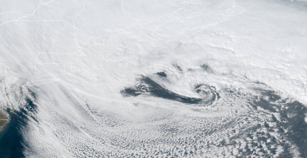
-
March 12/13/14 Blizzard/Winter Storm/WWA etc
metagraphica replied to Bostonseminole's topic in New England
NO way that Norwich CT reading of 9" is correct. They were in a heavier part of the band for hours and I'm over 13" here to the west of them in Salem. -
March 12/13/14 Blizzard/Winter Storm/WWA etc
metagraphica replied to Bostonseminole's topic in New England
Snowing lightly now that I'm in between the 2 heavy CT bands. Just took 3 measurements. 12.5", 13.5" and 15" on flat areas of the driveway away from the house. So I'll call it 13.75" so far. Might be able to squeak out another inch if that west most band moves overhead before the end. -
March 12/13/14 Blizzard/Winter Storm/WWA etc
metagraphica replied to Bostonseminole's topic in New England
Poor Kevin sucking fumes. Ginxy naked! Not too bad here IMBY - just to the west of the yellow returns in the eastern band. Almost 6" total so far.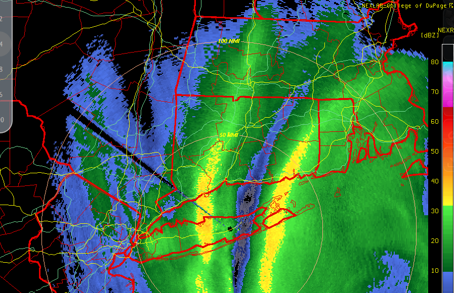
-
Something to watch for hours...

-
Devastating tornado strikes Joplin, Missouri
metagraphica replied to Hoosier's topic in Weather Forecasting and Discussion
In case people haven't seen this...a 5 day animation of the vis/ir satellite view of the storms. http://gizmodo.com/5805821