-
Posts
4,156 -
Joined
-
Last visited
Content Type
Profiles
Blogs
Forums
American Weather
Media Demo
Store
Gallery
Posts posted by Windspeed
-
-
The pattern right now just isn't condusive for Atlantic activity. Way too much mid-to-upper westerlies across the basin. We'll see where things stand in a couple of weeks and leading into August if a window of favoribility can emerge. But that window likely won't persist for too long. Yes, we're only in early July here. But the idea of an active period was banking on development prior to September, as a strong El Niño most likely shuts down the ASO by September anyway. Despite the favorable AMO, the lesson here is cyclical positive SST/OHC anomolies are not going to lead to an active year. You need a favorable atmospheric pattern in place. I'm not saying we don't get a big bad major landfall during an El Niño. Andrew comes to mind. Just takes a lot more luck with placement of TC and a temporary pattern. That being said, I have no confidence in 2023 being active or even reaching normal ACE values.
-
 2
2
-
-
LLC has dissipated.
-
 1
1
-
-
-
-
I still think the window for a potential active stretch with hurricanes will be small. Perhaps mid-July to the end of August. If a disturbance can get in the right place at the right time, sure, we may still see legitimate landfall threats. But everything to me looks like it will lead to a plethora of upper tropospheric troughs and strong upper level westerlies across the western Atlantic basin by September, if not before.
-
 1
1
-
-
Oh but wait, there's a nice convective flare-up over the LLC to give it a little more life for tonight... lolThe end is near for Bret as the Caribbean prepares to add another name to its graveyard.-
 1
1
-
-
Likely to be classified if trends continue even if its existence down the road is impeded by Bret. Then again, Bret may end up shredded in the Caribbean, so it is worth watching how it evolves and where it goes.

-
 5
5
-
-
3.2°C? That's a Super El Niño. Keep in mind that is the mean output. Hopefully it's overdoing it. Otherwise, yikes!Is that weak to moderate or just steady moderate during fall?
-
 1
1
-
-
Good grief...
-
 1
1
-
-
The Aus BoM's new modeling output for El Niño 3.4 is bonkers. I mean, obviously hoping this is overdone, tropics aside. We'd be in uncharted territory here.
-
Perhaps the 2023 season will indeed be front-loaded for activity for the remainder of June, with a busy July and August before shear does eventually increase across the tropical and subtropical Atlantic by September as El Niño inevitably increases mid-to-upper level influence. An active June, July, and August thanks to significantly warmer MDR and most favorable AMO, but with declining activity during ASO. It would be a definite reversal of the last decade, but with the timing of a strengthening southwesterly jet and flow over the Caribbean coming into play much earlier than typical October/November.This is about as good as it gets for early season MDR activity. It’s an intriguing environmental pattern over the next 5-10 days.-
 1
1
-
-
The pattern might actually support a Carla Cradle TC in a week or so but please keep in mind that it's just fantasy at this point. The GFS likes to make somethings out of that region but it must be taken with a grain of salt.
-
 1
1
-
 1
1
-
-
-
The vague outlook numbers are very much indicative of too much uncertainty. The Atlantic is anomonously warm and AMO looks favorable, however, a moderate to strong El Niño counters that. If we have deep layer shear setup over the WATL by August/September, any window of heightened activity would likely be small. Yes, we may still get a few powerful hurricanes, but I would feel very uncomfortable making a forecast this year. I still think we're looking at a below normal season. If there is activity, it may either be front-loaded or focused on July/August. I think ASO will shut down with shear and a limited ITCZ by September. But again, a lot of unknowns.
-
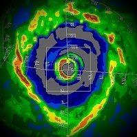
MAWAR is a such a powerful classic WPAC typhoon; textbook...

-
 4
4
-
-
Pretty nasty TC. Hoping for some gradual weakening prior to landfall, but clearly, based on the recent MW trends above, it's not weakening at present. Looks like bad impacts for Myanmar.

-
 1
1
-
-
-
-
I think the idea here is that even if the BoM is overdone, a moderate to strong El Niño is looking ever more likely. But perhaps the possibility of a super Niño is on the table, which I wasn't even considering before.So, BoM has +2.5 for ASO. Though anything's possible, I feel that's way warmer than what will verify then and even probably for the peak. The record high ASO back to 1850 is only +2.2 and just about all other models so far haven't been as warm as this BoM. Plus there tends to be a warm bias overall at this time of year. This will be interesting to follow.-
 1
1
-
-
The latest Australian BoM model just came out, predicting a super El Niño by August. This, taken with the current record high sea surface temperatures, is likely to drive record high global temps during the second half 2023. Interestingly, the Atlantic is still running high. If we get a pocket of favoribility over the Atlantic during August or September, we may still observe some decent Atlantic canes. But obviously, if we do so in fact experience a super El Niño, that window of activity should remain small.
If systems get in the right place at the right time, SSTs should be favorable for an intense hurricane or two in the Atlantic. But I don't think the Atlantic hurricane season is going to be the main weather news unfolding if indeed a super El Niño unfolds. Global SSTs are far above mean even in comparison to the last 40 years. We could see some extreme regional weather events such as hyper drought and floods. At any rate, here we are....
-
-
Yikes...

-
 1
1
-
-
10 hours into this crazy outbreak, three well-defined couplets are ongoing simultaneously in West Tennessee. Hope folks there took the watches and warnings seriously.

-
 1
1
-
 1
1
-
-
Evident debris ball after hit on Spencer, Indiana.

-
 1
1
-


2023 Atlantic Hurricane season
in Tropical Headquarters
Posted