

Windspeed
-
Posts
4,156 -
Joined
-
Last visited
Content Type
Profiles
Blogs
Forums
American Weather
Media Demo
Store
Gallery
Posts posted by Windspeed
-
-
There is still mid-level shear imparting the circulation. That being said, the core is showing a favorable environment for continued bursts of deep convection. So it's going to be another 24 hours of give and take as bursts of convection try to wrap up shear east and then north of the center, then likely get blown back and fail to wrap from 700 to 400 hPa levels. I'd imagine this will occur repeatedly as the LLC drives just west of Cuba and into the SE GOM. Mid-level flow values won't become more favorable until well into tonight. That is when we may start seeing more alignment and more pronounced intensification on Tuesday. Eventually, into Wednesday, the flow vector will become more dangerous for significant intensification all the way into landfall, hence modeling and the official forecast.Idalia has had a really hard time actually wrapping feeder bands into the center of the system-
 8
8
-
-
HAFS A and B both suggested a slow evolution of the vortex with persistent runs with convection lopsided just to the east. Some runs even losing and redeveloping the LLC, though the most recent runs have not lost it. The main point is that neither have shown significant intensification until the TC is lifting NNE through the SE GOM into Tuesday. We'll just have to see if this plays out IRL. Also, data should be injected from reconnaissance flights today into the parent universal GFS to get an even better handle.
-
4
-
-
It's interesting that both 18z HAFS TC models lose the vorticity somewhat over the next 24 hours. It then comes back on both and rapidly reorganizes from 36-48 hours, and shortly afterward, lifts NNE as a hurricane. I don't know if this is simulated proximity to the Rivera Maya coast or some other atmospheric influence occurring. But it is odd at the breakdown, then rapid ramp up on that TC blend in such a short period of time.
-
1
-
-
Yeah, Cowan just noted the tighter core. It's a little anemic on the convective side at the moment, but it does still appear to be organizing. New convective bursts would aid that process. Additionally, convection that was focused east and south of Cuba is getting further away. This may also aid in easing any negative influences and subsidence working against the COC. That being said, it is drifting very close to the Rivera Maya coastline. If it remains offshore, the TC may ramp up on Sunday. If it meanders inland, obviously, that will delay the intensification process. Of course, that is very much what the Globals had been doing for quite a number of OP runs since yesterday.Oh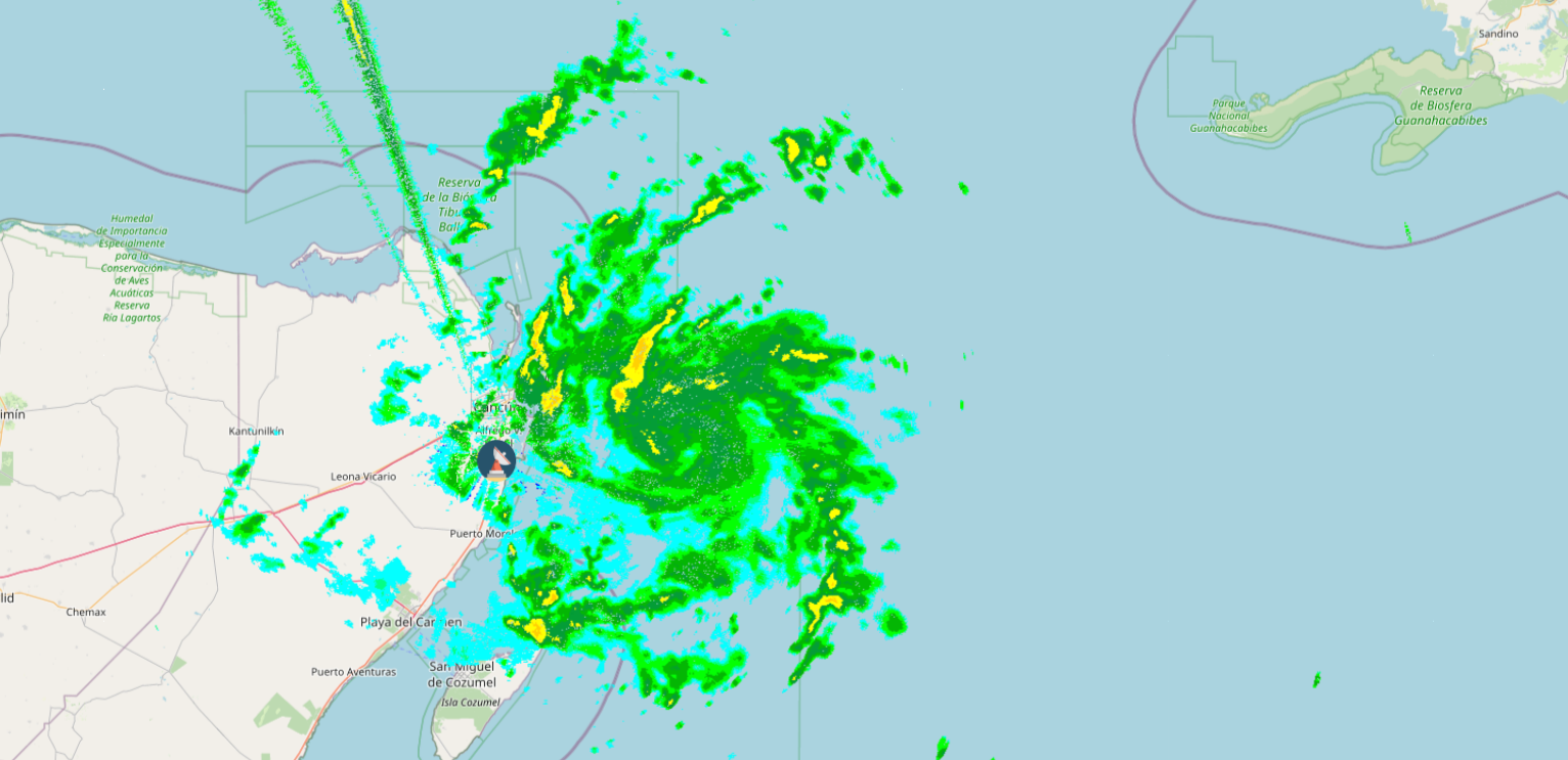
-
4
-
-
First graphic for posterity...

-
2
-
-
I think this is a depression as well and probably will be classified this afternoon, if not certainly by 5PM. That radar imagery and the low-level cloud flow is too much to ignore. It looks like TCG literally occurred just prior or during that loop. Hopefully the NHC can get reconnaissance moved up to this evening.Agree. I really think it’s land interaction at least initially.
The visible has been impressive, but look at the Cancun radar. This is a TD imo and if it’s not it’s damn close.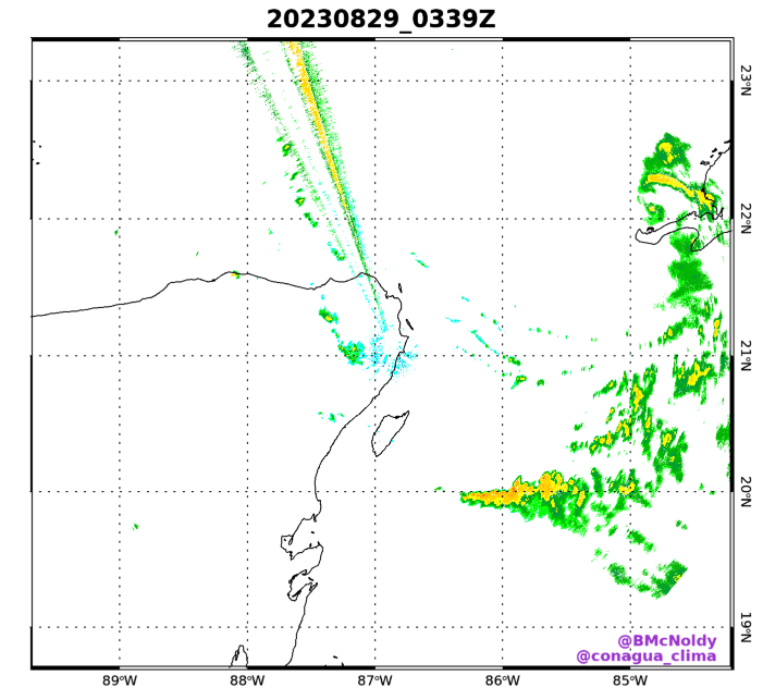
https://bmcnoldy.earth.miami.edu/tropics/radar/
As for steering flow and what this is going to do the next 24-48 hrs. Does it drift west over the Yucatan or remain over the straits? Possibly meander into the SE GOM? Huge implications over the slightest movements now we clearly have a COC.-
10
-
-
The only thing is perhaps land interaction as the ECMWF wants to shove the low inland. The GFS is also very close, meandering the low over or near to the Rivera Maya. They don't see TCG until Sunday into Monday, and it's 2-3 days before the steering flow lifts the TC northward. I think the modeling has to be taken seriously, but clearly they could be way off if TCG occurs today and the vortex remains over water.Does anyone have any thoughts about why models continue to refuse to strengthen this system at all through Monday, even though they all now show it remaining over the Caribbean and under upper ridging?-
4
-
-
Sorry, bro. Better practice Idalia. Like a vidalia onion, only no "V"....Please name the low pressure in the Atlantic so we don't have another stupid "I" name storm for the U.S. landfall!-
 1
1
-
-
I'm not so sure an LLC hasn't consolidated under the canopy. There is some very suspicious motion in the low-level cloud field since daybreak. If a low-level vort hasn't formed, it sure looks like it's going to be genes'ing in short order today. There is also a very clearly low-level west flow just to the south and ESE of Cozumel.This longer length loop really shows the organizational trend. Far more consolidated, with continuing vigorous convection. I don't think a LLC is directly under the center of the convective canopy, but this
1) looks further organized than the guidance suggests
2) currently lies in a highly favorable environment for further development, hence the 70/90% odds
3) has a greater chance of staying offshore given the consistent convective bursts to the east of the Yucatan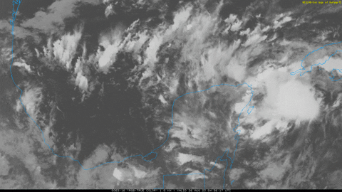
This is a good look for an invest. The more organized it becomes this weekend the more resilient it will be to shear/dry air in the Gulf. Really have to see if land interaction can disrupt this trend.
-
14
-
-
We currently do not have a flight plan for Invest 93L tomorrow. They do mention 93L in the outlook for Sunday.
    2. OUTLOOK FOR SUCCEEDING DAY:
       A. CONTINUE 12-HRLY FIXES ON FRANKLIN.
       B. A POSSIBLE LOW LEVEL INVEST IN THE NORTHWEST CARIBBEAN SEA
          NEAR 20.0N 86.2W FOR 27/1800Z.
       C. A POSSIBLE NOAA G-IV SYNOPTIC SURVEILLANCE MISSION OVER
          THE GULF OF MEXICO DEPARTING KLAL AT 27/1730Z.
They may however have to move something up to tomorrow. I'm a little surprised at how quickly convection is consolidating and maintaining persistence. I think this disturbance may be ahead of modeling in organization. No we do not yet have an LLC. Still, if deep convection does persist in the same general location, it may not take that long to tighten the broader circulation into something. Both the GFS and ECMWF show the disturbance hanging around the Yucatan for several days before it lifts north. Neither really close a low until Sunday. The ECMWF meanders that low inland over the Yucatan for some time as well. Yet here we are with all this convection focusing pretty far east of those modeling trends. Intriguing to watch unfold.
-
4
-
-
Wow, that nascent low-level circulation looks to be consolidating much further east than modeled. That may keep this off the Yucatan entirely as the disturbance continues to evolve.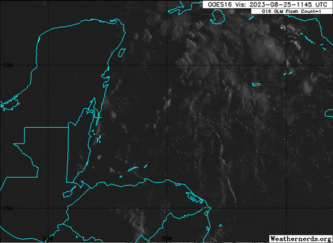


-
2
-
-
Yeah, it seems the mid-level shear is persisting and really doing a number on Franklin at this time.

-
2
-
-
Well, I mean, we did just have what would normally be a mid-to-late August Caribbean cruiser get smacked to all hell, then get kicked NNE of the Greaters by unrelenting Caribbean SW flow. Hrmmm.... But we may still get a major out this thanks to near virtually perfect timing.This system developing in NW Caribbean feels like something you’d see spin up in October, not August. The Atlantic has a late season feel to it at the moment
-
1
-
-
Looks like Franklin is going to find itself in an area of favorable upper divergence and a pocket of low wind shear in a few days as it swings west of Bermuda. Should be a solid poleward outflow jet to exhaust. Franklin is our first shot at a major. The TC models like it. Hopefully, it steers clear of coastal Canada. The Atlantic may find big ACE producers tough to come with uncertainties in the overall ASO pattern, but Franklin may give us a little bit here if it can go off over the weekend.
-
4
-
-
There is nothing on radar to suggest rapid development of a core occurring. It's just a slow and steady organizing cyclone. Folks there will gladly handle a little wind to get the beneficial rains for southern Texas. Now, if we can just get one of these into the Houston region and north-central Texas.
-
4
-
-
It's got perhaps 30 hrs left before landfall? If it can get a core established, it has a shot at minimal cane. That obviously would require a pretty impressive period of RI. But with the favorable upper environment and SSTs being so high, I'd say chances of RI are decent if that core can get established by this evening. Even if that doesn't occur, it should still be an intensifying TS into landfall.I think a 50-60kt landfall is what I’d be expecting at this time based off current trends-
3
-
-
A strong fetch is in place off the Baja with placement of Hilary's low and low-level jet. This event looks to be living up to the hype.


-
3
-
-
Hopefully, it's not a precursor event. LA can handle a 5.1 and smaller. But with all the ongoing flooding, we definitely don't want to see anything stronger.
Could be from heavy rain
.-
 1
1
-
-
There is an EQ swarm occurring near Ojai, CA.They just got a 5.0 earthquake. -
Just became Franklin, and you must be confusing this system (topic) with the Gulf of Mexico system. Franklin will not be a threat to the Gulf but could pose some interaction with the Mid-Atlantic to New England depending on how modeling evolves and trough vs western Atlantic ridging interaction.Dang, how long has it been Franklin? I assume a lot of lighting involved? The key for me is keeping this turkey away from Houston.-
6
-
-
Yeah, this is looking like a really significant flash flooding event for many areas of SoCal.
-
The issue here is a western MDR TUTT. The GFS seems to drive a TC through it, north of the Greater Antilles; but obviously that scenario isn't ideal for westward moving TC into WNW steering flow. I wouldn't get too excited yet. The pattern is crap for any long range CV system. We're just going to have to see what early September brings. I am not confident for above normal activity. I already stated this. We'll see...
Yes, of course a home-grown frontal remnant system could develop or a CAG system in the western Caribbean. But that is very low probability. It's just going to take some serious patience to see how this all irons out.
To put it mildly, I think the whole setup is garbage. Regardless of the AMO state, I do not like the upper level environment and state of subsidence right now.-
6
-
-
Hurricane Dora is only a few hours from crossing the dateline and becoming a typhoon. Shear is noticably increasing as well.

-
1
-
-
Dora looks healthy again after a bout with shear. Only a temporary reprieve as southwesterly shear is forecast to pick up again on Friday, or Saturday, rather, as it will have crossed the dateline and became a typhoon.

Hurricane Franklin
in Tropical Headquarters
Posted
Gorgeous hurricane to track with what will hopefully be minimal impacts to Bermuda in a few days. A nice August ACE engine as well.