-
Posts
4,156 -
Joined
-
Last visited
Content Type
Profiles
Blogs
Forums
American Weather
Media Demo
Store
Gallery
Posts posted by Windspeed
-
-
Of course, in IRL, there's also the potential that a future Margot remains weak due to shear. In part by Lee's upper level backside exhaust and a possible ULL that might form, imparting westerly shear. That could keep future potential Margot in check. But oh well, plenty of days left to watch this all unfold.Yep
That's what is going to make this storm go ots. If it wasn't there then the ridge would hold and the storm would most likely hit the coast.-
 5
5
-
-
The problem with getting a US strike now in the GFS is its forecast position of 96L, which is currently positioned near the Cabo Verdes. The GFS wants to make this a major hurricane (probably Margot) and drive it into 500mb ridging west of the Azores. This breaks down any block faster and keeps Lee away from any interior CONUS cutoff.

-
 7
7
-
 1
1
-
-
Based on modeling, it doesn't look like the Atlantic MDR is done, staying busy for at least a few more weeks. That being said, a +ENSO is still strengthening. Sub-tropical jet placement and shear across the Caribbean and MDR that was experienced in August has since subsided, which, to no coincidence, we have a developing major hurricane coming. But El Niño is still there, and perhaps it will have more effects to close out September into October. At any rate, despite a strong El Niño, I was wrong on ASO below normal activity. Very wrong.
-
 4
4
-
-
Lee is coming along with haste and will likely be a hurricane sometime overnight into Thursday. Waiting for those CBs to start swinging around the core. Should even see a period of RI on Thursday.

-
 1
1
-
-
Interesting discussion going on about that "death band". May aid in rapidly developing the core tonight.While it certainly has good vorticity it’s still very broad. This curved band is interesting on its west side-
 1
1
-
-
I don't disagree, I just figured that was his angle. I'm not going to let Ryan Maue ruin my day. lol...
The "+" is unnecessary sensationalism and not even a "thing." Just call it a strong cat 5. Draw a comparison to Camille or something. Don't make shit up for effect, it makes you look dumb. -
890s mb east or northeast of the Antilles would be a record. Actually, anything below 910mb (Dorian) would be a record outside of the GOM or Caribbean, so definitely, Good Luck!185 mph
890 millibars
i'm betting it all on this one
-
He probably just means significantly above the 135 kt threshhold. I mean, if Lee were to reach MPI after the first EWRC, it could get down in the 910s. A 150 kt storm is not impossible with this setup. I'm not calling for that as there can always be unexpected variables, but he probably thinks it will.
I really want to know what the + means in 5+.
-
18z EPS members are S and SW of 12z at 144hr. Still clears the Leewards and PR, but the ridge is a tick west and stronger. May not result in ECONUS interactions yet, but we'll need to see if a trend is beginning.Ah, the dreaded shrimp. This storm is speedrunning all of the harbingers of a future buzzsaw.
Don't love that upstream pattern amplification trend on the latest runs, either.-
 2
2
-
-
^ Lee will be a major hurricane well before this weekend. Expect the core to fully consolidate by 06Z Wednesday and RI by 06Z Thursday. Unless some weird structural issue occurs, it should be able to reach its first MPI hurdle of 100 kts and first ERC by 06Z Friday, perhaps even earlier. I just don't really see any inhibiting factors at all right now.
-
 2
2
-
-
TAFB ATCF Best Track now has AL132023 as a Tropical Storm. Would expect an upgrade to Lee by the NHC at 5PM AST.
-
 1
1
-
-
-
Wow, NHC is not holding back at all, I see. Yes, intensity guidence modeling is out the roof with a very high potential that Lee reaches at least Category 4 intensity. But it's the rarest of rare to see the first official TD forecast to become a Category 4. I'm not sure it's ever happened. I certainly do not recall a previous scenario out of memory. Not even going to dig, I really do not think this has ever occurred in my lifetime.
-
 10
10
-
-
^ The UKMET tracks would be more favorable for long-term TC intensity, as it traverses much higher OHC versus the upwelled wake of Franklin and Idalia. I don't know if that will be any kind of precursor to a swing west in the other globals on Tuesday, however.
-
Yes. Obviously, we're in the grey area of mid-range modeling still. We have a signal and pattern for recurve in place. But this is still far enough out that a major steering feature might not yet be correctly simulated. Hence, why, though there is some confidence, it's not chiseled out yet. We've got a pretty strong ECONUS high right now that might stick around longer than forecast and make the trough not be as strong. A mid-level trough could also cut off. Mid-level heights in the western Atlantic could model differently in a few days versus present, even if that chance will decrease if we don't see a swing by then.To confirm what I think you already know:
After aiming Irma for the SE US on the 8/31/17 EPS runs, the EPS mean moved NE for the next two days of runs to where about half recurved offshore the E coast (though the mean being near 76W wasn't nearly as far offshore as today's runs have 95L, which is near 67W and with only one member hitting):
Then the next day, 9/3/17 (seven days out) the EPS started trending back to the SW and were back to being centered on FL (just as the 8/31/17 0Z run was) by the 9/5/17 0Z run!-
 5
5
-
-
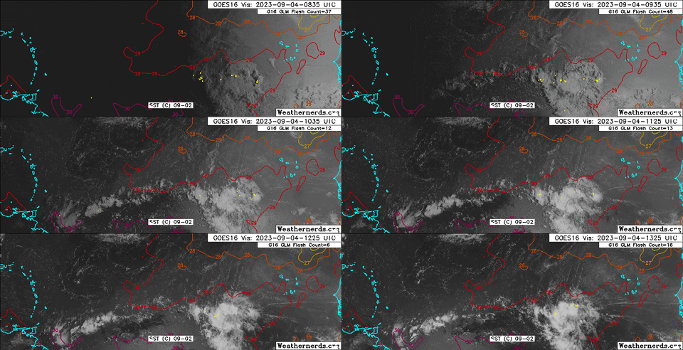
Recent ASCAT. Definitely a broad center, but looks closed. Needs continued bubbling convection to tighten low-level vorticity. We'll have a TC on Tuesday.

-
 3
3
-
-
I'm watching this region for some diurnal action tonight. It's been moistening and bubbling with low-level showers. But this is roughly the center of the broader circulation. The deeper convection to the north is increasing banding. Easterly shear appears to be easing up as well.

-
 3
3
-
-
Yes, at one point they did. Though they did initially and correctly suggest a south of west track through the MDR due to ridge placement, that ridge was initially modeled to break down in the west with an advancing ECONUS trough. But that trough was overmodeled and lifted out while the WAR kept building west. Even after Irma was driven into the Leewards, there were more Carolina solutions in the ensembles than S. Florida. The majority did finally come west when the ECONUS trough was handled better. Irma eventually steamrolled the northern coastline of Cuba, and the rest is history. It's just good to keep in mind that though we're used to surprises with the global OPs swinging back and forth, ensembles do swing as well when out far enough in range.Wow did the ensembles really have Irma that far north? I didn't remember that at all.-
 1
1
-
-
At any rate, it would be easy to get comfortable on the higher probability of OTS with ensembles screaming it. But as is reiterated, we're still well beyond 5 days. Modeling has improved since 2017, but even ensembles swing and miss on MDR systems outside of that window. Just keep in mind that the evolution of the WAR and an ECONUS trough is still not in stone, even if swing back to a rebuilding ridge or cutoff in the eastern interior is trending unlikely. This ensemble from Irma is a reminder that even a strong hurricane may not go polar as fast as initially modeled. We don't even have a TC yet.

-
 3
3
-
-
-
12z GFS is wasting no time. A hurricane by 54 hrs would be impressive for a global.
-
You know there are plenty of folks who are fascinated with TCs that do not want the destruction they can bring. Not everyone is a storm chaser. There are plenty of meteorological professionals and enthusiasts here. But obviously, the threat drives overwhelming interest if something does target land. Which makes perfect sense. A lot do not care unless a TC threatens their neck of the woods.They just like to shame and be dishonest about it lol.-
 4
4
-
 4
4
-
-
Gonna suck to waste this in an Atlantic fish storm
lol.. *shaking head*
In all seriousness, It would be awesome if potential Lee becomes a classic long-tracking intense CV hurricane, but hits nothing. The ACE off this storm alone could push us into above normal territory for the remainder of the season, which would be phenomenal during a moderate-to-strong El Niño year.-
 5
5
-
-
This mid-to-upper flow across the MDR is certainly not El Niño'ee at present. The shear that's there is due to moderate trades and positioning Azores ridge. There is definitely westward low-level motion south of the wave axis. Some banding features evolving on the northern periphery as it looks like folding is occurring. Still some dry air in the mid-levels, but nothing that should prevent slow and steady development. It is worth noting that both globals have a TS to minimal hurricane in 48-72 hours. So we would expect to see a low-level vort get going relatively soon.Hits are definitely outliers at this point, though I still caution everyone to stay away from locking anything in this far out, even as OTS remains favored currently.
Looking at 95L this morning, it's continuing to organize. Certainly on track to become a TC by midweek despite some shear.
-
 4
4
-


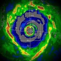
Category Five Hurricane Lee
in Tropical Headquarters
Posted
Don't you think that would be a better possibility though if Margot actually drove westward and pumped heights to its NW, versus merely moving NW into the region west of the Azores? Seems like its position there erodes heights that would aid in keeping Lee from turning NE.