Go Kart Mozart
-
Posts
3,128 -
Joined
-
Last visited
Content Type
Profiles
Blogs
Forums
American Weather
Media Demo
Store
Gallery
Everything posted by Go Kart Mozart
-
I believe it was Christmas night into the 26th. In SWCT we had an 11" snow pounding, with T-snow...then the occluded front moved through and it was drizzly. If I am recalling the correct storm, it was an all-timer for most of VT.
-
Thank you.
-
OK, but do you think we'll see improvements at 0z?
-
The high over Greenland is within spitting distance of the global record, which was recorded over Mongolia.
-
I've gotta raise the bullshit flag on that statement. I suspect that November snow has always been rare, so much so that no trend can be discerned.
-
The funny thing...the board absolutely needs a James/George character. The unbridled enthusiasm is great....like your puppy greeting you when you get home from work.
-
No more Crown?
-
I dunno. I'm in SWCT, climatologically not much different than EWR, and here's the view from my kitchen window this morning:
-
Not a threshing machine through the Mississippi Valley?
-
When I was a little guy, my mother would be puzzled and frustrated by my weather obsession. She would sing Que Sera to me....in her perfect Edith Bunker voice. I'm still in therapy.
-
23 or 24?
-
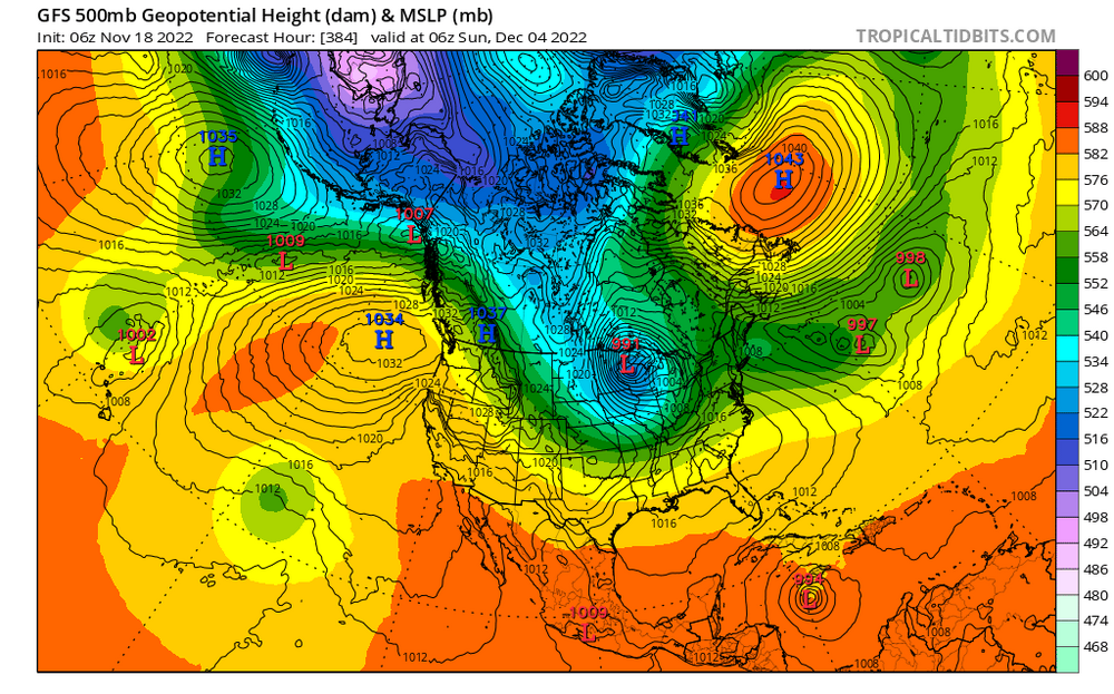
I have a nagging concern about the persistent SW trough. Let's hope we don't repeat last December with great NAO and killer RNA.
-
You're a papist. We're born again winter evangelicals.
-
Scientific analysis.
-
Ray already likes 23-24. Let's forget about the upcoming winter and focus on that one.
-
Are you sure that wasn't a volcanic eruption?
-
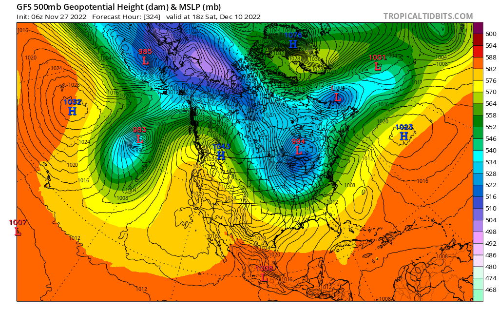
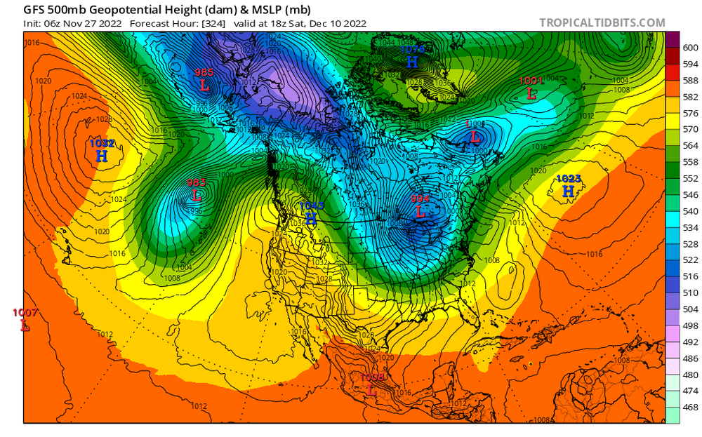
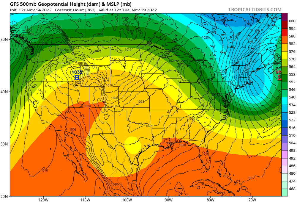
588dm NE of Labrador? We don't need no stinkin Pacific.
-
George, are you ready to take a shot at the Black Friday Blaster?
-
lol, one of these days this is gonna happen...screw EOTR and hammer WOTR. Of course it won't be this storm, but...
-
Damn, those look like javelins.
-
Never mind the naysayers George. 6"-12" down here?
-
You need to move up the street. Better elevation.
-
Uh oh, major work distraction!
-
I hope this happens. I'm a big fan of cold, windy, and dry with no prospects of storms.
-
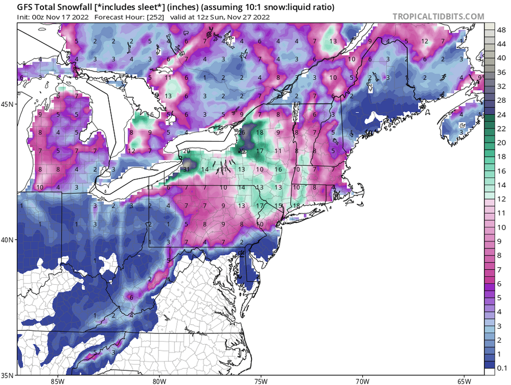
If we had snow cover down to at least 45n, that would be helpful for CNE.