Go Kart Mozart
-
Posts
3,128 -
Joined
-
Last visited
Content Type
Profiles
Blogs
Forums
American Weather
Media Demo
Store
Gallery
Everything posted by Go Kart Mozart
-
When Ryan speaks....I listen. Uh oh!
-
Damn, I was at Plymouth Lake when this happened. Just missed it.
-
The backbone of summer is breaking.
-
I have never contemplated the effects of firework smoke...until now!
-
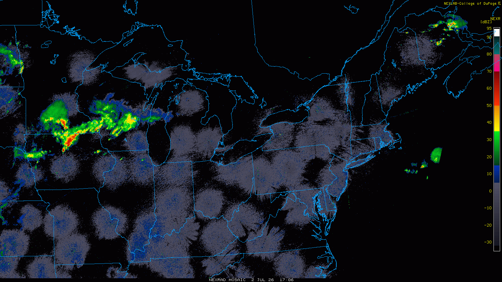
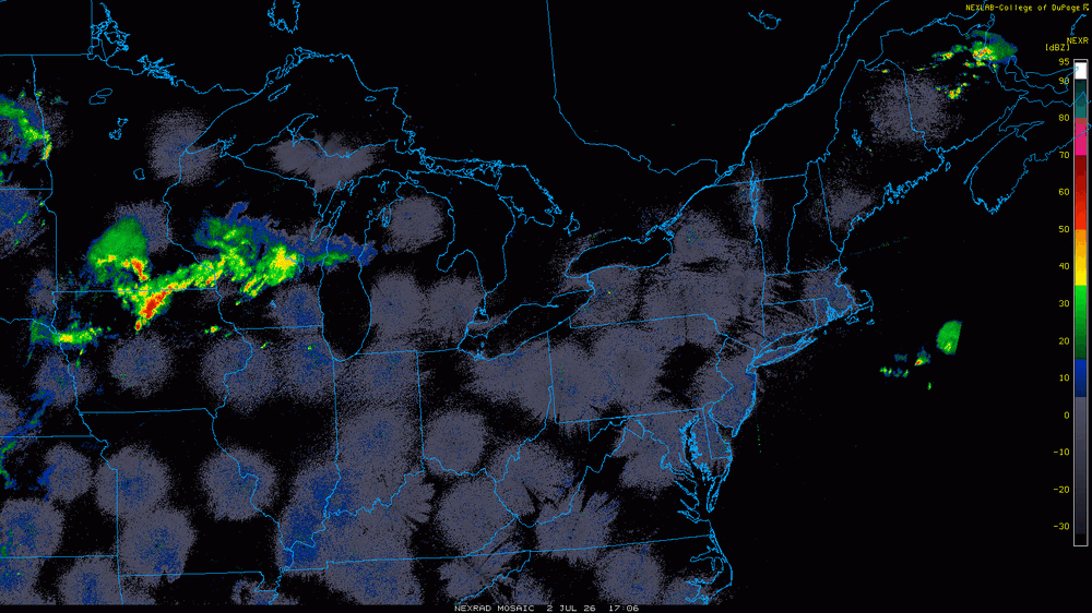
Incredibly clean radar for a July heatwave.
-
Anomalous Late Spring storm May 30 2026
Go Kart Mozart replied to HoarfrostHubb's topic in New England
Yup, the days of post-Memorial Day snowstorms seem to be a thing of the past. -

-
We should move to the Catskills

-
I doubt the sun comes out...even down here.
-
Poundage.
-
Did 76-77 have a thaw of more than a day or two?
-
I see lots of light and mod rain obs over ePA, although a lot of dry air is pouring in below 700mb.
-
1-3", lolies to 4"
-
Big anafront event incoming
-
I was living in the north end of BDR at the time. 6".
-
As the Jon Voight character said to Ned Beatty's character in Deliverance, "we're not out of this yet".
-
Euro Skynet with lots of snow mid-month.
-
"The law of averages". You can't argue with advanced mathematics like that!
-
I am going to the Lourdes Shrine in Litchfield to light a candle for this.
-
You forgot to mention that it was uphill, both ways!
-
If we get a snap-back blizzard after the heat, I hope it comes after a couple of cold days. We don't want the snow melting on warm roads. Snow covered roads are a necessary for our enjoyment.
-
Clipper Fires In Wednesday Feb 25 Disco/ Obs
Go Kart Mozart replied to Damage In Tolland's topic in New England
2.5" Trumbull. -
Clipper Fires In Wednesday Feb 25 Disco/ Obs
Go Kart Mozart replied to Damage In Tolland's topic in New England
Tapering now. Heading out to shovel-measure. -
Clipper Fires In Wednesday Feb 25 Disco/ Obs
Go Kart Mozart replied to Damage In Tolland's topic in New England
Fireworks display...short, intense, and a grand finale! -
Clipper Fires In Wednesday Feb 25 Disco/ Obs
Go Kart Mozart replied to Damage In Tolland's topic in New England
Huge flakes in this final weenie band.