

madwx
-
Posts
2,281 -
Joined
-
Last visited
Content Type
Profiles
Blogs
Forums
American Weather
Media Demo
Store
Gallery
Everything posted by madwx
-

Spring/Summer 2020 Medium & Long Range Discussion
madwx replied to Geoboy645's topic in Lakes/Ohio Valley
May 3-10 or so looks like it could be very cool for the time of year, especially in the eastern part of the subforum -
i'll be out if anything tracks into S WI, gotta get my storm chances in considering I most likely won't be able to go to the plains to chase this year
-
Check back at the end of June
-
yeah we are only catching 10% cases so in most states the rate of cases is just the amount of testing. A better method of seeing how many people are infected in each state is to count the deaths and assume the fatality rate is around 0.5-0.7% and calculate the cases from that.
-
I think a lot of the current spread is in places that people aren't able to social distance (prisons, work at meat packing plants, health care workers, etc.)
-
How do you propose infecting 80% of the population asap without massively overloading the hospital system. 20% of NYC got infected over 2 months and their system was on the brink of being overloaded.
-
the infection rate map mostly mirrors the testing rate map which is a good indicator that we're not catching all the cases
-
Spring/Summer 2020 Medium & Long Range Discussion
madwx replied to Geoboy645's topic in Lakes/Ohio Valley
looking like a trend to a weak la nina as summer goes on and atlantic/gom temps are above average. Wonder if we will have a couple tropical systems impact the midwest -
that would mean the actual infections have been about 10x the reported infections, if not slightly more.
-
Yeah definite trend upwards with temps, also no lows forecast below 36 in the point so the last freeze may have already happened here. Also dewpoints don't look to drop below 20 any more which my skin will definitely appreciate
-
this weather must be how winter weenies feel when it’s in the 70s in late November
-
Snow showers tonight. The winter that never ends. Can’t even buy an above average stretch for the next week or two
-
increasing evidence that Hydroxychloroquine has either no effect or a slight negative impact on patients being treated with it: https://www.medrxiv.org/content/10.1101/2020.04.16.20065920v1
-
'yeah, looking good. may head out to find a nice view to the NW and watch them roll in
-
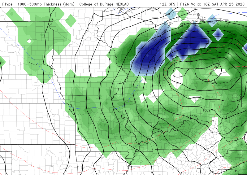
Hard pass. also i can't imagine there would be enough dynamic cooling at noon on april 25 to change the column over to snow.
-
i feel ya. It seems like the past 3 or 4 aprils have featured tons of NW flow with below normal temps. it would be nice if we could get some more zonal or sw flow and get some warmer temps and higher dewpoints in the area.
-
the only person that's been called a moron and idiot in the last 5 pages is the governor of Florida. I don't see any other name calling recently and everyone seems civil.
-
its not the number of deaths that's the scary part its how easily it could overwhelm the hospital system, its why we are doing this.
-
bought 2 bottles on February 23. Probably the best purchase i made this year
-
how about we make some sacrifices for the next year but don't shut everything down. both the 'shut everything down' and the 'screw it im gonna live my life like i used to' points of view are unrealistic and will cause the most damage. if we have continued social distancing, good hygeine measures, markedly increased antibody testing, no large gatherings like sporting events and concerts and shorter periods of stricter methods if any areas become hotspots then we don't have to choose from the false dichotomy that you've presented.
-
May 15 with a slow phase in after that, then maintaining a baseline of social distancing for around next year. Any time we can buy to get better treatments/therapeutics more widely available is essential. We've done a pretty good job flattening this first wave but we need to be prepared for waves to come again later, especially if we relax social distancing too much.
-
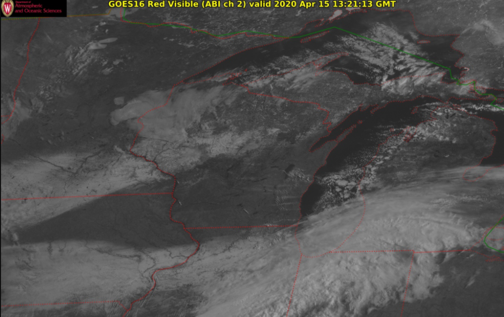
looking pretty good already. you can also see some lake effect clouds off the Madison chain of lakes, Lake Winnebago and even the Mississippi River
-
yeah unfortunately fast food is one of the only options for lower income people who are working extended hours during this time, and agreed on alcohol withdrawal. I don't think people realize how many americans are physically dependent on alcohol
-
looking like no snow except for some snow showers possible during the week
-
been a couple flurry storms so far, 40 mph + gusty winds precede each one and blow the neighbors lawn furniture around a bit. strongest one of the day about to hit here


