luckyweather
-
Posts
637 -
Joined
-
Last visited
About luckyweather

Recent Profile Visitors
4,219 profile views


-
Smoke induced convection, new one for me.

-
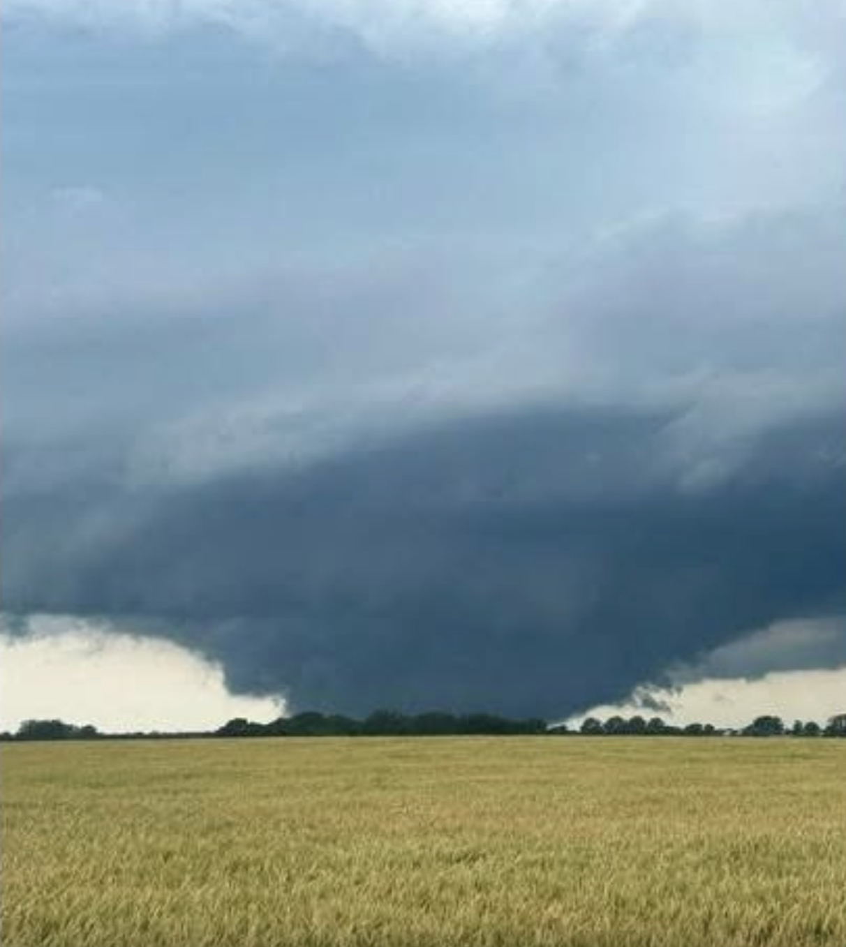
leading wind as the line approached ne of Rockford was pretty impressive. anemometer is busted so no substance to that other than “it was effin windy”. rotation south of Beloit, looks like it just got warned.
-
AL 2011 was 4 to 5 sigma, IL 2026 is 3.9 to 4 sigma. KS 08 was ~3 sigma and TX 15 was ~2 sigma. Your instinct was on point, AL11 is still the king, IL26 in 2nd place. there's still time lol
-
AL in 2011 with 146. “Padded” with 62 on April 27. KS in 2008 had 187. TX in 2015 had 244. Still a few outbreaks away from touching that in IL.
-
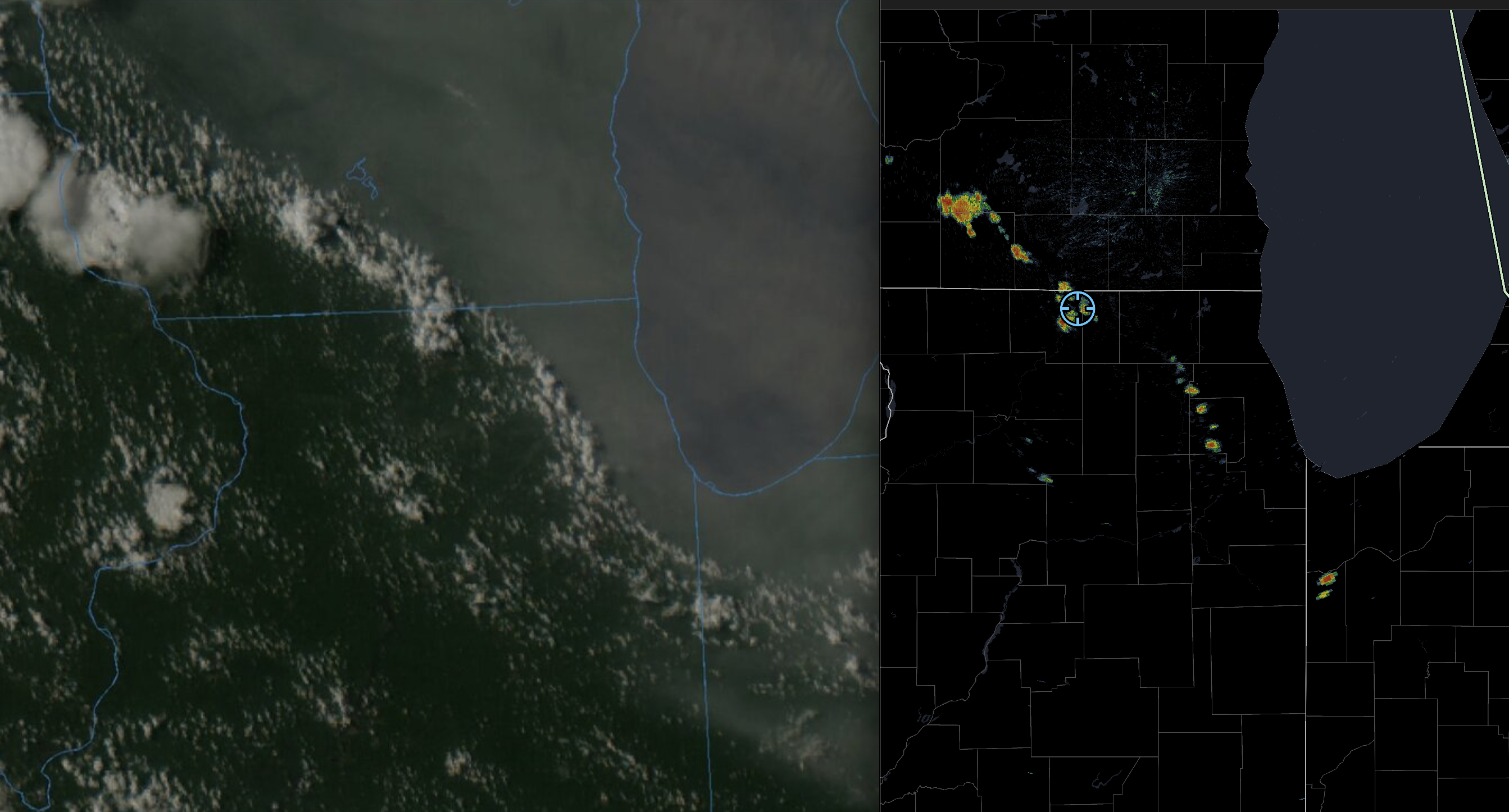
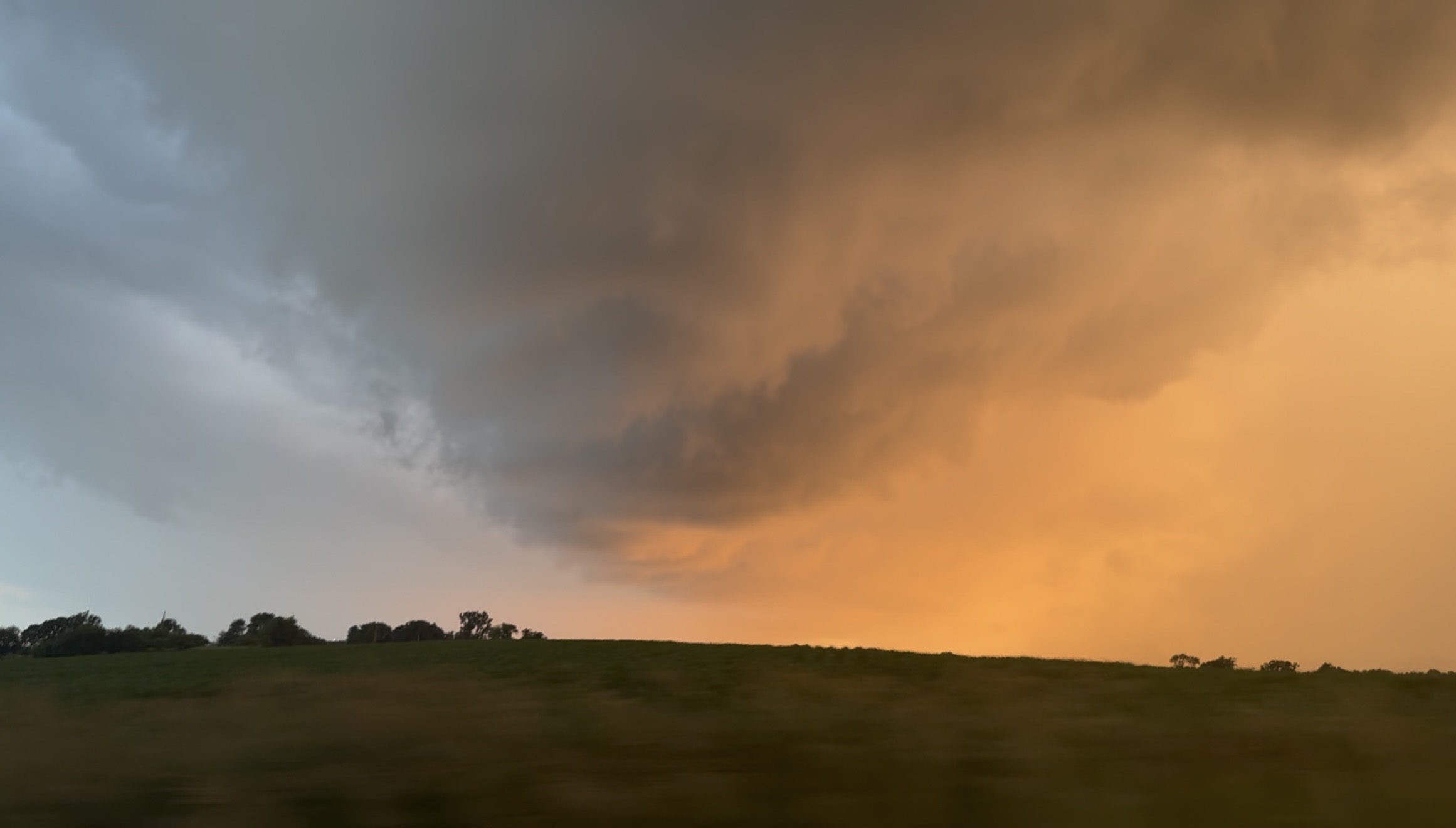
Still from video I took of the warned rotation in the notch in SE Rock County WI around a half hour ago, the greened up corn + the sunset made it majestic.

-
now ilx has it with Pana polygon
-
supposedly tog Palmer, IL outside of the Taylorsville, IL warning polygon.
-
92 stl 60 pia is just so wild to stare at in late June.
-
haven’t read this am’s and yet but yesterday pm lot afd ack’d this and basically said the strength of the low may aide in overcoming this
-
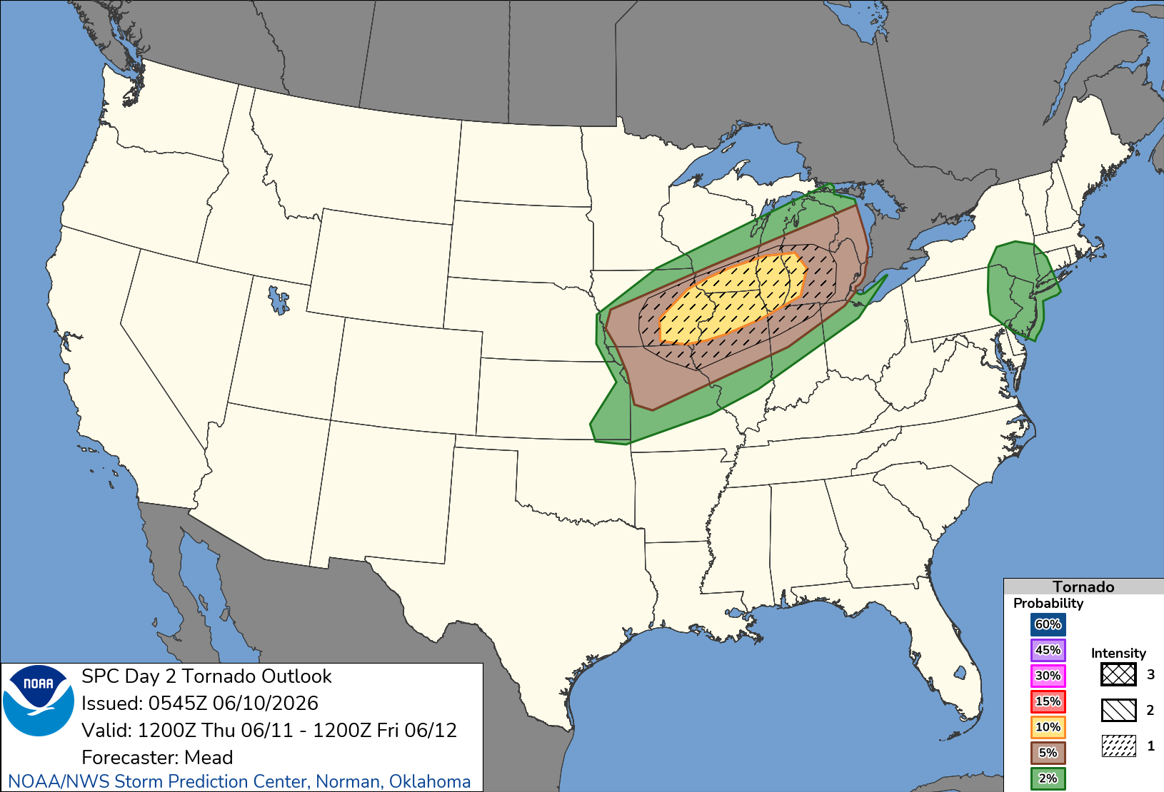
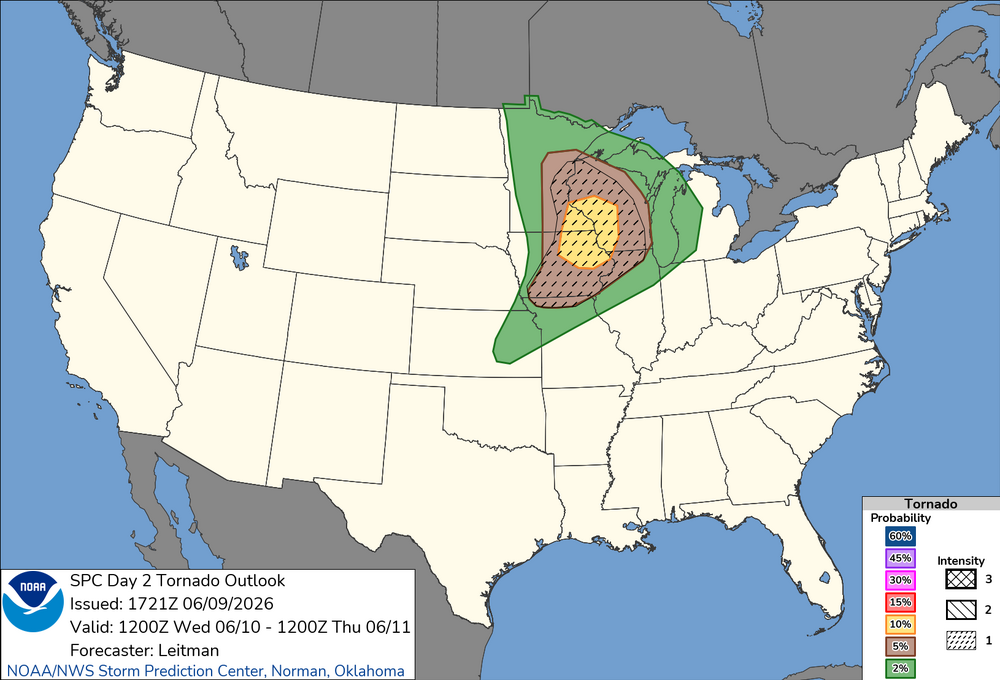
overnight d2
-
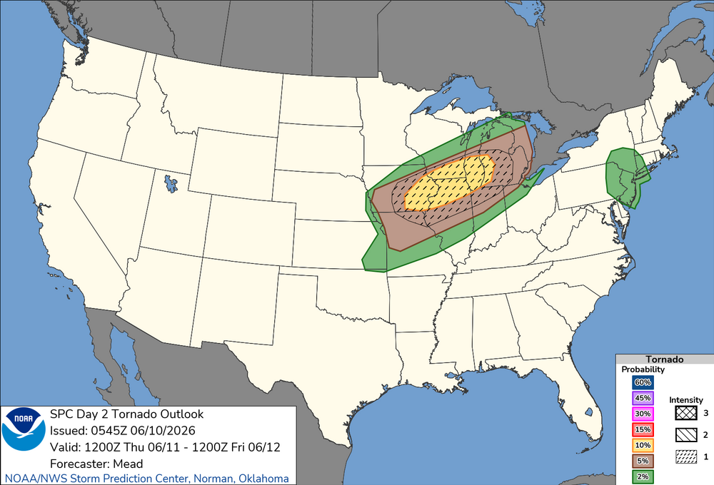
New D2 Tor Outlook. Seems like SW WI always gets the bullseye these days.
-
4th times the charm here between Roscoe and Rockton. All 4 roads in and out of my hood are closed, trees and power lines littering the roads. No power, no internet, partying like it’s 1899.
-
Damn man, close call there. Saw it hit from water tower webcam. Was legit. Looked like it was swallowing the town.
-
as of now if you target S. WI seems like platteville -> msn -> west bend is where I’d set up shop. probably platteville and watch development from there.