wxmeddler
-
Posts
6,883 -
Joined
-
Last visited
Content Type
Profiles
Blogs
Forums
American Weather
Media Demo
Store
Gallery
Everything posted by wxmeddler
-
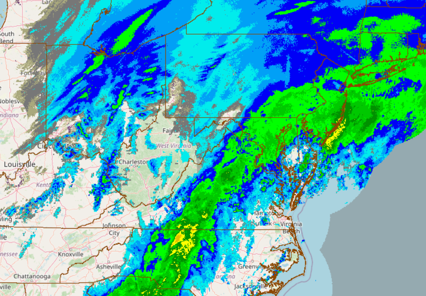
The thing to realize about dew points in this range is that the difference in water vapor between 10F and 0F is between bupkis, and slightly less than bupkis. Once you get down to negatives you're in "absolute bupkis" territory. That is to say that radiational cooling (~200 W/M^2) will absolutely overwhelm whatever tiny vapor pressure is being released by sublimination. Long-Wave radiational cooling will tank the temperatures (and therefore dew points) if given the chance to do so. The only thing that will stop radiational cooling is a blockage of the long wave infrared energy to space (ie. Clouds or Fog).
-

The Jan 31 Potential: Stormtracker Failure or 'Tracker Trouncing
wxmeddler replied to stormtracker's topic in Mid Atlantic
I remember when I first started tracking these things 84hrs was just getting into "what the **** are we dealing with range" not "ass hair ticks" range. Oh how times have changed, and yet I'd love to still be surprised Jan '00 style. -
The Jan 31 Potential: Stormtracker Failure or 'Tracker Trouncing
wxmeddler replied to stormtracker's topic in Mid Atlantic
Takeaways for the 0z runs are that that the globals are still shifting with the northern stream and fairly large disagreements remain. Accentuated by the fact the evolution is very sensitive. Convective feedback / parameterization issues starting to show with the rapid deepening. We wait. -
The Jan 31 Potential: Stormtracker Failure or 'Tracker Trouncing
wxmeddler replied to stormtracker's topic in Mid Atlantic
Interesting
-
The Jan 31 Potential: Stormtracker Failure or 'Tracker Trouncing
wxmeddler replied to stormtracker's topic in Mid Atlantic
H5 is a tick west. Precip is a tick east. No winners though. -
The Jan 31 Potential: Stormtracker Failure or 'Tracker Trouncing
wxmeddler replied to stormtracker's topic in Mid Atlantic
Convective feedback issues. It will sort itself in the next few frames. -
Dr. No strikes again
-
Haven't seen him walking around the building this week, I think he's at AMS in Houston.
-

-
Two more days of “ Check back in every 12 hours” mode till we close the book for the I-95. Ocean City maybe a day after that.
-
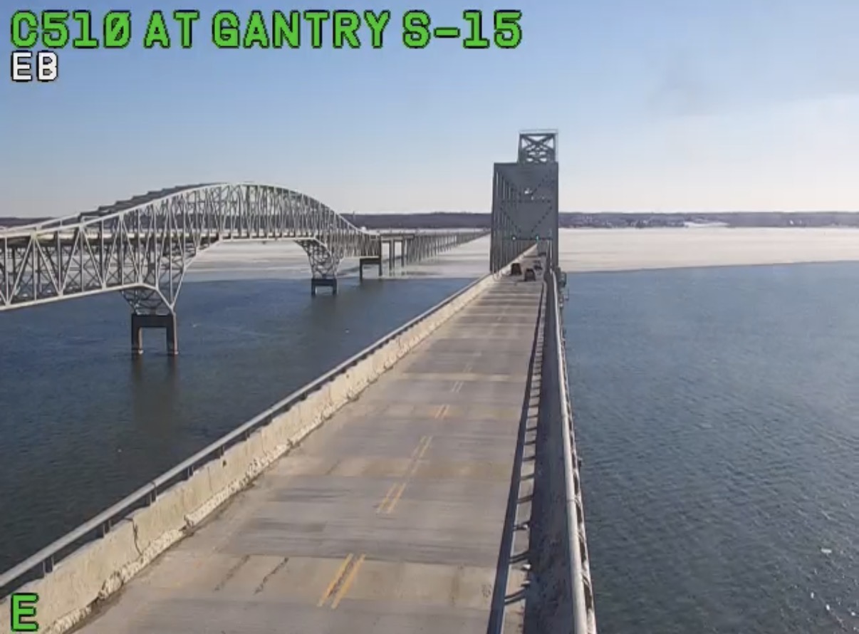
Winds definitely stayed up last night and prevented the low single digits in most places. Those that did go calm got to the advertised 5 deg-ish fairly easily. Look at all the ice that got pushed to the east side of the bay yesterday to Kent Island.

-
If the weenies want a bit of a glimmer of hope to hold onto, climatology does not support a surface low that OTS. Pretty rare.
-
AIFS-Op definitely trending in the wrong direction today.
-
AIFS is ever so slightly S and E of 18z which is ever so slightly further E of the 12z at 0z Sunday.
-
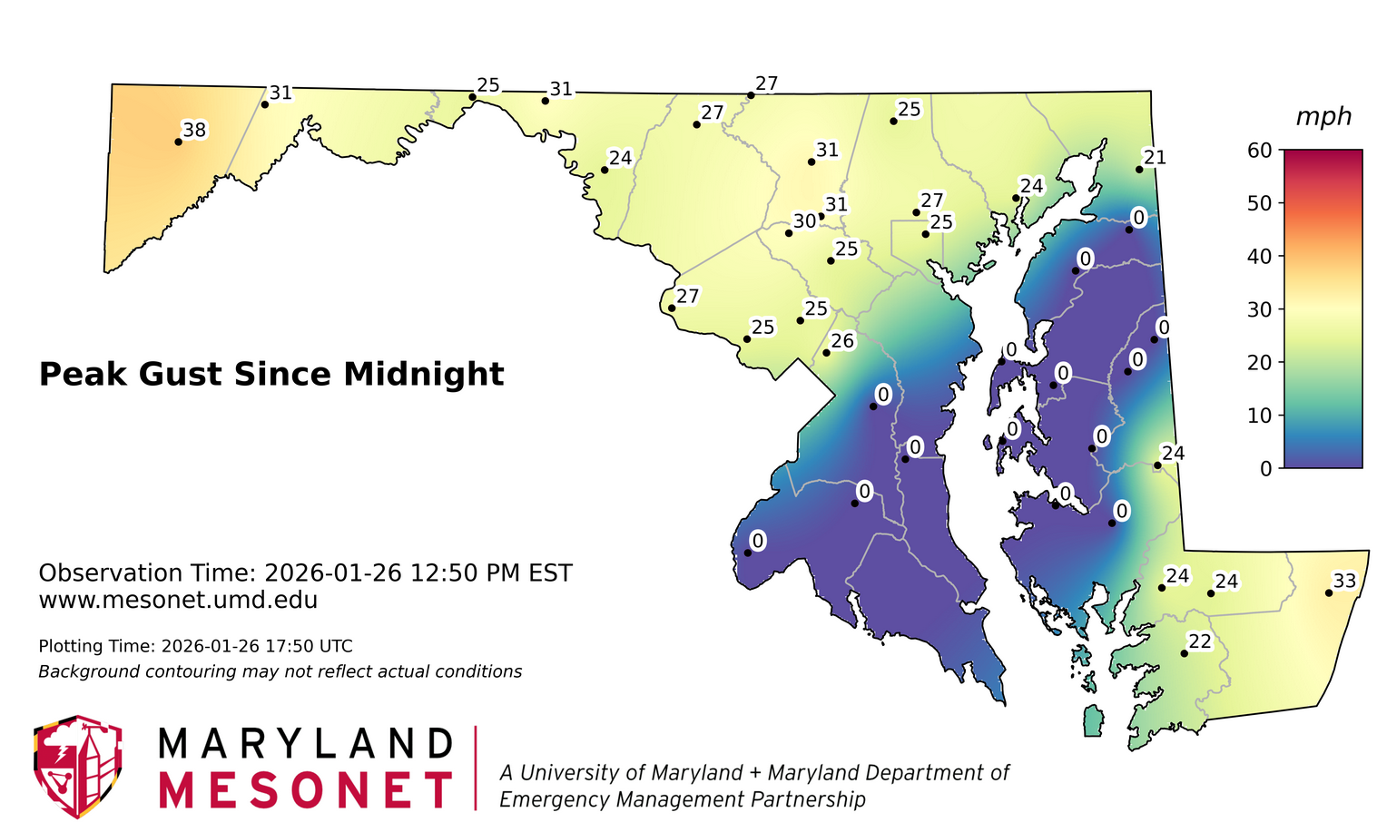
Ugh, gonna be a pain to QC all this out. I'm hoping that the wind and sunshine today breaks most of them loose. All iced over.

-
Locked in on *something* happening nearby. But I agree, it's a bit further east than we would want at this point.
-
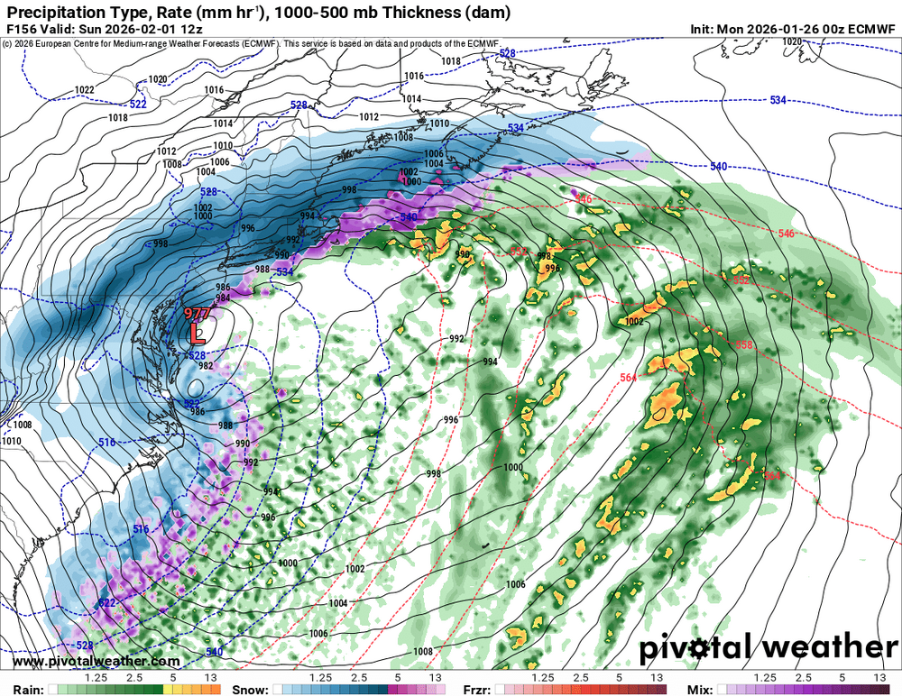
lol.. 977 on Ocean City and a CCB band from the Caribbean
-
It's legitimately a 36 hr event.
-
Good god man, there are children who visit this forum.
-
Positive signs thus far.
-
Yes, this is honestly the big takeaway. The ensemble means were all 1.3-1.6" and we passed that significantly.
-
I'm well aware, but when the EuroAI Ens locks in on an idea, *something* is about to happen. Of course details are going to be scant a week out.
-
Ho-Lee-Fuk
.gif.ea897a29f25415c1bb35e687b769e4e3.gif)
-
I'll take 1 18Z Euro Please
-
About 50/50 ZR/IP here now. Good thing the back end approaches.