wxmeddler
-
Posts
7,001 -
Joined
-
Last visited
Content Type
Profiles
Blogs
Forums
American Weather
Media Demo
Store
Gallery
Everything posted by wxmeddler
-
As far as I can tell, the 90F high temperature measured in Hancock today by the Mesonet was the highest temperature measured in Maryland for the date (03/22). The previous record was 88F (tied at multiple sites and dates). It's definitely not the March all-time though ; That record is 97F on 03/30/1998 in Downtown Baltimore.
-
Went out to Annapolis today and it was amazing. 15 deg cooler along the water. Hancock low of 35 and High of 90 is crazy. We never get a diurnal of 55 degrees. I'm gonna have to take a look back and see when that last happened in the state.
-
Agreed, there is a meager amount of MUCAPE hanging around and with EL's near -35C. Which, if storms can fire, should be able to produce lightning. 850-500 lapse rates are around 8C/KM which isn't half-bad. The storms could be quite "pulsey" as well as the LFC-EL shear is pretty weak, only about 15 kts (Pink lines).

-
Yes! First time meeting her. I see why you two get along so well We exchanged info.
-
70 at Ft. Meade, 55 in Annapolis. #BayBreezing
-
The going rate is one bottle cap per inch of bust.
-
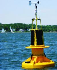
The MD Mesonet stations has sunshine detectors (pyranometers). We're recording the data and eventually we'll have statistics on it but it fairly low on the priority list. We should be able to do % of sunshine and energy but % of normal will be harder to determine since there isn't a good history.
-
 It's a race to see how far east the pingers get before the dry slot arrives.
 -
Completely agree, you'd never know from LWX.
-
BWI G44kt (50mph)
-
Our thermometer is painfully slow as well. My student is currently running an inter-comparison of fast thermometers so we're getting fantastic data at 3 second intervals. I'll post it here once it's done.
- 1,093 replies
-
- 1
-

-
- severe
- thunderstorms
- (and 1 more)
-
IAD just gusted to 57 kts... Edit: Ahhhh, of course the Eskimo Joe beat me.
-
Wind gusts to 40 mph even without the convection. Temps falling 10 deg in 5 minutes with the front.
-
The cold front emerging out from the rain along the Blue Ridge right now with no convection associated with it would absolutely be a way to cap off this day.
-
Yeah, these 50+ dbz returns are definitely putting out 3-5"/hr rain rates.
-
Shear too strong given lack (or near none) low level instability. Lapse rates aren't helping but we knew that going in. Edit: Also, almost no lightning with these. Can't get any serious updrafts to -20C. Kinda pathetic.
-
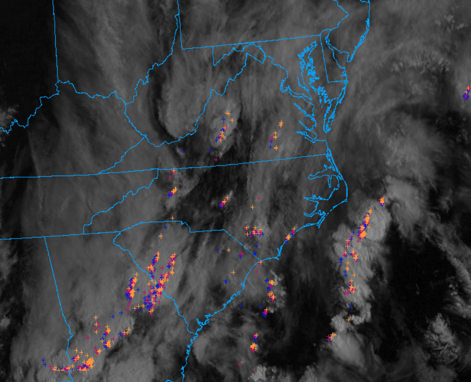
Only storms I'm worried about the next few hours are the ones throwing out lightning. Most of this stuff is not exhibiting strong vertical organization.
- 1,093 replies
-
- 1
-
-
- severe
- thunderstorms
- (and 1 more)
-
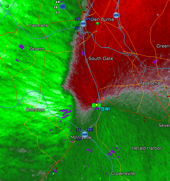
That's a TDS
-
Lack of lightning in this line tells me that it's not taking advantage of the instability that should be present. That will limit gust potential.
- 1,093 replies
-
- 5
-

-
- severe
- thunderstorms
- (and 1 more)
-
65/63 is better than I thought where we would be this morning. Small break in the cirrus over North Carolina Piedmont headed our way, but otherwise pretty socked in.
- 1,093 replies
-
- 2
-
-
- severe
- thunderstorms
- (and 1 more)
-
The 0z HRRR is the exact failure mode that seems most likely, the crapvection from the west hangs on and is enhanced east of the mountains by the synoptic lift. By the time the low ejects, the moisture is wiped.
-
The failure mode is for sure if the squall in the TN Valley right now stays together over the mountains and wipes our moisture at 11AM. And the associated low clouds hang around with it.
-
My thoughts align with Mark's (surprise surprise). Any cell that breaks out ahead of the line should be taken with caution, but the squall line damage should be fairly localized. This will NOT be a derecho situation where there is widespread 60-80 mph gusts. The 60-80 mph gusts will be localized into 1-3 mile wide swaths. Parameters I'll be watching is MLCAPE, 3CAPE, 0-2km SR Winds
- 1,093 replies
-
- 4
-
-
- severe
- thunderstorms
- (and 1 more)