Met1985
-
Posts
16,909 -
Joined
-
Last visited
Content Type
Profiles
Blogs
Forums
American Weather
Media Demo
Store
Gallery
Everything posted by Met1985
-
Yeah starting tomorrow morning we are definitely going to be in deep winter.
-
What some of yall seeing snow?! Congratulations to those that are!
-
Euro wasn't that bad. Has our storm and another one around the 17th.
-
It's the light stuff that accumulates fast.
-
Clouds have that milky snow look to them here.
-
I just went out to start the truck and swear I saw a few stray flurries.
-
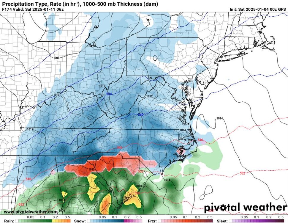
This is basically moving due east. There isn't going to be much warming at all with this. If this gets here in about an hour we are going to have some major issues. The ground is cold and frozen and temps are below freezing. Sent from my SM-G998U using Tapatalk
-
A dang cold night and morning here. Had a low of 18 with a current temp of 23 degrees. Sometimes we do ok in CAD Sometimes we don't. Just depends on how the holler holds the cold. Definitely didn't think it would be this cold still this morning.
-
Just looked at the models. Things still look good. I see the Euro jumped on board and that's good. Euro is dang cold also.
-
Yeah another weird solution. On to the next model run lol.
-
This run is a mess.
-
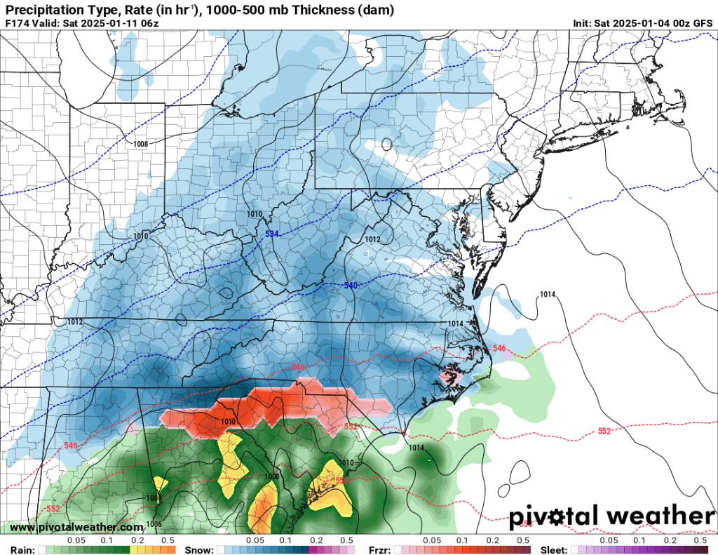
The beginning Sent from my SM-G998U using Tapatalk
-
Yeah I still think we see some more major changes to this system.
-
The more separation the worst the temps will be unless we have the cold high pressing further south...
-
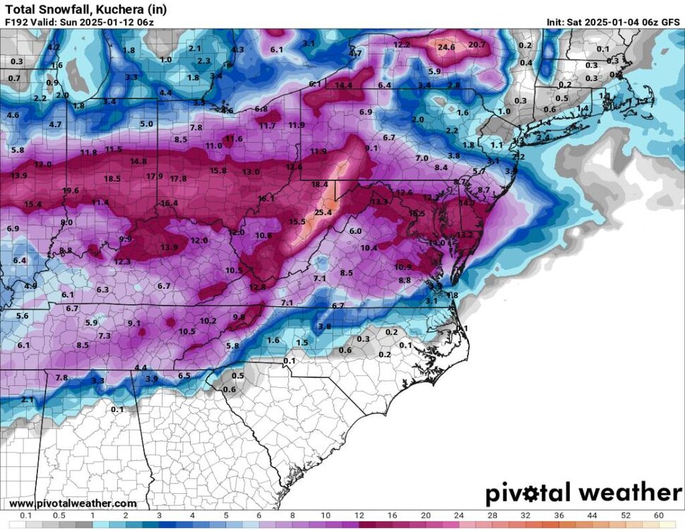
Gfs has been coming in colder for the onslaught of precipitation tomorrow afternoon. Looks like more ice.
-
Good luck up there in the Mid Atlantic!
-
Oh yeah looks promising. Just the lead up hopefully to a bigger system.
-
Yeah this whole setup is far from being hammered down. I still don't like the low kind of being buried and delayed. But color me skeptical on that.
-
Also got down to 17 this morning.
-
This could be a mountains special. Still a ways to go. The old saying get this in the range of 48 to 72 hours. Sent from my SM-G998U using Tapatalk
.thumb.jpg.5941d0f7d50945aff645dfd47b8238ec.jpg)
-
That's what I'm hear for. We've got some great looks coming up. An exciting pattern ahead.
-
Temps are trending colder and longer. Heck we may even see some ice early on down here now....
-
Ashe-Watauga-Tazewell-Smyth-Grayson-Mercer-Summers- Including the cities of Tazewell, Independence, Flat Top, Whitetop, Hinton, Marion, Troutdale, Hix, Boone, Volney, West Jefferson, and Bluefield 302 AM EST Sat Jan 4 2025 ...WINTER WEATHER ADVISORY REMAINS IN EFFECT UNTIL 4 AM EST EARLY THIS MORNING... ...WINTER STORM WATCH REMAINS IN EFFECT FROM SUNDAY MORNING THROUGH MONDAY EVENING... * WHAT...For the Winter Weather Advisory, an additional half an inch of snow is possible. Winds gusting as high as 35 mph. For the Winter Storm Watch, heavy mixed precipitation possible. Total snow accumulations of one to two inches and ice accumulations of one tenth to three tenths of an inch possible. * WHERE...Portions of northwest North Carolina, southwest Virginia, and southeast West Virginia. * WHEN...For the Winter Weather Advisory, until 4 AM EST early this morning. For the Winter Storm Watch, from Sunday morning through Monday evening.
-
Can't ask for a better scenario for the region.
-
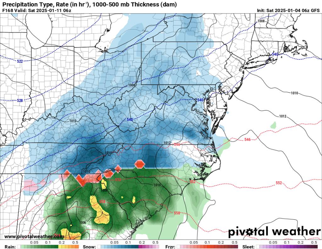
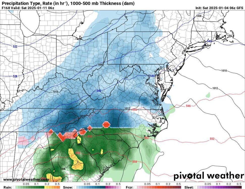
Snapshot Sent from my SM-G998U using Tapatalk


.jpg.7af1bae6a88cadc1c941207691efaf29.jpg)