Met1985
-
Posts
16,911 -
Joined
-
Last visited
Content Type
Profiles
Blogs
Forums
American Weather
Media Demo
Store
Gallery
Everything posted by Met1985
-
More rainfall later. Sent from my SM-G998U using Tapatalk
-
I wonder if we get some sun we see some instability this evening.
-
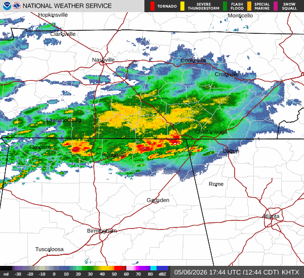
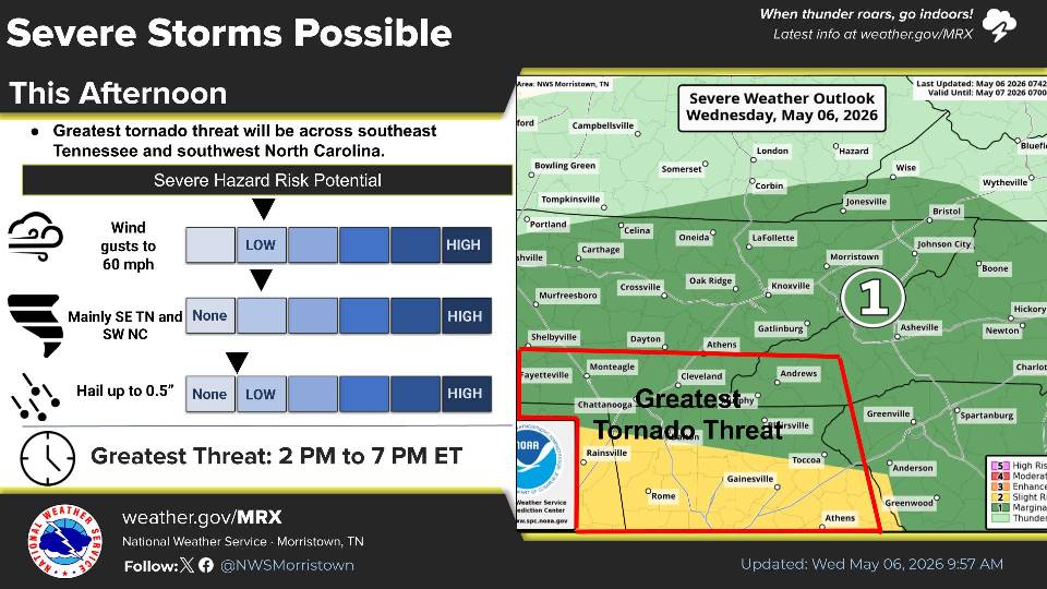
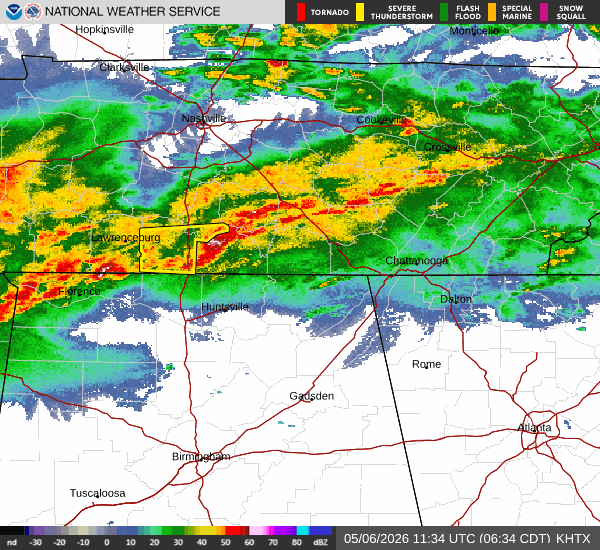
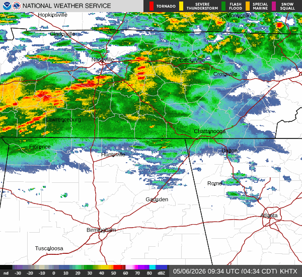
More developing in TN.
-
Finally
-
Awesome! Hardly anything in Asheville.
-
Looks like some heavy rain entering the area.
-
Could be interesting later on. Sent from my SM-G998U using Tapatalk
-
Jimbo!
-
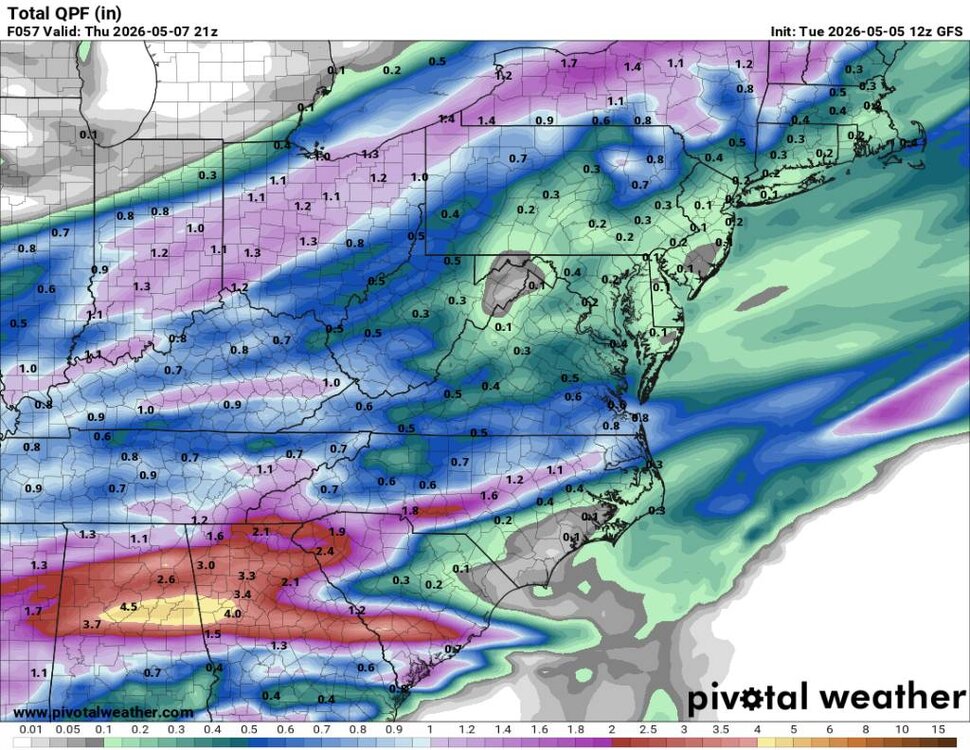
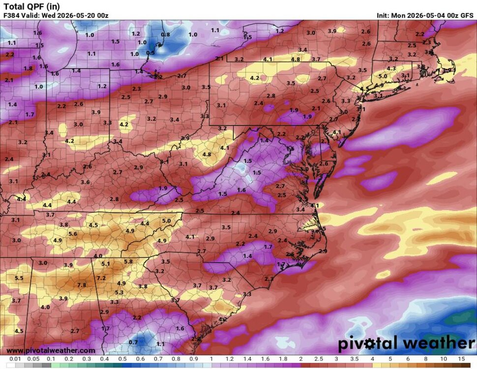
Latest models coming in much wetter this morning which is great news. Sent from my SM-G998U using Tapatalk
-
Looks like from about Haywood south is going to get a good wollup today and tonight. Better buckle up.
-
This looks really good. Sent from my SM-G998U using Tapatalk
-
This looks promising. Sent from my SM-G998U using Tapatalk
-
The models are backing off a lot on precipitation. Everything is dropping south. Where is this in the freaking winter.
-
Ill take whatever we can get but this sucks. Sent from my SM-G998U using Tapatalk
-
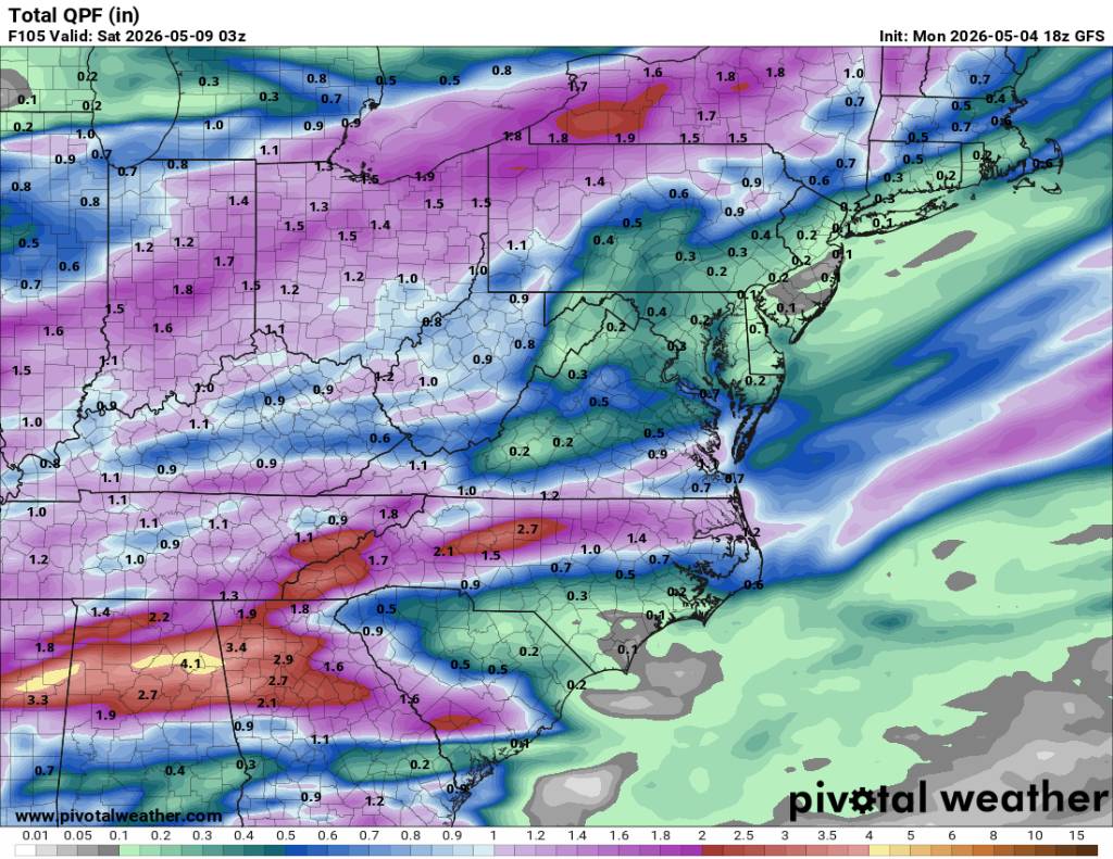
18z gfs backed off a bit but honestly we'll take anything. Sent from my SM-G998U using Tapatalk

-
Today's Euro has jokes. Sent from my SM-G998U using Tapatalk
-
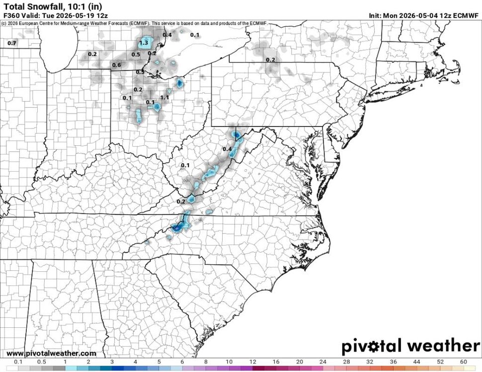
Fun times out in Colorado WHAT...Heavy snow expected. Total snow accumulations between 10 and 24 inches, heaviest above 8,000 feet. Isolated totals up to 30 inches possible across the higher mountains in Boulder and Larimer counties. * WHERE...Rocky Mountain National Park, the Medicine Bow Range, and the northern Front Range foothills, including Red Feather Lakes, Estes Park, and Nederland.
-
Yeah this has been a snap back for sure. 32 degrees yesterday morning and 33 degrees this morning. Ill take it.
- 365 replies
-
- 3
-

-
- severe
- mountain snow
- (and 1 more)
-
There sure is. Especially this week coming up.
-
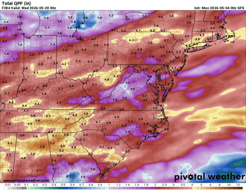
12z gfs looking great still. Sent from my SM-G998U using Tapatalk
.thumb.jpg.05bb360a740e8f928f716b0b327cee3b.jpg)
-
Beggers can't be choosers. The ground is so dry that even last weeks rainfall the ground just soaked up super quick but either way we need rain.
-
Yeah going to be a stout cold front again this week after some great beneficial rainfall.
- 365 replies
-
- 3
-
-
- severe
- mountain snow
- (and 1 more)
-
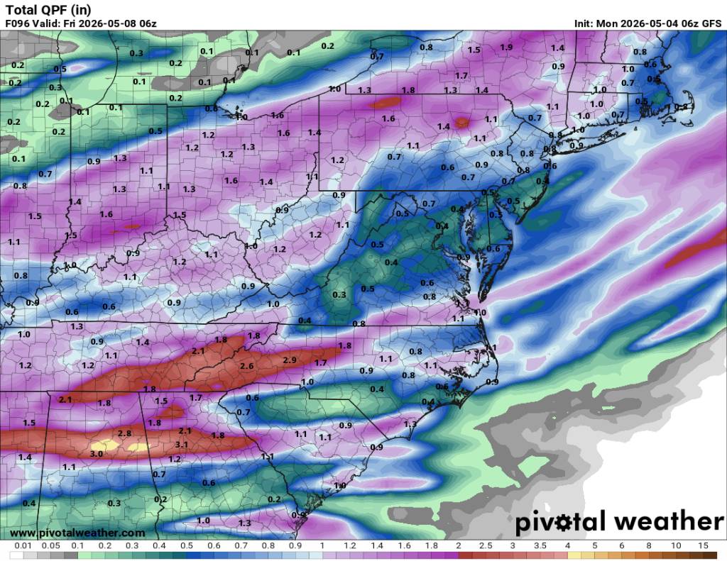
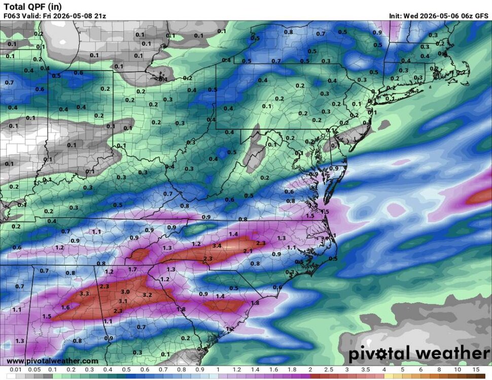
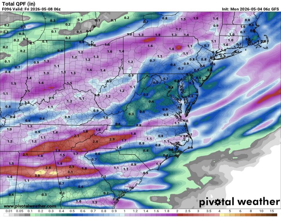
This mornings 6z GFS looks freaking amazing starting Wednesday through Friday. 2 to 3 inches of rainfall? Yes please. Sent from my SM-G998U using Tapatalk
-
Another frosty morning with a current temp and low of 33 degrees.
-
Hopefully Sent from my SM-G998U using Tapatalk


.jpg.9044e02deb335385823436be91ce48c1.jpg)