

Met1985
-
Posts
16,674 -
Joined
-
Last visited
Content Type
Profiles
Blogs
Forums
American Weather
Media Demo
Store
Gallery
Everything posted by Met1985
-
It'll be snowing this time tomorrow.
-
I've just learned especially this season to not look for anything too far out. I've been sucked in and let down as well. Maybe things shift better later but we've seen this before.
-
Some major rain with thunder and lightning coming through.
-
Bump
-
18z gfs is a nice flow snow for Thursday, and a nice light event for the next weekend. Promising.
-
18z gfs coming in more robust for Sunday morning. Sent from my SM-G998U using Tapatalk
-
Yeah tonight's rainfall is going to put a dent to this dry spell.
-
Also for this weekend I wouldn't be surprised to possibly see some snow flying around Sunday morning.
-
Ok so we basically have 2 potentials for some snow. One is next Thursday and the other is possibly next weekend. Both of these systems I'd be extremely cautious with. We are seeing changes from run to run and this is about a week to 10 days out.
-
Good to see some positives within range on the map. Always remember the 3 day rule though.
-
We will see for yall outside the mountains. I've seen a lot of heartbreak with yall. The next 7 days look decent.
-
Beautiful color this morning. Sent from my SM-G998U using Tapatalk


-
It'll be much more interesting once we get into next week. 5 days out is my magic number. Things look good but we've been burnt recently.
-
Just a word from the wise. These fantasy storms are ok but as we have seen the ensembles and longe range model runs have been atrocious this season.
-
Been like this most of the season.
-
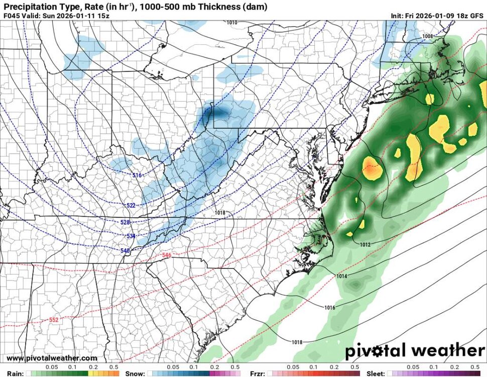
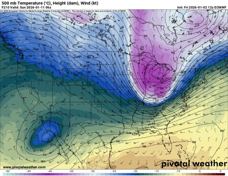
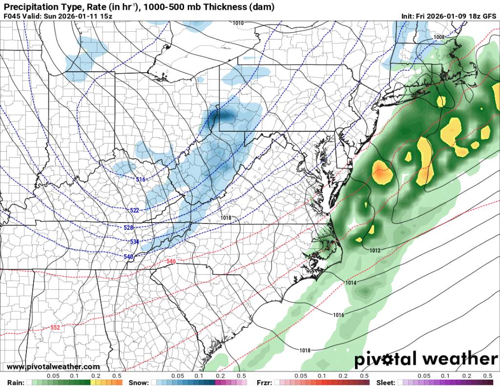
12z euro. It's in the mid to long range and we've seen what the points look like but this is kind of what we want. Sent from my SM-G998U using Tapatalk
.thumb.jpg.fe440d2e4ac6dc5661e4519ef7f5ffa2.jpg)
.thumb.jpg.d347ac395ec06a728afaa3776177c3a8.jpg)
.thumb.jpg.3af67a2a2465562810457aa3fa22cd95.jpg)
-
Oh yeah yall can get hammered with a Miller A. It will ge nice when that pattern sets back in.
-
You damn right I do. Im an optimist even when the pattern is crappy. Seen it too many times. The pattern is volatile and honestly it's been like that for most of the season. No reason for that to change now. I hope your right about after the 10th. Many ensembles look to build the EPO ridge out west after that time period but as we've seen the ridge out west collapses...
-
Overnight Euro didn't look bad. Hopefully we get through this warm-up and then the pattern will be a bit more favorable. Although I've seen that the real time frame to look at is the end of January through the first of February.
-
Well the NW territories have had temps anywhere from negative 30 to near negative 60 degrees recently. And im sorry but im not hedging bets on long range this season. Just like when wncsnow said that the 10th through the 20th would verify cold. I said I don't trust the models that far out this season. Now look at everything.
-
We can still score with above normal or a near normal temp profile in Canada. What we don't need is an arctic high pressing so far south that it's 0 degree and dry as a bone. Our best snows are thread the needle honestly. Some win some don't but that's winter in the SE.
-
This is on point.
-
We get snow in February, March, and in April. It happens all the time but usually with flow snows. We've gotten feet of snow just with flow snows before. Yall just get downsloped so bad that the moisture just hangs out over the border.
-
You better get ready for spring in your area.
-
Yeah these flakes are sizable. The best thing is that non of the models showed this at all.


.jpg.a800ed741693447ad14a66c8cad86051.jpg)
.jpg.a95906e66ba4824a2a2bbd23317ef994.jpg)
.jpg.c3ba2de998b768de099f303a26bfdb11.jpg)