Met1985
-
Posts
16,680 -
Joined
-
Last visited
Content Type
Profiles
Blogs
Forums
American Weather
Media Demo
Store
Gallery
Everything posted by Met1985
-
It would be pleasant for yall. I know yall are starving.
-
Looks like it's about to be glory for yall down east.
-
Front wheel drive?
-
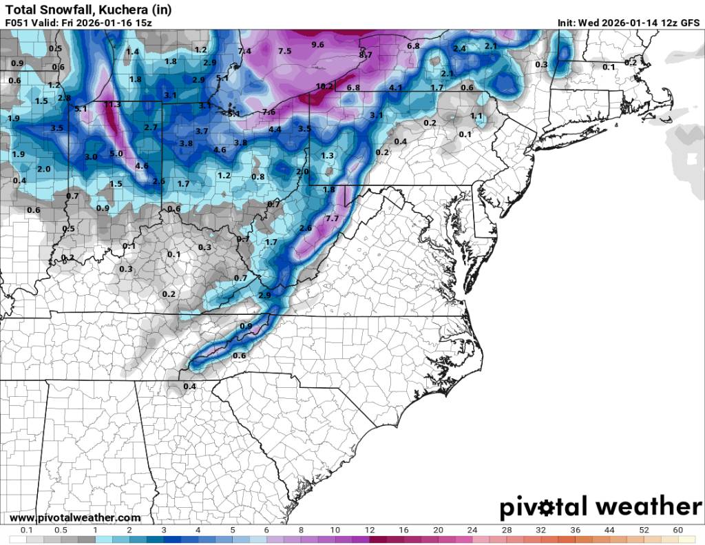
12z gfs actually going back to a longer duration event along the border. Sent from my SM-G998U using Tapatalk

-
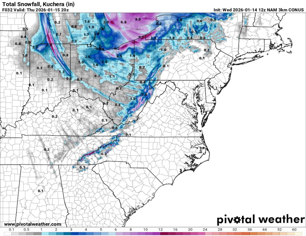
NAM 3K looks pretty good for the border. Sent from my SM-G998U using Tapatalk

-
Yeah tonight is going to be fun around here.
-
Some CAD going on this morning. Was 39 at home and frost here at work. Probably around 33 degrees.
-
From GSP this morning. Sent from my SM-G998U using Tapatalk
-
You sure? I know you a little nervous lol.
-
Yeah multiple events on the horizon for us. And very cold temps so if anyone is worried about the ground temp don't because it's going to be very cold for several days.
-
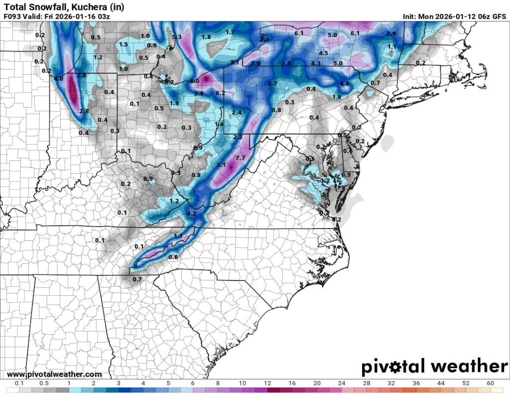
Looking at things currently from a model standpoint it looks like this weekends flow snow will be better than the Wednesday night flow snow but things can still change.
-
It'll trend north lol.
-
I haven't looked at the models but are they looking better today because overnight shifted to a shorter duration.
-
Good.
-
For mid week. Sent from my SM-G998U using Tapatalk
-
Also current temp and low of 14 degrees.
-
Models aren't digging the vort like yesterday so this isn't a long duration event anymore. Totals are cut way back. The one good thing I see is that we may see severe small flow events the next 10 days. Sent from my SM-G998U using Tapatalk

-
Temperature has just dropped off the cliff. Down to 22 degrees already.
-
Yeah 18z looked good again for us. The adjustments are not done though but hopefully we see more continuity.
-
Yeah the GFS was showing the moisture from this morning coming in for a few days but was playing catchup as well. The Euro didn't have it until yesterdays 12z run. The euro has been too dry as well. But the euro at least at the H5 pattern basically nailed this cold front from 10 days out except the surface temps surprise surprise we about 20 to 30 degrees TOO WARM. honestly I only look at the gfs at short range anymore but all models have been struggling.
-
Oh yeah the Euro nailed the H5 pattern but has been way off on temperatures and moisture. The gfs is handling short range better in my opinion. The GFS did a much better job at the rainfall this week and still underestimated rainfall totals in most of WNC. The temperatures have been atrocious at lead time and I mean some 20 to 30 degrees bad but it's H5 pattern has been stellar so go figure. I like the look for mid week but as most know im an optimist and this looks like the best chance for snow since November really. As you noted. Honestly I don't even look at the gfs anymore for mid to longe range leads.
-
Yes sir Larry.
-
Most in the western part of NC got a lot of rainfall from Friday to Saturday. Anywhere from 2 to 6 inches. A lot of highway flooding and basements flooded. But Eastern NC got nothing.
-
I definitely get that for sure but the Euro really missed today's snow here until the last minute. We will see.
-
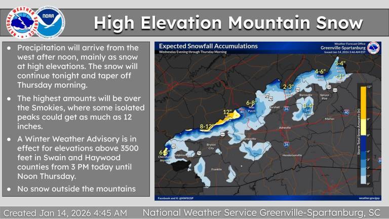
Nice! I've noticed these broke containment across the mountains. I mean that may happen Thursday depending on things. Hopefully we get blasted.