

Chicago WX
-
Posts
18,285 -
Joined
Content Type
Profiles
Blogs
Forums
American Weather
Media Demo
Store
Gallery
Posts posted by Chicago WX
-
-
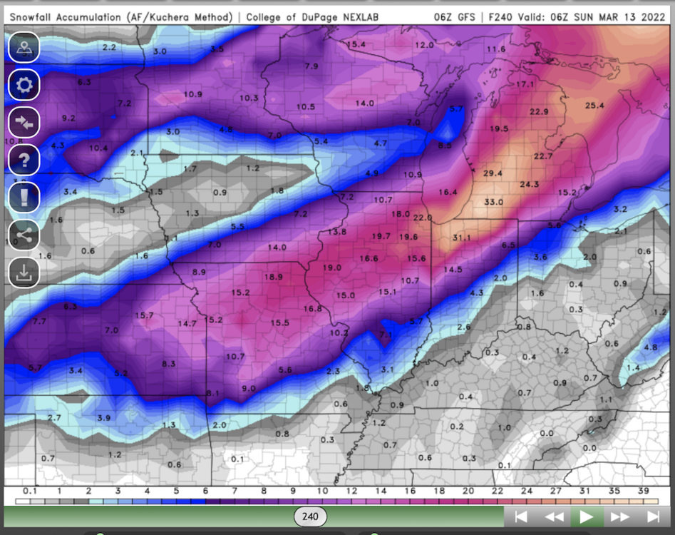
For sh*ts and giggles, the 6z ICON went east and buries Chicago with 20"+.

And my previous post wasn't trying to be sour grapes because MBY isn't in the bullseye anymore. Just trying to have some perspective with this whole situation. Historic storms happen, no doubt about it, but they're also pretty rare for a reason. Alas, hope I'm wrong and some people on here are measuring drifts to their roof lines.

-
 1
1
-
-
10 minutes ago, A-L-E-K said:
NAM range begins today for all the real heads
6z was going well west at the end of its clown range. RGEM too, but maybe not as far west. All FWIW.
Regardless, I agree with RC about the GFS and not just because its a rainer IMBY now. It kept pulling the historic totals with the Feb system last winter, which was obviously wrong in the end. I mean I guess there's still a chance, but I wouldn't bet on it. December is not usually our (locally) prime time for widespread 12"+ amounts. It's usually January and February. Still, this whole thing has a major vibe to it because of the high wind and extreme cold aspect to it...even if the top amounts are only, let's say 12-14". Even areas that see 4-6" will have a wild ride with the cold/wind part.
If I had to pick the locales for the bigger snows right now, I'd go KC up through cyclone's/hawkeye's BY and then up thru WI. Subject to change of course...
-
14 minutes ago, ILSNOW said:
Chicago can you/are you allowed to post the map?
thanks
Pivot weather has EPS QPF for free, amongst other freebies.
-
20 minutes ago, Chicago Storm said:
12z EPS bumped west as well, actually favor NW of the OP Euro.
Nice bump in QPF too
-
What a day of runs. F*cking epic.
-
2
-
 1
1
-
-
Had to come out of hiding with that run. This GFS run and the Euro run from a couple of days ago are the most epic runs I've ever seen on weather models. Snow, wind, and cold combo. Chances of verifying exactly like that are slim, but a person can dream. It's an easy top 5 storm all-time for the region.
-
4
-
2
-
-
Worst start to met spring I can recall. Seriously awful weather. And more f*cking rain in the forecast for the next 7 days. Hope we go full on drought this summer!
 Though I know better because all it does is rain here.
-
18 minutes ago, Cary67 said:
What's your seasonal total?
32.4"
4.3" on 0.23" liquid is my final for the event. Fluff job. Ready for some warmth now though...
-
 1
1
-
-
29 minutes ago, ricosuave said:
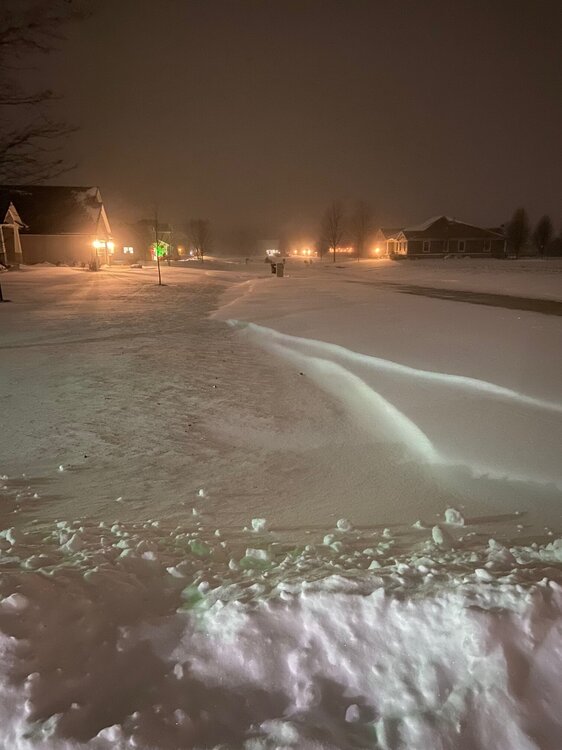
Overperforming here 25 miles south of Kankakee. I have between 3 and 4 inches and it's still snowing moderately.
In IKK too. Just took the dogs out and went and measured 3.8". And still snowing. Nice surprise.
-
2
-
-
If it's going to snow now...this is how you do it I guess. Totals are from two systems in the next 10 days.

-
 1
1
-
-
Looks like a fairly minor event, but models all over the place. NAM brings the first part pretty far north, and then uninterested with the "main" storm. GFS continues with its idea. GEFS a bump north. Canadian is paltry and has took a step back. And last but not least, in this 12z cycle so far, the Ukie has gone way north and puts down 3-5" even up here.

-
54 minutes ago, cyclone77 said:
Yep, looks like a rainer Tues, followed by another miss southeast with this storm lol.

Nah. This one will be more spread the wealth.
-
7 minutes ago, vortex said:
Any idea how much you have now?
Tough to measure by me because of the drifting.
lol, nice...good luck. I haven't gone out to check. Going to wait until it stops to do my final. And shovel out the driveway...
-
1
-
-
57 minutes ago, vortex said:
Though less snow, this storm seemed more enjoyable than GHDIII.
Yeah, this was all action from start to finish. Wind added something to this one too. Of course, I'd take another GHD III as well.
-
2
-
-
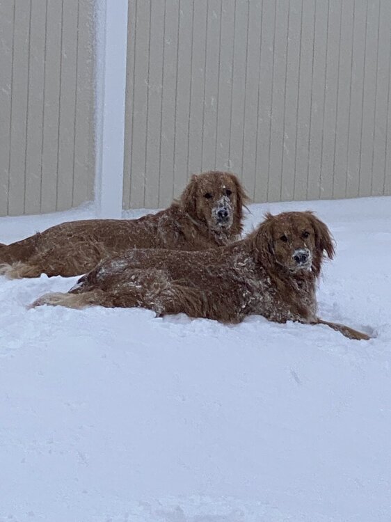
My two snow lovers in the backyard.
-
16
-
-
Got home about 15 minutes ago. Took several measurements (lots of drifting) and came up with 4.2". Pretty much been an inch per hour since it started.
-
Just wow here right now
-
4
-
-
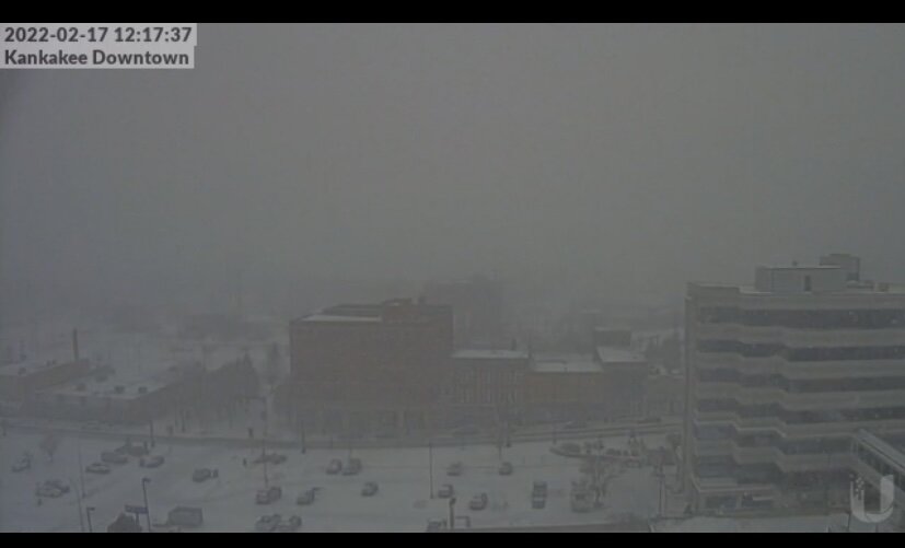
Getting close to a block visibility right now. Just pounding since it began. Too bad this storm is a quick mover…
-
2
-
-
29 minutes ago, WeatherMonger said:
Rain, sleet and snow today. Think they pulled mail carriers from their routes, going to have to change their motto...
.
Different breed down there.

We haven’t missed a day up here, including GHD III.

-
1
-
-
Drifting is gonna be bad. Not a wet snow like LOT was thinking…
-
7 minutes ago, vortex said:
Jeb would be jealous. Haha
Downtown cam definitely verifies your observations.
That’s my route today.

-
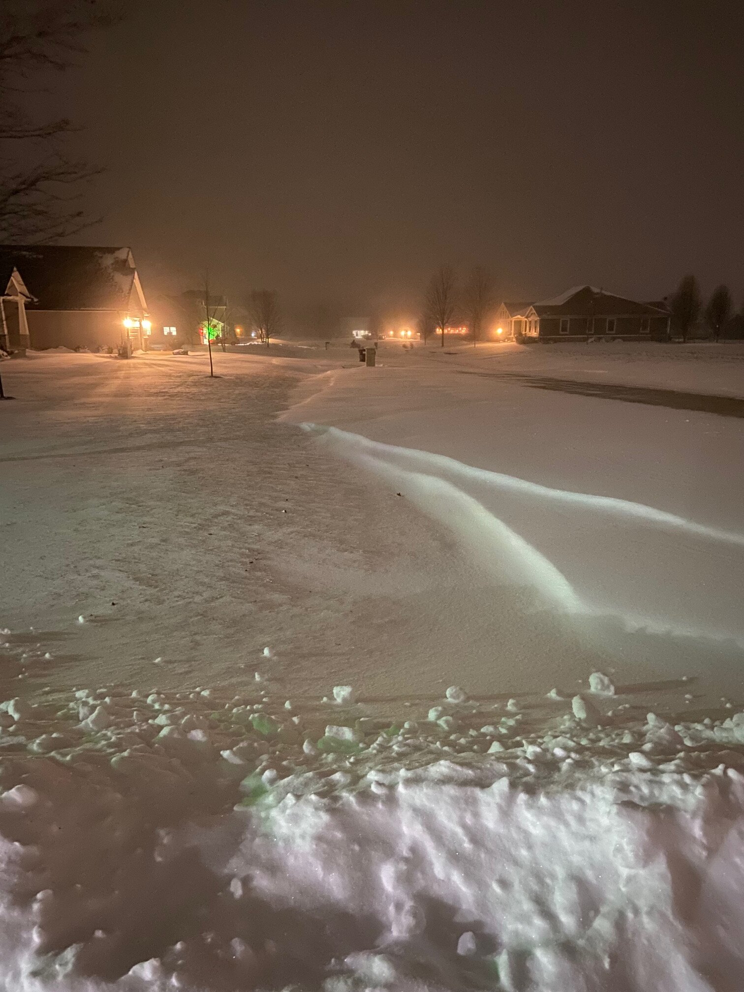
Just pound town here. My visibility is 2 blocks at best right now. Walking south is ok, but walking north is hell with the driving snow.
-
8
-
-
17 minutes ago, vortex said:
Pretty much all snow here now at my house
Yeah, didn’t take long. Getting close to calling it rip city right now. Roads are a disaster already…
-
3
-
-
It has started here. But as sleet mixed with some flakes.


Pre-Christmas (Dec 21-23rd) Winter Storm
in Lakes/Ohio Valley
Posted
6z Euro doesn’t look to weaker to me. It’s a tick or two stronger with the slp at 90 hours versus the 0z run at 96. It’s east a bit for sure. I guess QPF is a bit less, but otherwise I think the run would deliver similar results to the 0z run. I mean it’s no GFS, but…yeah.