

Chicago WX
-
Posts
18,285 -
Joined
Content Type
Profiles
Blogs
Forums
American Weather
Media Demo
Store
Gallery
Posts posted by Chicago WX
-
-
8 minutes ago, TheNiño said:
Everyone seems cranky in here.
A lot of sarcasm. At least from me. Though some are perpetually cranky it seems.

Anyways, sometimes it’s fun to try pull out a little more snow in the end, when things have gone off the cliff for a day or two. Hopefully everyone does well enough to have some decent snows tomorrow and Friday.
-
Just now, mimillman said:
Gonna need another hand for those rare 12” events in Lansing
Easy under on Lansing. Probably mix there.
-
 1
1
-
-
9 minutes ago, Hoosier said:
00z NAM deepens more quickly.
HRRR and 3k too. Granted, we’re not talking extreme changes, but a little improvement is very appreciated.
")
-
1
-
-
So the 0z HRRR was different. Heads up cyclone

-
16 minutes ago, cyclone77 said:
Euro def isn't what it used to be. Better off using tarot cards while trying to forecast anything beyond 72hrs these days lol.
lol, yes. And that's just 3 days worth of runs. Euro didn't used to be like that. Remember outside of this timeframe, it was showing an east coast blizzard. Then moved 1000 miles west, and now in the last 3 days is escaping back east. Crazy awful.

-
12 minutes ago, Chicago Storm said:

Garbage model
-
2
-
 1
1
-
 1
1
-
-
10 minutes ago, Hoosier said:
Those were the days.
You and I were the first 2 Midwesterners over there in a sea of east coasters. Then one by one, more people from the Lakes/OV joined.
Yeah. It all started for me in December 2000. Wondered why we were getting all this snow. First I found NWS AFD’s and then computer models. Had no idea how to read/use them, but kinda figured it out. Then I found the TWC forums. And then someone posted a link to WWBB. And the rest is history.
-
28 minutes ago, Hoosier said:
Was thinking back on stuff lately. Remember that period of time when we were in charge at WWBB? God that was so long ago.
1 minute ago, Harry said:Omg.. 20years? Or very close to it.

The past few years feel as if I have gone back 25+ years. Doing stuff I was doing then but perhaps a little harder. Been slowing it down a bit though lately..
2000
It was a much simpler time. All we had was the ETA, NGM, AVN, MRF, GGEM...and the Euro ran once a day at 3:00 AM, with like 5 available layers (no QPF). Things have certainly changed.
-
And no doubt the timing of holiday travel influenced their decision. I get that part.
-
LOT just issued a Winter Storm Warning for the CWA. Thought they'd go WWA, alas...
EDIT: blizzard warning for Porter County
...WINTER STORM WARNING IN EFFECT FROM NOON THURSDAY TO 6 AM CST
SATURDAY...

* WHAT...Snow and blowing snow producing occasional white out
  conditions expected. Total snow accumulations of 2 to 5 inches.
  Winds gusting as high as 50 mph expected. Wind chill values of
  25 to 35 below zero expected.

* WHERE...Portions of east central and northeast Illinois.

* WHEN...From noon Thursday to 6 AM CST Saturday.

* IMPACTS...Falling or blowing snow may result in white out
  conditions with zero visibility at times, making travel
  extremely difficult. Power outages will also be possible as a
  result of strong wind gusts to 50 mph. Roads will likely quickly
  become ice covered as temperatures rapidly fall Thursday
  afternoon.

* ADDITIONAL DETAILS...Dangerously cold wind chills as low as 25
  to 35 below zero are likely Thursday night through Friday night.
  Wind chills of this magnitude can cause frostbite on exposed
  skin in as little as 20 minutes.
-
17 minutes ago, A-L-E-K said:
good chunk of hi-res guidance is a DAB, emphasis on the AB
Very paltry. Think T-1" may be a better call at this point. I can see this being just 3-4 hours of arctic sand that blows around into corners. I’d give my odds of a white Christmas at 30% right now.
-
This piece of crap is (or was) supposed to replace the NAMs I believe. Don't know if thats still in the cards. Regardless, hug it tight Michigan folks.

-
1
-
 3
3
-
-
I'm grasping for straws, but the 12z HRRR ticked totals up in a bit in IL. Farther east, looks like it developed a bit faster, was a slight shift west, versus the 6z run. Might be just timing though.
I don't know why I'm still paying attention to this thing.

-
3
-
-
Maybe with the winds so strong, we can get some of the higher totals to the west and northwest to blow more snow in here helping "bump" totals.
")
But yeah, locking in 1-2" for MBY total. Very short duration of snow and consistent drying trends on the models making me like that call. Hoping for those to the east, that solutions hold and they get buried.
-
1
-
-
18z NAM was better. I mean, it’s got to start somewhere.

-
18 minutes ago, Michigander said:
I seriously wish we could share some of this snow with you all. In my back yard we've gotten about 43" of lake effect already this year. My roof needs a break.
Appreciate the sentiment. Looks like we’ll get a little, so that’ll help the mood.
-
2
-
-
7 minutes ago, Kaner88 said:
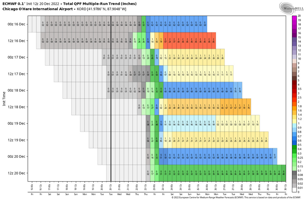
ECMWF has now halved QPF for Chicago for two straight runs... 24 hours to go from 1.2" to 0.3" QPF
It’s been no better than the other models. Not what it used to be for sure.
-
Looking real good for MI. Good luck to you all!
Thinking a 1-2” call is solid for MBY. Anything more is gravy right now.
-
1
-
1
-
-
Looks pretty much like a front for those of us in IL. 1-3/2-4” seems like a good call right now. It is what it is. Folks in IN and MI still holding on to hope. Hope no more slips east for them.
-
2
-
-
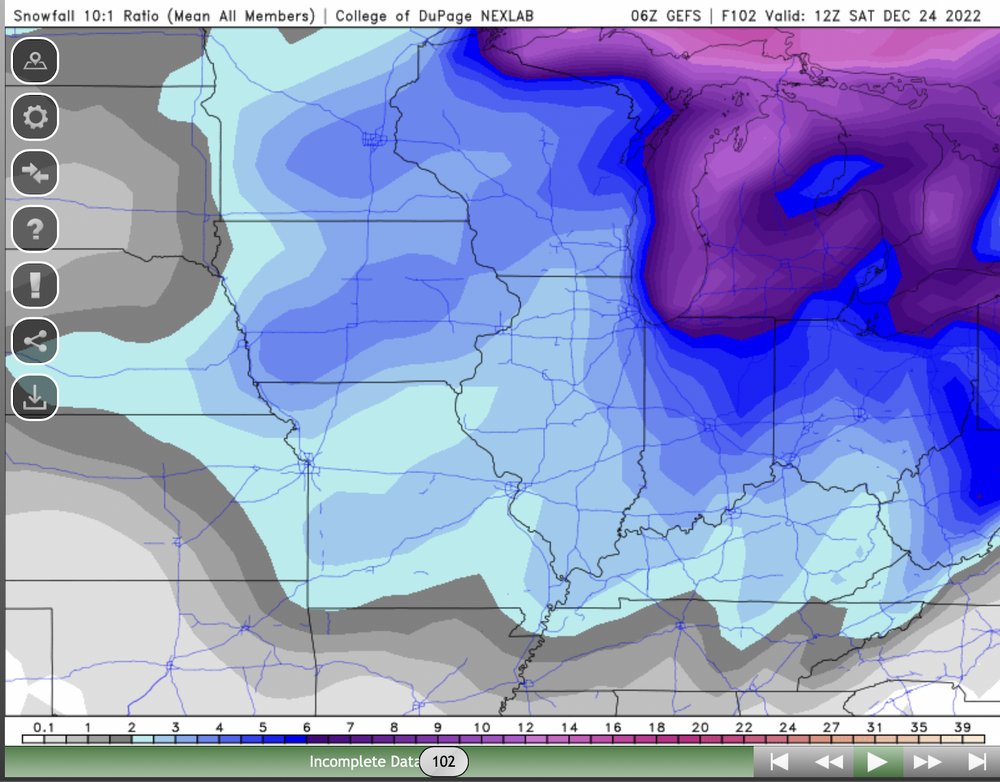
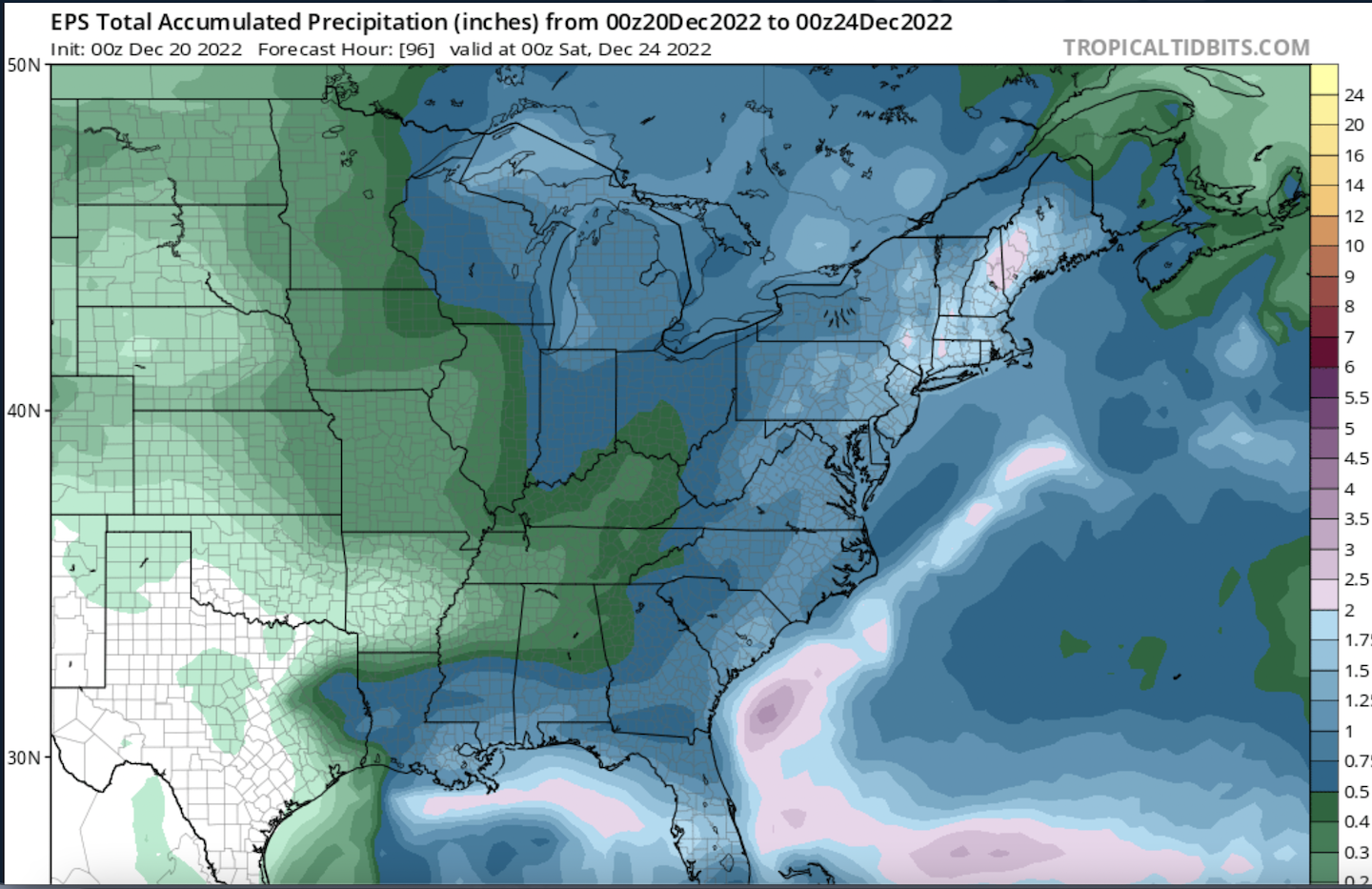
Here's the 0z EPS mean total QPF. Pretty much a carbon copy of the 12/18 0z run, interestingly enough. The runs between these two were more generous with the 0.50-0.75" shading farther west in IL. MI has added a bit, BTW, probably owing to the eastern shift/later developing tendencies.

-
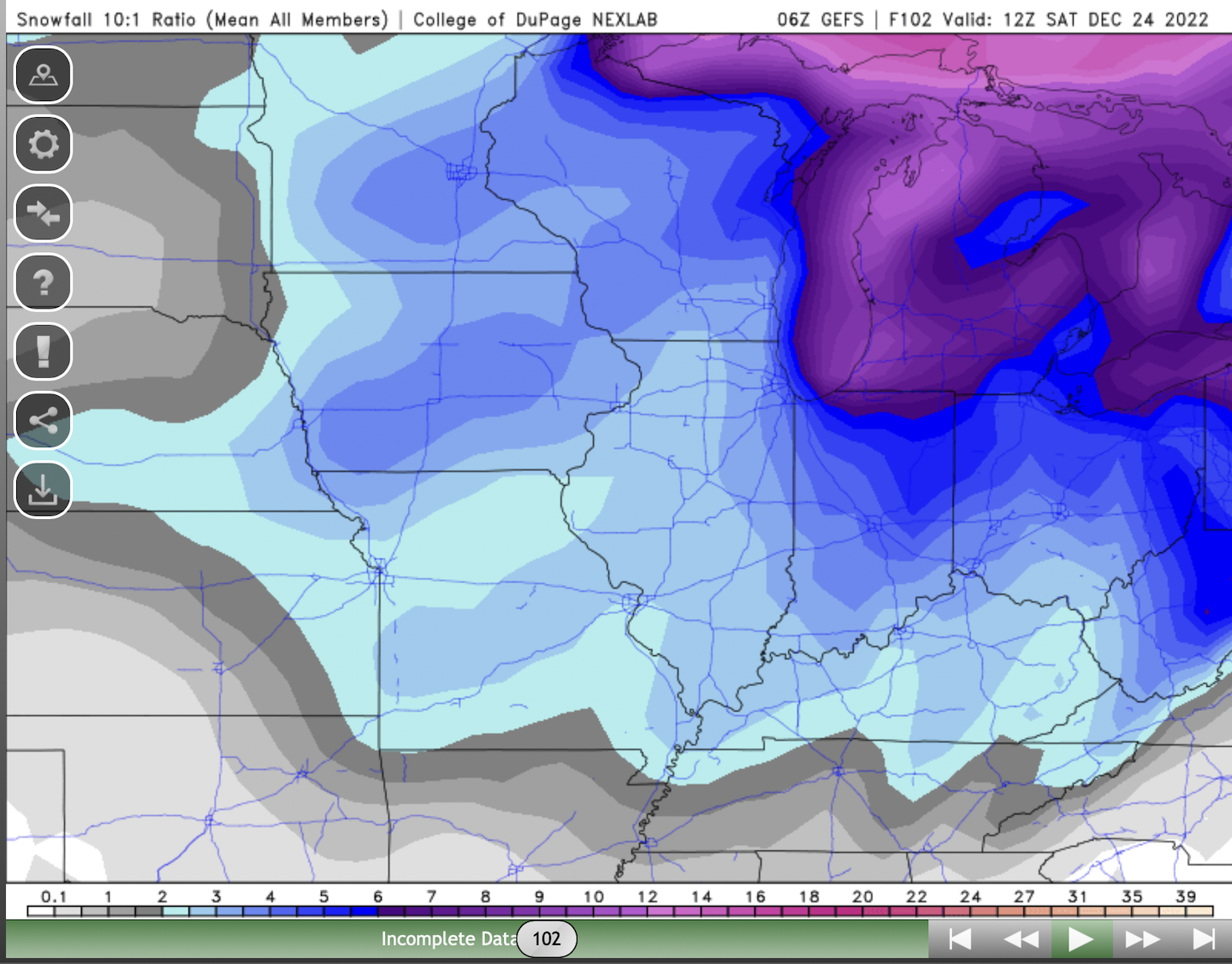
GEFS tend to play follow the leader, but holy crap versus what was projected a day ago...to this below off the current 6z run.
And no not saying storm cancel at all, just posting the run.
-
1
-
-
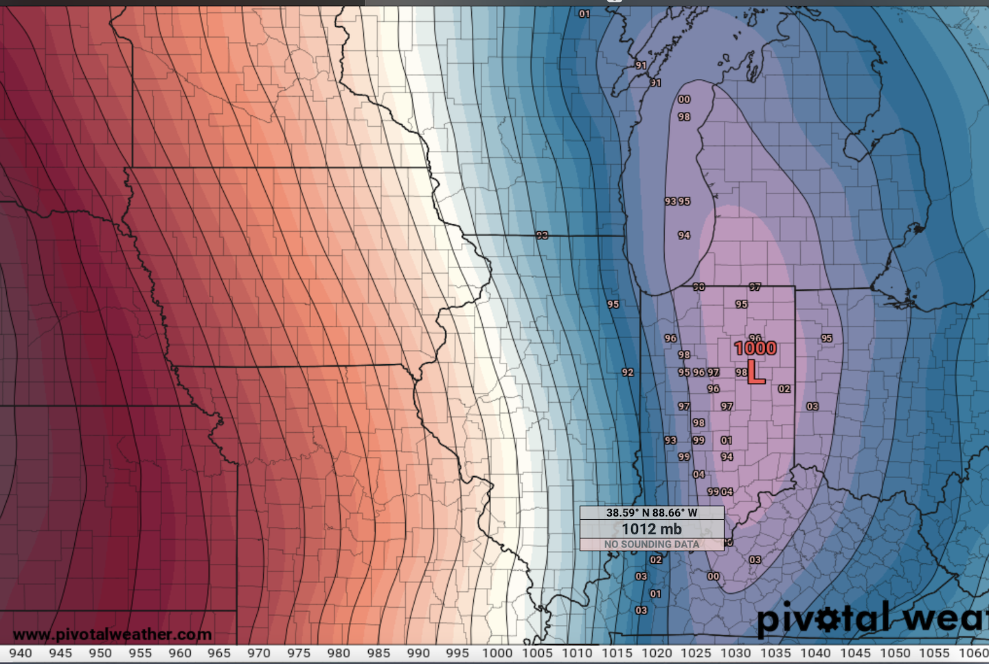
Majority of the 0z EPS members are leaning left at 0z Friday, alas still a shift east from previous runs.

-
12 minutes ago, A-L-E-K said:
Lost the one feature that made the event interesting, pre xmas modd dust+ is nice but will be a letdown after the what the euro teased in mid range
DAB that all blows away into the Lake leaving you with bare ground on Christmas

-
1
-
-
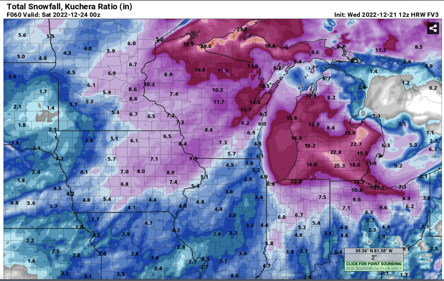
18z RGEM goes through Indiana. Solid hit for many. Nothing extreme, but solid.

Pre-Christmas (Dec 21-23rd) Winter Storm Part 2
in Lakes/Ohio Valley
Posted
LOT bumped totals an inch for I-55 and east, now 3-5". My p&c now has 3-7". Also considered upgrading the same area to a Blizzard Warning, but don't think it'll quite meet visibility/wind criteria. 9z HRRR and RAP look pretty solid.