-
Posts
18,395 -
Joined
Content Type
Profiles
Blogs
Forums
American Weather
Media Demo
Store
Gallery
Everything posted by Chicago WX
-
Of course after my last post, snow has picked in intensity. Grass getting almost all covered. Roof tops accumulating too.
-
Not unless rates pick up here. Just been a steady light snow all morning. Some slushy accums on the grass tips, stairs, etc...but nothing too great.
-
Snowing here now. Just gonna be a white rainer though...
-
Anyways, 12z NAM is an acceptable outcome. If we're going to do this...then let's really do this.
-
Getting the J&J vaccine on Friday at Walgreens. Parents have had their first and are coming up on their second. GF and her mom fully vaccinated too. So my closest circle is about complete.
-
On a scale from 1 to 10, today is a 0. F*ck this weather.
-

Beware the Ides of March (and into the 16th)
Chicago WX replied to Hoosier's topic in Lakes/Ohio Valley
Pouring rain and sleet. Elevated objects (wires, etc) are iced up, even with the windy conditions. 31˚/26˚ at mi casa. Good thing I got the day off. Time for a nap. -

Beware the Ides of March (and into the 16th)
Chicago WX replied to Hoosier's topic in Lakes/Ohio Valley
Sleet. 32˚/17˚ at my house. East winds have gusted as high as 43 mph this morning. Just a nasty nasty day. -
RC is starting the celebration early this year. Sunday (St. Patrick`s Day) also has an increasing chance to end up dry and seasonable, especially if the bowling ball over the High Plains continues to slow. Official forecast has some low PoPs due to some operational and ensemble members still slightly faster. While it`s several days out, think that trend will be toward consensus of slower ECMWF suite, which would hold rain off until Sunday night at the earliest, and possibly not until Monday. Temperatures will be in the 40s on Sunday for most, though again upper 30s lakeside. Chance PoPs on Monday appear quite reasonable and if this ends up being the day with more widespread light to moderate rain as it appears it could be, temperatures would probably also end up lower than in official forecast. Pattern looks to remain on the active side beyond day 7, with typically low confidence in the details. The current CPC 6-10 and 8-14 day outlooks favor temperatures to average out below normal. Castro
-

February Snow Bonanzas - the new norm in SE MI?
Chicago WX replied to michsnowfreak's topic in Lakes/Ohio Valley
Snowiest Februaries for Chicago 1) 29.0" in 2011 2) 27.8" in 1896 3) 26.8" in 2015 4) 26.2" in 1994 5) 22.6" in 1900 T6) 22.5" in 2010 T6) 22.5" in 1967 8) 21.8" in 2008 9) 21.6" in 2021 10) 21.1" in 1901 T11) 20.3" in 2018 T11) 20.3" in 2007 13) 19.8" in 1908 14) 19.7" in 1978 15) 19.5" in 2014 21) 16.1" in 2013 Though there have been some clunkers too, in the past 20 or so. Especially some early-mid 2000's Februaries... 1) T in 2017 T14) 1.5" in 2003 16) 1.8" in 2002 T20) 2.2" in 2001 21) 2.5" in 2006 22) 2.7" in 2005 -
I'll admit I don't pay attention to the weather when it's boring as hell...but woke up this morning, checked out the p&c forecast and saw a forecasted high of 47˚ for today. Not too bad. Will go with the light jacket at work today. Well, that busted, lol. Only made it to 38˚ today. Still a decent amount of snow around here. Couldn't have helped I'm sure. Tomorrow's forecast is 56˚. I'll bring my light and medium jacket...just in case.
-
My girlfriend had the same symptoms as you. She got it in November. Most lasting thing for her was loss of taste and smell for about a month. Then it came back. Regardless, she’s a nurse, and was in the first wave of shots. Got both (Pfizer), and had no problems at all with either, other than a sore arm for a couple of days. I like you, am eligible for the vaccines too. I had back in November too, but milder symptoms than my gf. I’ve actually decided to wait for awhile to get them, figuring I’d like to see others (like my parents) get theirs. I’m not worried for myself, think I can wait considering everything. Also with vaccine supply in IL kind of sketchy, especially here locally, I’d rather wait my turn in line a little longer.
-
2020-21 Season Snowfall Totals (thru 2/21)...Departure To Date (thru 2/21)...Snow Depth (as of 7:00 AM on 2/21) Akron Canton, OH: 46.0"...+12.2"...5" Alpena, MI: 46.4"...-15.5"...8" Chicago, IL: 47.0"...+19.5"...16" Cincinnati, OH: 29.2"...+11.9"...8" Cleveland, OH: 43.2"...-5.4"...7" Columbia, MO: 13.7"...-1.5"...4" Columbus, OH: 26.6"...+6.8"...5" Dayton, OH: 27.9"...+10.0"...8" Des Moines, IA: 54.5"...+27.9"...9" Detroit, MI: 40.3"...+8.9"...11" Dubuque, IA: 53.3"...+21.6"...16" Duluth, MN: 63.5"...+1.5"...14" Eau Claire, WI: 26.6"...-8.0"...7" Evansville, IN: 6.5"...-3.4"...2" Flint, MI: 46.0"...+9.9"...11" Fort Wayne, IN: 30.9"...+4.1"...10" Grand Rapids, MI: 44.3"...-17.2"...12" Green Bay, WI: 27.1"...-10.7"...9" Houghton Lake, MI: 41.2"...-10.5"...16" Indianapolis, IN: 22.2"...+0.4"...5" International Falls, MN: 36.5"...-17.5"...13" Kansas City, MO: 12.0"...-3.1"...T La Crosse, WI: 29.0"...-3.6"...10" Lansing, MI: 43.7"...+4.2"...15" Lexington, KY: 20.8"...+10.3"...2" Louisville, KY: 17.6"...+7.5"...2" Madison, WI: 43.1"...+4.4"...13" Mansfield, OH: 38.9"...+3.9"...13" Marquette, MI: 89.2"...-54.1"...20" Milwaukee, WI: 46.1"...+10.6"...19" Minneapolis, MN: 42.6"...+3.1"...8" Moline, IL: 41.2"...+15.9"...13" Muskegon, MI: 40.5"...-38.0"...15" Paducah, KY: 13.4"...+5.5"...3" Peoria, IL: 24.4"...+4.4"...9" Rochester, MN: 32.5"...-5.3"...7" Rockford, IL: 34.5"...+5.1"...15" Romeoville, IL: 46.3"...+20.4"...14" St. Cloud, MN: 30.7"...-1.5"...5" St. Louis, MO: 12.1"...-1.9"...4" Sault Ste Marie, MI: 69.5"...-26.8"...19" South Bend, IN: 51.5"...-3.5"...13" Springfield, IL: 20.4"...+3.5"...5" Toledo, OH: 34.9"...+6.5"...12" Waterloo, IA: 47.4"...+20.0"...13" Wausau, WI: 29.2"...-13.6"...13" Youngstown, OH: 53.2"...+7.7"...4"
- 11 replies
-
- 6
-

-

-
- midwest
- season snowfall
-
(and 2 more)
Tagged with:
-
It's been an incredible 3+ weeks of deep deep winter. Best run I can recall really. I will remember it fondly. But my body is ready for a break. Climbing at times, 3'+ snow banks to get to peoples houses ,day after day, is completely taxing. Walking thru yards with a foot and a half of snow...is exhausting. Navigating peoples sidewalks and porches that they have of course, not completely cleaned in 3 weeks, is almost maddening. Packed steps and porches of snow and ice...how the f*ck do they get in and out of the house all day? Seriously people, do us a favor and clean your sh*t up. That's my rant despite this absolutely great stretch of winter. Alas, in a few months...because seasons and all...I'll be complaining about heat and humidity, lol. Best climo.
-
Yep. Beautiful flakes falling here. Snow on snow on snow on snow...
-
-15˚ at IKK right now.
-
No problem RC. And yeah, I've thought about joining CoCoRAHS. May need to...to at least give this area some legit snowfall reports.
-
Not sure where to put this, but...in the past 18 days (Jan 30 thru today), I've measured 33.7" of snow. An incredible run in my book. Especially in light of how lame winter was until this point. 2013-14 is always going to be hard to beat, and it probably won't in my lifetime, but I didn't have a run that winter...like I've had this winter, in a timespan such as this one.
-
I tried that move too. Didn't work. But my parent's situation was even worse. I go over there this morning at 5:00 am to clear their walks and driveway. They live across the street from a church. Well their plowing company had already came and did the church grounds. But where did they deposit a rather large pile of snow? Halfway at the end of my parent's driveway. I mean WTF. I wasn't pleased. Took some work. Told my mom to call today and give them hell.
-
lol, the gf wanted to cook out Sunday night. Told her I was too lazy to dig it out. So I went to my parent's house and used their grill. They keep it in the garage.
-
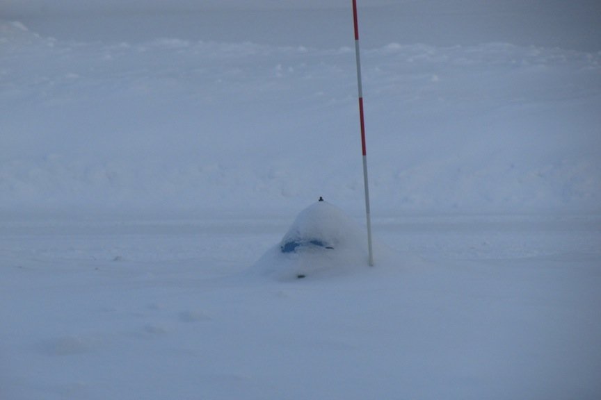
And a couple from the entertainment section in the backyard...
-
Looks like by their map, they went with the lowballs. lol, figures. Regardless, safe to say 8-10" fell across the county. After shoveling the driveway out tonight, from the city plowing it shut, I snapped a few photos around from the house.
-
Epic
-
And it's snowing again.
-
Missed my midnight measurement... , but woke up at 4 to start shoveling. Measured 4.3" additional...so a storm total of 9.7". Good stuff.


