Snowstorms
-
Posts
4,126 -
Joined
Content Type
Profiles
Blogs
Forums
American Weather
Media Demo
Store
Gallery
Everything posted by Snowstorms
-
It was average here snow wise. Temp wise was warm. That's great. Keep up with your vitamins everyday, maybe exercise or go for a walk if you can, and you'll be 100% in no time.
-
I'm surprised with your preference for warmer weather you're living in the snowbelt haha. But I agree. I honestly thought we'd have an awesome sunny week but it's been gloomy. I suspect it's because the lakes are still running warm even though the air temperature is cold creating more condensation and hence more clouds and mist. 20's are increasingly rare from Nov-Mar in Ontario. We might get the odd one or two in March but that's rare. YYZ has only hit 20C 4 times since 2000. 1980's and 1990's had several but prior to that it was maybe once every few years. Otherwise, our best chance at hitting 20C again is April 2021 so strap in.
-
Interesting. Goes back to what I was saying earlier. Cold Octobers are rare in Nina's. 1988 and 1999 were both crap. There was a few cold outbreaks but they were dry as hell overall. 1974-75 was a warm winter with no cold outbreaks. I'll take the other 3 any day. Btw hope you're feeling better
-
To be honest, I know some right off the boat. But most of the time I have to google "F to C" just so you guys can understand. I personally like C > F and km/hr > mph but I prefer inches > cm for snow.
-

Upstate/Eastern New York
Snowstorms replied to BuffaloWeather's topic in Upstate New York/Pennsylvania
I agree. Although some Nov's can be hit or miss, i.e. Nov 2016 or 2010. Same thing with March. Some exceptionally cold Marches have occurred in La Nina's. Jan/Feb can be our best month if the gradient pattern that is so common in Nina's sets up over our area. -
Upstate/Eastern New York
Snowstorms replied to BuffaloWeather's topic in Upstate New York/Pennsylvania
Pretty impressive block over the Pole. Haven't seen that in a while. Cold outbreaks like this are rare in La Nina Octobers. -
Was supposed to be sunny today. Instead it's cloudy and dark. On the bright side, hit 70F for the first time this month. Might be our last for the year.
-
La Nina and below average Octobers are rare. More typical in Nino's. Do you know any that have occurred during a La Nina in Chicago? How did the following winter pan out?
-
939 cases today. Highest yet. Doug Ford just announced all gyms and indoor dining will be temporarily closed for 28 days effective as early as tomorrow. Casinos and convention centers could also close. Practically stage 2 lockdown again. 44% of recent outbreaks in Toronto have been tied to restaurants and other entertainment venues. We’ve been on a steady increase since late August, so this was inevitable.
-
I agree. Feb 2013 was arguably one of the best phased storms in recent times. Got 16" from that storm. Although 2012-13 wasn't officially a La Nina, much of that winter resembled a typical Nina pattern. Having an active northern stream increases the chances for more phased storms which can be very beneficial especially for us in the Great Lakes area. 2007-08 featured a lot of that.
-
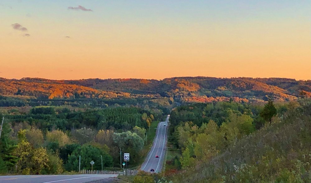
Took this yesterday about 40 mins north of my house. Whole lotta colors.
-
America is doomed. If leaders and politicians are undermining the severity of the virus, the general public will abide and assume it's "okay" too.
-
Even though last winter was ridiculously warm, we still managed to finish above average. Not saying that's the outcome in every warm winter. For example, 2011-12 was shit show. Not taking anything on the long-range models at face value. But with the exceptional decline in Arctic sea ice since 2011, one would have to assume all that ocean heat being released back into atmosphere in the Fall would have an impact on the winter NAO/AO.
-
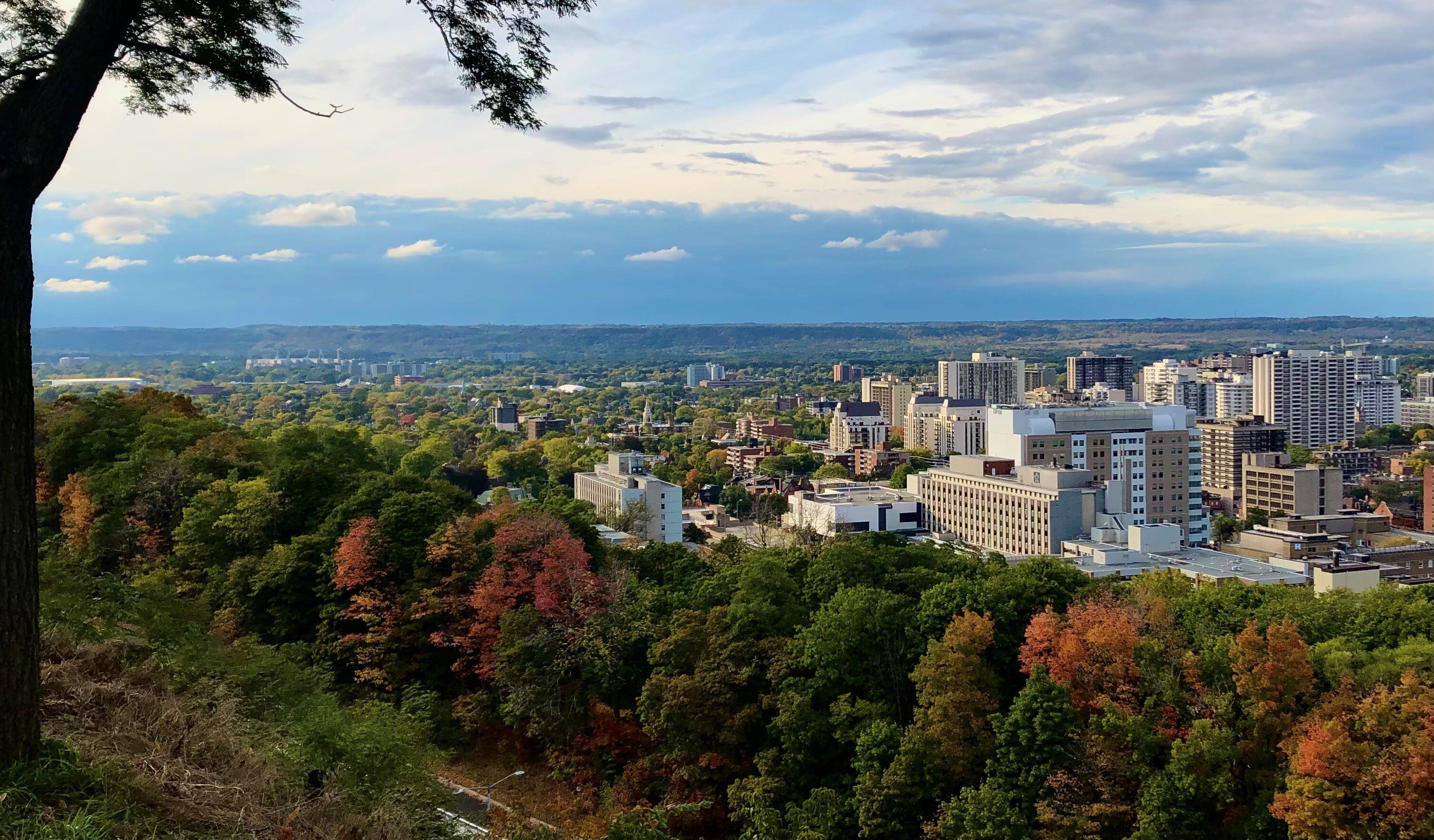
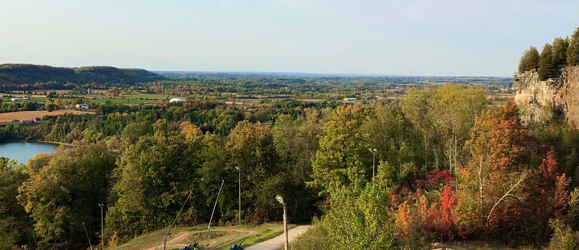
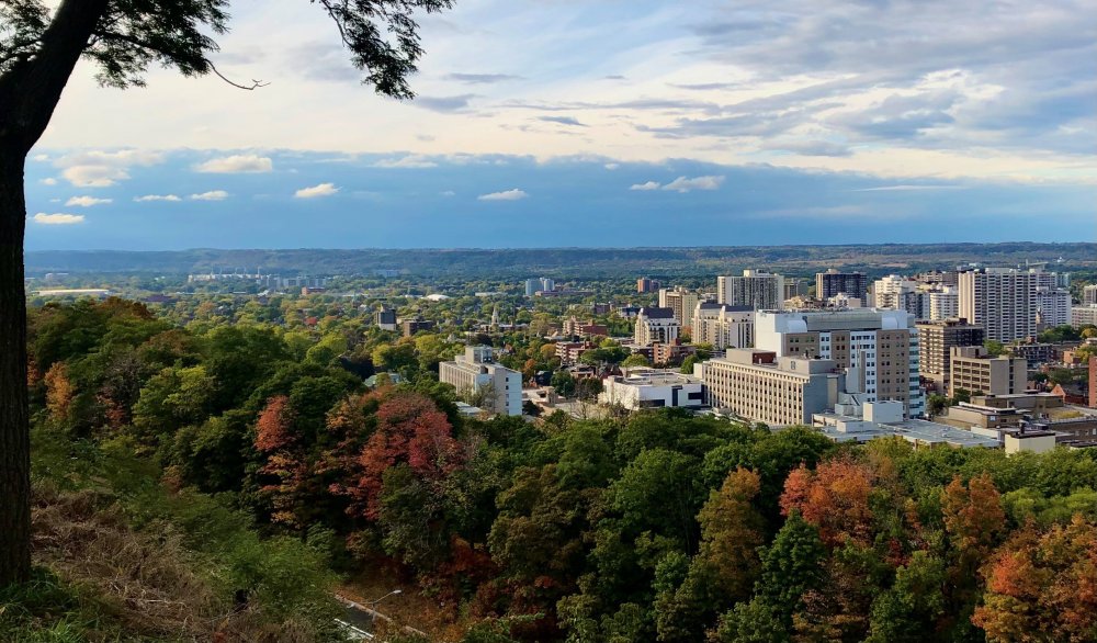
Any mountains from prehistoric times, in what is now called the Canadian Shield, have flattened thanks to erosion and the last ice age in Ontario. Unlike parts of New England all we have are rolling hills everywhere with the occasional high peak like the ones I'm standing on below. Took this shot on Saturday and the one below about 2.5 weeks ago.

-
Nice. Typical mid-late Fall weather this week with a warming trend by the weekend. It's Thanksgiving this weekend in Canada so definitely looking forward to a stellar long weekend.
-
Apart of this forum, Covid has been the topic of discussion for the last 9 months and quite frankly, I am tired of hearing about it. It's affecting everyone mentally and depression rates are skyrocketing now. I mean sure you might hear on the news "Derecho rips through Iowa" or "Hurricane Laura slams Louisiana" but within a few days its back to Covid again. Don't get me wrong I’m in no way downplaying the severity of the virus or its impact on the entire world. I'm just hoping we collectively as a society can move past this towards better days in the future, whether it be next year or the following year and hopefully find a cure. Edit: Here's something to cheer everyone up.
-
Upstate NY Banter and General Discussion..
Snowstorms replied to wolfie09's topic in Upstate New York/Pennsylvania
How is upstate NY doing considering you guys are our closest neighbor? Corona cases have been steadily rising here since late August. 732 cases today which is the highest daily count since this pandemic began. No real progression towards a second lockdown yet, however back in the summer they made masks mandatory in all indoor settings. As of now the border remains closed for all non-essential travel. -
2016-17 came off a very strong Nino and was during +PDO that started in 2014. I would assume even just based off that, it's not an ideal analogue for this year. I wonder if we see a multi-year Nina event this year and would it be enough to move us back into a longer term deep -PDO like the late 2000s. Last multi-year Nina event was 1998-2001 and prior to that 1973-1976.
-
Dec 08 and January 2009 were both awesome up this way with 26" and 28", respectively. We cracked freezing 4 days in Jan 09 but it was barely above. We had better snow cover retention in 2008-09 than 2007-08. Although 2008-09 was a +QBO, it was a second year Nina with a deeply -PDO unlike this year.
-
Upstate/Eastern New York
Snowstorms replied to BuffaloWeather's topic in Upstate New York/Pennsylvania
A lot of Gulf Low's that winter. Outside of LES, I'm assuming Western NY did pretty well with those. -
Euro and CFS both have a robust easterly wind burst over the next 2 weeks. Still a lot of cold subsurface anomalies esp below eastern Nino regions. I would expect the ENSO regions to cool down over the next few weeks solidifying a moderate Nina come NDJ. Even across western regions it has cooled down some over the past few weeks. We currently have an east based La Nina right now. 2017 and 2007 are the two most recent east-based La Nina’s. 2013 too if you want to consider it as it was borderline weak Nina. I would assume Nina's are fairly dry for your region in the winter.
-
Forgive me if I am wrong as I'm still learning about the Hadley Cell Circulation and Global Angular Momentum on my own, but doesn't a typical La Nina induce the expansion of the Hadley Cell?
-
1949-50 was a strong Nina gradient winter. However, QBO was negative that winter.
-
Upstate/Eastern New York
Snowstorms replied to BuffaloWeather's topic in Upstate New York/Pennsylvania
Wow, that's a sick view. Good vibes. Wanted to go there this year but then Covid happened. -
Looked back at some historic snowstorms during previous La Nina's and one really stood out to me. On Feb 24, 1965 a strong Gulf Low had developed and tracked up north towards the Ohio Valley and later on to Quebec. Toronto recorded 17" with that storm. I was reading an old news article that mentioned it was the worst storm in Detroit in 35 years with nearly a foot of snow. Some other cities like Indianapolis received 10" of snow and Toledo received close to a foot as well. Would be nice to experience something like that again. I'd gladly take a repeat of 1964-65, thanks.