

andyhb
-
Posts
20,234 -
Joined
-
Last visited
Content Type
Profiles
Blogs
Forums
American Weather
Media Demo
Store
Gallery
Everything posted by andyhb
-
What? Mid-late May is climatological peak season for these areas.
-
SREF popping a 90 this early (FH 72) is a pretty good indicator of a problem on Thursday.
-
10+ violent tornadoes and the rest of the numbers usually follow suit. Any outbreak like that automatically earns the title "historic" in my book. Actually any outbreak with more than a half dozen violent tornadoes does so. There are other factors such as location (see: 5/31/1985) and time of year (e.g. 1/21-22/99, 2/5/08) that also factor in.
-
Pressing X to doubt moisture mixing out that severely so close to the Gulf with unimpeded return flow. Not like the temps are in the upper 90s or 100s either.
-
Probably worth noting that while the progged warm sector on the models is not especially extensive in terms of northward extent, it is very extensive in the longitudinal (W-E) direction. This matters when you have a setup with westerly winds aloft.
-
Wouldn't be shocked if we end up with two EF4s out of that lead supercell.
-
Absolutely nuts.
-
Good stuff, retweeted.
-
Not sure if this is yours or if you have a twitter account, but this should be shared.
-
Yet another EF3 in Columbia’s CWA.
-
Tornado scars showing up from visible satellite. Saw a lot of this post-4/27/11.
-
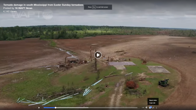
High end damage all around along this portion of the Bassfield-Soso, MS EF4 track.
-
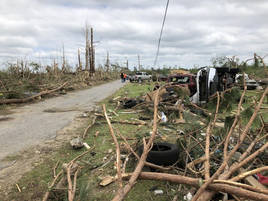
Debris travelling crazy distances is a hallmark of high end tornadoes (and often high end setups) and this is no exception.
-
Nope, I believe it is from the first tornado, which dissipated before hitting Bassfield.
-
LIX keeping it at EF3 as of now.
-
Tornado from second supercell is prelim EF3. The first tornado from the lead supercell (same that produced the Bassfield EF4) is EF2 (in Walthall County). Just wanted to clarify since this all is quite confusing indeed.
-
Very intense vegetation damage along this portion of the first tornado's path near Bassfield, MS.
-
Major tornado just struck Seneca, SC head on. 63.5 dBZ debris ball, TDS bottoming out.
-
61 dBZ debris ball and I had +73/-134 mph a couple of scans ago, that is a very strong tornado.
-
Cell near Thomaston, GA looks close to producing and it could be a sig tor if it does.
-
This whole violent tornadoes on trolley tracks idea is eerily similar to 4/11/65 in S MI.
-
Cell is taking on more classic supercell characteristics. Cell in behind doing the same.
-
The event in January comes to mind. That QLCS was very prolific, produced several long-tracked tornadoes (and several EF2s), and led to several deaths despite instability quite a bit lower than this. There is also a substantial after dark component to this, which extends to the East Coast. I don't really know what you mean by "what I'm describing". If you're implying I'm saying the doom of the SE is coming on Sunday, that's definitely not it. A high end outbreak is not locked in, but saying brief, weak tornadoes are mostly going to happen with this level of shear and low level moisture regardless of storm mode is also a bit on the extreme side.
-
I'll tell right now that with those shear profiles, VBV isn't going to make a large difference. Also the critical angles are between 45 and 65˚ in most soundings I've pulled, which is well within the typical range seen in Dixie. That's not even accounting for the fact that mesoscale factors can alter critical angles significantly. On top of that, even with mixed mode here, any embedded spin ups will be producing tornadoes and potentially strong ones with such high 0-1 km SRH (and this continues all the way to the Eastern Seaboard). To assume a mixed mode or even a QLCS here means "brief/weak tornadoes" would be a mistake.
-
There's more to a "historic" tornado outbreak than just parameters. My biggest concern as of now is early convection mitigating the threat, especially if the warm front has more difficulty lifting north than forecast. UK and Euro are consistent in a fairly ominous solution, but they also were for 3/28.

