

forkyfork
-
Posts
30,712 -
Joined
-
Last visited
Content Type
Profiles
Blogs
Forums
American Weather
Media Demo
Store
Gallery
Everything posted by forkyfork
-

Wake Me Up When September Ends..Obs/Diso
forkyfork replied to 40/70 Benchmark's topic in New England
need a frost for that -
Wake Me Up When September Ends..Obs/Diso
forkyfork replied to 40/70 Benchmark's topic in New England
ok -
Wake Me Up When September Ends..Obs/Diso
forkyfork replied to 40/70 Benchmark's topic in New England
the ACATT crowd has been doing this shit for over a decade -
take a wintertime norlun trough and add warm season convection. very difficult forecast
-
we could be looking at a significant flood event friday if some of the meso models are correct
-
extent gets more and more irrelevant as the ice cover thins out. 15% coverage of thin floes is not the same as 100% coverage of thick ice
-
-
do not want
-
another 12-16 hours to go
-
that gfs map is already too low in most of nj/nyc and there are 18 hours to go lol
-
a training band could pop up at any time before it arrives
-
that map is already too low in parts of nj
-
it's always looked like a fronto round sat morning/afternoon followed by showery precip and then another round of steady heavy rain with the the remnant low
-
omg, the models that have been waffling around have waffled again
-
your 10 mile run is in trouble, sorry
-
Extended summer stormlover74 future snow hole banter thread 23
forkyfork replied to BxEngine's topic in New York City Metro
i have a 100% win record. cool -
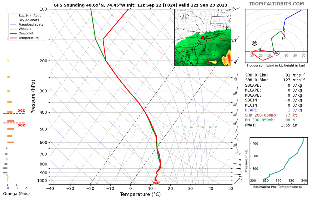
pwats get close to 2". so much dry air @winterwx21
-
much stronger with the low on this run. dumpage coming
-
Tracking The 3”+ Heavy Rainfall Events Since 2010
forkyfork replied to bluewave's topic in New York City Metro
bumping for this weekend -
sun into mon might bust high if the models are too fast to spin down the system
-
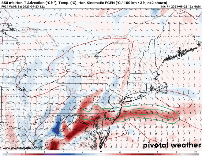
confluence can enhance banding on the north sides of these systems btw
-
what dry air issue?
-
1-2" tomorrow, 1-2" sun through tues
-
this is all i need to see for tomorrow
- 465 replies
-
- 10
-

-


