forkyfork
-
Posts
30,804 -
Joined
-
Last visited
Content Type
Profiles
Blogs
Forums
American Weather
Media Demo
Store
Gallery
Everything posted by forkyfork
-
december isn't a winter month anymore and white christmases are disappearing
-
the morning of nemo the euro showed the 2" liquid line well into nj
-

Extended summer stormlover74 future snow hole banter thread 23
forkyfork replied to BxEngine's topic in New York City Metro
BAM! weather! -
the peak winds aloft happen around 12z and winds are sse. snooze
-
i can't find the dwarfing rootstock i want
-
climate change is taking this away from most of us
-
it's that magical time of year when guys in new england hope for a pattern change around christmas
-
for a true comparison you'd need to use standard deviation
-
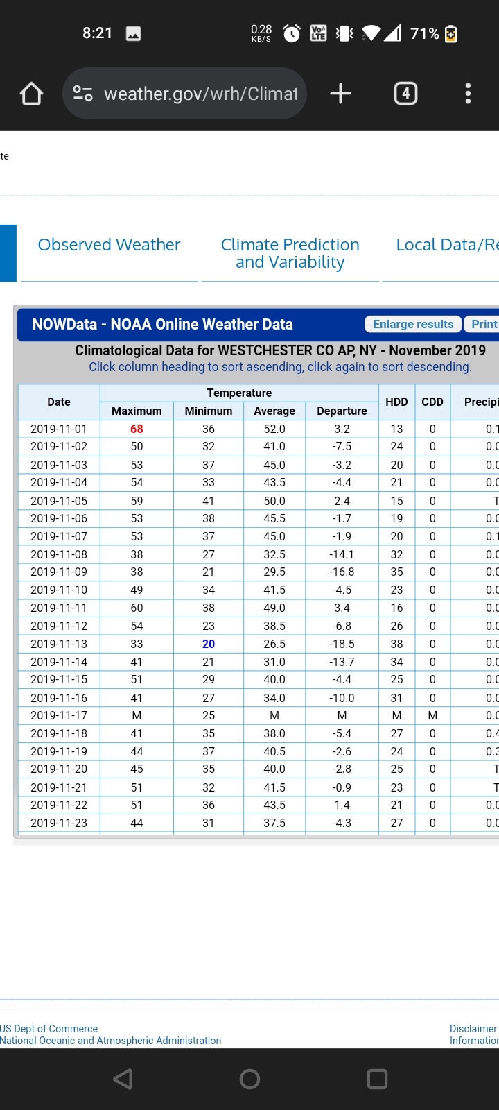
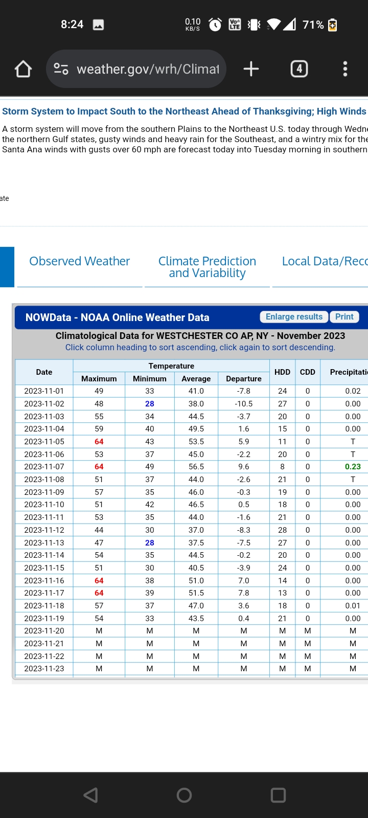
i remember when we got snow in december from less than ideal patterns
-
i don't mean a ku or anything i mean like 2"
-
this is honestly not a bad look
-
models had below freezing temps for the entire metro last night. oops
-
he saw it coming
-
why should they cool when co2 is only increasing?
-
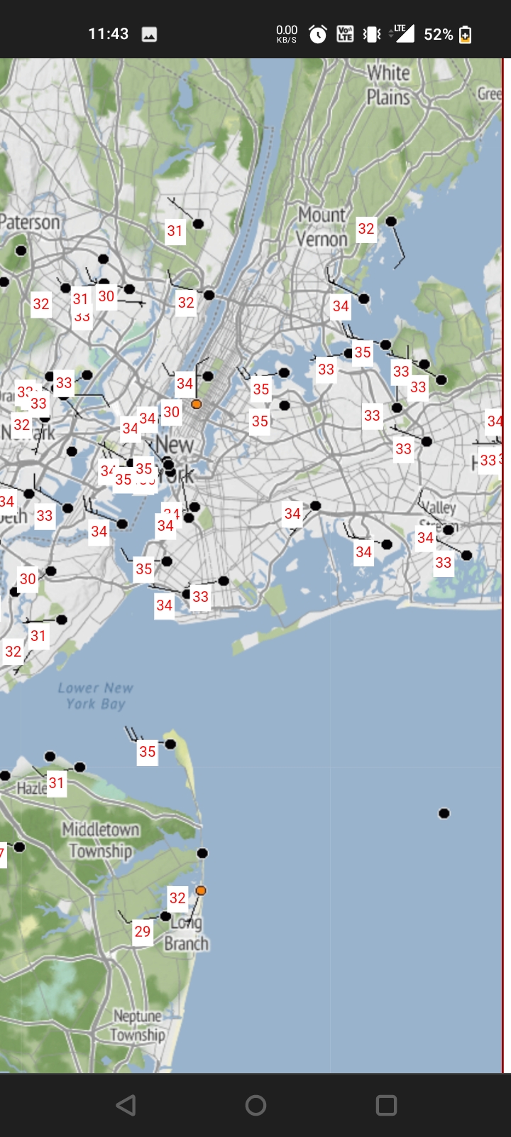
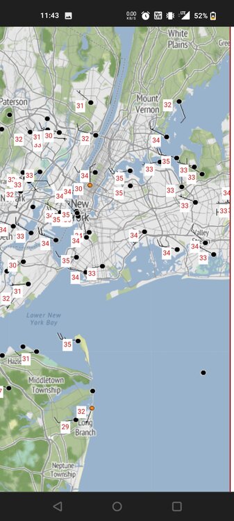
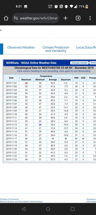
the record low at port jervis is 11
-
the record low is 19 lol
-
Extended summer stormlover74 future snow hole banter thread 23
forkyfork replied to BxEngine's topic in New York City Metro
why were you up so late? go to bed -
finally a wet nino stj system
-
the cams show an impressively large area of 2"
-
-
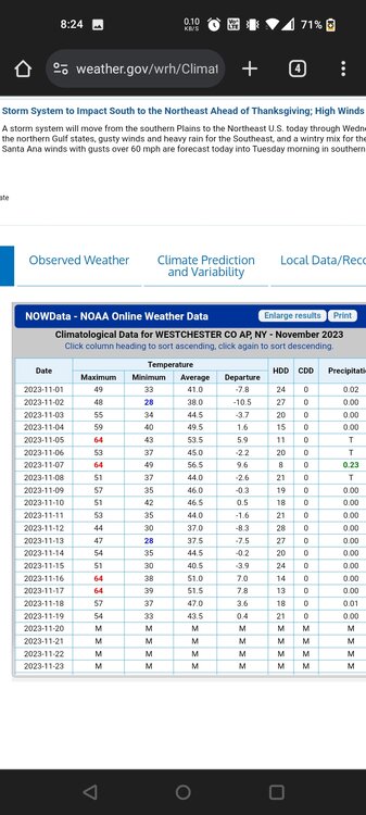
four years ago you had more
-
that's a radical change for an ensemble mean inside day 7
-
lol
-
the 80s were frigid with near average snow. nothing close to the furnace winters we've been seeing