forkyfork
-
Posts
30,798 -
Joined
-
Last visited
Content Type
Profiles
Blogs
Forums
American Weather
Media Demo
Store
Gallery
Everything posted by forkyfork
-
the pattern does get worse starting friday
-
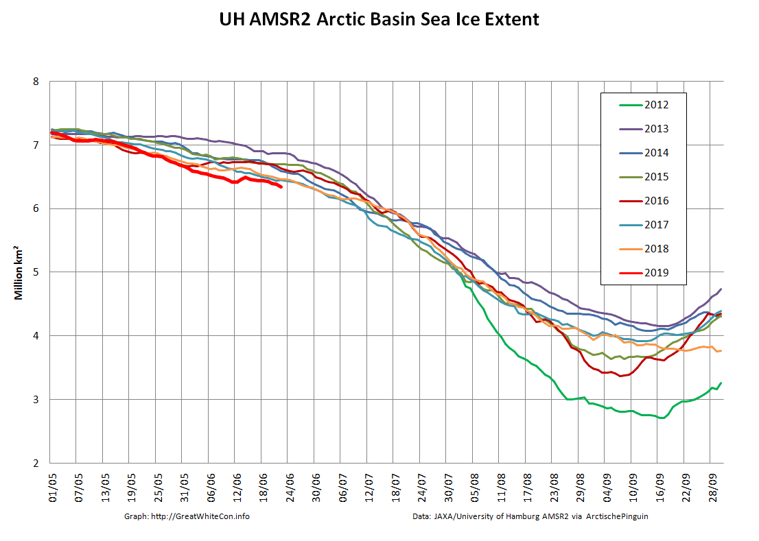
area had a drop of -180 today
-
too bad so sad

-
both area and extent are in first place on AMSR2 data
-
piomas updated for mid june. from the sea ice forum:
-
he'll disappear in about a week
-
extent dropped 91k today so that ice is starting to vanish
-
area drops + extent gains = lots of spread out janky ice which will result in an extent nosedive when it melts
-
i don't need to. it's right there on your graph. lol
-
notice how the bright green line is at the bottom around this timeframe yet it winds up along the top later in the season. what's the point of focusing on a region that's irrelevant right now?
-
looks like CAB area doesn't matter until later in the season. why did you remove the legends from that graph?
-
oh
-
how's area doing?
-
lol
-
keep praying
-
what a trash prediction
-
silence, denier
-
does this low scoot out or rot in place?
-
-
this would be an interesting start to may
-
the 0z eta run the night of friday 3/2/01
-

Tracking The 3”+ Heavy Rainfall Events Since 2010
forkyfork replied to bluewave's topic in New York City Metro
12/21 ...NEW HAVEN COUNTY... WOODBRIDGE 3.28 400 PM 12/21 PUBLIC SEYMOUR 3.24 415 PM 12/21 TRAINED SPOTTER -
what happened to snowlover?
-
i'm not reading that
-
science doesn't care about your opinion