

BullCityWx
-
Posts
8,892 -
Joined
-
Last visited
Content Type
Profiles
Blogs
Forums
American Weather
Media Demo
Store
Gallery
Posts posted by BullCityWx
-
-
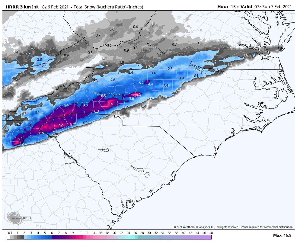
18z NAM dew points are still too high on initialization.
-
NAM dew points are ten degrees or more off
-
2 minutes ago, CAD_Wedge_NC said:
That gets me in the bull's eye here in Maiden. I will eat a piece of my shoe if I get that much snow tonight.
It would be the biggest bust since 1/23/03.
-
I don’t think the HRRR ever had anything but sleet or snow that run west of Charlotte.
-
-
HRRR having a nice run for Greenville-Spartanburg up through Cleveland County up to Lincolnton.
-
-
5 minutes ago, griteater said:
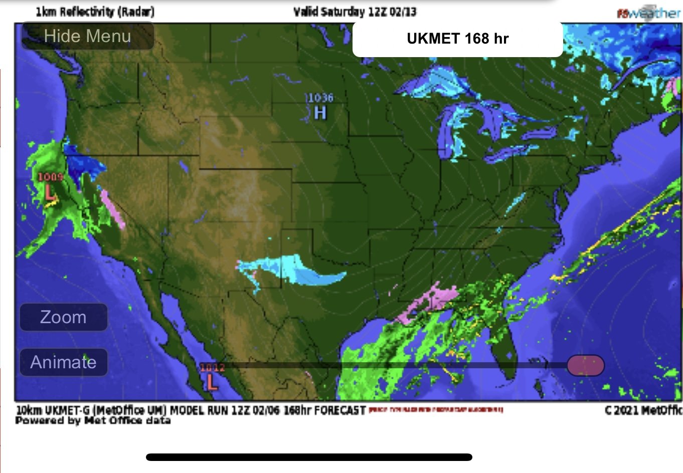
I just want to see the cold vortex in Canada drop down. Euro/EPS from last night never dropped it down because it loses the NE PAC ridging, so that’s the close the curtains scenario. UKMet and GFS/GEFS look similar at 144 today where they both want to swing it down out of Canada.
You know it seems like the UKMET has been the one most on top of the trends lately.
-
People have to realize that maybe this isn’t a sleet or snow event but the extracted data on BUFKIT shows Greensboro very close to a n ice storm disaster at 12z. What do we know about ice events? They almost always trend colder.
-
 1
1
-
-
1 minute ago, wncsnow said:
It's funny how everyone is freaking out about temps. All the models forecasted 50 and up for a lot of us today so this isn't some big shock.....And as others have said it has and can snow after being warm a few hours earlier. It's cold up high. Rates will overcome
We do this every storm. Usually the same People.
-
2
-
-
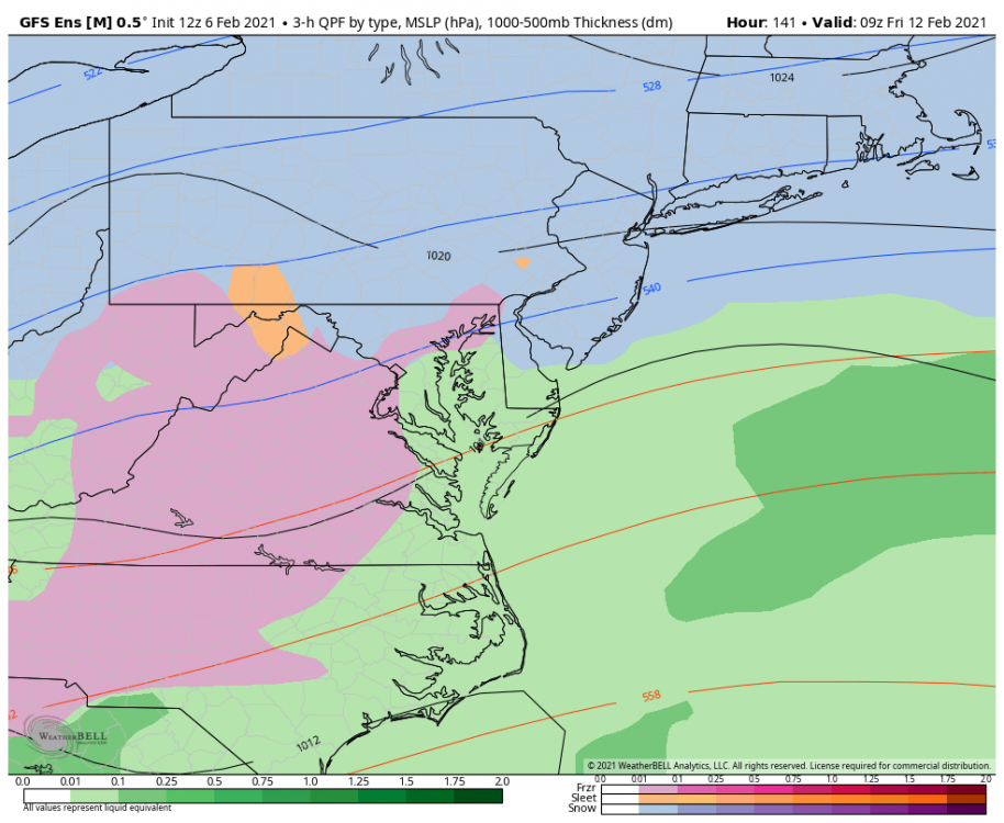
We need a 100 mile shift 130 hours away for a major ice event.
-
1 minute ago, Leesville Wx Hawk said:
Just saw that. Looks like the cold will finally win out by Saturday then a disturbance. I’ve seen this scenario play out before. In general, it takes artic air to make life interesting east of the mountains.
Yep, it’s a tale as old as time on this side of the mountains.
-
3 minutes ago, btownheel said:
Don’t do this to yourselves y’all. If you aren’t in the mountains, this is a bunch of rain. It’s 51 degrees here...
.It was 51 degrees the day before the last event in places that received almost half a foot.
-
4
-
 1
1
-
-
1 minute ago, Buddy1987 said:
12z GFS def trending the right way for next week for mountains as of right now. @BornAgain13 and I verbatim would look to get some pretty serious ice accretion. There’s 1040-1041 not too far away from being in an optimal spot. If that keeps shifting southward along with the flow of 5h could be an entirely different outcome as what’s modeled currently. Needing to get through this first storm first.
Yeah not bad trends at all. Day 7.5 snow as well for much of NC.
-
15 minutes ago, wncsnow said:
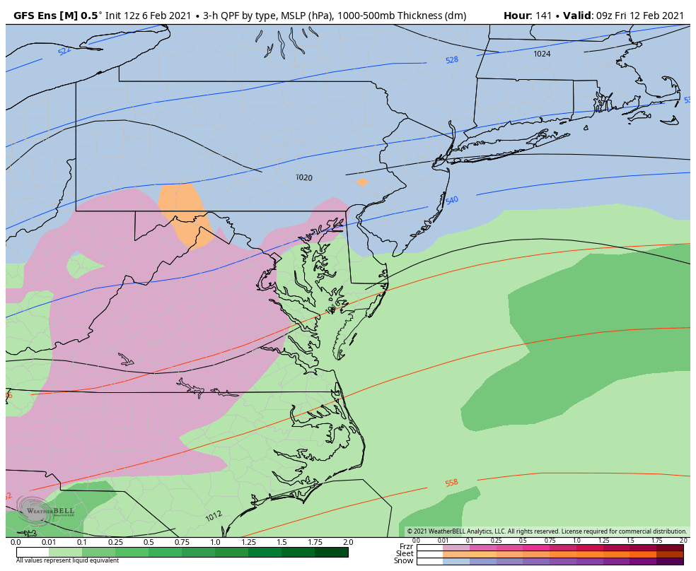
I'm a little confused at this run too. I have .7 qpf and only 2.5 snow and 850s and 925s are good here too.
Our warm nose has been around 700MB
-
This run would get me to the previous 30 year mean so
-
Little bit better run this time for the NW Triangle.
-
1
-
-
18 minutes ago, burrel2 said:
Upstate/Triangle folks will like the 21z rap. It’s a crush job.
YOU SIR HAVE A DEAL
-
1
-
-
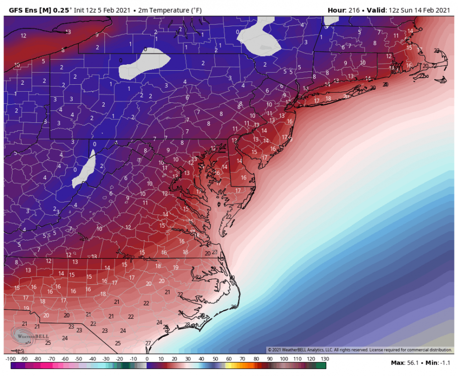
This is insane.
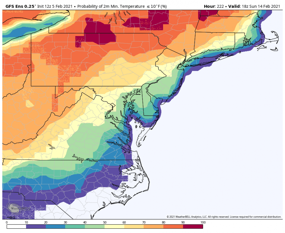
-
I dont know if I've ever seen a nearly 20 below normal MEAN:
-
Just now, ILMRoss said:
GEFS is way too wind-shield wipery for my taste, will stick with the euro ens, but verbatim it's telling me to buy a portable phone charger and make sure all the heavy blankets are clean
You are right about that on all counts.
6 minutes ago, frazdaddy said:You should charge for the therapy
I'll setup a therapy venmo.
-
4 minutes ago, burrel2 said:
I’ll be very, very surprised if you don’t get at least 4 inches. I’d bet the house on it.
I said earlier I think you might be sitting pretty as well.
-
Those of yall hyperventilating over the OP GFS can be reassured that the GEFS evolution of this event is nothing like the OP.
-
 1
1
-
1
-
-
This will be a better GEFS run from what I am seeing through 135. Not as good as the euro.


2/6/-2/7 Snow Threat
in Southeastern States
Posted
eight degrees too high at GSP.