

BullCityWx
-
Posts
8,892 -
Joined
-
Last visited
Content Type
Profiles
Blogs
Forums
American Weather
Media Demo
Store
Gallery
Posts posted by BullCityWx
-
-
-
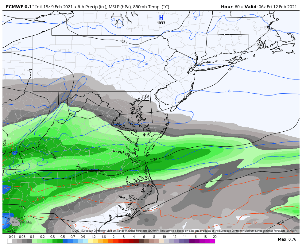
The wedge on the ICON extends to Anniston, AL. Freeing rain almost to the Charleston peninsula.
-
Just now, Blue_Ridge_Escarpment said:
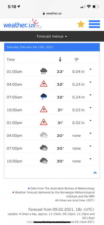
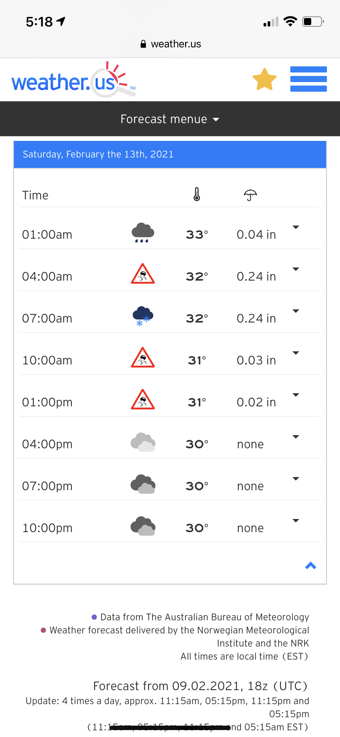
Well over an inch of qpf here with temps in low 20s....
My guess is sleet with the conditions present
-
 1
1
-
-
The icon just dropped a lot of...freezing rain or sleet I’m just not sure.
-
2
-
-
ICON actually moved south with the storm on Saturday, fringing the triangle with precip.
-
2 minutes ago, BornAgain13 said:
The Stormvista, from what I understand takes everything at 32 degrees or lower and makes it snow. A lot of that is ICE... someone can correct me if I'm wrong
Yes, those maps are why kuchera maps were invented.
-
9 minutes ago, msuwx said:
It’s had its ups and downs. Did fairly well with convection.
It was way too cold with the event a couple weekends ago. It was pretty good with the last weekend.
Did well with the rate of clearing today.
Ha, I watch Mike Maze on WRAL and he had forecasted and expected clouds to hang in. You could tell he was beaming about the clouds moving out quicker.
-
15 minutes ago, WXNewton said:
Did freezing rain make it into the Catawba Valley area?
It got really close. A degree or two and most of NC is in it.
-
1
-
-
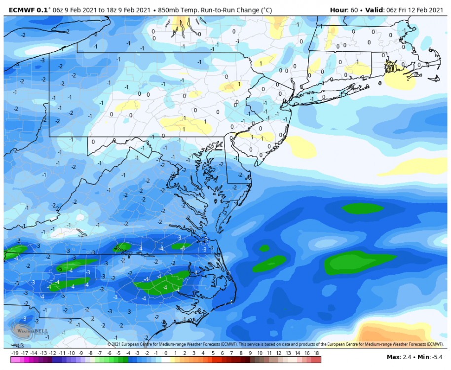
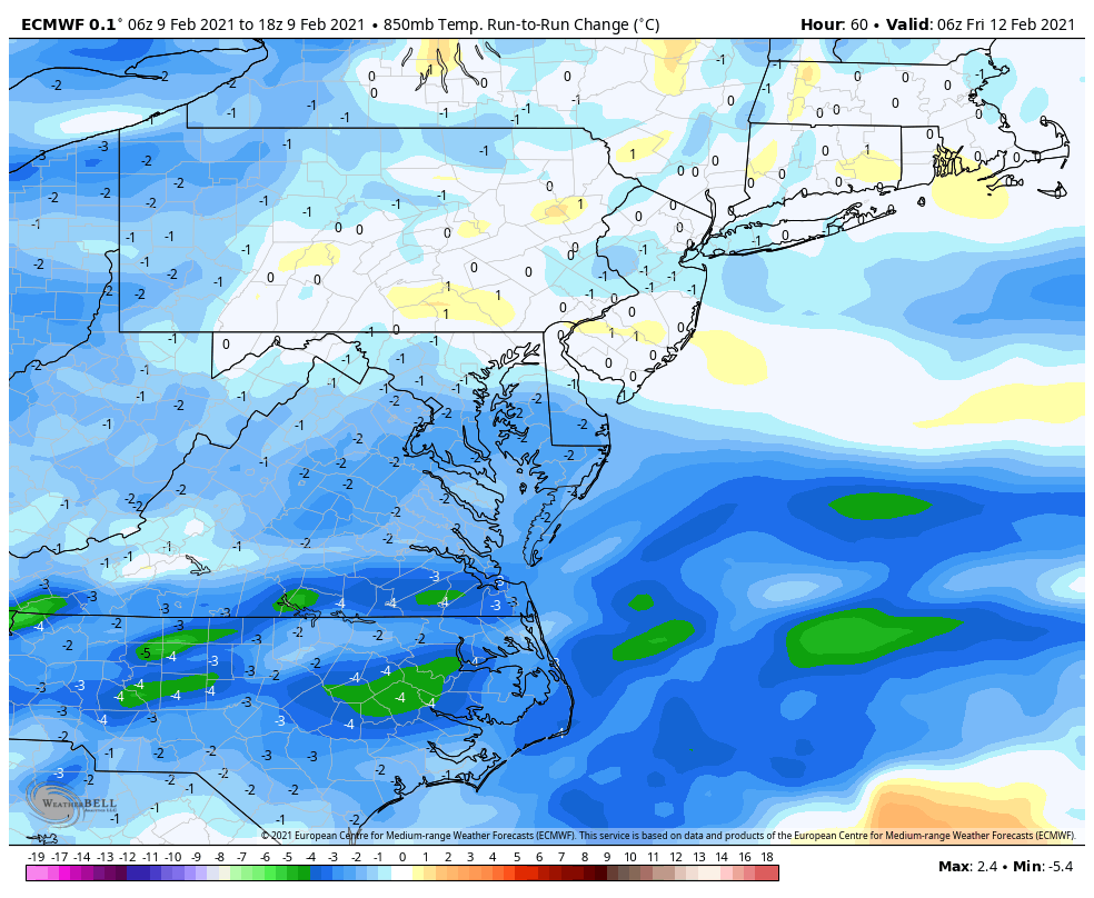
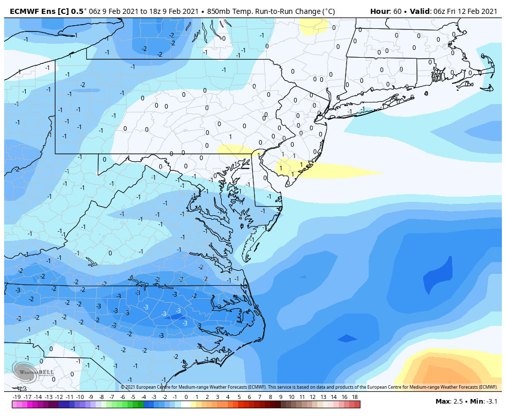
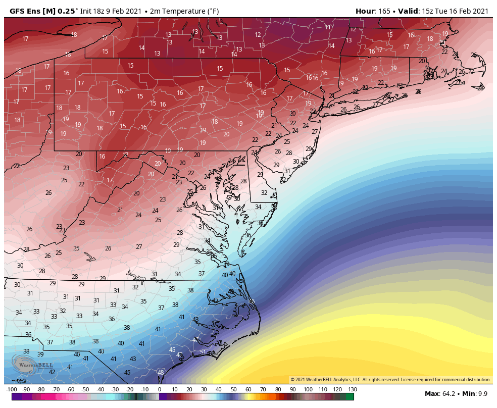
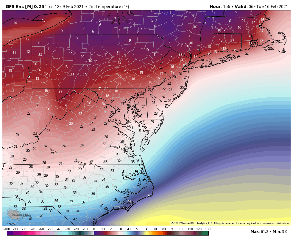
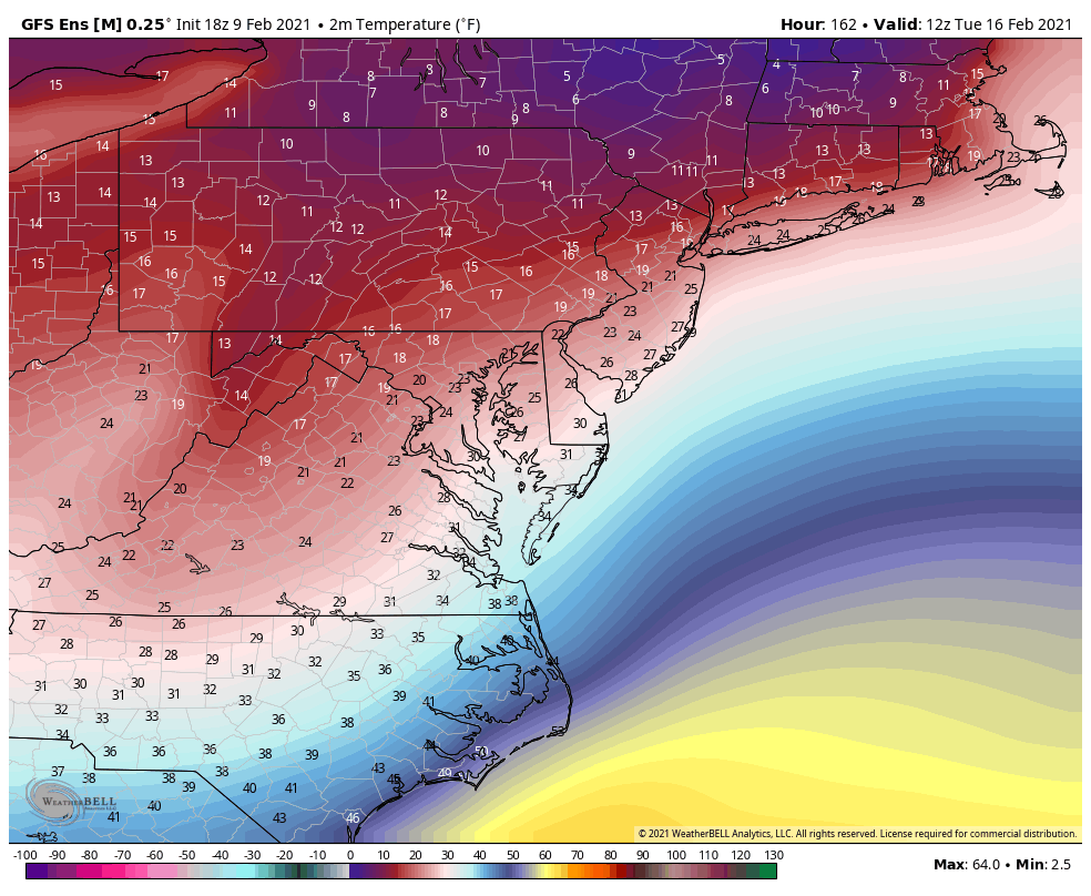
The reason why that is important is our 925MB temps are solidly below freezing. That could be the difference between mostly sleet and a good bit of freezing rain.
-
I didn’t even really notice this at 18z but that 850 line is so close I can practically see it.

-
1
-
-
One more trend like this and the northern tier of triad and triangle counties are going to be in the snow.
-
1
-
-
The euro control continued the colder trend for Friday with the 850 line almost laying exactly across the border. If you take TDF for example, the 850 line started close to Richmond. TDF was at +4C at 6z.
-
36 minutes ago, jburns said:
Well damn. Just as I was about to release my life’s work. “73 Years of Weather, Which Storms I Liked and Which Storms I Hated”.
Now what am I supposed to do with 784 pre-prepared posts?
You can write a new book about how you seemingly get more snow than I do in every storm we’ve tracked together over the last 20 years. Not that I’m bitter or anything.
-
 3
3
-
-
-
Actually 925 temps might mean that is sleet instead of ZR.
-
11 minutes ago, Blue_Ridge_Escarpment said:
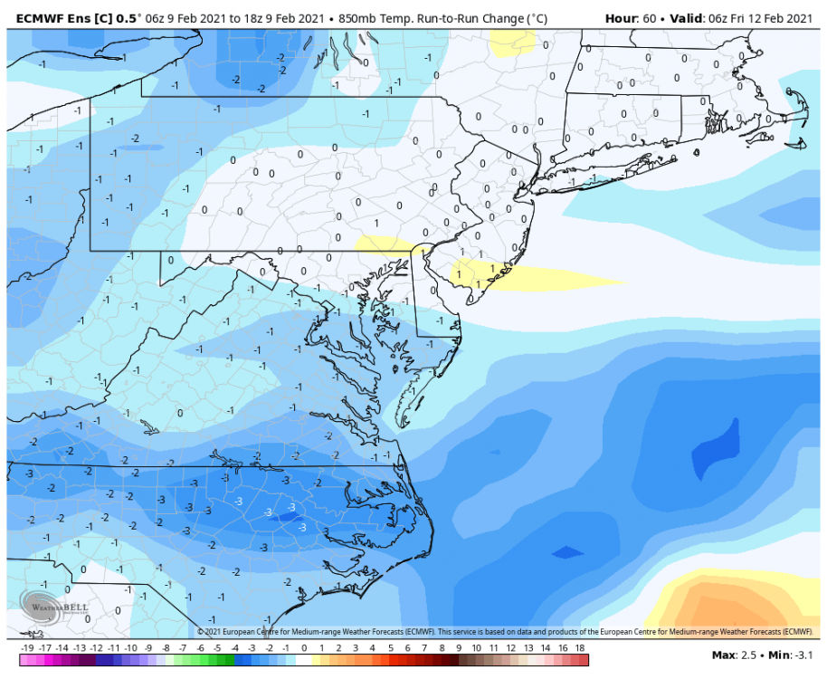
18Z euro coming in colder.
Round two incoming as well.
-
1
-
-
5 minutes ago, WeatherWeenie87 said:
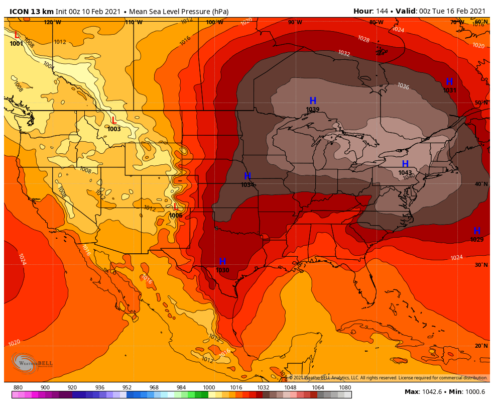
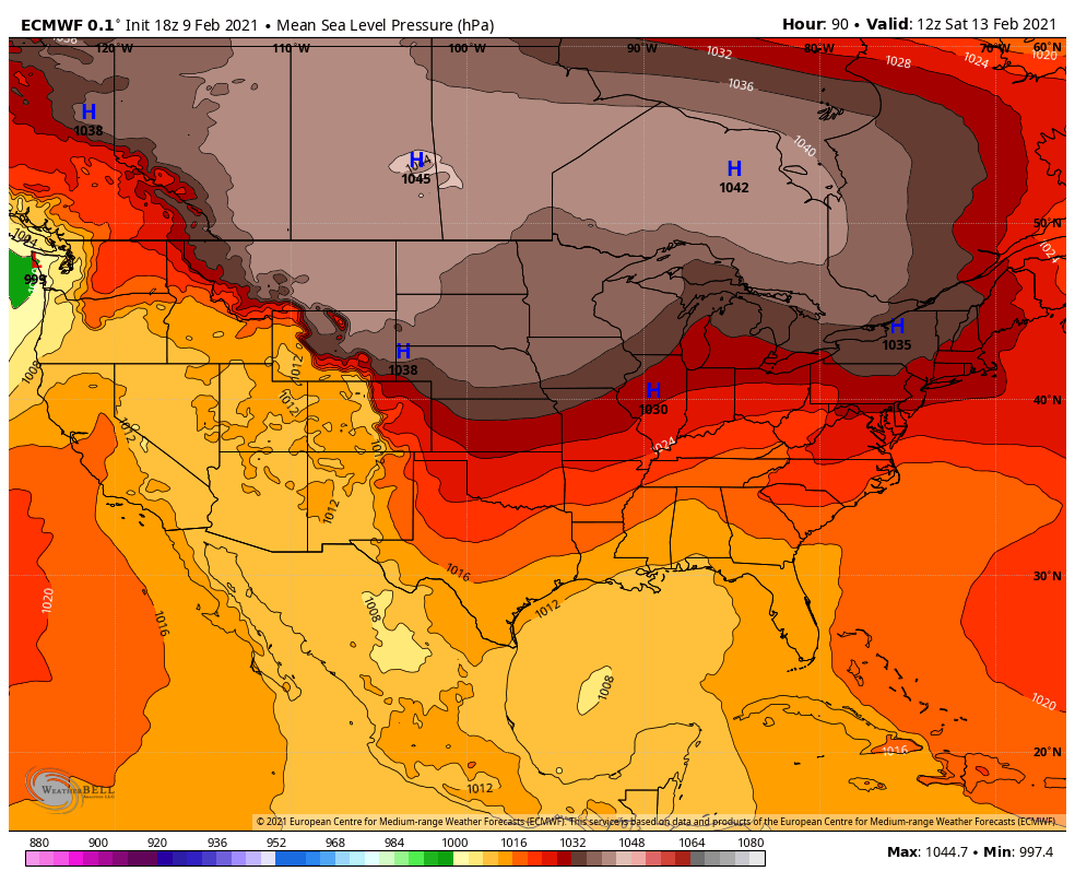
it's actually 1044

This time it looks like we will not have the marginal cold issues to deal with. I know lakes lows have screwed us over the last few years.

This is true, but it's also about the gradients.
Wrong storm. There’s a thread for the weekend event.
-
5 minutes ago, eyewall said:
You really have to be 30 or below for efficient icing. Once you close in on 32 it is pretty much over. A lot of times models don't do well with the self-limiting properties. You really need an optimal CAA feed.
The 1034 MB high over NYS isn’t optimal?
-
-
18z GEFS mean has a significant ice storm Tuesday.
-
1
-
-
3 minutes ago, NorthHillsWx said:
It barely advances the freezing line past the Virginia border counties and does so as precipitation moves out. It was well north and had less precip. Storm is still there but not an ice storm for the Carolinas as had been depicted on the earlier 12z run
So am I just imagining what it shows for Durham?
-
I get that it’s easy to be frustrated but the ICON clearly has the storm. It oscillated slightly but it’s still there.
-
Just now, BornAgain13 said:
Is this a Thunderstorm of ZR for next Tuesday? Lol

Sent from my SM-N981U using Tapatalk
Yes. I’ve experienced that before.
-
53 minutes ago, NorthHillsWx said:
ICON is considerably warmer than 12z with considerably less precip. Does not have the weekend ice storm
What?

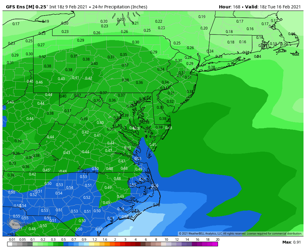
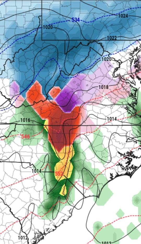
Ice/Snow threat Friday-Sunday
in Southeastern States
Posted
Can we keep the shitposting to the whining thread? If you're in your feelings about this might not being a Raleigh threat, I cant help that.